List of former board schools in Brighton and Hove

Last updated

This plaque on the former Finsbury Road Board School records the date of its opening, 1881, and the name of the Brighton and Preston School Board. Hanover Lofts (former Finsbury Road Board School), Finsbury Road, Hanover, Brighton (January 2014) (Plaque).jpg
This plaque on the former Finsbury Road Board School records the date of its opening, 1881, and the name of the Brighton and Preston School Board.

Between 1870 and the early 20th century, "a distinguished group of board schools" [1] were built in the area covered by the present city of Brighton and Hove on the south coast of England. All were designed and built by the local firm of Thomas Simpson & Son, whose members were Scottish architect Thomas Simpson (1825–1908) and his Brighton-born younger son Gilbert Murray Simpson friba (1869–1954). John William Simpson, the older of Thomas's two sons, may also have been involved with some of the work. [2]

Contents

There was no nationally coordinated scheme of primary-level education until the Elementary Education Act 1870 (33 & 34 Vict. c. 75) was passed; this empowered local councils to form school boards with elected members and funded by rates. [3] Brighton's population was growing rapidly at the time, and many new schools were needed. Thomas Simpson was appointed architect and surveyor to the Brighton School Board in 1871 and held the same positions with the Hove School Board from 1876. In 1878, Brighton School Board merged with that of the neighbouring parish of Preston to form the Brighton and Preston School Board, and Simpson became the architect and surveyor of this new entity. [4]

Many of the schools were large buildings of "excellent" architectural quality, situated in rapidly expanding suburban areas such as Round Hill, Queen's Park and Prestonville. Thomas Simpson and his son, who became a partner in the firm in 1890, used a range of materials—characteristically red brick, terracotta and pebbledashing—and their preferred style evolved from Queen Anne Revival on the early schools towards a more elaborate "Edwardian Free style". [4] The final school, St Luke's (1903), has been described as "the culmination of [Thomas Simpson's] career". [5] As of 2013, it was one of five with Grade II listed status. [6] Some of the schools have been demolished, while others have closed and are now in residential use or are owned by other educational institutions (some were acquired by Brighton Polytechnic and Brighton College of Technology during the 20th century); but several remain in use as primary schools. [3] Finsbury Road School was threatened with demolition in 1999 but was granted listed status and thereby saved; [7] and the York Place Elementary Schools were nearly destroyed by bombing in 1940 during the Brighton Blitz. [8]

After its formation, the Brighton School Board also took over a small number of existing schools and schoolrooms based in chapels. Also within the Board's remit were industrial schools for persistent truants. The first, established in a former workhouse in the village of Chailey in 1875, moved seven years later to a house in Patcham. The second, in Mile Oak near Portslade, was built in conjunction with the London School Board. [3]

Board schools

NameImageLocationDateGradeNotesRefs
Middle Street School (†)
The Lanes
50°49′21″N0°08′34″W / 50.8226°N 0.1428°W / 50.8226; -0.1428 (Site of former Middle Street Schools)
1809The Union Charity School was founded by Edward Goff in 1807. It was for boys only, but a girls' school was added in 1809. They later took the names Royal Union School and Middle Street School. Goff gave £400 and £200 respectively for the two schools, but other financial support came from the public. Although the schools were non-denominational, Sunday attendance at a Congregational chapel was required. The school board took over the running of the schools in 1874, and the buildings survived for just under a century from that time: the present Middle Street Primary School replaced the old school in February 1973 on a slightly different site. [3] [9]
Puget's Schools (†)
The Lanes
50°49′20″N0°08′24″W / 50.8222°N 0.1400°W / 50.8222; -0.1400 (Site of former Puget's School)
1861These schools were in Clarence Yard behind North Street. They were taken over by the school board in 1870. No trace remains of the buildings or the street on which they stood. [3]
Fairlight Place Board School Fairlight Primary and Nursery School (former Board School), Fairlight Place, Brighton (January 2014) (1).JPG Elm Grove
50°50′06″N0°07′31″W / 50.8349°N 0.1252°W / 50.8349; -0.1252 (Fairlight Place Board School)
1870Fairlight Place itself was built up at the same time as the school. Thomas Simpson's building was remodelled in 1931 and is still in use with the name Fairlight Primary and Nursery School. [3] [10]
York Place Elementary Schools City College Brighton & Hove (former York Place Board School), Pelham Street, Brighton (January 2014) (2).JPG North Laine
50°49′43″N0°08′10″W / 50.8286°N 0.1361°W / 50.8286; -0.1361 (York Place School)
1870Simpson's buildings were extended in 1884 when girls' and boys' secondary school buildings were added. These were named York Place Secondary School from 1898 and moved out in 1926 and 1931 respectively to the new Varndean School campus (built by Gilbert Murray Simpson). The 1870 buildings then took the names Fawcett School for Boys and Margaret Hardy School for Girls, and when these transferred to new premises in Patcham in the 1960s Brighton Technical College (now City College Brighton & Hove) acquired them. The stone-banded red brickwork is in Simpson & Sons' "typical Brighton Board School manner". [3] [4]
[11] [12]
Hanover Terrace Board School
Hanover
50°49′51″N0°07′43″W / 50.8308°N 0.1285°W / 50.8308; -0.1285 (Site of former Hanover Terrace Board School)
1873Thomas Simpson built this school on a narrow site between Hanover Terrace, which had been developed in the early 1830s, and Coleman Street. It became a boys-only school in 1928, and the infants department shut four years later. After World War II it became Brighton Secondary Technical School. By 1990 it was an annexe of the Brighton College of Technology, but in 1999 planning permission was granted for its demolition and replacement with houses. [3] [10]
[13] [14]
Richmond Street Board School
Carlton Hill
50°49′35″N0°07′58″W / 50.8264°N 0.1327°W / 50.8264; -0.1327 (Site of former Richmond Street Board School)
1873This was the first Brighton school to offer meals to pupils. It was one part of the Richmond Street/Sussex Street schools complex which ran along Claremont Row between the two streets. The buildings were compulsorily purchased in 1959 and demolished as part of the Carlton Hill redevelopment scheme. [3] [15]
[16]
Sussex Street Board School
Carlton Hill
50°49′33″N0°07′59″W / 50.8257°N 0.1330°W / 50.8257; -0.1330 (Site of former Sussex Street Board School)
1874Built to Thomas Simpson's design a year after the neighbouring Richmond Street school, it was treated as part of the same complex: the two parts were for girls and boys respectively, and playgrounds separated them. A nursery school was added, but the site of the school has disappeared under postwar housing development. [3] [15]
[16]
Freshfield Place Board School Queen's Park Primary School (former Board School), Freshfield Place, Brighton (August 2019) (3).JPG Queen's Park
50°49′22″N0°07′35″W / 50.8228°N 0.1263°W / 50.8228; -0.1263 (Freshfield Place Board School)
1880The school continues in use as Queen's Park Primary School and has about 400 pupils between the ages of 3 and 11. [3] [17]
Preston Road Board School Former Preston Road Board School Preston Road, Brighton (December 2013).JPG Preston Park
50°50′08″N0°08′32″W / 50.8355°N 0.1423°W / 50.8355; -0.1423 (Preston Road Board School)
1880Simpson built this "excellent" school on a site between the London Road viaduct and the bottom of Preston Park. It continued in use as a junior school until 1937; it later served secondary-age pupils as the Preston Technical Institute and subsequently became the Preston Road Campus of City College Brighton & Hove, specialising in the teaching of plumbing. In October 2016 it was sold for residential conversion. The building's "flamboyant" architectural features include gables with pediments, steep roofs and prominent chimney-stacks. [3] [18]
[19] [20]
[21]
Finsbury Road Board School Hanover Lofts (former Finsbury Road Board School), Finsbury Road, Hanover, Brighton (January 2014) (3).JPG Hanover
50°49′41″N0°07′37″W / 50.8281°N 0.1269°W / 50.8281; -0.1269 (Finsbury Road Board School)
1881IIThe school was bought by Brighton Polytechnic in 1956. Listed in 1999 in response to threatened demolition, it was converted in 2003 to flats called Hanover Lofts. The former junior school section rises to two storeys and is flanked by higher projecting cross-wings. The infants section has one cross-wing and is lower but wider, with an 11-window range. The Arts and Crafts-style building is of brown brick with red-brick and concrete dressings, a slate roof (topped with a cupola) and terracotta decoration. [3] [7]
[4] [22]
[23]
Circus Street School (demolished) Circus Street Annexe of University of Brighton (From East) (October 2011).JPG Carlton Hill
50°49′29″N0°08′05″W / 50.8247°N 0.1348°W / 50.8247; -0.1348 (Circus Street School)
1883The Board took over an existing school on this street in 1870, but Thomas Simpson's yellow-brick building replaced it in 1883. It closed in 1926: the pupils transferred to Richmond Street and Sussex Street, and the building was sold to Brighton Polytechnic. The Circus Street Annexe, as it was later known, was refurbished in 2010. In the early 21st century major redevelopment was proposed for the Circus Street area; in 2005 the council stated that "the Annexe has some architectural and historic merit but its retention will not be a requirement of any redevelopment scheme", and a plan which involved demolition was unveiled in 2012. The building was demolished in summer 2017. [3] [15]
[16] [24]
[25] [26]
Connaught Road School Connaught Centre, Connaught Road, Hove (NHLE Code 1393480) (May 2020) (2).jpg Hove
50°49′46″N0°10′37″W / 50.8295°N 0.1769°W / 50.8295; -0.1769 (Connaught Road School)
1884IISimpson's plans for this school were dated July 1882, but John T. Chappell built it in 1884. It was used as a primary school for exactly a century, after which it became an adult education centre. Representing an "elegant", "distinctive" and early use of the Queen Anne style, it is a yellow- and red-brick building with curved gables and terracotta-coloured render. Extensions were added in 1893 and 1903—designed by Simpson—and in 1900, to the design of Clayton & Black. [4] [27]
[28]
Ditchling Road Board School Downs Junior School, Rugby Road, Brighton (December 2013) (1).JPG Round Hill
50°50′21″N0°08′03″W / 50.8392°N 0.1343°W / 50.8392; -0.1343 (Ditchling Road Board School)
1890IILike the Finsbury Road school, this brown-brick building has separate wings for infants and juniors, of one and two storeys respectively. Four prominent gable ends face Rugby Road, each with pediments and brick louvres. There is rich terracotta and brick decoration. The school is still in use as the Downs Junior School. [3] [29]
Elm Grove School Elm Grove Primary School, Elm Grove, Brighton (April 2013) (1).jpg Elm Grove
50°49′54″N0°07′24″W / 50.8318°N 0.1232°W / 50.8318; -0.1232 (Elm Grove School)
1893The road dates from 1852, and the densely populated residential area to which it gave its name developed between 1860 and 1880. Children transferred to the new school from an older school on Bentham Road. Now known as Elm Grove Primary School, it caters for more than 400 pupils between 4 and 11. It is in the "typical earlier Board School style" of Thomas Simpson. [3] [4]
[30] [31]
[32]
Stanford Road Board School Stanford Road School (former Board School), Prestonville, Brighton (September 2010).JPG Prestonville
50°50′09″N0°08′51″W / 50.8358°N 0.1475°W / 50.8358; -0.1475 (Stanford Road Board School)
1893IINow a primary school serving the Prestonville suburb, the complex four-part building "retains its original plan and detailed features" inside and has many distinctive features on the exterior: a three-storey clock tower, decorative mouldings and pediments, a gabled timber belfry, gables in various shapes, pilasters and balustrades. Brown and red brick, stone, tile and render are the main materials. [2] [3]
St Luke's Board School St Luke's School (former Board School), St Luke's Terrace, Brighton (July 2010) (2).JPG Queen's Park
50°49′38″N0°07′17″W / 50.8271°N 0.1214°W / 50.8271; -0.1214 (St Luke's Board School)
1903II"The most prominent building" in the Queen's Park area is the final school the Simpsons designed together. The "variety of materials and ornamental devices" in the Arts and Crafts-style composition include red and brown brickwork, terracotta, stone dressings, tiles, wood and lead; and aediculae, stair turrets, arched windows with moulded swags in their spandrels, large and small gables, bell-cots and the Brighton Borough coat of arms. The school remains in use. [3] [4]
[5] [33]

Schoolrooms and Industrial schools

Belgrave Street Congregational Chapel's schoolroom was taken over by the Board in 1870. Former Belgrave Street Congregational Chapel, Belgrave Street, Hanover, Brighton (January 2014).JPG
Belgrave Street Congregational Chapel's schoolroom was taken over by the Board in 1870.

When the Brighton School Board was founded in 1870, it took over two schoolrooms based in Nonconformist chapels in inner suburban areas. One was at the London Road Chapel ( 50°49′49″N0°08′14″W / 50.8303°N 0.1371°W / 50.8303; -0.1371 ) on Belmont Street, [3] which dated from 1830 and which was used by the Countess of Huntingdon's Connexion until 1881, after which it adopted a Congregational character. Thomas Simpson had extended the building early in his career, in 1856–57. The chapel was demolished in 1976, 18 years after its closure. [34] [35] The other was at Belgrave Street Congregational Chapel [3] ( 50°49′44″N0°07′49″W / 50.8289°N 0.1304°W / 50.8289; -0.1304 ) in Hanover—a building which still stands, albeit not in religious use. This was another of Thomas Simpson's buildings: he designed it in either 1859 [36] or 1865 in a stuccoed Early English Gothic Revival style. [37] It included a schoolroom from the beginning, and this was in continuous use until 1942—thereby outlasting the school board. The building became an annexe of Brighton Polytechnic, then was turned into flats in the late 1990s. [7]

The Brighton and Preston School Board acquired a former workhouse in Chailey, East Sussex in 1875 and converted it into the Brighton and Preston Board Industrial School for Boys. It was registered on 9 June 1875. [38] The 18th-century building is Grade II-listed and is now part of Chailey Heritage School. [39] The new Brighton and Preston School Board Industrial School, at Purley Lodge in Patcham ( 50°51′47″N0°09′04″W / 50.8631°N 0.1511°W / 50.8631; -0.1511 ), received its industrial school certification on 12 October 1882 but closed in 1905. [38]

At Mile Oak Road between Portslade and Mile Oak ( 50°50′47″N0°13′41″W / 50.8463°N 0.2281°W / 50.8463; -0.2281 ) was the Brighton Town and London County Council Industrial School for Boys, later known as Portslade Industrial School and then Mile Oak Junior Approved School for Boys. This was built and funded jointly by Brighton and Preston School Board and the London School Board. It received its industrial school certification on 3 May 1902 and was built at a cost of £30,000. The annual running costs, reported as £3,342 in 1904, were split equally between the two councils. The "handsome structure of red brick" [40] had above its entrance a distinctive sculpture of a boy with an open book on his knees. Following a final name change to the Mile Oak Community Home in 1971, the institution closed on 31 August 1977 and the site was cleared for housing. Only the entrance lodges remain. [3] [38] [41] [42]

See also

Related Research Articles

<span class="mw-page-title-main">Grade II* listed buildings in Brighton and Hove</span>

There are 72 Grade II* listed buildings in the city of Brighton and Hove, England. The city, on the English Channel coast approximately 52 miles (84 km) south of London, was formed as a unitary authority in 1997 by the merger of the neighbouring towns of Brighton and Hove. Queen Elizabeth II granted city status in 2000.

<span class="mw-page-title-main">Clock Tower, Brighton</span> Historic site in East Sussex, England

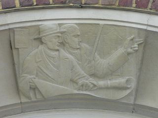
The Clock Tower is a free-standing clock tower in the centre of Brighton, part of the English city of Brighton and Hove. Built in 1888 in commemoration of the Golden Jubilee of Queen Victoria, the distinctive structure included innovative structural features and became a landmark in the popular and fashionable seaside resort. The city's residents "retain a nostalgic affection" for it, even though opinion is sharply divided as to the tower's architectural merit. English Heritage has listed the clock tower at Grade II for its architectural and historical importance.

<span class="mw-page-title-main">Grade II listed buildings in Brighton and Hove: A–B</span>

As of February 2001, there were 1,124 listed buildings with Grade II status in the English city of Brighton and Hove. The total at 2009 was similar. The city, on the English Channel coast approximately 52 miles (84 km) south of London, was formed as a unitary authority in 1997 by the merger of the neighbouring towns of Brighton and Hove. Queen Elizabeth II granted city status in 2000.

<span class="mw-page-title-main">Grade II listed buildings in Brighton and Hove: C–D</span>

As of February 2001, there were 1,124 listed buildings with Grade II status in the English city of Brighton and Hove. The total at 2009 was similar. The city, on the English Channel coast approximately 52 miles (84 km) south of London, was formed as a unitary authority in 1997 by the merger of the neighbouring towns of Brighton and Hove. Queen Elizabeth II granted city status in 2000.

<span class="mw-page-title-main">Buildings and architecture of Brighton and Hove</span>

Brighton and Hove, a city on the English Channel coast in southeast England, has a large and diverse stock of buildings "unrivalled architecturally" among the country's seaside resorts. The urban area, designated a city in 2000, is made up of the formerly separate towns of Brighton and Hove, nearby villages such as Portslade, Patcham and Rottingdean, and 20th-century estates such as Moulsecoomb and Mile Oak. The conurbation was first united in 1997 as a unitary authority and has a population of about 253,000. About half of the 20,430-acre (8,270 ha) geographical area is classed as built up.

<span class="mw-page-title-main">Grade II listed buildings in Brighton and Hove: E–H</span>

As of February 2001, there were 1,124 listed buildings with Grade II status in the English city of Brighton and Hove. The total at 2009 was similar. The city, on the English Channel coast approximately 52 miles (84 km) south of London, was formed as a unitary authority in 1997 by the merger of the neighbouring towns of Brighton and Hove. Queen Elizabeth II granted city status in 2000.

Thomas Lainson, FRIBA was a British architect. He is best known for his work in the East Sussex coastal towns of Brighton and Hove, where several of his eclectic range of residential, commercial and religious buildings have been awarded listed status by English Heritage. Working alone or in partnership with two sons as Lainson & Sons, he designed buildings in a wide range of styles, from Neo-Byzantine to High Victorian Gothic; his work is described as having a "solid style, typical of the time".

<span class="mw-page-title-main">Round Hill, Brighton</span> Inner suburban area in Brighton, UK

Round Hill is an inner suburban area of Brighton, part of the coastal city of Brighton and Hove in England. The area contains a mix of privately owned and privately rented terraced housing, much of which has been converted for multiple occupancies, and small-scale commercial development. It was developed mostly in the late 19th century on an area of high land overlooking central Brighton and with good views in all directions, the area became a desirable middle-class suburb—particularly the large terraced houses of Roundhill Crescent and Richmond Road, and the exclusive Park Crescent—and within a few decades the whole of the hill had been built up with smaller terraces and some large villas.

<span class="mw-page-title-main">John Leopold Denman</span> British architect (1882–1975)

John Leopold DenmanFRIBA was an architect from the English seaside resort of Brighton, now part of the city of Brighton and Hove. He had a prolific career in the area during the 20th century, both on his own and as part of the Denman & Son firm in partnership with his son John Bluet Denman. Described as "the master of ... mid-century Neo-Georgian", Denman was responsible for a range of commercial, civic and religious buildings in Brighton, and pubs and hotels there and elsewhere on the south coast of England on behalf of Brighton's Kemp Town Brewery. He used other architectural styles as well, and was responsible for at least one mansion, several smaller houses, various buildings in cemeteries and crematoria, and alterations to many churches. His work on church restorations has been praised, and he has been called "the leading church architect of his time in Sussex"; he also wrote a book on the ecclesiastical architecture of the county.

Clayton & Black were a firm of architects and surveyors from Brighton, part of the English city of Brighton and Hove. In a career spanning the Victorian, Edwardian and interwar eras, they were responsible for designing and constructing an eclectic range of buildings in the growing town of Brighton and its neighbour Hove. Their work encompassed new residential, commercial, industrial and civic buildings, shopping arcades, churches, schools, cinemas and pubs, and alterations to hotels and other buildings. Later reconstituted as Clayton, Black & Daviel, the company designed some churches in the postwar period.

<span class="mw-page-title-main">First Church of Christ, Scientist (Brighton)</span> Church in Brighton and Hove , United Kingdom

The First Church of Christ, Scientist is a church serving members of the Church of Christ, Scientist denomination in the English coastal city of Brighton and Hove. The present building, originally a "notable" private house in Brighton's exclusive Montpelier suburb, was extended and converted into a church by prolific local architecture firm Clayton & Black in 1921.

<span class="mw-page-title-main">163 North Street, Brighton</span> Building in Brighton, England

The building at 163 North Street in Brighton, part of the English coastal city of Brighton and Hove, was erected in 1904 for an insurance company and has since been used as a branch by several banks and building societies. It now houses a bookmaker's shop. The distinctive pink granite Edwardian Baroque-style office, embellished with towers, decorative carvings and a landmark cupola, has been called "the most impressive building" on Brighton's main commercial thoroughfare. One of many works by prolific local architecture firm Clayton & Black, it has been described as their chef d'œuvre. English Heritage has listed it at Grade II for its architectural and historical importance.

<span class="mw-page-title-main">Palmeira Square</span> 19th century residences in Hove, England

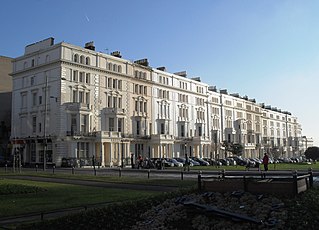
Palmeira Square is a mid-19th-century residential development in Hove, part of the English city and seaside resort of Brighton and Hove. At the southern end it adjoins Adelaide Crescent, another architectural set-piece which leads down to the seafront; large terraced houses occupy its west and east sides, separated by a public garden; and at the north end is one of Hove's main road junctions. This is also called Palmeira Square, and its north side is lined with late 19th-century terraced mansions. Commercial buildings and a church also stand on the main road, which is served by Brighton & Hove bus routes 1, 1A, N1, 2, 5, 5A, 5B, N5, 6, 25, 46, 49, 60, 71, 71A and 96.

Horatio Nelson Goulty was an English architect. He designed several buildings in Brighton and was an important figure in the town's public affairs in the early Victorian era.

<span class="mw-page-title-main">Prestonville, Brighton</span>

Prestonville is a largely residential area in the northwest of Brighton, part of the English city of Brighton and Hove. It covers a long, narrow and steeply sloping ridge of land between the Brighton Main Line and Dyke Road, two major transport corridors which run north-northwestwards from the centre of Brighton. Residential development started in the 1860s and spread northwards, further from central Brighton, over the next six decades. The area is characterised by middle-class and upper-middle-class housing in various styles, small-scale commercial development and long eastward views across the city. Two Anglican churches serve Prestonville—one at each end of the area—and there are several listed buildings.

Thomas Simpson (1825–1908) was a British architect associated with the seaside town of Brighton. As architect to the Brighton and Preston School Board and the equivalent institution in neighbouring Hove, he designed "a distinguished group of board schools" during the late 19th century, when the provision of mass education was greatly extended. Many of these schools survive and some have listed status. He also worked on five Nonconformist chapels for various Christian denominations, using a wide variety of materials and architectural styles. He was the father of Sir John William Simpson and Gilbert Murray Simpson, who both became architects.

Gilbert Murray Simpsonfriba (1869–1954) was a British architect from Brighton who did most of his work in the seaside resort. In 1890 Simpson joined his father Thomas, architect to the Brighton and Preston School Board and the Hove School Board, and helped to design some of the "distinguished group of board schools" for those institutions during the late 19th century. He took over the firm of Thomas Simpson & Son when his father died in 1908, and went on to design several other institutional buildings in Brighton. His elder brother Sir John William Simpson was also an architect.

<span class="mw-page-title-main">Percy and Wagner Almshouses</span> Historic site in East Sussex, United Kingdom

The Percy and Wagner Almshouses are a group of 12 almshouses in the inner-city Hanover area of the English coastal city of Brighton and Hove. The first six date from 1795 and are among the few pre-19th-century buildings left in the city. Six more were added in a matching style in 1859. They are the only surviving almshouses in Brighton and have been listed at Grade II for their architectural and historical importance.

References

Notes

  1. Antram & Morrice 2008 , p. 24.
  2. 1 2 Historic England. "Stanford County Junior School including walls, gate piers & railings, Stanford Road (west side), Brighton (Grade II) (1380951)". National Heritage List for England . Retrieved 29 April 2014.
  3. 1 2 3 4 5 6 7 8 9 10 11 12 13 14 15 16 17 18 19 20 21 Carder 1990 , §172.
  4. 1 2 3 4 5 6 7 Antram & Pevsner 2013 , p. 196.
  5. 1 2 Carder 1990 , §138.
  6. "The Brighton and Hove Summary Lists of Historic Buildings (ENS/CR/LB/03)" (PDF). Brighton & Hove City Council (Environment Department, Design & Conservation Team). 21 October 2013. Archived from the original (PDF) on 23 September 2015. Retrieved 26 February 2014.
  7. 1 2 3 Jones & Pollard 1999 , p. 45.
  8. Rowland 1997 , p. 13.
  9. Berry 2005 , p. 171.
  10. 1 2 Carder 1990 , §49.
  11. Carder 1990 , §189.
  12. Antram & Morrice 2008 , p. 88.
  13. "Hanover Terrace School". My Brighton and Hove (c/o QueenSpark Books). 22 March 2006. Archived from the original on 8 May 2014. Retrieved 24 April 2014.
  14. Jones & Pollard 1999 , p. 43.
  15. 1 2 3 Jones & Pollard 1999 , p. 44.
  16. 1 2 3 Collis 2010 , p. 301.
  17. "Queen's Park Primary School". Department for Education. 11 April 2014. Archived from the original on 29 July 2014. Retrieved 27 April 2014.
  18. Carder 1990 , §133.
  19. "How to find us". City College Brighton & Hove. 2014. Archived from the original on 8 May 2014. Retrieved 24 April 2014.
  20. Antram & Morrice 2008 , pp. 183–184.
  21. le Duc, Frank (7 October 2016). "City College sells Brighton annexe for housing". Brighton and Hove News. Archived from the original on 10 October 2016. Retrieved 10 October 2016.
  22. Historic England. "Finsbury Road Board School, Finsbury Road, Brighton (Grade II) (1380503)". National Heritage List for England . Retrieved 24 April 2014.
  23. Creffield, Fran (2013). "Finsbury Road, BN2" (PDF). Brand Vaughan. Archived from the original (PDF) on 5 May 2014. Retrieved 24 April 2014.
  24. "Circus Street Annexe refurbishment ..." University of Brighton (Estate and Facilities Management). 2010. Archived from the original on 8 May 2014. Retrieved 3 March 2014.
  25. "Circus Street/Municipal Market Development Brief (March 2005)" (PDF). Brighton and Hove City Council. July 2005. pp. 7–8. Archived (PDF) from the original on 8 May 2014. Retrieved 3 March 2014.
  26. Evans, Rebecca (3 February 2012). "£80m city plan revived". The Argus . Newsquest Media Group. Archived from the original on 8 May 2014. Retrieved 3 March 2014.
  27. Historic England. "Connaught Centre (former Connaught Road School), including carpenters' workshop, Connaught Road, Hove (Grade II) (1393480)". National Heritage List for England . Retrieved 15 January 2013.
  28. Middleton 2002 , Vol. 3, pp. 97–100.
  29. Historic England. "Downs Junior School and Attached Walls and Gate Piers, Rugby Road, Brighton (Grade II) (1380839)". National Heritage List for England . Retrieved 29 April 2014.
  30. Carder 1990 , §63.
  31. "Elm Grove School". My Brighton and Hove (c/o QueenSpark Books). 22 March 2006. Archived from the original on 5 May 2014. Retrieved 27 April 2014.
  32. "Elm Grove Primary School". Department for Education. 10 March 2014. Archived from the original on 5 May 2014. Retrieved 27 April 2014.
  33. Historic England. "St Luke's School, St Luke's Terrace, Brighton (Grade II) (1380894)". National Heritage List for England . Retrieved 24 April 2014.
  34. Collis 2010 , p. 185.
  35. Elleray 2004 , p. 12.
  36. Jones & Pollard 1999 , p. 41.
  37. Elleray 2004 , p. 10.
  38. 1 2 3 "Reformatories and Industrial Schools in England and Wales". Peter Higginbotham. 2014. Archived from the original on 25 June 2014. Retrieved 29 April 2014.
  39. Historic England. "Former Workhouse Building at Old Heritage, Heritage Crafts School, North Common, Chailey (Grade II) (1043986)". National Heritage List for England . Retrieved 29 April 2014.
  40. Middleton 2002 , Vol. 9, p. 44.
  41. Middleton 2002 , Vol. 9, pp. 43–47.
  42. Hamblett, Ray; Langrish, Bernard (21 November 2007). "Mile Oak Approved School: Demolition in 1977". My Brighton and Hove (c/o QueenSpark Books). Archived from the original on 8 May 2014. Retrieved 29 April 2014.

Bibliography

  • Antram, Nicholas; Morrice, Richard (2008). Brighton and Hove. Pevsner Architectural Guides. London: Yale University Press. ISBN   978-0-300-12661-7.
  • Antram, Nicholas; Pevsner, Nikolaus (2013). Sussex: East with Brighton and Hove. The Buildings of England. London: Yale University Press. ISBN   978-0-300-18473-0.
  • Berry, Sue (2005). Georgian Brighton. Chichester: Phillimore & Co. Ltd. ISBN   1-86077-342-7.
  • Carder, Timothy (1990). The Encyclopaedia of Brighton. Lewes: East Sussex County Libraries. ISBN   0-86147-315-9.
  • Collis, Rose (2010). The New Encyclopaedia of Brighton. (based on the original by Tim Carder) (1st ed.). Brighton: Brighton & Hove Libraries. ISBN   978-0-9564664-0-2.
  • Elleray, D. Robert (2004). Sussex Places of Worship. Worthing: Optimus Books. ISBN   0-9533132-7-1.
  • Jones, Lavender; Pollard, Jacqueline (1999). Hilly Laine to Hanover: a Brighton Neighbourhood. Brighton: Brighton Books Publishing. ISBN   978-1-901454-04-8.
  • Middleton, Judy (2002). The Encyclopaedia of Hove & Portslade. Brighton: Brighton & Hove Libraries.
  • Rowland, David (1997). The Brighton Blitz. Seaford: S.B. Publications. ISBN   1-85770-124-0.