List of power stations in Laos

Last updated

Electricity generation in Laos is produced by one coal-fired power plant and several hydroelectric dams. 53% of power generated in 2016 came from renewable sources. The majority of power produced from the Honsa plant is exported to Thailand. The Xayaburi run-of-river dam is expected to generate over 7,000 GWh of electricity per year, which will mainly be exported to Thailand as part of the development of an interconnected Southeast Asian energy market. [1]

Contents

Thermal

Power PlantFuelCapacity (MW)UnitsYear completed
Hongsa Lignite18783 x 626 MW2015

Hydroelectric

Table 1: Existing Lao hydropower stations (15 MW installed capacity and above). [2]

Plant nameRiverRiver BasinLocationCODInstalled capacity (MW)Mean annual energy (GWh)Height (m)Crest length (m)Total storage (m3)Max reservoir area (km2)
Don Sahong Mekong Mekong 13°57′22″N105°57′51″E / 13.956223°N 105.964247°E / 13.956223; 105.964247 (Don Sahong HPP) 20202402,000256,800252.2
Houay Ho Houayho/Xekong Mekong 15°03′34″N106°45′52″E / 15.059464°N 106.764377°E / 15.059464; 106.764377 (Houayho HPP) 1999152450793,53037
Houay La NgeHouay La-Nge Mekong 15°46′30″N107°03′18″E / 15.774865°N 107.054896°E / 15.774865; 107.054896 (Houay La Nge HPP) 202360290581791493.6
Houay Lamphan GnaiXekong Mekong 15°21′23″N106°29′56″E / 15.356495°N 106.498949°E / 15.356495; 106.498949 (Houay Lamphan Gnai HPP) 201584.84807774.51409
Houay PorHouay Por Mekong 15°32′44″N106°15′24″E / 15.545605°N 106.256763°E / 15.545605; 106.256763 (Houay Por HPP) 2018157560.76
Lower Houay Lam PhanhHouay Lamphan Mekong 15°19′17″N106°37′48″E / 15.321515°N 106.630123°E / 15.321515; 106.630123 (Lower Houay Lam Phanh HPP) 202215685552373.9
Nam AoNam Ao Mekong 19°09′39″N103°16′59″E / 19.160876°N 103.283107°E / 19.160876; 103.283107 (Nam Ao HPP) 2023159226130524.9
Nam BengNam Beng Mekong 19°56′47″N101°14′15″E / 19.946436°N 101.237563°E / 19.946436; 101.237563 (Nam Beng HPP) 20143614525.584.83,6110.7
Nam Che 1Nam Che Mekong 19°03′17″N103°30′49″E / 19.054645°N 103.513536°E / 19.054645; 103.513536 (Nam Che 1 HPP) 201916.82350
Nam Chien 1Nam Che Mekong 19°08′43″N103°33′26″E / 19.145395°N 103.557259°E / 19.145395; 103.557259 (Nam Chien 1 HPP) 2018104448.268.836714
Nam Houng 1Nam Houng Mekong 19°11′24″N101°48′23″E / 19.189914°N 101.806322°E / 19.189914; 101.806322 (Nam Young 1 HPP) 202315571.52
Nam Khan 2 Nam Khan Mekong 19°41′07″N102°22′11″E / 19.685364°N 102.369791°E / 19.685364; 102.369791 (Nam Khan 2 HPP) 201513055816040530.5
Nam Khan 3 Nam Khan Mekong 19°44′49″N102°13′22″E / 19.747016°N 102.222793°E / 19.747016; 102.222793 (Nam Khan 3 HPP) 2016884807774.51409
Nam Kong 1Nam Kong Mekong 14°32′47″N106°44′27″E / 14.546513°N 106.740933°E / 14.546513; 106.740933 (Nam Kong HPP 1) 20211606498738667921.8
Nam Kong 2Nam Kong Mekong 14°29′41″N106°51′24″E / 14.494672°N 106.856669°E / 14.494672; 106.856669 (Nam Kong HPP 2) 2018662645021071.44.2
Nam Kong 3Nam Kong Mekong 14°33′59″N106°54′45″E / 14.566338°N 106.912551°E / 14.566338; 106.912551 (Nam Kong 3 HPP) 2021542046550047132
Nam LeukNam Leuk/Nam Ngum Mekong 18°26′15″N102°56′48″E / 18.437406°N 102.94675°E / 18.437406; 102.94675 (Nam Leuk HPP) 20006021551.580018517.2
Nam Lik 1Nam Lik Mekong 18°37′10″N102°23′14″E / 18.619438°N 102.387252°E / 18.619438; 102.387252 (Nam Lik 1 HPP) 20196425636.57222.3
Nam Lik 1-2Nam Lik Mekong 18°47′38″N102°07′00″E / 18.793782°N 102.116714°E / 18.793782; 102.116714 (Nam Lik 1-2 HPP) 20101004351033281124.4
Nam Mang 1Nam Mang Mekong 18°32′03″N103°11′47″E / 18.53423°N 103.196286°E / 18.53423; 103.196286 (Nam Mang 1 HPP) 2016642257028016.50.148
Nam Mang 3Nam Gnogn Mekong 18°20′58″N102°45′55″E / 18.349383°N 102.765244°E / 18.349383; 102.765244 (Nam Mang 3 HPP) 200440150281514910
Nam Ngiep 1Nam Ngiep Mekong 18°38′45″N103°33′08″E / 18.645828°N 103.552329°E / 18.645828; 103.552329 (Nam Ngiep 1 HPP) 20192721,5461675301,19267
Nam Ngiep 1 (DS)Nam Ngiep Mekong 18°38′53″N103°34′18″E / 18.647966°N 103.571591°E / 18.647966; 103.571591 (Nam Ngiep 1 (DS) HPP) 20191810520904.61.27
Nam Ngiep 2Nam Ngiep Mekong 19°14′36″N103°17′02″E / 19.243328°N 103.283818°E / 19.243328; 103.283818 (Nam Ngiep 2 HPP) 201518073270.5163
Nam Ngiep 2BNam Ngiep Mekong 19°09′21″N103°20′46″E / 19.155918°N 103.346031°E / 19.155918; 103.346031 (Nam Ngiep 2B HPP) 20151876
Nam Ngiep 3ANam Ngiep Mekong 19°14′37″N103°17′02″E / 19.243546°N 103.283913°E / 19.243546; 103.283913 (Nam Ngiep 3A HPP) 2014441443011013.851.8
Nam Ngum 1 Nam Ngum Mekong 18°31′52″N102°32′51″E / 18.531068°N 102.547577°E / 18.531068; 102.547577 (Nam Ngum 1 HPP) 19713151,455704684,700370
Nam Ngum 2 Nam Ngum Mekong 18°45′19″N102°46′35″E / 18.755374°N 102.776476°E / 18.755374; 102.776476 (Nam Ngum 2 HPP) 20116152,300181.54213,590122.2
Nam Ngum 5 Nam Ngum Mekong 19°21′22″N102°37′16″E / 19.356095°N 102.621196°E / 19.356095; 102.621196 (Nam Ngum 5 HPP) 2012120507104.525831414.6
Nam Ou 1 Nam Ou Mekong 20°05′18″N102°15′55″E / 20.0883°N 102.265379°E / 20.0883; 102.265379 (Nam Ou 1 HPP) 20191607106544289.19.56
Nam Ou 2 Nam Ou Mekong 20°24′42″N102°28′22″E / 20.411698°N 102.472817°E / 20.411698; 102.472817 (Nam Ou 2 HPP) 201612054655352121.715.7
Nam Ou 3 Nam Ou Mekong 20°41′43″N102°39′55″E / 20.695251°N 102.665404°E / 20.695251; 102.665404 (Nam Ou 3 HPP) 202015068572340168.613.26
Nam Ou 4 Nam Ou Mekong 21°07′13″N102°29′39″E / 21.120153°N 102.494173°E / 21.120153; 102.494173 (Nam Ou 4 HPP) 2020116524473001249.37
Nam Ou 5 Nam Ou Mekong 21°24′41″N102°20′39″E / 21.411349°N 102.344263°E / 21.411349; 102.344263 (Nam Ou 5 HPP) 20162401,0497433517.22
Nam Ou 6 Nam Ou Mekong 21°24′41″N102°20′39″E / 21.411349°N 102.344263°E / 21.411349; 102.344263 (Nam Ou 6 HPP) 20161807398840917.01
Nam Ou 7 Nam Ou Mekong 22°04′40″N102°15′52″E / 22.07779°N 102.264436°E / 22.07779; 102.264436 (Nam Ou 7 HPP) 20201908111478251,49438.16
Nam Pha GnaiNam Pha Gnai Mekong 19°00′48″N102°15′52″E / 19.013318°N 102.264436°E / 19.013318; 102.264436 (Nam Pha Gnai HPP) 201619.2130651481.5
Nam PhayNam Phay Mekong 19°06′34″N102°45′27″E / 19.109357°N 102.757461°E / 19.109357; 102.757461 (Nam Phay HPP) 201886419.518.92
Nam San 3ANam San Mekong 19°07′45″N103°39′42″E / 19.129193°N 103.661752°E / 19.129193; 103.661752 (Nam San 3A HPP) 201669278.4753501238.5
Nam San 3BNam San Mekong 19°05′08″N103°37′12″E / 19.085633°N 103.619938°E / 19.085633; 103.619938 (Nam San 3B HPP) 201545198
Nam Tha 1 Nam Tha Mekong 20°14′58″N100°53′33″E / 20.249467°N 100.892433°E / 20.249467; 100.892433 (Nam Tha 1 HPP) 2018168759.493.7349.21,755113.9
Nam Tha Had MuakNam Tha Mekong 20°14′34″N100°42′44″E / 20.24264°N 100.712302°E / 20.24264; 100.712302 (Nam Tha 1 HPP) 202237.5102.67
Nam Theun 1 Nam Theun Mekong 18°21′24″N104°08′53″E / 18.356733°N 104.148017°E / 18.356733; 104.148017 (Nam Theun 1 HPP) 20226502,5611777712,77293.6
Nam Theun 2 Nam Theun/Xe Bangfai Mekong 17°59′50″N104°57′08″E / 17.997353°N 104.952306°E / 17.997353; 104.952306 (Nam Theun 2 HPP) 20101,0755,936483253,500450
Theun-Hinboun Nam Theun Mekong 18°15′40″N104°33′45″E / 18.261005°N 104.562525°E / 18.261005; 104.562525 (Theun-Hinboun Hydropower Plant) 19982201,645488101,30049
Theun-Hinboun Expansion ProjectNam Gnouang Mekong 18°17′50″N104°38′10″E / 18.297248°N 104.636171°E / 18.297248; 104.636171 (Theun-Hinboun Expansion Project) 20132221,395654802,45049
Xayaburi Mekong Mekong 19°15′14″N101°48′49″E / 19.254006°N 101.813699°E / 19.254006; 101.813699 (Xayaburi HPP) 20191,2856,035488101,30049
Xe Kaman 1Xe Kaman Mekong 14°57′39″N107°09′23″E / 14.960724°N 107.156336°E / 14.960724; 107.156336 (Xe Kaman 1 HPP) 20182901,0961201854,804149.8
Xe Kaman 3Xe Kaman Mekong 15°25′31″N107°21′45″E / 15.425194°N 107.362611°E / 15.425194; 107.362611 (Xe Kaman 3 HPP) 20142501,000102543141.55.2
Xe Kaman-SanxayXe Kaman Mekong 14°53′20″N107°07′02″E / 14.888908°N 107.117133°E / 14.888908; 107.117133 (Xe Kaman-Sanxay HPP) 201832131.2281801.76
Xe Lanong 1Xe Lanong Mekong 16°21′23″N106°14′19″E / 16.356276°N 106.238749°E / 16.356276; 106.238749 (Xe Lanong 1 HPP) 202070269.967.5302953
Xepian-XenamnoyXepian/Xenamnoy Mekong 15°01′34″N106°37′39″E / 15.026115°N 106.627369°E / 15.026115; 106.627369 (Xepian-Xenamnoy HPP) 20194271,788731,6001,04350.6
Xe Nam Noy - Xe KatamXenamnoi/Xekatam Mekong 15°07′05″N106°37′00″E / 15.117928°N 106.616688°E / 15.117928; 106.616688 (Xepian-Xenamnoy HPP) 201620.183
Xeset 1Xeset Mekong 15°29′31″N106°16′43″E / 15.49200°N 106.27867°E / 15.49200; 106.27867 (Xeset 1 HPP) 19944515418124
Xeset 2Xeset Mekong 15°24′14″N106°16′49″E / 15.403775°N 106.280332°E / 15.403775; 106.280332 (Xeset 1 HPP) 20097630926144
Xeset 3Xe Don Mekong 15°20′32″N106°18′40″E / 15.342113°N 106.31115°E / 15.342113; 106.31115 (Xeset 3 HPP) 20172380111.3

Hydropower infrastructure under construction in the Mekong River Basin

Table 2: Hydropower dams under construction in Laos (15 MW installed capacity and above) [2]

ProjectRiverRiver basinLocationCODInstalled capacity (MW)Mean Annual Energy (GWh)Height (m)Crest length (m)Total storage (million m3)Max reservoir area (km2)
Houay Kaouane Mekong 20°04′00″N102°11′32″E / 20.06663°N 102.192339°E / 20.06663; 102.192339 (Houay Kaouane)  ?24
Luang Prabang Mekong Mekong 20°04′00″N102°11′32″E / 20.06663°N 102.192339°E / 20.06663; 102.192339 (Luang Prabang Dam) 20301,4606,500802751,589.572.39
Nam AngNam Ang Mekong 15°07′21″N107°06′31″E / 15.122545°N 107.108512°E / 15.122545; 107.108512 (Nam Ang Dam) 202431183.30.03
Nam EmounNam Emoun Mekong 15°34′27″N106°58′10″E / 15.5743°N 106.969395°E / 15.5743; 106.969395 (Nam Emoun Dam) 2025131.5460.59291270.070.16
Nam Hinboun 1Nam Hinboun Mekong 17°43′42″N104°34′17″E / 17.728201°N 104.571382°E / 17.728201; 104.571382 (Nam Hinboun 1 Dam) 20241579.743370
Nam Hinboun 2Nam Hinboun Mekong 18°01′25″N104°25′30″E / 18.023739°N 104.425006°E / 18.023739; 104.425006 (Nam Hinboun 2 Dam)  ?30155.2382.57
Nam NgaoNam Hinboun Mekong 20°23′54″N100°25′55″E / 20.398288°N 100.431852°E / 20.398288; 100.431852 (Nam Ngao Dam)  ?1581.169438.62.57
Nam Neun 3Nam NeunVietnam Coast 20°01′06″N103°49′00″E / 20.018273°N 103.816601°E / 20.018273; 103.816601 (Nam Neun 3 Dam) 20256025011034012
Nam Ngum 3 Nam Ngum Mekong 19°05′03″N102°52′44″E / 19.084097°N 102.878817°E / 19.084097; 102.878817 (Nam Ngum 3 Dam) 20244802,3452203951,41127.51
Nam Ngum 4 Nam Ngum Mekong 19°27′14″N103°00′37″E / 19.453804°N 103.010325°E / 19.453804; 103.010325 (Nam Ngum 4 Dam) 202424087274110
Nam Phan (Bolevan)Nam Phak Mekong 15°04′32″N106°08′21″E / 15.075548°N 106.139196°E / 15.075548; 106.139196 (Nam Phan Dam) 2025168788
Nam Pot 1Nam Pot Mekong 19°09′19″N103°15′59″E / 19.15518°N 103.266356°E / 19.15518; 103.266356 (Nam Pot 1 Dam)  ?20924.9
Nam Sam 3Nam SamVietnam Coast 20°08′59″N104°30′39″E / 20.149713°N 104.510899°E / 20.149713; 104.510899 (Nam Sam 3 Dam) 2025156626
Xe Lanong 2Xe Lanong Mekong 16°17′31″N106°31′04″E / 16.291893°N 106.517774°E / 16.291893; 106.517774 (Xe Lanong 2 Dam)  ?3514355
Xekong A (DS) Xekong Mekong 14°35′57″N106°33′15″E / 14.599171°N 106.554175°E / 14.599171; 106.554175 (Xekong A (DS)) 202586334.78.595.0325.4
Xekong 4B (DS) Xekong Mekong 15°44′39″N106°44′55″E / 15.744284°N 106.748666°E / 15.744284; 106.748666 (Xekong 4B) 20271758011171,004.722.4

Related Research Articles

<span class="mw-page-title-main">Mekong</span> Major river in Southeast Asia

The Mekong or Mekong River is a trans-boundary river in East Asia and Southeast Asia. It is the world's twelfth-longest river and the third-longest in Asia with an estimated length of 4,909 km (3,050 mi) and a drainage area of 795,000 km2 (307,000 sq mi), discharging 475 km3 (114 cu mi) of water annually. From its headwaters in the Tibetan Plateau, the river runs through Southwest China, Myanmar, Laos, Thailand, Cambodia, and southern Vietnam. The extreme seasonal variations in flow and the presence of rapids and waterfalls in the Mekong make navigation difficult. Even so, the river is a major trade route between Tibet and Southeast Asia. The construction of hydroelectric dams along the Mekong in the 2000s through the 2020s causes serious problems for the river's ecosystem, including the exacerbation of drought.

<span class="mw-page-title-main">Dams and reservoirs in Laos</span>

Dams and reservoirs in Laos are the cornerstone of the Lao government's goal of becoming the "battery of Asia".

<span class="mw-page-title-main">Nam Theun 2 Dam</span> Dam in Bolikhamsai and Khammouane Provinces, Laos

The Nam Theun 2 Hydropower Project, or simply NT2, is a hydroelectric dam on the Nam Theun River in Laos. Commercial operation of the plant began in April 2010. The scheme diverts water from the Nam Theun, a tributary of the Mekong River, to the Xe Bang Fai River, enabling a generation capacity of 1,075 MW, from a 350 m (1,148 ft) difference in elevation between the reservoir and the power station.

The Nam Ngum Dam is a hydroelectric dam on the Nam Ngum River, a major tributary of the Mekong River in Laos. It was the first hydropower dam built in the Lao PDR.

<span class="mw-page-title-main">Électricité du Laos</span>

Électricité du Laos(EDL) is the state corporation of Laos that owns and operates the country's electricity generation, electricity transmission and electricity distribution assets. The company also manages the import and export of electricity from the national electricity grid of the country. EDL was founded in 1959 and is headquartered in Vientiane.

<span class="mw-page-title-main">Hydropower dams in Myanmar</span>

There are almost 200 large dams in Myanmar. Myanmar (Burma) has a large hydroelectric power potential of 39,000 megawatts (52,000,000 hp), although the economical exploitable potential is about 37,000 megawatts (50,000,000 hp). Between 1990 and 2002, the country tripled its installed capacity of hydro plants, increasing from 253 megawatts (339,000 hp) to 745 megawatts (999,000 hp). Total installed capacity in 2010 is at least 2,449 megawatts (3,284,000 hp) MW, 6% of potential. Several large dams are planned to increase future hydro utilization.

<span class="mw-page-title-main">Hydropower in the Mekong River Basin</span>

The estimated hydropower potential of Mekong River Basin about 58,930 Megawatts (MW). As of February 2024, there are an estimated 167 Hydropower Plants (HPPs) in the Mekong, with a combined installed capacity of some 36,376.3 MW. An additional 20 HPPs are currently under construction and at various stages of completion. These have a combined installed capacity of an additional 4,535.5 MW.

<span class="mw-page-title-main">Sirindhorn Dam</span> Dam in Sirindhorn, Ubon Ratchathani

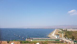
The Sirindhorn Dam is in Sirindhorn District, Ubon Ratchatani, Thailand. It impounds the Lam Dom Noi River, and its reservoir is the province's largest water resource. The dam was commissioned in 1971 to serve as a hydropower facility as well as to supply irrigation water. The dam was named after Princess Royal Sirindhorn. All of the electricity generated by the dam is destined for domestic markets. The dam was constructed and is owned and operated by the Electricity Generating Authority of Thailand and is located in the Mekong River Basin, just upstream from the controversial Pak Mun Dam.

The Sambor Dam is a proposed dam and hydroelectric power station on the Mekong River south of Sambor village in Prek Kampi District, Kratie Province, Cambodia. If built, it would be the lowest dam of the Mekong's mainstream dams, and largest in Cambodia.

The Lam Takhong Dam is an embankment dam on the Lam Takhong River between Pak Chong District and Sikhio District in Nakhon Ratchasima Province, Thailand. The dam was originally constructed in 1974 for the purposes of irrigation and water supply but after 2002, its water storage also serves as the lower reservoir for the Lam Takhong pumped storage power plant, Thailand's first power plant of that type.

<span class="mw-page-title-main">Ubol Ratana Dam</span> Dam in Ubolratana, Khon Kaen

The Ubol Ratana Dam, formerly known as the "Phong Neeb Dam", is a multi-purpose dam in tambon Khok Sung, Ubolratana district, approximately 50 km (31 mi) north of Khon Kaen, Khon Kaen province, Thailand. It was the first hydroelectric power project developed in Thailand's northeastern area of Isan. The dam impounds the Nam Phong, which flows into the Chi River and thence to the Mun River, a tributary of the Mekong River. The dam was given its current name by royal permission in 1966, in honour of princess Ubol Ratana, the eldest child of King Bhumibol Adulyadej.

<span class="mw-page-title-main">Xayaburi Dam</span> Dam in Xayaburi

The Xayaburi Dam is a run-of-river hydroelectric dam on the Lower Mekong River, approximately 30 kilometres (19 mi) east of Sainyabuli (Xayaburi) town in northern Laos. Commercial operation of the dam started in October 2019. The main purpose of the dam is to produce hydroelectric power, 95% of which is to be purchased by the Electricity Generating Authority of Thailand (EGAT). The project is surrounded in controversy due to complaints from downstream riparians and environmentalists. Preliminary construction began in early-2012, but work on the dam itself was suspended shortly thereafter due to complaints from Cambodia and Vietnam downstream. After making modifications to the dam's design, Laos started construction with a ceremony on 7 November 2012. The Xayaburi Dam is the first of the 11 dams planned on the lower Mekong.

The Don Sahong is a hydroelectric dam commissioned in 2020 on the Mekong River in Siphandone area of Champasak Province, Laos, less than two kilometers upstream of the Laos–Cambodia border.

The Houay Ho is a dam located in the Samakkhixay District of Attapeu Province, Laos, 160 km (99 mi) east of Pakse and 30 km (19 mi) northwest of Attapeu. The project is considered the first privately financed joint venture 'build-operate-transfer' (BOT) hydropower project in Laos. It has installed capacity of 152.1 megawatts (204,000 hp), almost all of which is exported to Thailand.

This page describes energy and electricity production, consumption and import in Laos.

Renewable energy in Thailand is a developing sector that addresses the country’s present high rate of carbon emissions. Several policies, such as the Thirteenth Plan or the Alternative Energy Development Plan, set future goals for increasing the capacity of renewable energy and reduce the reliance of nonrenewable energy. The major sources of renewable energy in Thailand are hydro power, solar power, wind power, and biomass, with biomass currently accounting for the majority of production. Thailand’s growth is hoped to lead to renewable energy cost reduction and increased investment.

Thailand has set targets and policies for the development of its energy sector for 2035, with priority being given to indigenous renewable energy resources, including hydropower.

Vietnam utilizes four main sources of renewable energy: hydroelectricity, wind power, solar power and biomass. At the end of 2018, hydropower was the largest source of renewable energy, contributing about 40% to the total national electricity capacity. In 2020, wind and solar had a combined share of 10% of the country's electrical generation, already meeting the government's 2030 goal, suggesting future displacement of growth of coal capacity. By the end of 2020, the total installed capacity of solar and wind power had reached over 17 GW. Over 25% of total power capacity is from variable renewable energy sources. The commercial biomass electricity generation is currently slow and limited to valorizing bagasse only, but the stream of forest products, agricultural and municipal waste is increasing. The government is studying a renewable portfolio standard that could promote this energy source.

<span class="mw-page-title-main">Nam Ou river cascade dams</span>

The Nam Ou cascade hydropower project is a series of seven hydroelectric dams along the Nam Ou river which are located in the provinces of Phongsaly and Luang Prabang in northern Laos. The project is managed by the Power Construction Corporation of China (PowerChina) and the Lao government. The project is the series of dams include seven levels of reservoirs in an attempt to mitigate ecological deterioration. The construction of the hydropower project is being completed in two phases. Phase I of the dams, including Nam Ou 2, Nam Ou 5, and Nam Ou 6 began operating on May 12, 2016. Phase II of the dams, including Nam Ou 1, 3, 4, and 7 is expected to be completed in 2020.

References

  1. "Thailand Aims to Be Southeast Asia's Power-Trading Middleman". Bloomberg. Retrieved 2019-08-26.
  2. 1 2 "WLE, 2016. Dataset on the Dams of the Irrawaddy, Mekong, Red and Salween River Basins. Vientiane, Lao PDR: CGIAR Research Program on Water, Land and Ecosystems - Greater Mekong". CGIAR Research Program on Water, Land and Ecosystems (Greater Mekong). Retrieved 2018-04-04.