Lyons, New York

Last updated

Lyons, New York
Wayne County Courthouse, Lyons, NY.jpg
Wayne County Courthouse
Nickname: 
"Peppermint City"
Wayne County New York incorporated and unincorporated areas Lyons highlighted.svg
Location in Wayne County and the state of New York.
Coordinates: 43°03′35″N076°59′33″W / 43.05972°N 76.99250°W / 43.05972; -76.99250
CountryUnited States
State New York
County Wayne
Settled1789
EstablishedMarch 1, 1811 [1]
Government
  Type Town Board
   Supervisor Jim Brady [2]
   Clerk Sal J. Colatarci
   Court Justice Richard Youngman
Justice Phil DeSain [3]
Area
[4]
  Total4.69 sq mi (12.15 km2)
  Land4.61 sq mi (11.95 km2)
  Water0.08 sq mi (0.20 km2)
Elevation
410 ft (137 m)
Population
 (2020)
  Total3,989
  Density864.73/sq mi (333.88/km2)
Time zone UTC−5 (Eastern (EST))
  Summer (DST) UTC−4 (EDT)
ZIP Code
14489
Area code(s) 315 and 680
FIPS code 36-43962
GNIS feature ID0956197
Website http://lyonstown.com/

Lyons is a town in and the county seat of Wayne County, New York, United States. The population was 5,682 at the 2010 census. It is named after Lyon, France. [5]

Contents

The Town of Lyons is in the south-central part of the county and contains a hamlet also named Lyons, formerly a village. It is located on the Erie Canal.

History

The area was part of the Pulteney Estate. Settlement began circa 1789. The region was originally known as "The Forks." The Town of Lyons was formed from the Town of Sodus in 1811. The Erie Canal was completed as far as Lyons by 1821.

In 1825, the size of the town was reduced upon the formation of the Town of Arcadia.

Geography

According to the United States Census Bureau, the town has a total area of 37.6 square miles (97.4 km2), of which 37.5 square miles (97.1 km2) is land and 0.1 square mile (0.3 km2) (0.32%) is water.

New York State Route 14 and New York State Route 31 intersect in the hamlet of Lyons.

Demographics

Historical population
CensusPop.Note
1820 3,972
1830 3,603−9.3%
1840 4,30219.4%
1850 4,92514.5%
1860 5,0763.1%
1870 5,1150.8%
1880 5,76212.6%
1890 6,2288.1%
1900 5,824−6.5%
1910 5,9131.5%
1920 5,559−6.0%
1930 5,073−8.7%
1940 5,0760.1%
1950 5,3796.0%
1960 6,14714.3%
1970 6,015−2.1%
1980 6,0731.0%
1990 6,3154.0%
2000 5,831−7.7%
2010 5,682−2.6%
2020 3,989−29.8%
U.S. Decennial Census [6]

As of the census [7] of 2010, there were 5,682 people, 2,206 households, and 1,389 families residing in the town. The population density was 151.1 inhabitants per square mile (58.3/km2). The racial makeup of the town was 87.1% White, 8.1% Black or African American, 0.4% Native American, 0.2% Asian, 0.0% Pacific Islander, 1.7% from other races, and 2.5% from two or more races. Hispanic or Latino of any race were 4.7% of the population.

There were 2,206 households, out of which 26.0% had children under the age of 18 living with them, 41.7% were married couples living together, 15.4% had a female householder with no husband present, and 37.0% were non-families. 29.9% of all households were made up of individuals, and 11.8% had someone living alone who was 65 years of age or older. The average household size was 2.41 and the average family size was 2.94.

In the town, the population was spread out, with 24.8% under the age of 20, 6.2% from 20 to 24, 23.5% from 25 to 44, 28.5% from 45 to 64, and 16.9% who were 65 years of age or older. The median age was 41.9 years. For every 100 females, there were 96.0 males. For every 100 females age 18 and over, there were 96.1 males.

The median income for a household in the town was $39,198, and the median income for a family was $53,430. Males had a median income of $40,883 versus $30,914 for females. The per capita income for the town was $21,016. About 14.9% of families and 21.3% of the population were below the poverty line, including 36.2% of those under age 18 and 10.3% of those age 65 or over.

Housing

There were 2,458 housing units at an average density of 65.4 per square mile (25.3/km2); a total of 10.3% of housing units were vacant.

There were 2,206 occupied housing units in the town, of which 1,443 were owner-occupied units (65.4%), while 763 were renter-occupied (34.6%). The homeowner vacancy rate was 1.8% of total units. The rental unit vacancy rate was 12.0%. [7]

Economy

The H. G. Hotchkiss Essential Oil Company plant H. G. HOTCHKISS ESSENTIAL OIL COMPANY PLANT, WAYNE COUNTY, NY.jpg
The H. G. Hotchkiss Essential Oil Company plant

H.G. Hotchkiss moved his Hotchkiss Essential Oil Company to Lyons in 1841, where it became an important business in the local economy.

Arts and culture

The Dipper Dredge No. 3 and Towar–Ennis Farmhouse and Barn Complex are listed on the National Register of Historic Places. [8]

Remnants of the former Enlarged Erie Canal Lock 56 (also called the Poorhouse Lock) are located along Dry Dock Road near the current Lock 28A and dry docks complex west of Lyons, just off N.Y. Route 31. It was a double-chamber lock built in 1842, and had a lift of 10.12 feet (3.08 m) to the west. The lock was abandoned around 1911. [9]

Lyons is part of the Erie Canalway National Heritage Corridor. [10] Erie Canal Lock 28A is located just west of the bridge on Dry Dock Road, off N.Y. Route 31. It was built around 1913, and has a lift of 19.5 feet (5.85 m) to the west. [11] The dry docks complex is adjacent to the lock, operated by the New York State Canal Corporation.

Notable people

Communities and locations in the Town of Lyons

Related Research Articles

<span class="mw-page-title-main">Aurelius, New York</span> Town in New York, United States

Aurelius is a town in Cayuga County, New York, United States. The population was 2,610 at the 2020 census. The town was named after the Roman emperor Marcus Aurelius. It is at the western edge of the county and borders the city of Auburn.

<span class="mw-page-title-main">Concord, New York</span> Town in New York, United States

Concord is a town in Erie County, New York, United States. The population was 8,494 at the 2010 census. The town is believed to be named after Concord, Massachusetts, by early settlers from New England.

<span class="mw-page-title-main">Pendleton, New York</span> Town in New York, United States

Pendleton is a town on the southern edge of Niagara County, New York, United States. It is east of the city of Niagara Falls and southwest of the city of Lockport. The population was 6,397 at the 2010 census.

<span class="mw-page-title-main">Royalton, New York</span> Town in New York, United States

Royalton is a town in Niagara County, New York, United States. The population was 7,660 at the 2010 census.

<span class="mw-page-title-main">Verona, New York</span> Town in New York, United States

Verona is a town in southwestern Oneida County, New York, United States. The population was 6,293 at the 2010 census. The town was named after Verona, Italy.

<span class="mw-page-title-main">DeWitt, New York</span> Town in New York, United States

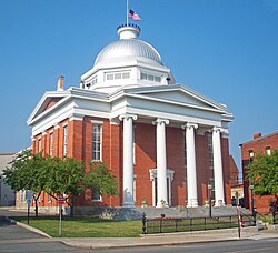
DeWitt is a town in Onondaga County, New York, United States. As of the 2020 census, the population was 26,074. The town is named after major Moses DeWitt, a judge and soldier. An eastern suburb of Syracuse, DeWitt also is the site of most of the campus and all of the academic buildings of Le Moyne College.

<span class="mw-page-title-main">Gaines, New York</span> Town in New York, United States

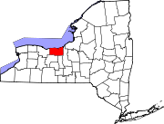
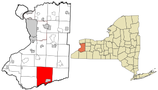
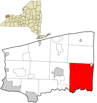
Gaines is a town in Orleans County, New York, United States. The population was 3,378 at the 2010 census. The town is named after General Edmund P. Gaines, who defended the area during the War of 1812.

<span class="mw-page-title-main">Murray, New York</span> Town in Orleans County, New York

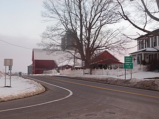
Murray is a town in Orleans County, New York, United States. The population was 6,259 at the 2000 census.

<span class="mw-page-title-main">Phoenix, New York</span> Village in New York, United States

Phoenix is a village in Oswego County, New York, United States. The population was 2,382 at the 2010 census. The name is derived from Alexander Phoenix. The village of Phoenix lies in the Lake Ontario lake-effect snow belt, with seasonal snow totals regularly exceeding 200 in (510 cm). Phoenix lies in the southwest part of the town of Schroeppel.

<span class="mw-page-title-main">Tyre, New York</span> Town in New York, United States

Tyre is a town in Seneca County, New York, United States. The population was 1,002 at the 2020 census. The town is named after the Lebanese city of Tyre.

<span class="mw-page-title-main">Arcadia, New York</span> Town in New York, United States

Arcadia is a town in Wayne County, New York, United States. The population was 14,244 at the 2010 census.

<span class="mw-page-title-main">Clyde, New York</span> Village in New York, United States

Clyde is a village in Wayne County, New York, United States. The population was 2,093 at the 2010 census. It was named after the River Clyde, in Scotland, and the village sits on the Clyde River, a tributary of the Seneca River.

<span class="mw-page-title-main">Galen, New York</span> Town in New York, United States

Galen is a town in Wayne County, New York, United States. The population was 4,290 at the 2010 census. The town is named after the classical physician Galen.

<span class="mw-page-title-main">Newark, New York</span> Village in New York, United States

Newark is a village in Wayne County, New York, United States, 35 miles (56 km) south east of Rochester and 48 miles (77 km) west of Syracuse. The population was 9,017 at the 2020 census. The Village of Newark is in the south part of the Town of Arcadia and is in the south of Wayne County. It is the most populous community in Wayne County.

<span class="mw-page-title-main">Ripley, New York</span> Town in New York, United States

Ripley is a town on Lake Erie in the westernmost part of Chautauqua County, New York, United States. The population was 2,310 at the time of the 2020 census. The town was named after Eleazer Wheelock Ripley, a general in the War of 1812. There are no incorporated villages in the town, but there is one census-designated place: the hamlet of Ripley. The town is perhaps best known as being the western terminus of the New York State Thruway.

<span class="mw-page-title-main">Macedon, New York</span> Town in New York, United States

Macedon is a town in Wayne County, New York, United States. The population was 9,148 at the 2010 census.

<span class="mw-page-title-main">Palmyra (village), New York</span> Village in New York, United States

Palmyra is a village in Wayne County, New York, United States. The population was 3,536 at the 2010 census. The village, along with the town, is named after Palmyra in present-day Syria.

<span class="mw-page-title-main">Palmyra, New York</span> Town in New York, United States

Palmyra is a town in southwestern Wayne County, New York, United States. The population was 7,975 at the 2010 census. The town is named after the ancient city Palmyra in Syria.

<span class="mw-page-title-main">Lyons (hamlet), New York</span> Hamlet and CDP in New York, United States

Lyons is a hamlet in Wayne County, New York, United States. The population was 3,619 at the 2010 census. It is located in the southern half of the town of Lyons. The hamlet and the town are named after Lyon, France. Originally named "The Forks", Lyons was renamed by land agent George Williamson.

<span class="mw-page-title-main">Macedon (hamlet), New York</span> Hamlet and CDP in New York, United States

Macedon is a hamlet located in the Town of Macedon in Wayne County, New York, United States. As of the 2010 census, the hamlet had a total population of 1,523. It is in the south-central part of the town and is southeast of Rochester.

References

  1. Wayne County Office of County Historian - Town of Lyons History Archived July 6, 2015, at the Wayback Machine , Retrieved June 7, 2015.
  2. Town of Lyons, Town Board Members, Retrieved May 25, 2019.
  3. Town of Lyons, Employee Directory, Retrieved May 25, 2019.
  4. "ArcGIS REST Services Directory". United States Census Bureau. Retrieved September 20, 2022.
  5. Lyons, New York -- History of Lyons Archived March 4, 2016, at the Wayback Machine , Retrieved January 18, 2015.
  6. "Census of Population and Housing". Census.gov. Retrieved June 4, 2015.
  7. 1 2 "U.S. Census website". United States Census Bureau . Retrieved January 18, 2015.
  8. "National Register Information System". National Register of Historic Places . National Park Service. March 13, 2009.
  9. The Erie Canal (Lock 56 - Poorhouse Lock), Retrieved January 20, 2015.
  10. National Park Service - Erie Canalway National Heritage Corridor Brochure, New York, Retrieved January 21, 2015.
  11. NY Canals (Index of Locks), Retrieved January 30, 2015.
  12. "Archives". Los Angeles Times .
  13. "PATTERSON, William, (1789 - 1838)". Biographical Directory of the United States Congress. Retrieved March 12, 2014.
  14. https://assembly.state.ny.us/write/upload/pdfs/20170626_78563.pdf [ bare URL PDF ]
  15. "Woman of the Month: Mildred Taylor".