The Territory of Heard Island and McDonald Islands (HIMI) is an Australian external territory comprising a volcanic group of mostly barren Antarctic islands, about two-thirds of the way from Madagascar to Antarctica. The group's overall area is 372 km2 (144 sq mi) and it has 101.9 km (63 mi) of coastline. Discovered in the mid-19th century, the islands lie on the Kerguelen Plateau in the Indian Ocean and have been an Australian territory since 1947. They contain Australia's only two active volcanoes. The summit of one, Mawson Peak, is higher than any mountain in all other Australian states or territories, except Dome Argus, Mount McClintock and Mount Menzies in the Australian Antarctic Territory.

Peter I Island is an uninhabited volcanic island in the Bellingshausen Sea, 450 kilometres (240 nmi) from continental Antarctica. It is claimed as a dependency of Norway and, along with Bouvet Island and Queen Maud Land, composes one of the three Norwegian dependent territories in the Antarctic and Subantarctic. The island measures approximately 11 by 19 kilometres, with an area of 156 km2 (60 sq mi); its highest point is the ultra-prominent, 1,640-metre-tall (5,380 ft) Lars Christensen Peak. Nearly all the island is covered by a glacier, and it is surrounded most of the year by pack ice, making it inaccessible during these times. There is little vertebrate animal life on the island, apart from some seabirds and seals.

Mawson Station, commonly called Mawson, is one of three permanent bases and research outposts in Antarctica managed by the Australian Antarctic Division (AAD). Mawson lies in Holme Bay in Mac. Robertson Land, East Antarctica in the Australian Antarctic Territory, a territory claimed by Australia. Established in 1954, Mawson is Australia's oldest Antarctic station and the oldest continuously inhabited Antarctic station south of the Antarctic Circle. It houses approximately 20 personnel over winter and up to 53 in summer.

Vinson Massif is a large mountain massif in Antarctica that is 21 km (13 mi) long and 13 km (8 mi) wide and lies within the Sentinel Range of the Ellsworth Mountains. It overlooks the Ronne Ice Shelf near the base of the Antarctic Peninsula. The massif is located about 1,200 kilometres (750 mi) from the South Pole. Vinson Massif was discovered in January 1958 by U.S. Navy aircraft. In 1961, the Vinson Massif was named by the Advisory Committee on Antarctic Names (US-ACAN), after Carl G. Vinson, United States congressman from the state of Georgia, for his support for Antarctic exploration. On November 1, 2006, US-ACAN declared Mount Vinson and Vinson Massif to be separate entities. Vinson Massif lies within the unrecognised Chilean claim under the Antarctic Treaty System.

Mount Jackson is a mountain that dominates the upland of the southern part of the Antarctic Peninsula. It is located in Palmer Land, within the Antarctic claims of Argentina, Chile and the United Kingdom. With an elevation of 3,184 metres (10,446 ft), Mount Jackson was once thought to be the highest mountain in the Antarctic Peninsula and the British Antarctic Territory, before the true height of Mount Hope was measured. Discovered by members of the United States Antarctic Service, 1939–41, it was named for Andrew Jackson, the seventh President of the United States. The first ascent of Mount Jackson was made by a team led by John Crabbe Cunningham of the British Antarctic Survey (BAS) in 1964. Mount Jackson's geology was studied in 1972 as part of the Palmer Island investigations by a team of geologists.

Big Ben is a volcanic massif that dominates the geography of Heard Island in the southern Indian Ocean. It is a stratovolcano with a diameter of about 25 km (16 mi). Its highest point is Mawson Peak, which is 2,745 m (9,006 ft) above sea level. Much of it is covered by ice, including 14 major glaciers which descend from Big Ben to the sea. Big Ben is the highest mountain in Australian states and territories, except for those claimed in the Australian Antarctic Territory. A smaller volcanic headland, the Laurens Peninsula, extends about 10 km (6 mi) to the northwest, created by a separate volcano, Mount Dixon; its highest point is Anzac Peak, at 715 m (2,346 ft).

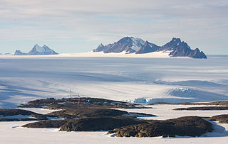
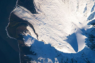
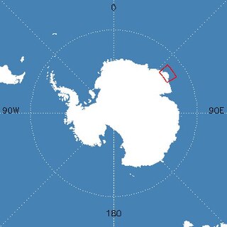
The Framnes Mountains is a group of Antarctic mountain ranges in Mac. Robertson Land, to the south of the Mawson Coast. The range is surrounded by, and largely covered by, an ice sheet.

Mount Siple is a potentially active Antarctic shield volcano, rising to 3,110 metres (10,203 ft) and dominating the northwest part of Siple Island, which is separated from the Bakutis Coast, Marie Byrd Land, by the Getz Ice Shelf. Its youthful appearance strongly suggests that it last erupted in the Holocene. It is capped by a 4-by-5-kilometre summit caldera, and tuff cones lie on the lower flanks. Recely Bluff is on the northeast slope of the mountain, about 7 nautical miles (13 km) from the peak. Its volume of 1,800 cubic kilometres (430 cu mi) is comparable to that of Mount Erebus.

The David Range (67°54′S62°30′E is a mountain range that extends for 26 kilometres in the Framnes Mountains of Mac.Robertson Land in Antarctica. The range is surrounded by, and largely covered by, an ice sheet. Only the peaks are visible.

Anzac Peak is a 715-metre-high (2,346 ft) volcano on the Laurens Peninsula of Heard Island in the Southern Ocean. It lies to the northwest of Mawson Peak. Despite its low elevation of just over 700 metres high, the peak and several neighbouring peaks have permanent snow and ice, like the Jacka Glacier with several icefalls.

The Volcanic Seven Summits are the highest volcanoes on each of the seven continents, just as the Seven Summits are the highest peaks on each of the seven continents. Summiting all seven is regarded as a mountaineering challenge, first postulated as such in 1999.
John Mayston Béchervaise OAM, MBE was an Australian writer, photographer, artist, historian and explorer. He is especially notable for his work and achievements in Antarctica.

Mount Elkins, also known as Jökelen is a dark, steep-sided mountain with three major peaks, the highest 2,300 meters (7,500 ft) above sea level, in the Napier Mountains of Enderby Land. Enderby Land is part of East Antarctica and is claimed by Australia as part of the Australian Antarctic Territory. The mountain was named after Terence James Elkins, an ionospheric physicist with the Australian National Antarctic Research Expeditions at Mawson Station in 1960.
Erratic Point is a small, moss-covered point at the head of South West Bay, 1.3 nautical miles (2.4 km) northeast of Cape Gazert, on the west side of Heard Island in the southern Indian Ocean. The First German Antarctica Expedition in 1902 charted a cape in this vicinity, from the summit of Mount Drygalski, and applied the name "Kap Lerche." In November 1929 the British Australian and New Zealand Antarctic Research Expedition under Douglas Mawson charted a small point in this position and applied the name "Erratic Point" because of the large number of massive erratic boulders encountered there. The Australian National Antarctic Research Expedition was unable to find any significant feature in this immediate area during their 1948 survey of the island, hence the name Erratic Point was retained by them for this small point.

The Masson Range is a high broken chain of mountains, consisting primarily of the North Masson, Central Masson and South Masson Ranges, forming a part of the Framnes Mountains.

North Masson Range is part of the Masson Range, which is divided into three parts of which this segment is the northern, rising to 1,030 metres (3,380 ft) and extending 3 miles (4.8 km) in a north–south direction.
Mount Henderson is a mountain in the Framnes Mountains of Mac. Robertson Land in the Antarctic. It is southeast of Holme Bay and northeast of the Masson Range.

The geography of the Heard Island and McDonald Islands (HIMI) refers to the geography of Heard Island and the McDonald Islands, one of the most remote places on earth. The islands belong to Australia and are located 4,000 kilometres (2,485.5 mi) southwest of the mainland in the Southern Ocean. These subantarctic islands were transferred to Australia by the United Kingdom in 1947. They lie between Madagascar and Antarctica.


