Metro Vancouver Regional District

Last updated

Metro Vancouver
Metro Vancouver Regional District
Vancouver by Sentinel-2.jpg
Satellite image of Metro Vancouver
Flag of the Metro Vancouver Regional District.svg
Metrovancouver.svg
CAN BC Greater Vancouver Regional District locator.svg
Location in British Columbia
CountryCanada
ProvinceBritish Columbia
Incorporated [1] 29 June 1967
Name change [1] 13 June 1968
Name change [2] 30 January 2017
Administrative office Burnaby
Electoral Areas A
Government
[3]
  TypeRegional district
  BodyBoard of Directors
  Chair George Harvie (Delta)
  Vice chairJohn McEwen (Anmore)
Area
 (2021) [4]
  Land2,878.93 km2 (1,111.56 sq mi)
Highest elevation
1,990 m (6,530 ft)
Lowest elevation
0 m (0 ft)
Population
 (2021) [4]
  Total2,642,825
  Estimate 
(2023) [5]
2,950,509
  Rank2 (Canadian CD)
  Density918.0/km2 (2,378/sq mi)
   Rank2 (Canadian CD)
Demonym Metro Vancouverite
Time zone UTC−08:00 (PST)
  Summer (DST) UTC−07:00 (PDT)
Area codes 604 / 778 / 236 / 672
Website metrovancouver.org OOjs UI icon edit-ltr-progressive.svg

The Metro Vancouver Regional District (MVRD), or simply Metro Vancouver, is a Canadian political subdivision and corporate entity representing the metropolitan area of Greater Vancouver, designated by provincial legislation as one of the 28 regional districts in British Columbia. [6] [7] The organization was known as the Regional District of Fraser–Burrard for nearly one year upon incorporating in 1967, and as the Greater Vancouver Regional District (GVRD) from 1968 to 2017.

Contents

Metro Vancouver borders Whatcom County, Washington, to the south, the Fraser Valley Regional District to the east, the Squamish-Lillooet Regional District to the north, and the Nanaimo Regional District and Cowichan Valley Regional District across the Strait of Georgia to the west.

The MVRD is under the direction of 23 local authorities and delivers regional services, sets policy and acts as a political forum. The regional district's most populous city is Vancouver, and Metro Vancouver's administrative offices are located in the city of Burnaby. The MVRD's boundaries match those of the Vancouver census metropolitan area (CMA) as identified by Statistics Canada.

History

The Greater Vancouver Water District and the Greater Vancouver Sewerage and Drainage District were established in 1924 and 1956 respectively. [8] The Government of British Columbia incorporated a regional district for this western portion of the Lower Mainland named the Regional District of Fraser-Burrard on 29 June 1967. [1] Just under a year later, the regional district was renamed as the Greater Vancouver Regional District (GVRD) on 13 June 1968. [1]

In 2007, the GVRD applied to change its official legal name a second time to simply "Metro Vancouver", which was deemed more recognizable at the time. [9] British Columbia's Minister of Community Services denied the application due to the absence of the term "regional district" within the proposed new name, though it was suggested that the GVRD could brand itself under the unofficial name of Metro Vancouver. [9] After nine years, with growing public recognition of Metro Vancouver, the overall success of the brand, and confusion between the brand and the official legal name of the regional district, the GVRD moved in 2016 to change its name to the Metro Vancouver Regional District. [9] [10] The regional district was therefore formally renamed a second time by the Government of British Columbia on 30 January 2017 to the Metro Vancouver Regional District. [2]

Geography

The Metro Vancouver Regional District (MVRD) is located east of the Strait of Georgia and north of the State of Washington and is bisected by the Fraser River. [11] The boundaries of the MVRD match those of the Vancouver CMA. [11] [12]

Membership

With 662,248 residents recorded in the 2021 census, Vancouver is the most populated city in Metro Vancouver. Concord Pacific Master Plan Area.jpg
With 662,248 residents recorded in the 2021 census, Vancouver is the most populated city in Metro Vancouver.
With a population of 568,322 (2021), Surrey is the second-most populated city in Metro Vancouver. King George Hub (20230507 150235).jpg
With a population of 568,322 (2021), Surrey is the second-most populated city in Metro Vancouver.
Burnaby is the third-most populated city in Metro Vancouver with a population of 249,125 (2021). Metrotown 201807.jpg
Burnaby is the third-most populated city in Metro Vancouver with a population of 249,125 (2021).

This regional district comprises 23 local authorities as members: 21 municipalities, one electoral area and one treaty First Nation. [13]

Metro Vancouver member populations ( edit )
Member Census subdivision Population (2021)Population (2016) % change (2016–2021)2021 provincial rank
Anmore Village2,3562,210+6.6%185th
Belcarra Village687643+6.8%301st
Bowen Island Island municipality4,2563,680+15.7%118th
Burnaby City249,125232,755+7.0%3rd
Coquitlam City148,625139,284+6.7%6th
Delta City108,455102,238+6.1%10th
City of Langley City28,96325,888+11.9%30th
Township of Langley District municipality132,603117,285+13.1%8th
Lions Bay Village1,3901,334+4.2%251st
Maple Ridge City90,99082,256+10.6%15th
Metro Vancouver A Regional district electoral area18,61216,133+15.4%39th
New Westminster City78,91670,996+11.2%17th
City of North Vancouver City58,12052,898+9.9%20th
District of North Vancouver District municipality88,16885,649+2.9%16th
Pitt Meadows City19,14618,573+3.1%37th
Port Coquitlam City61,49858,612+4.9%19th
Port Moody City33,53533,551±0.0%28th
Richmond City209,937198,309+5.9%4th
Surrey City568,322517,887+9.7%2nd
Tsawwassen First Nation2,256816+176.5%191st
Vancouver City662,248631,486+4.9%1st
West Vancouver District municipality44,12242,473+3.9%23rd
White Rock City21,93919,952+10.0%33rd
Metro Vancouver 2,642,8252,463,431+7.3%
Source: Statistics Canada [14] ; Metro Vancouver Regional District [15]

Electoral Area A comprises all unincorporated land within the regional district boundaries, which totals about 818 square kilometres. Most of the area is in the northernmost part of the district, including residential areas and isolated dwellings on Howe Sound between Lions Bay and Horseshoe Bay, on Indian Arm to the north of Deep Cove and Belcarra/Anmore and on the west side of Pitt Lake to the north of Port Coquitlam. Other areas included are Barnston Island on the Fraser River, Passage Island between Bowen Island and West Vancouver, and finally the urban communities of the University of British Columbia and the University Endowment Lands, in which 98% of the population of Electoral Area A lives. [16]

There are also seventeen Indian reserves within the geographical area that are not subject to governance by local authorities or the regional district; they have a combined population of 7,550 (2006).

The cities of Abbotsford and Chilliwack and the district of Mission, located to the east, although often linked to Vancouver in promotions and tourism, are part of a separate regional district, the Fraser Valley Regional District.

Demographics

Metro Vancouver
YearPop.±%
189121,887    
190142,926+96.1%
1911 164,020+282.1%
1921232,597+41.8%
1931347,709+49.5%
1941393,898+13.3%
1951562,462+42.8%
1961790,741+40.6%
19711,028,334+30.0%
19811,169,831+13.8%
19911,602,590+37.0%
1996 1,831,665+14.3%
2001 1,986,965+8.5%
2006 2,116,581+6.5%
2011 2,313,328+9.3%
2016 2,463,431+6.5%
2021 2,642,825+7.3%

As a census division in the 2021 Canadian census conducted by Statistics Canada, the Metro Vancouver Regional District had a population of 2,642,825 living in 1,043,319 of its 1,104,532 total private dwellings, a change of

Panethnic groups in the Metro Vancouver Regional District (2001–2021)
Panethnic group2021 [18] [19] 2016 [20] [21] 2011 [22] [23] 2006 [24] 2001 [25]
Pop. %Pop.%Pop.%Pop.%Pop.%
European [lower-alpha 1] [lower-alpha 2] 1,124,4751,179,1001,197,9851,182,3551,204,970
East Asian [lower-alpha 3] 606,920557,745488,240451,790395,540
South Asian 369,295291,005252,405207,165164,365
Southeast Asian [lower-alpha 4] 198,940168,075156,315112,36585,485
Middle Eastern [lower-alpha 5] 87,09062,44048,87035,59027,340
Indigenous 63,34561,45552,37540,31036,855
Latin American 51,50034,80529,12522,69518,715
African 41,18029,83023,54520,67018,405
Other/Multiracial [lower-alpha 6] 65,35041,78031,83525,03515,810
Total responses2,607,0152,426,2352,280,6952,097,9651,967,480
Total population2,642,8252,463,4312,313,3282,116,5811,986,965
Note: Totals greater than 100% due to multiple origin responses

Governance

Metro Vancouver technically comprises four separate corporate entities: the Metro Vancouver Regional District (MVRD), the Greater Vancouver Sewerage and Drainage District (GVS&DD), the Greater Vancouver Water District (GVWD) and the Metro Vancouver Housing Corporation (MVHC). [6] Each of these is governed by a board of directors. The board of the MVRD has 40 directors coming from the 23 local authorities who are MVRD members. [3] The number of directors coming from each local authority is determined by population, and the number of votes allocated to each director further helps proportionally represent the population distribution of the region. Each board director is also an elected official of one of the local authorities, with the exception of the elected representative for Electoral Area A (which has no council).[ citation needed ]

As of 2017, the organization had about 1,500 employees. [26] The current organizational structure shows ten departments reporting to the Chief Administrative Officer: [27] Human Resources & Corporate Services; External Relations; Financial Services; Legal Services & Aboriginal Relations; Board & Information Services; Liquid Waste Services; Parks & Housing Services; Planning & Environment; Solid Waste Services; and Water Services.[ citation needed ]

Administrative role

The principal function of Metro Vancouver is to administer resources and services which are common across the metropolitan area. The Metro Vancouver Board has defined its strategic priorities for 2015 through 2018 in its Board Strategic Plan. [28]

The organization categorizes its work into action areas [6] as described in the following subsections. However, 84% of the organization's budget is spent in three of those areas – the three utilities (water, liquid waste, solid waste). [6] Metro Vancouver's commitments and its members' commitments to each action area are outlined in eight board-approved management plans [29] as referenced below.

Water

Metro Vancouver manages the Cleveland Dam, located in the District of North Vancouver. The dam is used to store portions of the Lower Mainland's drinking water. ClevelandDam-front.jpg
Metro Vancouver manages the Cleveland Dam, located in the District of North Vancouver. The dam is used to store portions of the Lower Mainland's drinking water.

Metro Vancouver's water utility is committed to the goals and strategies in the Drinking Water Management Plan, [30] as approved by the board. The three goals are to:

As noted, there are four legal entities that operate under the name Metro Vancouver: the GVWD, the GVS&DD, the MVRD and MVHC. The GVWD provides tap water to a land area covering more than 2,600 km² with all of the water coming from three sources: the Capilano reservoir, the Seymour reservoir and the Coquitlam reservoir. Metro Vancouver controls the Cleveland Dam on the Capilano reservoir, which supplies 40 percent of the district's water. [31]

Liquid waste

Metro Vancouver operates and maintains the liquid waste facility, which includes managing "the network of trunk sewers, pumping stations and wastewater treatment plants that connect with municipal sewer systems". [32] Throughout operations, the organization is committed to protecting public health and the environment, and recovering as much resources (energy, nutrients, etc.) as possible out of the waste stream. [6]

The liquid waste utility is committed to the goals and strategies in the Integrated Liquid Waste and Resource Management plan, [33] as approved by the board. The three goals are to:

Solid waste

Metro Vancouver's solid waste utility is committed to the goals and strategies in the Integrated Solid Waste and Resource Management plan, [34] as approved by the board. The four goals are to:

One initiative of the organization was the Ashcroft Manor Ranch Mega-Landfill Proposal in Ashcroft, British Columbia, in the Thompson Country of the British Columbia Interior, as there is no more room in the Lower Mainland for Metro Vancouver's garbage.[ citation needed ] A similar project nearby adjacent to the town of Cache Creek, British Columbia has almost reached capacity. Environmental concerns about the area's sensitive shrub–steppe climate and ecology are strong, while Highland Valley Copper, near Logan Lake, has offered the use of its mine-pit instead. Other MVRD landfill locations serving the regional district in the past have been in the Fraser Mills area, between the Trans-Canada Highway and the Fraser, and at Port Mann, beneath the south foot of the Port Mann Bridge.

Housing

Metro Vancouver owns and manages housing complexes throughout the region via the Metro Vancouver Housing Corporation (MVHC); it also forms policy on homelessness and affordable housing for the region. The MVHC's board-approved goals, as outlined in the Affordable Housing Strategy, [35] are to:

The MVHC's sole shareholder is the Metro Vancouver Regional District. The number of directors of the housing corporation is 13. [36]

Regional planning

Metro Vancouver works in collaboration with its members to achieve a shared vision of livability across the generations, as laid out in the Regional Growth Strategy (RGS), [37] which was approved by the board in 2011, replacing the Livable Region Strategic Plan (LRSP). [38] Th RGS requires each member local authority to provide a Regional Context Statement to "demonstrate to the Metro Vancouver Board how its Official Community Plan Supports the RGS." [6] The five goals of the RGS are to:

Regional planning also includes planning and policy-making in agriculture and the food industry. The organization is committed to the goals and strategies in the Regional Food System Strategy, [39] as approved by the board. The goals are to:

In 2018, the organization's board also adopted the Ecological Health Framework, [40] which encapsulates Metro Vancouver’s collective efforts around ecological health and provides guiding principles, goals, and strategies to help achieve the vision of a "beautiful, healthy, and resilient environment for current and future generations." The goals are:

Air quality

The organization runs programs and set policy to protect public health and the environment with respect to air quality, improve visual air quality and minimize the region's contribution to climate change. [6] The organization is committed to the goals and strategies in the Integrated Air Quality and Greenhouse Gas Management Plan, [41] as approved by the board. The three goals are to:

Regional parks

The parks department of Metro Vancouver oversees the development and maintenance of 23 [42] regional parks, as well as various nature reserves and greenways. The organization is committed to the goals and strategies in the Regional Parks Plan, [43] as approved by the board. The four goals are to:

Regional parks are distinct from municipal parks in that they are typically more "wild" and represent unique geographical zones within the region, such as bogs and mature rainforests.

Regional economic prosperity

Regional economic prosperity is a service of Metro Vancouver organized to advance a shared prosperity in the region. The service is structured around three functions: fostering collaboration, conducting regional data collection and research, and attracting investment. [44]

Regional federation

Metro Vancouver undertakes support functions that underpin the rest of its service areas. In these areas, the organization commits to "contribute to the effective and efficient performance of our regional roles through leadership and collaboration with our members and other stakeholders." There are eight strategic directions guiding work in this area: [28]

The organization's board has also adopted the Corporate Climate Action Plan, [45] the purpose of which is to, "set out strategies and actions to achieve Metro Vancouver's commitment to corporate carbon neutrality and to adapt [its] corporate infrastructure and activities to the anticipated consequences of climate change." The strategies of the plan are to:

See also

Notes

  1. 2001–2016: Statistic includes all persons that did not make up part of a visible minority or an indigenous identity.
  2. 2021: Statistic includes all persons belonging to the non-indigenous and non-visible minority "White" population group.
  3. Statistic includes total responses of "Chinese", "Korean", and "Japanese" under visible minority section on census.
  4. Statistic includes total responses of "Filipino" and "Southeast Asian" under visible minority section on census.
  5. Statistic includes total responses of "West Asian" and "Arab" under visible minority section on census.
  6. Statistic includes total responses of "Visible minority, n.i.e." and "Multiple visible minorities" under visible minority section on census.

Related Research Articles

<span class="mw-page-title-main">Lower Mainland</span> Region in British Columbia, Canada

The Lower Mainland is a geographic and cultural region of the mainland coast of British Columbia that generally comprises the regional districts of Metro Vancouver and the Fraser Valley. Home to approximately 3.05 million people as of the 2021 Canadian census, the Lower Mainland contains sixteen of the province's 30 most populous municipalities and approximately 60% of the province's total population.

<span class="mw-page-title-main">Burnaby</span> City in British Columbia, Canada

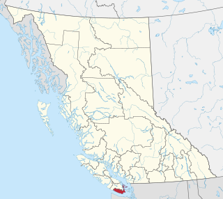
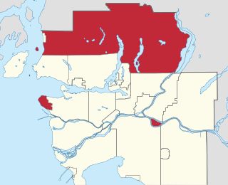
Burnaby is a city in the Lower Mainland region of British Columbia, Canada. Located in the centre of the Burrard Peninsula, it neighbours the City of Vancouver to the west, the District of North Vancouver across the confluence of the Burrard Inlet with its Indian Arm to the north, Port Moody and Coquitlam to the east, New Westminster and Surrey across the Fraser River to the southeast, and Richmond on the Lulu Island to the southwest.

<span class="mw-page-title-main">Regional District of Kootenay Boundary</span> Regional district in British Columbia, Canada

The Regional District of Kootenay Boundary (RDKB) is one of 28 regional districts in the province of British Columbia, Canada. As of the 2016 Canadian census, the population was 31,447. The area is 8,095.62 km2. The RDKB was incorporated in 1966 and consists of eight incorporated municipalities and five unincorporated electoral areas. The regional district's offices are in the City of Trail, with secondary offices in the City of Grand Forks. Other major population centres include the cities of Rossland and Greenwood, and the villages of Fruitvale, Warfield, and Montrose. The region also encompasses electoral areas A, B/Lower Columbia-Old Glory, C/Christina Lake, D/Rural Grand Forks and E/West Boundary including Rock Creek, Bridesville, Beaverdell and Big White Ski Resort.

<span class="mw-page-title-main">Capital Regional District</span> Regional district in British Columbia, Canada

The Capital Regional District (CRD) is a local government administrative district encompassing the southern tip of Vancouver Island and the southern Gulf Islands in the Canadian province of British Columbia. The CRD is one of several regional districts in British Columbia and had an official population of 415,451 as of the Canada 2021 Census.

<span class="mw-page-title-main">Sooke</span> District municipality in British Columbia, Canada

Sooke is a district municipality on the southern tip of Vancouver Island, Canada, 38 kilometres (24 mi) by road from Victoria, the capital of British Columbia. Sooke, the westernmost of Greater Victoria's Western Communities, is to the north and west of the Sooke Basin. It is a regional centre for residents in neighbouring communities, including Otter Point, Shirley and Jordan River.

<span class="mw-page-title-main">Greater Vancouver</span> Metropolitan area in British Columbia, Canada

Greater Vancouver, also known as Metro Vancouver, is the metropolitan area with its major urban centre being the city of Vancouver, British Columbia, Canada. The term "Greater Vancouver" describes an area that is roughly coterminous with the region governed by the Metro Vancouver Regional District (MVRD), though it predates the 1966 creation of the regional district. It is often used to include areas beyond the boundaries of the regional district but does not generally include wilderness and agricultural areas that are included within the MVRD.

<span class="mw-page-title-main">Sunshine Coast Regional District</span> Regional district in British Columbia, Canada

The Sunshine Coast Regional District is a regional district in British Columbia, Canada. It is located on the southern mainland coast, across Georgia Strait from Vancouver Island. It borders on the qathet Regional District to the north, the Squamish-Lillooet Regional District to the east, and, across Howe Sound, the Metro Vancouver District to the south. The regional district offices are located in the District Municipality of Sechelt.

<span class="mw-page-title-main">Fraser Valley Regional District</span> Regional district in British Columbia, Canada

The Fraser Valley Regional District (FVRD) is a regional district in British Columbia, Canada. Its headquarters are in the city of Chilliwack. The FVRD covers an area of 13,361.74 km2 (5,159 sq mi). It was created in 1995 by an amalgamation of the Fraser-Cheam Regional District and Central Fraser Valley Regional District and the portion of the Dewdney-Alouette Regional District from and including the District of Mission eastwards.

<span class="mw-page-title-main">Regional District of Nanaimo</span> Regional district in British Columbia, Canada

The Regional District of Nanaimo is a regional district located on the eastern coast of Vancouver Island, British Columbia, Canada. It is bordered to the south by the Cowichan Valley Regional District, to the west by the Alberni-Clayoquot Regional District, and to the northwest by the Comox Valley Regional District. Its administration offices are located in Nanaimo. During the 2016 census, its population was established at 155,698.

<span class="mw-page-title-main">Cowichan Valley Regional District</span> Regional district in British Columbia, Canada

The Cowichan Valley Regional District is a regional district in the Canadian province of British Columbia that is on the southern part of Vancouver Island, bordered by the Nanaimo and Alberni-Clayoquot Regional Districts to the north and northwest, and by the Capital Regional District to the south and east. As of the 2021 Census, the Regional District had a population of 89,013. The regional district offices are in Duncan.

<span class="mw-page-title-main">Winnipeg Metropolitan Region</span> Metropolitan area in Manitoba, Canada

The Winnipeg Metropolitan Region is a metropolitan area in the Canadian province of Manitoba located in the Red River Valley in the southeast portion of the province of Manitoba, Canada. It contains the provincial capital of Winnipeg and 17 surrounding rural municipalities, cities, and towns.

<span class="mw-page-title-main">Metro Vancouver Electoral Area A</span> Regional district electoral area in British Columbia, Canada

Metro Vancouver Electoral Area A is a part of Metro Vancouver in British Columbia. It includes several unincorporated areas: the University Endowment Lands and the University of British Columbia, west of the City of Vancouver; Bowyer, Passage, and Barnston Islands; the west side of Pitt Lake; the northern portion of Indian Arm; and a large area to the north of the North Shore that is mostly mountainous and sparsely populated except for certain subdivisions between Horseshoe Bay and the Village of Lions Bay.

<span class="mw-page-title-main">Edmonton Metropolitan Region</span> Metropolitan area in Canada, Alberta

The Edmonton Metropolitan Region (EMR), also commonly referred to as Greater Edmonton or Metro Edmonton, is a conglomeration of municipalities centred on Edmonton, the capital of the Canadian province of Alberta.

<span class="mw-page-title-main">Regional District of Mount Waddington</span> Regional district in British Columbia, Canada

The Regional District of Mount Waddington (RDMW) is a regional district in British Columbia. It takes in the lower Central Coast region centred on the Queen Charlotte Strait coast of northern Vancouver Island and the adjoining parts of mainland British Columbia. It has a total land area of 20,288.4 km2 and a 2016 census population of 11,035 persons, most of which is in towns on Vancouver Island and adjoining islands. The administrative centre is in the town of Port McNeill. Other municipalities include the district municipality of Port Hardy, the village of Port Alice, and the village of Alert Bay.

<span class="mw-page-title-main">Central Coast Regional District</span> Regional district in British Columbia, Canada

Central Coast Regional District is a regional district in British Columbia, Canada. It has a total land area of 24,559.5 km2. When it was created in 1968, it was known as the Ocean Falls Regional District, named for the then-largest town in the region, the company town of Ocean Falls, which has since become a ghost town. The district name was confirmed in 1974, but changed to Central Coast Regional District in 1976.

The demographics of Metro Vancouver indicate a multicultural and multiracial region. Metro Vancouver is a metropolitan area, with its major urban centre being Vancouver, British Columbia, Canada. The Vancouver census metropolitan area, as defined by Statistics Canada, encompasses roughly the same territory as the Metro Vancouver Regional District, a regional district in British Columbia. The regional district includes 23 local authorities. Figures provided here are for the Vancouver census metropolitan area and not for the City of Vancouver.

<span class="mw-page-title-main">Metrotown, Burnaby</span> Town centre of Burnaby in British Columbia, Canada

Metrotown is a town centre serving the southwest quadrant of Burnaby, British Columbia, Canada. It is one of the city's four officially designated town centres, as well as one of Metro Vancouver's regional town centres. It is the central business district of the City of Burnaby.

South Asian Canadians in Metro Vancouver are the third-largest pan-ethnic group in the region, comprising 369,295 persons or 14.2 percent of the total population as of 2021. Sizable communities exist within the city of Vancouver along with the adjoining city of Surrey, which houses one of the world's largest South Asian enclaves.

<span class="mw-page-title-main">South Asian Canadians in British Columbia</span>

The South Asian community in British Columbia was first established in 1897. The first immigrants originated from Punjab, British India, a northern region and state in modern-day India and Pakistan. Punjabis originally settled in rural British Columbia at the turn of the twentieth century, working in the forestry and agricultural industries.

<span class="mw-page-title-main">Sikhism in Greater Vancouver</span> Religious community

Sikhism in Greater Vancouver is one of the main religions across the region, especially among the Indo-Canadian population. The Sikh community in Vancouver is the oldest, largest and most influential across Canada, having begun in the late 19th century.

References

  1. 1 2 3 4 "Order in Council No. 1873/1968". Government of British Columbia. 13 June 1968. Archived from the original on 20 February 2017. Retrieved 20 February 2017.
  2. 1 2 "Order of the Lieutenant Governor in Council: Order in Council No. 023, Approved and Ordered January 30, 2017". 30 January 2017. Archived from the original on 20 February 2017. Retrieved 20 February 2017.
  3. 1 2 Metro Vancouver. "Board Members". Archived from the original on 16 May 2017. Retrieved 10 December 2018.
  4. 1 2 3 "Data table, Census Profile, 2021 Census of Population – Vancouver [Census metropolitan area], British Columbia". Archived from the original on 10 February 2022. Retrieved 10 February 2022.
  5. Services, Ministry of Citizens'. "Population Estimates – Province of British Columbia". www2.gov.bc.ca. Archived from the original on 24 July 2019. Retrieved 11 April 2024.
  6. 1 2 3 4 5 6 7 Metro Vancouver (January 2013). "2013 Action Plan" (PDF). Archived from the original (PDF) on 17 September 2013. Retrieved 30 January 2013.
  7. "Goodbye GVRD, hello Metro Vancouver". Vancouver Sun. 2 August 2007. Archived from the original on 29 September 2007. Retrieved 1 March 2012.
  8. "Metro Vancouver history". Metro Vancouver. Archived from the original on 29 July 2016. Retrieved 19 February 2017.
  9. 1 2 3 "Metro Vancouver Legal Entities Name Change" (PDF). Metro Vancouver. 1 September 2016. Archived from the original (PDF) on 20 February 2017. Retrieved 19 February 2017.
  10. "Metro Vancouver Name Change". Metro Vancouver. Archived from the original on 20 February 2017. Retrieved 19 February 2017.
  11. 1 2 Census Division 5915: Greater Vancouver, RD (PDF) (Map). Statistics Canada. 2016. Archived (PDF) from the original on 20 February 2017. Retrieved 19 February 2017.
  12. Census Metropolitan Area 933: Vancouver (PDF) (Map). Statistics Canada. 2016. Archived (PDF) from the original on 20 February 2017. Retrieved 19 February 2017.
  13. "Member Municipalities". Metro Vancouver. Archived from the original on 28 January 2017. Retrieved 19 February 2017.
  14. "Table 98-10-0002-02 Population and dwelling counts: Canada, provinces and territories, and census subdivisions (municipalities)". Statistics Canada. 9 February 2022. Retrieved 24 February 2022.
  15. "Members". Metro Vancouver Regional District. Retrieved 26 February 2022.
  16. "About Electoral Area A". Metro Vancouver. Metro Vancouver. Archived from the original on 10 May 2024. Retrieved 13 September 2018.
  17. "Population and dwelling counts: Canada and census divisions". Statistics Canada. 9 February 2022. Archived from the original on 6 March 2023. Retrieved 3 April 2022.
  18. Government of Canada, Statistics Canada (21 September 2022). "Indigenous identity by Registered or Treaty Indian status: Canada, provinces and territories, census divisions and census subdivisions". www12.statcan.gc.ca. Archived from the original on 27 October 2022. Retrieved 28 October 2022.
  19. Government of Canada, Statistics Canada (26 October 2022). "Visible minority and population group by generation status: Canada, provinces and territories, census metropolitan areas and census agglomerations with parts". www12.statcan.gc.ca. Archived from the original on 4 February 2009. Retrieved 26 October 2022.
  20. Government of Canada, Statistics Canada (17 June 2019). "Aboriginal Identity (9), Age (20), Registered or Treaty Indian Status (3) and Sex (3) for the Population in Private Households of Canada, Provinces and Territories, Census Divisions and Census Subdivisions, 2016 Census – 25% Sample Data". www12.statcan.gc.ca. Archived from the original on 26 September 2022. Retrieved 6 October 2022.
  21. Government of Canada, Statistics Canada (27 October 2021). "Census Profile, 2016 Census Greater Vancouver, Regional district [Census division], British Columbia and British Columbia [Province] Visible Minority". www12.statcan.gc.ca. Archived from the original on 12 June 2021. Retrieved 14 January 2023.
  22. Government of Canada, Statistics Canada (23 January 2019). "2011 National Household Survey: Data tables Aboriginal Identity (8), Age Groups (20), Registered or Treaty Indian Status (3) and Sex (3) for the Population in Private Households of Canada, Provinces, Territories, Census divisions and Census subdivisions, 2011 National Household Survey". www12.statcan.gc.ca. Archived from the original on 6 October 2022. Retrieved 6 October 2022.
  23. Government of Canada, Statistics Canada (27 November 2015). "NHS Profile, Greater Vancouver, RD, British Columbia, 2011 Visible Minority". www12.statcan.gc.ca. Archived from the original on 14 January 2023. Retrieved 14 January 2023.
  24. Government of Canada, Statistics Canada (20 August 2019). "2006 Community Profiles Greater Vancouver British Columbia (Regional district)". www12.statcan.gc.ca. Archived from the original on 10 May 2024. Retrieved 14 January 2023.
  25. Government of Canada, Statistics Canada (2 July 2019). "2001 Community Profiles Greater Vancouver Regional District British Columbia (Regional District)". www12.statcan.gc.ca. Archived from the original on 14 January 2023. Retrieved 14 January 2023.
  26. Metro Vancouver. "Departments". Archived from the original on 10 May 2024. Retrieved 7 February 2017.
  27. "Departments". Archived from the original on 15 December 2018. Retrieved 14 December 2018.
  28. 1 2 "Metro Vancouver Board Strategic Plan 2015 to 2018" (PDF). Archived (PDF) from the original on 17 June 2016. Retrieved 5 October 2016.
  29. "Compendium of Regional Management Plans". Archived from the original on 21 February 2013. Retrieved 14 February 2013.
  30. Metro Vancouver (January 2011). "Metro Vancouver Drinking Water Management Plan" (PDF). Archived from the original (PDF) on 27 August 2013. Retrieved 14 February 2013.
  31. "Metro Vancouver Water Sources & Supply". Archived from the original on 12 July 2007. Retrieved 23 September 2006.
  32. Wastewater Collection & Treatment Archived 21 February 2013 at the Wayback Machine . Metrovancouver.org. Retrieved on 26 July 2013.
  33. Metro Vancouver (May 2010). "Integrated Liquid Waste and Resource Management" (PDF). Archived from the original (PDF) on 16 September 2012. Retrieved 14 February 2013.
  34. Metro Vancouver (July 2010). "Integrated Solid Waste and Resource Management" (PDF). Archived from the original (PDF) on 17 September 2013. Retrieved 14 February 2013.
  35. Metro Vancouver (20 June 2016). "Metro Vancouver Regional Affordable Housing Strategy" (PDF). Archived (PDF) from the original on 14 February 2019. Retrieved 15 May 2019.
  36. Metro Vancouver (19 February 2013). "Greater Vancouver Regional District Regular Board Meeting Friday, February 22, 2013" (PDF). Retrieved 26 February 2013.[ permanent dead link ]
  37. Metro Vancouver (29 July 2011). "Regional Growth Strategy" (PDF). Archived from the original (PDF) on 24 December 2012. Retrieved 14 February 2013.
  38. Metro Vancouver (December 1999). "Livable Region Strategic Plan" (PDF). Archived from the original (PDF) on 24 December 2012. Retrieved 24 October 2012.
  39. Metro Vancouver (February 2010). "Regional Food System Strategy" (PDF). Archived from the original (PDF) on 22 December 2012. Retrieved 14 February 2013.
  40. Metro Vancouver (October 2018). "Ecological Health Framework". Archived from the original on 29 November 2021. Retrieved 29 November 2021.
  41. Metro Vancouver (October 2011). "Integrated Air Quality and Greenhouse Gas Management Plan" (PDF). Archived from the original (PDF) on 27 August 2013. Retrieved 14 February 2013.
  42. "Regional Parks, Greenways & Reserves". Metro Vancouver. Archived from the original on 28 January 2017. Retrieved 7 February 2017.
  43. Metro Vancouver (28 October 2011). "Regional Parks Plan" (PDF). Archived from the original (PDF) on 27 August 2013. Retrieved 14 February 2013.
  44. Metro Vancouver. "Regional Economic Prosperity". Archived from the original on 10 May 2024. Retrieved 14 August 2020.
  45. Metro Vancouver (16 June 2010). "Corporate Climate Action Plan" (PDF). Archived (PDF) from the original on 26 November 2018. Retrieved 14 December 2018.