Early European settlement in the area was known as "Innes Corners" (after homesteader Adam Innes); in 1911, the area became known as "Langley Prairie", part of the Township of Langley a.k.a. Langley Township since 1873. Twentieth-century improvements in transportation access, including the construction of the British Columbia Electric Railway in 1910, Fraser Highway in the 1920s, and Pattullo Bridge in 1937, profoundly impacted the area, transforming it from rural into the main urban and commercial core of the Township.[5] In turn, this birthed the need for upgraded and new amenities, especially with respect to health, infrastructure, safety and sanitation.
The municipal government, however, refused to finance these projects as it bowed, instead, to politically influential farming communities and smaller, mostly rural, business centres, like Fort Langley, Milner and Murrayville, that viewed such spending as unnecessary.[6][7] Talk of secession began in Langley Prairie in the 1930s, as a result. Headed by a panel of important residents and businesspersons, including Richard Langdon, president of the Langley Board of Trade, the push for independence came to a head in the 1950s.[7]
Specifically, two issues decided Langley's future. First was street lights, which Langley Prairie argued were needed not only for safety but also progress, yet on which reeve George Brooks declared "not a nickel" would be spent. Second was Langley Prairie's belief that it had neither the political sway nor fair share of municipal services that it deserved relative to its local tax contribution.[6] Langley Prairie by then constituted 20% of the Township's tax base. A referendum on secession was therefore held in September, 1954. It passed with over 85% of the vote.[7] Langley Prairie officially seceded and became the City of Langley on March 15, 1955.[5]
City plan
Aerial View of Langley City in 1959
Road network
Langley City follows the same block system as its neighbouring Township of Langley as well as other Districts in the Fraser Valley, where Streets run north-south, and Avenues run east-west.
Development barriers
Many natural and artificial barriers prevent Langley City from following a complete tidy grid:
The land governed by the City is not a rectangle but an uneven shape with "cut-out" corners.
Fraser Highway intersects the City at an approximate 45-degree angle North West to South East, mirrored by Glover Road which enters the city North East to South West.
The Nicomekl River flows through the middle of the city East to West.
Railroad tracks run across the north of the City.
This has affected development in a number of ways, for example, the Langley Bypass turns 45 degrees in the north-west, tracing the boundary outline since it was constructed by the City and could not go over the boundary into the Langley Township. Many streets come to an abrupt halt when reaching the river and continue on the other side without a connecting bridge. Roads such as Douglas Crescent, Logan Avenue, and Eastleigh Crescent parallel the 45-degree angles of Fraser Highway and Glover Road, almost proposing an alternative grid at an angle which conflicts with the grid in place. Even Grade Crescent, which is much further south than these roads, follows this same angle, demonstrating the impact Fraser Highway had on the development of Langley.
Langley City's Downtown was developed around Old Yale Road, which later on became Fraser Highway. Until 1964, Fraser Highway was part of the Trans-Canada Highway network - this major route attracted many businesses to the area.[8]
Today, with the Trans-Canada Highway now in the north of the Langley Township, the downtown is more pedestrian oriented. Where Fraser Highway goes through the downtown it is reduced to a single lane of traffic in one direction to limit traffic flow. This stretch is often affectionately referred to by residents as "The One-Way" and is lined with restaurants and shops on either side, making it a retail centre in the city. Douglas Park is also near this area in the downtown and is seen as the main park in the city, frequently being used for events and shows.
McBurney Plaza in Downtown Langley
In Summer 2013, McBurney Plaza opened to the public replacing McBurney Lane (previously used as a parking lot).[9] This area connects Fraser Highway and Douglas Park with a pedestrian boulevard, providing outdoor space for cafes and space the city can use for street performance and other civic events.
Just outside this downtown centre are strip malls and a number of low rise apartment buildings. Most detached housing remains outside the downtown area.
Childcare
By 2024, Langley had 1,400 childcare spots, which was less than needed.[10]
In 2024, amid a shortage of childcare facilities in Langley, the City Council banned the opening of new childcare facilities in downtown Langley.[10] Mayor Nathan Pachal who supported the ban said that there was now an opportunity for the city to get creative to find new ways to create childcare spaces in the city.[10]
Parks
There are over 17 public parks in this city. They range from small neighbourhood adventure playgrounds, to larger parks with nature trails, wildlife, and various sporting fields and equipment.
Brydon Park
This park contains an adventure playground, a paved play area for ball hockey and basketball, an intermediate soccer field, and a softball diamond. Public washrooms are available, though a close eye on your children is advisable, as used needles and other drug paraphernalia are often found lying in the open. Brydon Lagoon is south of the park and has a peaceful perimeter walk around the lagoon where one may observe wildfowl and turtles.[11]
City Park
This park features Al Anderson Memorial Pool, a children’s waterpark and playground, a lacrosse box, twelve picnic tables, and public washrooms. A covered picnic shelter that can accommodate up to 75 people is available and can be booked for a picnic.[11]
Uplands Dog Off-Leash Park
This is an 18-acre, fully fenced area with a perimeter walking path. Dogs and their owners can meet and enjoy a large open space for walking and playing. There is also a drinking fountain designed for both dogs and people.[11]
The park contains an adventure playground, two tennis courts, a water park (seasonal), bowling green, sports box, basketball hoops and public washrooms. It also has an outdoor covered performance platform called "Langley Spirit Square". Langley Spirit Square is the site of an annual Shakespeare performance, "Bard in the Valley."
Douglas Recreation Centre, situated in the park, offers many programs for the citizens of Langley and is also available for rentals such as wedding receptions or banquets and other events.
In 2000, there were plans to build a library in the park, but public opposition forced the library be built elsewhere.[13] In 1971, Langley's city council had plans to install a Chinese garden in the park, but this was never carried out.[14] In 1982, a day care centre in the park was replaced by a bowls meeting house and a bowling green was established adjacent to it.[15]
Douglas Park is the main park in the City of Langley for events, festivals and other civic activities. Featuring a permanent stage, the park is equipped for live performance of music, theatre and other arts.[11]
Linwood Park
This park contains a fenced dog park and a wheelchair accessible playground. Public washrooms are available.[11]
Nicomekl Park
This park has a suitable parking area and is the starting point to enter the floodplain and various walking trails.[11]
Penzer Action Park
This park is home to North America's largest Parkour Course, with an in-ground trampoline, numerous climbing walls, balance beams, and swinging bars will provide hours of creative physical fun. In addition, there is a kid size parkour course, a basketball court with optional volleyball net, dirt jumps for mountain bike enthusiasts, and a pump track. A nature trail passes through the park.
Rotary Centennial Park
This park contains a playground, ball diamond, senior soccer field, display garden beds, and public washrooms. A paved walking path follows the perimeter, and the facilities are wheelchair accessible.[11]
Sendall Gardens
This park contains botanical gardens that feature 3.67 acres of plants, shrubs and trees. A nature trail passes through this park, and there are two duck ponds. There are several varieties of wildfowl in the park, including geese and ducks. The tropical greenhouse has a wide variety of exotic plants and is open to the public April 1 to October 1.[11]
Major roads in the City of Langley include 200 Street, 64 Avenue, Fraser Highway, Glover Road, and the Langley Bypass which carries part of British Columbia Highway 10. These roads serve as the backbone of the road infrastructure network by handling traffic from the west in Surrey, Delta, and Ladner, as well as from the east in Aldergrove and Abbotsford.
Trains from across the country pass by the city on a regular basis. A major rail corridor runs alongside the Langley Bypass and towards the Roberts Bank Superport, which handles the export and import of various commodities coming in and out of Asia.[18]
The City of Langley is served by TransLink, which operates the regional transportation network of Metro Vancouver. Langley is served by several regular bus routes, and six "community shuttle" routes operating smaller capacity mini-buses. Currently, Langley doesn't have a rapid transit service, but an extension of the SkyTrain'sExpo Line is planned, and it will reach all the way to the city of Langley, which is planned to have one station. They are aiming to finish construction by 2028.
The Fraser Highway is one of the major east-west corridors servicing the City of Langley and the Township of Langley. The "502" bus route operates on a 15-minute headway (12 minutes during rush hour) from the Surrey Central Station in north Surrey to the Langley Centre bus loop in the City of Langley via Fraser Highway. The "503" Express service, launched on June 23, 2014, provides express service between Surrey Central Station and Langley Centre and local service through the Township of Langley into Aldergrove.[19] In September 2019, the 503 was upgraded to provide service every 8 minutes during peak hour. Riders are now given the benefit of being able to board and get off the bus at any 503 stop.[20]
The other major routes include the "320 Surrey Central Station" (via Cloverdale), "341 Guildford" (via Cloverdale, & Newton), the "364 Scottsdale" (via 64th avenue), and the "501 Surrey Central Station" (via 200 St, Carvolth Exchange, Port Kells Industrial and to Surrey Central Station via Guildford Exchange. The "595" to Maple Ridge heads along 208 street, and across the Golden Ears Bridge.
As of December 1, 2012,[21] TransLink had created a new "555 Port Mann Express / Lougheed Town Centre Station" rapid bus service which operates between Carvolth Exchange (in Langley Township) and Lougheed Town Centre Station[22] (in Burnaby) via Highway 1, with just one stop along the way in Surrey. This bus takes approximately 20 minutes from start to finish in one direction. It runs frequently; approximately every 15 minutes during peak times, and every 30 minutes during off-peak times.
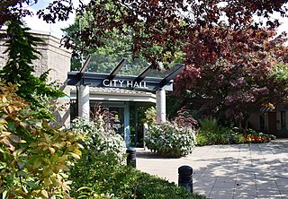
Langley City Council has seats for one mayor and six councillors. Each serves a 4-year term and attends council meetings on a bi-weekly basis. Other governmental departments include the Office of the Chief Administrative Officer, Corporate Services, Development Services & Economic Development, Engineering, Parks & Environment, Recreation, Culture and Community Services, and the Langley City Fire Rescue Service. The City of Langley has a joint RCMP detachment with the township of Langley.
In the 2021 Census of Population conducted by Statistics Canada, Langley had a population of 28,963 living in 12,598 of its 13,271 total private dwellings, a change of 11.9% from its 2016 population of 25,888. With a land area of 10.18km2 (3.93sqmi), it had a population density of 2,845.1/km2 (7,368.7/sqmi) in 2021.[2]
Ethnicity
Panethnic groups in the City of Langley (2001−2021)
Al Anderson Memorial – 25-metre public swimming pool
Douglas Recreation Centre
Langley Fire Rescue Hall
Langley City FVRL Library
Cascades Casino, Coast Hotel & Convention Centre
Numerous parks
Neighbourhoods
The City of Langley's Community Profile[36] identifies six neighbourhoods based on elementary school catchment area: Nicomekl, Douglas, Simonds, Blacklock, Alice Brown and Uplands.
↑ Statistic includes all persons that did not make up part of a visible minority or an indigenous identity.
↑ Statistic includes total responses of "Filipino" and "Southeast Asian" under visible minority section on census.
↑ Statistic includes total responses of "Chinese", "Korean", and "Japanese" under visible minority section on census.
↑ Statistic includes total responses of "West Asian" and "Arab" under visible minority section on census.
↑ Statistic includes total responses of "Visible minority, n.i.e." and "Multiple visible minorities" under visible minority section on census.
Related Research Articles
The Lower Mainland is a geographic and cultural region of the mainland coast of British Columbia that generally comprises the regional districts of Metro Vancouver and the Fraser Valley. Home to approximately 3.05million people as of the 2021 Canadian census, the Lower Mainland contains sixteen of the province's 30 most populous municipalities and approximately 60% of the province's total population.
Richmond is a city in the coastal Lower Mainland region of British Columbia, Canada. Mainly a suburban city, it occupies almost the entirety of Lulu Island, between the two estuarine distributaries of the Fraser River. Encompassing the adjacent Sea Island and several other smaller islands and uninhabited islets to its north and south, the suburb neighbours Vancouver and Burnaby on the Burrard Peninsula to the north, New Westminster and Annacis Island to the east, Delta to the south, and the Strait of Georgia to the west.
Surrey is a city in British Columbia, Canada. It is located south of the Fraser River on the Canada–United States border. It is a member municipality of the Metro Vancouver regional district and metropolitan area. Mainly a suburban city, Surrey is the province's second-largest by population after Vancouver and the third-largest by area after Abbotsford and Prince George. Seven neighbourhoods in Surrey are designated town centres: Cloverdale, Fleetwood, Guildford, Newton, South Surrey, and City Centre encompassed by Whalley.
Burnaby is a city in the Lower Mainland region of British Columbia, Canada. Located in the centre of the Burrard Peninsula, it neighbours the City of Vancouver to the west, the District of North Vancouver across the confluence of the Burrard Inlet with its Indian Arm to the north, Port Moody and Coquitlam to the east, New Westminster and Surrey across the Fraser River to the southeast, and Richmond on the Lulu Island to the southwest.
The Township of Langley is a district municipality immediately east of the City of Surrey in southwestern British Columbia, Canada. It extends south from the Fraser River to the Canada–United States border, and west of the City of Abbotsford. Langley Township is not to be confused with the City of Langley, which is adjacent to the township but politically is a separate entity. Langley is located in the eastern part of Metro Vancouver.
Maple Ridge is a city in British Columbia, Canada. It is located in the northeastern section of Greater Vancouver between the Fraser River and the Golden Ears, which is a group of mountain summits which are the southernmost of the Garibaldi Ranges of the Coast Mountains. Maple Ridge's population in 2021 was 90,990. Its downtown core area was once known as Haney.
Chilliwack is a city of about 100,000 people and 261 km2 (100 sq mi) in the Canadian province of British Columbia. It is located about 100 km (62 mi) east of the City of Vancouver in the Fraser Valley. The enumerated population is 93,203 in the city and 113,767 in the greater metropolitan area. It is the second-fastest growing metropolitan area in Canada.
Port Coquitlam is a city in British Columbia, Canada. It is one of 21 municipalities comprising Metro Vancouver. Located 27 km (17 mi) east of Vancouver, it is on the north bank of the confluence of the Fraser River and the Pitt River. Coquitlam borders it to the north and west. Pitt Meadows lies across the Pitt River from it. Port Coquitlam is bisected by Lougheed Highway and the Canadian Pacific Kansas City railway. Port Coquitlam is often referred to as "PoCo". It is Canada's 93rd-largest municipality by population.
West Vancouver is a district municipality in the province of British Columbia, Canada. A member municipality of the Metro Vancouver Regional District, West Vancouver is to the northwest of the city of Vancouver on the northern side of English Bay and the southeast shore of Howe Sound, and is adjoined by the District of North Vancouver to its east. Together with the District of North Vancouver and the City of North Vancouver, it is part of a local regional grouping referred to as the North Shore municipalities, or simply "the North Shore".
Mission is a city in the Lower Mainland of the province of British Columbia, Canada. It was originally incorporated as a district municipality in 1892, growing to include additional villages and rural areas over the years, adding the original Town of Mission City, long an independent core of the region, in 1969. It is bordered by the city of Abbotsford to the south and the city of Maple Ridge to the west. To the east are the unincorporated areas of Hatzic and Dewdney.
Pitt Meadows is a municipality within Metro Vancouver in southwestern British Columbia, Canada. Incorporated in 1914, it currently has a land area of 86.34 square kilometres (33.34 sq mi) with a population of 19,146 as of 2021. The municipality received its name from the Pitt River and Pitt Lake. Pitt Meadows is one of 21 municipalities including Electoral Area A that comprises the Metro Vancouver Regional District.
White Rock is a city in British Columbia, Canada, and a member municipality of the Metro Vancouver Regional District. It is bordered by Semiahmoo Bay to the south and is surrounded on three sides by Surrey. To the southeast across a footbridge lies the Semiahmoo First Nation, which is within the borders of Surrey. Semiahmoo Bay and the Southern Gulf Islands in the Strait of Georgia are also to the south.
Duncan is a city on southern Vancouver Island in British Columbia, Canada. It is the smallest city by area in Canada. It was incorporated in 1912.
Greater Vancouver, also known as Metro Vancouver, is the metropolitan area with its major urban centre being the city of Vancouver, British Columbia, Canada. The term "Greater Vancouver" describes an area that is roughly coterminous with the region governed by the Metro Vancouver Regional District (MVRD), though it predates the 1966 creation of the regional district. It is often used to include areas beyond the boundaries of the regional district but does not generally include wilderness and agricultural areas that are included within the MVRD.
North Cowichan is a district municipality established in 1873 on Vancouver Island, in British Columbia, Canada. The municipality is part of the Cowichan Valley Regional District. North Cowichan is noted for a landscape including forests, beaches, rivers, and lakes. The municipality encompasses the communities of Chemainus; Westholme; Crofton; Maple Bay; and "the South End". The latter is an informal name for a built-up area which is essentially a suburb of the City of Duncan, a separate municipality.
Westwood Plateau is a neighbourhood in the northern region of Coquitlam, British Columbia.
The District of Kent is a district municipality located 116 kilometres (72 mi) east of Vancouver, British Columbia. Part of the Fraser Valley Regional District, Kent consists of several communities, the largest and most well-known being Agassiz—the only town in the municipality—Harrison Mills, Kilby, Mount Woodside, Kent Prairie, Sea Bird Island and Ruby Creek. Included within the municipality's boundaries are several separately-governed Indian reserves, including the Seabird Island First Nation's reserves on and around the island of the same name.
Queensborough is a neighbourhood in the city of New Westminster, British Columbia, Canada. It is on the eastern tip of Lulu Island on the Fraser River.
Langley Centre is an on-street bus exchange located in downtown Langley City, British Columbia, Canada. As part of the TransLink system, it serves the municipalities of Langley City and Langley Township with routes to Surrey, Maple Ridge, and White Rock, that provide connections to SkyTrain and the West Coast Express rail services for travel towards Vancouver.
South Asian Canadians in Metro Vancouver are the third-largest pan-ethnic group in the region, comprising 369,295 persons or 14.2 percent of the total population as of 2021. Sizable communities exist within the city of Vancouver along with the adjoining city of Surrey, which houses one of the world's largest South Asian enclaves.
This page is based on this Wikipedia article Text is available under the CC BY-SA 4.0 license; additional terms may apply. Images, videos and audio are available under their respective licenses.