Metropolitan Borough of Stoke Newington

Last updated

Stoke Newington
Stoke newington town hall 2.jpg
Stoke Newington Town Hall
Metropolitan Borough of Stoke Newington.svg
Stoke Newington within the County of London
History
  Origin Stoke Newington parish
  Created1900
  Abolished1965
  Succeeded by London Borough of Hackney
Status Metropolitan borough
GovernmentStoke Newington Borough Council
   HQ Stoke Newington Church Street
   Motto Respice Prospice {Look to the past and the future}
Arms-stoke-newington.jpg
Coat of arms of the borough council
Metropolitan Borough of Stoke Newington Map of borough boundary

The Metropolitan Borough of Stoke Newington was a metropolitan borough in the County of London between 1900 and 1965 when it became part of the London Borough of Hackney.

Contents

Formation and boundaries

Predecessor authorities

The borough was the successor to two local authorities: the vestry of Stoke Newington parish in the County of London and the South Hornsey Urban District Council in Middlesex. [1]

Under the Metropolis Management Act 1855 Stoke Newington had been grouped with the neighbouring parish of Hackney under the administration of the Hackney District Board of Works. The union with Hackney was very unpopular with the inhabitants of Stoke Newington, and following unsuccessful attempts to end it in 1864, 1880 and 1890, the parish regained independence in 1894. Stoke Newington Vestry consisted of 60 vestrymen, elected from five wards. [2]

South Hornsey formed the southern part of the parish of Hornsey, consisting of the Brownswood Park area south of Finsbury Park, 29 acres (0.1 km2) of Clissold Park and two detached areas entirely surrounded by the parish of Stoke Newington. The exclaves of South Hornsey effectively cut off the south-eastern section of Stoke Newington from the rest of the parish. A local board was formed to govern the area in 1867, becoming an urban district under the Local Government Act 1894. [3]

Formation

The London Government Act 1899 provided that the County of London should be divided into metropolitan boroughs. The new authorities were to based on existing parishes with simplified boundaries. It was intended that each borough would have a population of between 100,000 and 400,000 inhabitants. Where an area fell below the threshold of 100,000 inhabitants, it might still be constituted a borough if it had a rateable value exceeding 500,000 pounds.

Stoke Newington presented a problem, as its population fell well below the prescribed limits. It was recognised that there were three possibilities: to recombine the parishes of Hackney and Stoke Newington into a single borough; to divide the existing parish of Hackney and combine the wealthier northern section with Stoke Newington to form a municipality with the boundaries of the Hackney North parliamentary constituency; or to add neighbouring areas of Middlesex to increase the population.

The first two options were rejected due to the experience of "intolerable and interminable feuds" between the districts when they were previously "forced together", and because the First Lord of the Treasury, Arthur Balfour recognised that there was "great ill-feeling and mutual ill-will... between the inhabitants of the two districts"; [4] it was therefore decided to merge the bulk of South Hornsey, with a population about 20,000, with Stoke Newington. While this still created a borough of only about 50,000 inhabitants, and thus "the smallest borough in London, the anomaly would be a gradually diminishing one, because the population in this district was rapidly increasing. When dividing London up into boroughs they could not avoid creating some anomalies as to size." [5]

Boundaries

Under the 1899 legislation, boundary commissioners were appointed to set the boundaries of the new boroughs. The existing parish boundaries frequently divided houses or related to field boundaries that had disappeared with the urbanisation of the area. The commissioners realigned the boundary lines so that for the most part they ran down the centre of roads, railways or watercourses. [6]

To the north, the borough had a boundary with Middlesex, marked by the course of the New River and the Seven Sisters Road. Stoke Newington's boundaries with the two neighbouring metropolitan boroughs within the County of London were as follows: [7]

Coat of arms

Unofficial arms used 1900 - 1934 Stoke Newington old.png
Unofficial arms used 1900 – 1934

The long association with the dean and chapter of St Paul's Cathedral is represented by the red background and crossed swords. The cross is from the arms of William Patten, first lord of the manor and rebuilder of the church of St Mary, in 1550. The trees represent the ancient forest, and the green lion, that of John Dudley. The griffin refers to Daniel Defoe, and the banner, the arms of Sir Thomas Abney.

The Latin motto translates as Look to the past and the future, the arms were granted on 12 June 1934. [9]

When merged to found the London Borough of Hackney in 1965, oaks from these arms were put in the new coat of arms of the London Borough of Hackney.

The coat of arms of 1934 replaced an unofficial device adopted by the council on incorporation in 1900. At the top of the shield was a representation of the parish church. The lower part of the shield featured the arms of the cities of London and Westminster on the left, and the attributed arms of the Kingdom of Essex representing Middlesex on the right. These armorial devices were chosen to represent the union of Stoke Newington in the County of London and South Hornsey in Middlesex. The crest was formed by a tree, recalling Stoke Newington's origin as a village in the Middlesex Forest. [10]

Population and area

Constituent parishes 1801-1900
Statistics compiled by the London County Council, in 1901 show the population growth in London, over the preceding century. The figures compiled by the council for 1891 do not agree with those that appear in the census reports, however which gave a population of 47,988 for the area. [11]

Year [12] 1801181118211831184118511861187118811891
Population1,9842,7583,3604,1925,5226,13411,29717,45237,56147,828

Metropolitan Borough 1900-1961
The area of the parish of Stoke Newington was 639 acres (2.6 km2) in 1891. Following the addition of most of South Hornsey and the boundary adjustments with Hackney and Islington, the area of the borough in 1901 was 863 acres (3.5 km2). [8] The populations recorded in National Censuses were:

Year1901 [11] 1911 [13] 1921 [14] 1931 [15] 19411951 [16] 1961 [16]
Population51,24750,65952,17251,208 [17] 49,13652,301

Politics

A map showing the wards of Stoke Newington Metropolitan Borough as they appeared in 1916. Stoke Newington Met. B Ward Map 1916.svg
A map showing the wards of Stoke Newington Metropolitan Borough as they appeared in 1916.
Stoke Newington Town Hall. An austere building (perhaps reflecting local nonconformist traditions) compared with those of nearby boroughs like Shoreditch. (January 2006) Stoke newington town hall.jpg
Stoke Newington Town Hall. An austere building (perhaps reflecting local nonconformist traditions) compared with those of nearby boroughs like Shoreditch. (January 2006)

Incorporated vestry

In 1891 as its population had increased the parish of St Mary Stoke Newington was divided into five wards (electing vestrymen): Lordship (15), Church (15), Manor (12), Clissold (9) and Palatine (9). [18] [19]

Borough council

The borough council consisted of 30 councillors and 5 aldermen. In 1900 the boundary commissioners divided the borough into six wards for the election of councillors:

WardNo. of
councillors
AreaPopulation
1901
Population
1931
Church688 acres (0.4 km2)11,2489,993
Clissold379 acres (0.3 km2)6,1706,651
Lordship6278 acres (1.1 km2)5,7746,023
Manor3146 acres (0.6 km2)5,3215,146
Palatine340 acres (0.2 km2)5,7665,338
South Hornsey9232 acres (0.9 km2)16,96818,057

The first council elected consisted entirely of "Non-Party" candidates, although The Times noted that they were "Conservative in character". [20] The entire council continued to be described as Independent or Non-Party until the 1934 election when the Labour Party gained 13 seats to the Independents' 17. Labour gained control of the council in 1945, taking all of the seats on the council. [21] The Conservative Party first ran in the 1949 election, winning control from Labour by 23 seats to 7. [22]

The wards of the borough were redrawn in 1953, with the area divided into ten wards, each electing three councillors. This reflected the change in settlement in the area, in particular the construction of new estates of council flats, including the London County Council's large Woodberry Down development which housed about a seventh of the borough's population. The names of the wards, a number of which were named after famous residents of Stoke Newington, were as follows: [2]

Labour regained power at the 1953 election with 24 seats to 6 Conservatives. [23] They held control at subsequent elections, taking all the seats in 1959. [24] [25] The final election of the council on 10 May 1962 saw four Liberal Party councillors elected to form an opposition group to the 26 Labour members. [26]

Parliamentary constituency

Until 1918 the area formed part of the constituency of Hackney North. In 1918 a new constituency of Stoke Newington identical with the metropolitan borough was created. Due to loss of population, the two constituencies were merged in 1950 as Hackney North and Stoke Newington. [27]

See also

Related Research Articles

<span class="mw-page-title-main">London Borough of Hackney</span> London borough in United Kingdom

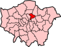
The London Borough of Hackney is a London borough in Inner London, England. The historical and administrative heart of Hackney is Mare Street, which lies 5 miles (8 km) north-east of Charing Cross. The borough is named after Hackney, its principal district. Southern and eastern parts of the borough are popularly regarded as being part of east London, with the northwest belonging to north London. Its population is 281,120 inhabitants.

<span class="mw-page-title-main">Stoke Newington</span> Area in London, England

Stoke Newington is an area occupying the northwest part of the London Borough of Hackney, England. The area is five miles northeast of Charing Cross. The Manor of Stoke Newington gave its name to Stoke Newington the ancient parish.

<span class="mw-page-title-main">London Borough of Haringey</span> London borough in United Kingdom

The London Borough of Haringey is a London borough in North London, classified by some definitions as part of Inner London, and by others as part of Outer London. It was created in 1965 by the amalgamation of three former boroughs. It shares borders with six other London boroughs. Clockwise from the north, they are: Enfield, Waltham Forest, Hackney, Islington, Camden, and Barnet.

<span class="mw-page-title-main">Metropolitan Borough of Camberwell</span> Former Metropolitan Borough in England

Camberwell was a civil parish and metropolitan borough in south London, England. Camberwell was an ancient parish in the county of Surrey, governed by an administrative vestry from 1674. The parish was included in the area of responsibility of the Metropolitan Board of Works in 1855 and became part of the County of London in 1889. The parish of Camberwell became a metropolitan borough in 1900, following the London Government Act 1899, with the parish vestry replaced by a borough council. In 1965 the borough was abolished and its former area became part of the London Borough of Southwark in Greater London.

<span class="mw-page-title-main">Metropolitan Borough of Finsbury</span>

The Metropolitan Borough of Finsbury was a metropolitan borough within the County of London from 1900 to 1965, when it was amalgamated with the Metropolitan Borough of Islington to form the London Borough of Islington.

<span class="mw-page-title-main">Metropolitan Borough of Islington</span> Former local authority of London, England

Islington was a civil parish and metropolitan borough in London, England. It was an ancient parish within the county of Middlesex, and formed part of The Metropolis from 1855. The parish was transferred to the County of London in 1889 and became a metropolitan borough in 1900. It was amalgamated with the Metropolitan Borough of Finsbury to form the London Borough of Islington in Greater London in 1965.

<span class="mw-page-title-main">Metropolitan Borough of Hackney</span>

The Metropolitan Borough of Hackney was a metropolitan borough of the County of London from 1900 to 1965. Its area became part of the London Borough of Hackney.

<span class="mw-page-title-main">Metropolitan Borough of Bethnal Green</span> Civil parish and metropolitan borough in London, England

Bethnal Green was a civil parish and a metropolitan borough in the East End of London, England.

<span class="mw-page-title-main">Metropolitan Borough of Shoreditch</span>

The Metropolitan Borough of Shoreditch was a metropolitan borough of the County of London between 1899 and 1965, when it was merged with the Metropolitan Borough of Stoke Newington and the Metropolitan Borough of Hackney to form the London Borough of Hackney.

<span class="mw-page-title-main">Hackney North and Stoke Newington (UK Parliament constituency)</span> Parliamentary constituency in the United Kingdom, 1950 onwards

Hackney North and Stoke Newington is a constituency represented in the House of Commons of the United Kingdom since 1987 by Diane Abbott, who served as Shadow Home Secretary from 6 October 2016 to 5 April 2020. Abbott was one of the first three Black British MPs elected, and the first female Black British MP in the UK. Abbott was elected as a Labour MP, but has been an Independent since having the Labour Party whip suspended on 23 April 2023.

<span class="mw-page-title-main">Parliamentary constituencies in London</span>

The region of Greater London, including the City of London, is divided into 73 parliamentary constituencies which are sub-classified as borough constituencies, affecting the type of electoral officer and level of expenses permitted.

<span class="mw-page-title-main">London Government Act 1899</span> United Kingdom legislation

The London Government Act 1899 was an Act of the Parliament of the United Kingdom that reformed the administration of the capital. The Act divided the County of London into 28 metropolitan boroughs, replacing the 41 parish vestries and District Boards of Works administering the area. The legislation also transferred a few powers from the London County Council to the boroughs, and removed a number of boundary anomalies. The first elections to the new boroughs were held on 1 November 1900.

Stoke Newington was an ancient parish in the county of Middlesex. It was both a civil parish, used for administrative purposes, and an ecclesiastical parish of the Church of England.

Hornsey was an ancient parish in the county of Middlesex. It was both a civil parish, used for administrative purposes, and an ecclesiastical parish of the Church of England.

<span class="mw-page-title-main">Hackney (parish)</span>

Hackney was a parish in the historic county of Middlesex. The parish church of St John-at-Hackney was built in 1789, replacing the nearby former 16th-century parish church dedicated to St Augustine. The original tower of that church was retained to hold the bells until the new church could be strengthened; the bells were finally removed to the new St John's in 1854. See details of other, more modern, churches within the original parish boundaries below.

The Finsbury Division was one of four divisions of the Hundred of Ossulstone, in the historic county of Middlesex, England. The area of the Finsbury Division is now the core of modern north London. The other divisions were named Holborn, Kensington and Tower. Ossulstone hundred was divided in the seventeenth century, with each of the four divisions replacing the hundred for most administrative purposes.

<span class="mw-page-title-main">Hackney North (UK Parliament constituency)</span> Parliamentary constituency in the United Kingdom, 1885–1950

Hackney North was a parliamentary constituency in "The Metropolis". It returned one Member of Parliament (MP) to the House of Commons of the Parliament of the United Kingdom.

<span class="mw-page-title-main">Hackney London Borough Council</span>

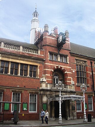
Hackney London Borough Council is the local government authority for the London Borough of Hackney, London, England, one of 32 London borough councils. The council is unusual in the United Kingdom local government system in that its executive function is controlled by a directly elected mayor of Hackney, most recently Philip Glanville of the Labour Party. Hackney comprises 19 wards, each electing three councillors. Following the May 2018 election, Hackney London Borough Council consists of 52 Labour Party councillors and five Conservative Party councillors. The council was created by the London Government Act 1963 whereby it replaced three local authorities: Hackney Metropolitan Borough Council, Shoreditch Metropolitan Borough Council and Stoke Newington Metropolitan Borough Council.

<span class="mw-page-title-main">South Hornsey</span>

South Hornsey was a local government district in Middlesex, England from 1865 to 1900.

Hackney was a local government district within the metropolitan area of London, England from 1855 to 1894. It was formed by the Metropolis Management Act 1855 and was governed by the Hackney District Board of Works, which consisted of elected vestrymen. It was in the part of the county of Middlesex that was within the area of the Metropolitan Board of Works. In 1889 it became part of the County of London and the district board functioned as a local authority under the London County Council.
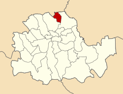
References

Like most British local authorities of the 1950s-60s, Stoke Newington possessed its own nuclear shelter. It is still there, though disused now except for storage. Shown here is the entrance still visible at the back of the town hall (September 2005) Stoke newington shelter 1.jpg
Like most British local authorities of the 1950s-60s, Stoke Newington possessed its own nuclear shelter. It is still there, though disused now except for storage. Shown here is the entrance still visible at the back of the town hall (September 2005)
  1. "Guide to Hackney Archives Collection". London Borough of Hackney. 11 November 2008. Retrieved 21 November 2009.
  2. 1 2 T F T Baker, C R Elrington (Editors), A P Baggs, Diane K Bolton, Patricia E C Croot (1985). "Stoke Newington: Local government". A History of the County of Middlesex: Volume 8: Islington and Stoke Newington parishes. British History Online. Retrieved 25 November 2009.{{cite web}}: |author= has generic name (help)CS1 maint: multiple names: authors list (link)
  3. T F T Baker, C R Elrington (Editors), A P Baggs, Diane K Bolton, M A Hicks, R B Pugh (1980). "Hornsey, including Highgate: Introduction". A History of the County of Middlesex: Volume 6: Friern Barnet, Finchley, Hornsey with Highgate. British History Online. Retrieved 25 November 2009.{{cite web}}: |author= has generic name (help)CS1 maint: multiple names: authors list (link)
  4. Arthur Balfour, Hansard:Vol 71, Col 979, https://api.parliament.uk/historic-hansard/commons/1899/may/18/london-government-bell
  5. "London Government Bill". Parliamentary Debates (Hansard) . 18 May 1899. Retrieved 21 November 2009.
  6. 1 2 "The New London Boroughs". The Times . 20 December 1899. p. 4.
  7. Great Britain Historical GIS / University of Portsmouth, Boundary Map of Stoke Newington MetB . Retrieved 26 November 2009.
  8. 1 2 3 T F T Baker, C R Elrington (Editors), A P Baggs, Diane K Bolton, Patricia E C Croot (1985). "Stoke Newington: Introduction". A History of the County of Middlesex: Volume 8: Islington and Stoke Newington parishes. British History Online. Retrieved 25 November 2009.{{cite web}}: |author= has generic name (help)CS1 maint: multiple names: authors list (link)
  9. Civic Heraldry accessed 14 December 2006
  10. R Crosley, London's coats of arms and the stories they tell, Robert Scott, London, 1928
  11. 1 2 "Table 9: Metropolitan Boroughs with Constituent Wards and Civil Parishes". Census of England and Wales 1901, County of London. London: HMSO.
  12. Statistical Abstract for London, 1901 (Vol. IV); Census tables for Stoke Newington Metropolitan Borough
  13. "Table 10: Administrative Counties, Urban Districts, (including County and other Municipal Boroughs) with their constituent Civil Parishes and Wards and Rural Districts with their constituent Civil Parishes". Census of England and Wales 1911. London: HMSO. p. 218.
  14. "Table 3: Administrative County, Metropolitan Boroughs, Wards and Civil Parishes". Census of England and Wales 1921, County of London. London: HMSO. p. 218.
  15. "Table C: Acreage and Census Population of Areas". Census of England and Wales 1931, Counties of London and Middlesex (Part II). London: HMSO. p. 16.
  16. 1 2 Stoke Newington MetB: Census Tables at Vision of Britain accessed 14 December 2006
  17. The census was suspended for World War II
  18. The London Gazette Issue: 26152. 14 April 1891. pp. 2062–2063. Retrieved 9 April 2015.
  19. The London Gazette Issue: 26132. 6 February 1891. p. 694. Retrieved 9 April 2015.
  20. The London borough elections, The Times, 3 November 1900
  21. The Municipal Elections – Results in London Boroughs, The Times, 3 November 1945
  22. More councils won by conservatives – Heavy Labour losses in London, 14 May 1949
  23. The municipal elections, Changes in London boroughs, The Times, 9 May 1953
  24. Labour gains in London poll, The Times, 12 May 1956
  25. Borough elections – London results, The Times, 9 May 1959
  26. Election results in the boroughs, The Times, 11 May 1962
  27. F A Youngs, Guide to the Local Administrative Units of England, Vol. I, Royal Historical Society, London, 1979

Further reading

51°33′43″N0°04′55″W / 51.562°N 0.082°W / 51.562; -0.082