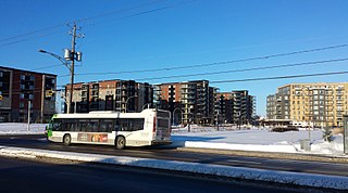
Longueuil is a city in the province of Quebec, Canada. It is the seat of the Montérégie administrative region and the central city of the urban agglomeration of Longueuil. It sits on the south shore of the Saint Lawrence River directly across from Montreal. The population as of the Canada 2016 Census totalled 239,700, making it Montreal's second largest suburb, the fifth most populous city in Quebec and twentieth largest in Canada.

Mantes-la-Jolie is a commune in the Yvelines department in the Île-de-France region of north-central France. It is located to the west of Paris, 48.4 km (30.1 mi) from the centre of the capital. Mantes-la-Jolie is a subprefecture of Yvelines.

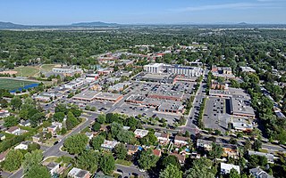
Camrose is a city in central Alberta, Canada that is surrounded by Camrose County. Located along Highway 13 it had its beginnings as a railroad hub.
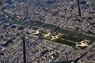
The 1st arrondissement of Paris is one of the 20 arrondissements of the capital city of France. In spoken French, this arrondissement is colloquially referred to as le premier. It is governed locally together with the 2nd, 3rd and 4th arrondissement, with which it forms the 1st sector of Paris (Paris-Centre).

Repentigny is an off-island suburb of Montreal, Quebec, Canada. It is located north of the city on the lower end of the L'Assomption River, and on the Saint Lawrence River. Repentigny and Charlemagne were the first towns off the eastern tip of the Island of Montreal. Repentigny is part of the Lanaudière region.
Blainville is a suburb of Montreal located on the North Shore in southwestern Quebec, Canada. Blainville forms part of the Thérèse-De Blainville Regional County Municipality within the Laurentides region of Quebec. The town sits at the foot of the Laurentian Mountains and is located 35 kilometres (22 mi) northwest of downtown Montreal.
Moka is a village in Mauritius located mainly in the Moka District. The western part of the village lies in the Plaines Wilhems District. Since 1967 it forms part of Constituency No. 8 Quartier Militaire and Moka. The village is administered by the Moka Village Council under the aegis of the Moka District Council. According to the census made by Statistics Mauritius in 2011, the population was at 8,846. The elevation is 203 meters and can be up to 425 meters in some places. Moka is directly on the other side of the Moka Range from Port Louis. The village is close to the mountain Le Pouce and the town Beau-Bassin Rose-Hill. Réduit is a suburb of the village where the State House and University of Mauritius is situated. The village is also home to the Mauritius Broadcasting Corporation and the Mahatma Gandhi Institute.

Grand Port is a district of Mauritius, situated in the east of the island. The name means "large port" in French. The district has an area of 260.3 km2 and the population estimate was at 112,997 as of 31 December 2015.

Curepipe also known as La Ville-Lumière, is a town in Mauritius, located mainly in the Plaines Wilhems District. Its eastern part lies in the Moka District. The town is administered by the Municipal Council of Curepipe. Curepipe lies at a higher elevation, often referred to as the "Central Plateau". According to the census made by Statistics Mauritius in 2018, the population of the town was at 78,618.

Brossard is a municipality in the Montérégie region of Quebec, Canada and is part of the Greater Montreal area. According to the 2021 census, Brossard's population was 91,525. It shares powers with the urban agglomeration of Longueuil and was a borough of the municipality of Longueuil from 2002 to 2006.
Saint-Bruno-de-Montarville is an off-island suburb of Montreal, in southwestern Quebec, Canada, on the south bank of the Saint Lawrence River just east of Montreal. It lies on the west flank of Mont Saint-Bruno, one of the Monteregian Hills. The population as of the Canada 2011 Census was 26,107. It merged with Longueuil in 2002 but de-merged in 2006.

Joliette is a city in southwest Quebec, Canada. It is approximately 50 kilometres (31 mi) northeast of Montreal, on the L'Assomption River and is the seat of the Regional County Municipality of Joliette. It is considered to be a part of the North Shore of Greater Montreal. The city is home to the Joliette Art Museum, whose works of art include paintings, sculptures, paper artwork and a large collection of art from the French Middle Ages.

Sainte-Anne-des-Plaines is a city in southwestern Quebec, Canada, 40 km northwest of the city of Montreal in the Thérèse-De Blainville Regional County Municipality, in the region of Laurentides. Its population was 14,990 during the census of 2014.

Pamplemousses is a district of Mauritius, located in the northwest of the island, and is one of the most densely populated parts of the island. The name of the district comes from the French word for grapefruits. The district has an area of 178.7 km2 and an estimated population of 139,966, as of 31 December 2015.

Plaines Wilhems is a district of Mauritius. It is the most populous district, with an estimated population of 366,506 at the end of 2018. The district is mainly urban; it consists of four towns, the village of Midlands and part of two other villages. The Plaines Wilhems district does not have a District Council; it has four Municipal Town Councils. The towns are Beau-Bassin Rose-Hill, Curepipe, Quatre Bornes and Vacoas-Phoenix. The villages are Midlands, Cascavelle and Moka. The district was named after Wilhem Leicknig. Of Prussian origin, he settled on the island of Mauritius, then known as Isle de France, in 1721.
Mapou is a village in northern Mauritius, located in Rivière du Rempart District. The village is administered by the Mapou Village Council under the aegis of the Rivière du Rempart District Council. According to the census by Statistics Mauritius in 2011, the population was 1,275.

A census of the population of the United Kingdom is taken every ten years. The 2011 census was held in all counties of the UK on 27 March 2011. It was the first UK census which could be completed online via the Internet. The Office for National Statistics (ONS) is responsible for the census in England and Wales, the General Register Office for Scotland (GROS) is responsible for the census in Scotland, and the Northern Ireland Statistics and Research Agency (NISRA) is responsible for the census in Northern Ireland.
Saint Pierre is a village in the district of Moka in Mauritius.It is considered to be found in the heart of Mauritius.The climatic conditions is cold and ideal especially during summer with cold breeze.
Lycée des Mascareignes is a private French international school in Saint Pierre, Moka, Mauritius. It serves senior high school classes.
The following is a timeline of the history of the city of Port Louis on the island of Mauritius.


