The St. Lawrence Seaway is a system of locks, canals, and channels in Canada and the United States that permits oceangoing vessels to travel from the Atlantic Ocean to the Great Lakes of North America, as far inland as Duluth, Minnesota, at the western end of Lake Superior. The seaway is named for the St. Lawrence River, which flows from Lake Ontario to the Atlantic Ocean. Legally, the seaway extends from Montreal, Quebec, to Lake Erie, and includes the Welland Canal. Ships from the Atlantic Ocean are able to reach ports in all five of the Great Lakes, via the Great Lakes Waterway.

Pictou is a town in Pictou County, in the Canadian province of Nova Scotia. Located on the north shore of Pictou Harbour, the town is approximately 10 km north of the larger town of New Glasgow.

Harbourfront is a neighbourhood on the northern shore of Lake Ontario within the downtown core of the city of Toronto, Ontario, Canada. Part of the Toronto waterfront, Harbourfront extends from Bathurst Street in the west, along Queens Quay, with its ill-defined eastern boundary being either Yonge Street or York Street. Its northern boundary is the Gardiner Expressway. Much of the district was former water lots filled in during the early 1900s to create a larger harbour district. After shipping patterns changed and the use of the Toronto harbour declined, the area was converted from industrial uses to a mixed-use district that is mostly residential and leisure.

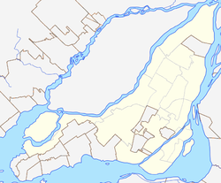
Ville-Marie is the name of a borough (arrondissement) in the centre of Montreal, Quebec. The borough is named after Fort Ville-Marie, the French settlement that would later become Montreal, which was located within the present-day borough. Old Montreal is a National Historic Site of Canada.

Réseau de transport de Longueuil (RTL) is a public transit system in the city of Longueuil, Quebec, Canada, and nearby communities on the South Shore of Montreal. The RTL had an annual ridership of 34,447,686 in 2013.

Saint Jacques Street, or St. James Street, is a major street in Montreal, Quebec, Canada, running from Old Montreal westward to Lachine.
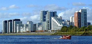
Glasgow Harbour in the following paragraphs is about a private sector urban regeneration scheme at Partick in the West End of the city of Glasgow, Scotland. It is not the history and development of the wider and internationally famous Glasgow Harbour from Glasgow Green to Clydebank which developed from the early 1800s and witnessed the birth and growth of modern shipbuilding and shipping.

Queen's Quay Terminal is a condominium apartment, office and retail complex in the Harbourfront neighbourhood in Toronto, Ontario, Canada. It was originally built in 1927 as a marine terminal with office, warehouse and cold-storage facilities. When shipping to Toronto declined in the 1960s and 1970s, the building was bought by the Government of Canada to be repurposed along with a section of the industrial waterfront. The Terminal Building itself was rebuilt in the 1980s with the addition of four floors of residential above the original facility, which was converted into retail and office uses. The cold storage wing was demolished and its plant building became The Power Plant gallery and Harbourfront Centre Theatre.

The Old Port of Montreal is the historic port of Montreal, Quebec, Canada. Located adjacent to Old Montreal, it stretches for over 2 km (1.2 mi) along the Saint Lawrence River. It was used as early as 1611, when French fur traders used it as a trading post.

Londonderry Port, now operating as Foyle Port, is a port located on Lough Foyle in Northern Ireland. It is the United Kingdom’s most westerly port and an important northerly port on the island of Ireland. The current port is at Lisahally, County Londonderry, though historically the port was upriver in the city of Derry itself. It is operated by the Londonderry Port and Harbour Commissioners, whose former offices, just north of the city's walls, are now a museum.

The Musée d'art contemporain de Montréal (MACM) is a contemporary art museum in Montreal, Quebec, Canada. It is located on the Place des festivals in the Quartier des spectacles and is part of the Place des Arts complex.

The Port of Hull is a port at the confluence of the River Hull and the Humber Estuary in Kingston upon Hull, in the East Riding of Yorkshire, England.
Stanley Street is a north–south street located in downtown Montreal, Quebec, Canada. It links Doctor Penfield Avenue in the north and De la Gauchetière Street in the south.

Saint Antoine Street, formerly known as Craig Street, is a street located in Montreal, Quebec, Canada. It runs to the south of Downtown Montreal and north of Old Montreal and Griffintown and Saint-Henri. It crosses the Quartier international de Montréal. Between Atwater Avenue and Greene Avenue, the north side of the street is in Westmount.

McGill Street is a street in Montreal named after James McGill after whom McGill University is named. The former head office building of Canadian National Railway Company, built for its predecessor Grand Trunk Railway, still stands on McGill Street and is now occupied by Quebec government offices.

The Sir George-Étienne Cartier National Historic Site is a historic house museum located in the Old Montreal district, of Montreal, Quebec, Canada. It commemorates the life and accomplishments of Sir George-Étienne Cartier. This reconstitution of the adjoining homes of the Cartier family features the architectural heritage left by the upper middle class of 19th-century Montreal, along with interpretive activities and theatrical performances.
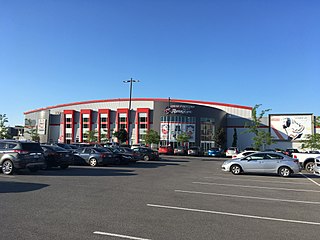
The Centre d'Excellence Sports Rousseau is a 3,100 capacity multi-purpose arena in Boisbriand, Quebec, Canada. It is home to the Blainville-Boisbriand Armada ice hockey club in the QMJHL, who were previously known as the Montreal Junior Hockey Club.
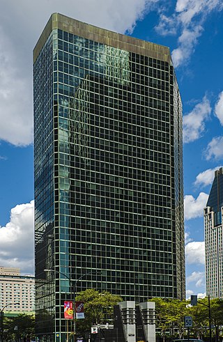
La Laurentienne Building is a 102-metre (335 ft), 27-story skyscraper in Montreal, Quebec, Canada. The building was designed by Dimitri Dimakopoulos & Associates for Marathon Realty, Lavalin and the Laurentian Bank. It is located on René-Lévesque Boulevard at the intersection of Peel Street, in the Ville-Marie borough of Downtown Montreal. It is adjacent to the Bell Centre and the 1250 René-Lévesque skyscraper to the south, and stands on the site of the former Laurentian Hotel.
Space for Life is a museum district in Montreal, Quebec, Canada. It brings together the city's four most prominent natural museums: the Montreal Biodome and the Rio Tinto Alcan Planetarium, situated in Montreal's Olympic Park, and the Montreal Botanical Garden and Montreal Insectarium, in the adjacent Maisonneuve Park.
École secondaire Marguerite-De Lajemmerais is a Francophone secondary public mixed school located in Rosemont-La Petite-Patrie borough in Montreal, Quebec. Part of the Centre de services scolaire de Montréal (CSSDM), it was originally in the catholic School board Commission des écoles catholiques de Montréal (CECM) before the 1998 reorganization of School boards from religious communities into linguistic communities in Quebec. In 2019, the school had 677 students.