On 28 April 2010, the Ministry of Road Transport and Highways officially notified the rationalized number system of the national highway network in the Gazette of the Government of India. It is a systematic numbering scheme based on the orientation and the geographic location of the highway. This was adopted to ensure more flexibility and consistency in the numbering of existing and new national highways. According to the system all north–south oriented highway will have even numbers increasing from the east to the west. Similarly all east–west oriented highways will be odd numbered increasing from the north to the south of the country.

National Highway 16 is a major National Highway in India that runs along east coast of West Bengal, Odisha, Andhra Pradesh, and Tamil Nadu. It was previously known as National Highway 5.
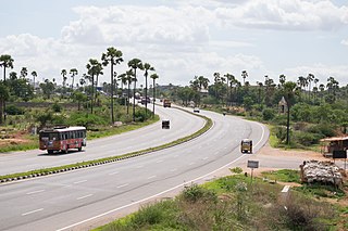
National Highway 65, , is a National Highway in India. It runs along the states of Maharashtra, Karnataka, Telangana and Andhra Pradesh. It starts at Pune and ends at Machilipatnam. Major cities on this route are Pune, Solapur, Hyderabad, Suryapet, Vijayawada and Machilipatnam. The section between Hyderabad and Vijayawada, is known as Vijayawada–Hyderabad Expressway and is a major expressway.
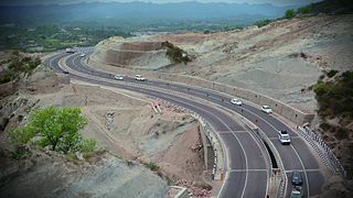
National Highway 44 is a major north–south National Highway in India and is the longest in the country.
National Highway 40, a combination of previous national highways 4 and 18, is a national highway in India. It starts at National Highway 44 junction at Kurnool and passes through Kadapa and Chittoor and terminates at Ranipet in Tamil Nadu. It is called Rayalaseema Express Highway. The highway was transformed into four lanes between Kurnool and Kadapa.
National Highway 118 is a national highway of India. It connects Asanbani and Jamshedpur in the state of Jharkhand. At 17 km (11 mi) length, it is one of the shortest national highways in India. Before renumbering of national highways, route of NH-118 was part of old national highway 32. It is a spur road of National Highway 18.
National Highway 135 is a national highway of India. It is a branch of National Highway 35.
National Highway 153, formerly NH-216, is a national highway in India. It is a spur road of National Highway 53. NH-153 traverses the state of Chhattisgarh in India.
National Highway 45 is a primary national highway in India. This highway runs in the states,sagartola of Madhya Pradesh and Chhattisgarh. The route of NH-45 was extended from Jabalpur to Bilaspur in June 2016.
National Highway 43 is a primary National Highway in India. It traverses from Gulganj in Madhya Pradesh, through Chhattisgarh and terminates at Chaibasa in Jharkhand. This national highway is 1,062.5 km (660.2 mi) long. Before renumbering of national highways NH-6 was variously numbered as old national highways 78, 23 & 33.

National Highway 55 is a National Highway in India connecting Sambalpur and Cuttack in Indian state of Odisha. Starting from NH 53 in Maneswar, Sambalpur, it terminates at NH 16, in Manguli Square, Cuttack. it is also known as Cuttack - Sambalpur Highway. Before renumbering of national highways of India, route of NH-55 was part of old national highway 42. This national highway is 262 km (163 mi) long.

National Highway 53, combination of old, & is a national highway in India. It connects Hajira in Gujarat and Paradeep port in Odisha. NH-53 traverses the states of Gujarat, Maharashtra, Chhattisgarh and Odisha in India. The road is the part of AH46 network in India and it is officially listed as running over 1949 km (1211 mi) from Kolkata to Surat. it is also known as Surat - Kolkata Highway. It passes through Maharashtra, Chhattisgarh and Odisha states.

National Highway 71 is a National Highway in India, that lies completely in the state of Andhra Pradesh. This highway passes through Temple city Tirupati and connects with Coastal Andhra Pradesh. The western terminal starts at the junction of National Highway 42 near Madanapalle and terminates at the junction of National Highway 16 near Naidupeta in the east.

National Highway 69, , is a 732 km (455 mi) long major National Highway in India, that runs through the states of Karnataka and Andhra Pradesh. The western terminal is at the junction of NH 66 near Honnavar, connects NH 48 near Sira, connects NH 44 near Chikkaballapur, connects NH 75 near Mulbagal and terminates at the east end Renigunta. Its old name was NH 234.

National Highway 61 is a National Highway in India connecting Bhiwandi in Maharashtra to Nirmal in Telangana. The route of this national highway was extended from Nirmal to Jagtial in the state of Telangana. NH-61 runs through states of Maharashtra and Telangana covering a distance of 758 km.
National Highway 552 is a National Highway in India. It is a spur road of National Highway 52. This highway traverses states of Rajasthan, Madhya Pradesh and Uttar Pradesh.
National Highway 42, , is a major National Highway in India, that runs in the states of Andhra Pradesh and Tamil Nadu. The northern terminal is at the National Highway 44 junction south of Anantapur inside Andhra Pradesh state and the southern terminal is at the National Highway 44 junction near Krishnagiri in Tamil Nadu.
National Highway 765, is a National Highway in India, which was formed as a new National Highway by up-gradation and passes through the states of Telangana and Andhra Pradesh. It starts at Hyderabad of Telangana and ends at Tokapelle road of Andhra Pradesh.

National Highway 19 is a national highway in India. It was previously referred to as Delhi–Kolkata Road and is one of the busiest national highways in India. After renumbering of national highways, Delhi to Agra route is now national highway 44 and Agra to Kolkata route is numbered national highway 19. It constitutes a major portion of the historical Grand Trunk Road. It is also part of AH1 of Asian Highway Network, that traverses from Japan to Turkey.


