Nautical mile

Last updated
Nautical mile
Nautic mile definition v2 English.svg
Historical definition – 1 nautical mile
General information
Unit of length
SymbolM, NM, [lower-alpha 1] or nmi
Conversions
1 M, NM, [lower-alpha 2] or nmi in ...... is equal to ...
    metre    1,852 [1]
    foot     6,076
    statute mile     1.151
    cable    10

A nautical mile is a unit of length used in air, marine, and space navigation, and for the definition of territorial waters. [2] [3] [4] Historically, it was defined as the meridian arc length corresponding to one minute (1/60 of a degree) of latitude at the equator, so that Earth's polar circumference is very near to 21,600 nautical miles (that is 60 minutes × 360 degrees). Today the international nautical mile is defined as 1,852 metres (about 6,076 ft; 1.151 mi). [5] The derived unit of speed is the knot, one nautical mile per hour.

Contents

Unit symbol

There is no single internationally agreed symbol, with several symbols in use. [1]

History

Visual comparison of a kilometre, statute mile and nautical mile Nauticalmilecomparison.svg
Visual comparison of a kilometre, statute mile and nautical mile

The word mile is from the Latin phrase for a thousand paces: mille passus . Navigation at sea was done by eye [12] until around 1500 when navigational instruments were developed and cartographers began using a coordinate system with parallels of latitude and meridians of longitude.

The earliest reference of 60 miles to a degree is a map by Nicolaus Germanus in a 1482 edition of Geography (Ptolemy) indicating one degree of longitude at the Equator contained "milaria 60". [13] An earlier manuscript map by Nicolaus Germanus in a previous edition of Geography (Ptolemy) stated "unul gradul log. et latitud sub equinortiali formet stadia 500 que fanut miliaria 62-1/2" (one degree longitude and latitude under the equator forms 500 stadia, which make 62-1/2 miles). [14] Whether a correction or convenience, the reason for the change from 62-1/2 to 60 miles to a degree is not explained. Eventually, the ratio of 60 miles to a degree appeared in English in a 1555 translation of Pietro Martire d'Anghiera's Decades: "[Ptolemy] assigned likewise to every degree three score miles." [15]

By the late 16th century English geographers and navigators knew that the ratio of distances at sea to degrees was constant along any great circle (such as the equator, or any meridian), assuming that Earth was a sphere. In 1574, William Bourne (mathematician) stated in A Regiment for the Sea the "rule to raise a degree" practised by navigators: "But as I take it, we in England should allowe 60 myles to one degrée: that is, after 3 miles to one of our Englishe leagues, wherefore 20 of oure English leagues shoulde answere to one degrée." [16] Likewise, Robert Hues wrote in 1594 that the distance along a great circle was 60 miles per degree. [17] However, these referred to the old English mile of 5000 feet and league of 15,000 feet, relying upon Ptolemy's underestimate of the Earth's circumference. [18] In the early seventeenth century, English geographers started to acknowledge the discrepancy between the angular measurement of a degree of latitude and the linear measurement of miles. In 1624 Edmund Gunter suggested 352,000 feet to a degree (5866 2/3 feet per arcminute). [19] [17] In 1633, William Oughtred suggested 349,800 feet to a degree (5830 feet per arcminute). [20] Both Gunter and Oughtred put forward the notion of dividing a degree into 100 parts, but their proposal was generally ignored by navigators. The ratio of 60 miles, or 20 leagues, to a degree of latitude remained fixed while the length of the mile was revised with better estimates of the earth’s circumference. In 1637, Robert Norwood proposed a new measurement of 6120 feet for an arcminute of latitude, which was within 44 feet of the currently accepted value for a nautical mile. [21]

Since the Earth is not a perfect sphere but is an oblate spheroid with slightly flattened poles, a minute of latitude is not constant, but about 1,861 metres at the poles and 1,843 metres at the Equator. [22] France and other metric countries state that in principle a nautical mile is an arcminute of a meridian at a latitude of 45°, but that is a modern justification for a more mundane calculation that was developed a century earlier. By the mid-19th century, France had defined a nautical mile via the original 1791 definition of the metre, one ten-millionth of a quarter meridian. [23] [24] So 10,000,000 m/90 × 60 = 1,851.85 m ≈ 1,852 m became the metric length for a nautical mile. France made it legal for the French Navy in 1906, and many metric countries voted to sanction it for international use at the 1929 International Hydrographic Conference.[ citation needed ]

Both the United States and the United Kingdom used an average arcminute—specifically, a minute of arc of a great circle of a sphere having the same surface area as the Clarke 1866 ellipsoid. [25] The authalic (equal area) radius of the Clarke 1866 ellipsoid is 6,370,997.2 metres (20,902,222 ft). [26] The resulting arcminute is 1,853.2480 metres (6,080.210 ft). The United States chose five significant digits for its nautical mile, 6,080.2 feet, whereas the United Kingdom chose four significant digits for its Admiralty mile, 6,080 feet.

In 1929 the international nautical mile was defined by the First International Extraordinary Hydrographic Conference in Monaco as exactly 1,852 metres (which is 6,076.12 ft). [1] The United States did not adopt the international nautical mile until 1954. [27] Britain adopted it in 1970, [28] but legal references to the obsolete unit are now converted to 1,853 metres (which is 6,079.40 ft). [29]

Similar definitions

The metre was originally defined as 110,000,000 of the length of the meridian arc from the North pole to the equator (1% of a centesimal degree of latitude), [lower-alpha 3] thus one kilometre of distance corresponds to one centigrad (also known as centesimal arc minute) of latitude. The Earth's circumference is therefore approximately 40,000 km. The equatorial circumference is slightly longer than the polar circumference  the measurement based on this (40,075.017 km/360 × 60 = 1,855.3 metres) is known as the geographical mile.

Using the definition 1/60 of a degree of latitude on Mars, a Martian nautical mile equals to 983 m (1,075 yd). This is potentially useful for celestial navigation on a human mission to the planet, both as a shorthand and a quick way to roughly determine the location. [31]

See also

Notes

  1. Alternative meanings of the abbreviation "nm" or "NM" are listed here.
  2. Alternative meanings of the abbreviation "nm" or "NM" are listed here.
  3. No meridian was specified in either 1791, 1793, 1795 or 1799 . For example, the Law of 18 Germinal an III (April 7, 1795) states: "Meter, the measure of length equal to the ten-millionth part of a terrestrial meridian contained between the north pole and the equator." [30]

Related Research Articles

<span class="mw-page-title-main">Minute and second of arc</span> Units for measuring angles

A minute of arc, arcminute (arcmin), arc minute, or minute arc, denoted by the symbol , is a unit of angular measurement equal to 1/60 of one degree. Since one degree is 1/360 of a turn, or complete rotation, one arcminute is 1/21600 of a turn. The nautical mile (nmi) was originally defined as the arc length of a minute of latitude on a spherical Earth, so the actual Earth circumference is very near 21600 nmi. A minute of arc is π/10800 of a radian.

The geographical mile is an international unit of length determined by 1 minute of arc along the Earth's equator. For the international ellipsoid 1924 this equalled 1855.4 metres. The American Practical Navigator 2017 defines the geographical mile as 6,087.08 feet (1,855.342 m). Greater precision depends more on the choice of the Earth's radius of the used ellipsoid than on more careful measurement, since the radius of the geoid varies more than 100 metres (328.084 ft) along the equator. In any ellipsoid, the length of a degree of longitude at the equator is exactly 60 geographical miles. The Earth's radius at the equator in the GRS80 ellipsoid is 6,378,137.0000 m, which makes the geographical mile 1,855.3248 m. The rounding of the Earth's radius to metres in GRS80 has an effect of 0.0001 m.

<span class="mw-page-title-main">Latitude</span> Geographic coordinate specifying north–south position

In geography, latitude is a coordinate that specifies the north–south position of a point on the surface of the Earth or another celestial body. Latitude is given as an angle that ranges from −90° at the south pole to 90° at the north pole, with 0° at the Equator. Lines of constant latitude, or parallels, run east–west as circles parallel to the equator. Latitude and longitude are used together as a coordinate pair to specify a location on the surface of the Earth.

<span class="mw-page-title-main">Longitude</span> Geographic coordinate that specifies the east-west position of a point on the Earths surface

Longitude is a geographic coordinate that specifies the east–west position of a point on the surface of the Earth, or another celestial body. It is an angular measurement, usually expressed in degrees and denoted by the Greek letter lambda (λ). Meridians are imaginary semicircular lines running from pole to pole that connect points with the same longitude. The prime meridian defines 0° longitude; by convention the International Reference Meridian for the Earth passes near the Royal Observatory in Greenwich, south-east London on the island of Great Britain. Positive longitudes are east of the prime meridian, and negative ones are west.

<span class="mw-page-title-main">Mile</span> Unit of length

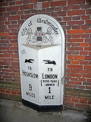
The mile, sometimes the international mile or statute mile to distinguish it from other miles, is a British imperial unit and United States customary unit of distance; both are based on the older English unit of length equal to 5,280 English feet, or 1,760 yards. The statute mile was standardised between the Commonwealth of Nations and the United States by an international agreement in 1959, when it was formally redefined with respect to SI units as exactly 1,609.344 metres.

<span class="mw-page-title-main">Mercator projection</span> Cylindrical conformal map projection

The Mercator projection is a conformal cylindrical map projection presented by Flemish geographer and cartographer Gerardus Mercator in 1569. It became the standard map projection for navigation due to its ability to represent north as 'up' and south as 'down' everywhere while preserving local directions and shapes. However, as a result, the Mercator projection inflates the size of objects the further they are from the equator. In a Mercator projection, landmasses such as Greenland and Antarctica appear far larger than they actually are relative to landmasses near the equator. Despite these drawbacks, the Mercator projection is well-suited to marine navigation and internet web maps and continues to be widely used today.

<span class="mw-page-title-main">Geographic coordinate system</span> System to specify locations on Earth

A geographic coordinate system (GCS) is a spherical or geodetic coordinate system for measuring and communicating positions directly on the Earth as latitude and longitude. It is the simplest, oldest and most widely used of the various spatial reference systems that are in use, and forms the basis for most others. Although latitude and longitude form a coordinate tuple like a cartesian coordinate system, the geographic coordinate system is not cartesian because the measurements are angles and are not on a planar surface.

<span class="mw-page-title-main">Prime meridian</span> Line of longitude, at which longitude is defined to be 0°

A prime meridian is an arbitrarily-chosen meridian in a geographic coordinate system at which longitude is defined to be 0°. Together, a prime meridian and its anti-meridian form a great circle. This great circle divides a spheroid, like Earth, into two hemispheres: the Eastern Hemisphere and the Western Hemisphere. For Earth's prime meridian, various conventions have been used or advocated in different regions throughout history. Earth's current international standard prime meridian is the IERS Reference Meridian. It is derived, but differs slightly, from the Greenwich Meridian, the previous standard.

<span class="mw-page-title-main">Celestial navigation</span> Navigation using astronomical objects to determine position

Celestial navigation, also known as astronavigation, is the practice of position fixing using stars and other celestial bodies that enables a navigator to accurately determine their actual current physical position in space or on the surface of the Earth without relying solely on estimated positional calculations, commonly known as dead reckoning. Celestial navigation is performed without using satellite navigation or other similar modern electronic or digital positioning means.

<span class="mw-page-title-main">History of geodesy</span>

The history of geodesy (/dʒiːˈɒdɪsi/) began during antiquity and ultimately blossomed during the Age of Enlightenment.

<span class="mw-page-title-main">Knot (unit)</span> Unit of speed

The knot is a unit of speed equal to one nautical mile per hour, exactly 1.852 km/h. The ISO standard symbol for the knot is kn. The same symbol is preferred by the Institute of Electrical and Electronics Engineers (IEEE), while kt is also common, especially in aviation, where it is the form recommended by the International Civil Aviation Organization (ICAO). The knot is a non-SI unit. The knot is used in meteorology, and in maritime and air navigation. A vessel travelling at 1 knot along a meridian travels approximately one minute of geographic latitude in one hour.

<span class="mw-page-title-main">Scale (map)</span> Ratio of distance on a map to the corresponding distance on the ground

The scale of a map is the ratio of a distance on the map to the corresponding distance on the ground. This simple concept is complicated by the curvature of the Earth's surface, which forces scale to vary across a map. Because of this variation, the concept of scale becomes meaningful in two distinct ways.

<span class="mw-page-title-main">Longitude by chronometer</span>

Longitude by chronometer is a method, in navigation, of determining longitude using a marine chronometer, which was developed by John Harrison during the first half of the eighteenth century. It is an astronomical method of calculating the longitude at which a position line, drawn from a sight by sextant of any celestial body, crosses the observer's assumed latitude. In order to calculate the position line, the time of the sight must be known so that the celestial position i.e. the Greenwich Hour Angle and Declination, of the observed celestial body is known. All that can be derived from a single sight is a single position line, which can be achieved at any time during daylight when both the sea horizon and the sun are visible. To achieve a fix, more than one celestial body and the sea horizon must be visible. This is usually only possible at dawn and dusk.

Decimal degrees (DD) is a notation for expressing latitude and longitude geographic coordinates as decimal fractions of a degree. DD are used in many geographic information systems (GIS), web mapping applications such as OpenStreetMap, and GPS devices. Decimal degrees are an alternative to using sexagesimal degrees. As with latitude and longitude, the values are bounded by ±90° and ±180° respectively.

<span class="mw-page-title-main">Marinus of Tyre</span> Roman cartographer and mathematician (c.70–130)

Marinus of Tyre was a Greek-speaking Roman geographer, cartographer and mathematician, who founded mathematical geography and provided the underpinnings of Claudius Ptolemy's influential Geography.

<span class="mw-page-title-main">History of longitude</span> Record of humanitys attempts to find east-west position on Earth

The history of longitude describes the centuries-long effort by astronomers, cartographers and navigators to discover a means of determining the longitude of any given place on Earth. The measurement of longitude is important to both cartography and navigation. In particular, for safe ocean navigation, knowledge of both latitude and longitude is required, however latitude can be determined with good accuracy with local astronomical observations.

The Arab, Arabic, or Arabian mile was a historical Arabic unit of length. Its precise length is disputed, lying between 1,800 metres (5,900 ft) and 2,000 metres (6,600 ft). It was used by medieval Arab geographers and astronomers. The predecessor of the modern nautical mile, it extended the Roman mile to fit an astronomical approximation of 1 minute of an arc of latitude measured along a north–south meridian. The distance between two pillars whose latitudes differed by 1 degree in a north–south direction was measured using sighting pegs along a flat desert plane.

<i>Longitude</i> (book) 1995 popular science book

Longitude: The True Story of a Lone Genius Who Solved the Greatest Scientific Problem of His Time is a 1995 best-selling book by Dava Sobel about John Harrison, an 18th-century clockmaker who created the first clock (chronometer) sufficiently accurate to be used to determine longitude at sea—an important development in navigation. The book was made into a television series entitled Longitude. In 1998, The Illustrated Longitude was published, supplementing the earlier text with 180 images of characters, events, instruments, maps and publications.

<span class="mw-page-title-main">Equator</span> Imaginary line halfway between Earths North and South poles

The equator is a circle of latitude that divides a spheroid, such as Earth, into the Northern and Southern hemispheres. On Earth, the Equator is an imaginary line located at 0 degrees latitude, about 40,075 km (24,901 mi) in circumference, halfway between the North and South poles. The term can also be used for any other celestial body that is roughly spherical.

<span class="mw-page-title-main">Earth's circumference</span> Distance around the Earth

Earth's circumference is the distance around Earth. Measured around the equator, it is 40,075.017 km (24,901.461 mi). Measured passing through the poles, the circumference is 40,007.863 km (24,859.734 mi).

References

  1. 1 2 3 Göbel, E.; Mills, I.M.; Wallard, Andrew, eds. (2006). The International System of Units (SI) (PDF) (8th ed.). Paris: Bureau International des Poids et Mesures. p. 127. ISBN   92-822-2213-6. Archived from the original (PDF) on 2017-08-14. Retrieved 2017-06-20.
  2. Wragg, David W. (1973). A Dictionary of Aviation (first ed.). Osprey. p. 200. ISBN   9780850451634.
  3. "mile | unit of measurement". Encyclopædia Britannica. Archived from the original on 2022-10-25. Retrieved 2016-06-10.
  4. "UNITED NATIONS CONVENTION ON THE LAW OF THE SEA". www.un.org. Archived from the original on 2017-12-18. Retrieved 2016-06-10.
  5. Wragg, David W. (1973). A Dictionary of Aviation (first ed.). Osprey. p. 200. ISBN   9780850451634.
  6. "WS SIGMET Quick Reference Guide" (PDF). ICAO. Archived (PDF) from the original on 2020-11-21. Retrieved 2016-06-09.
  7. International Standards and Recommended Practices, Annex 5 to the Convention on International Civil Aviation, “Units of measurement to be Used in Air and Ground Operations”, ICAO, Fifth Edition, July 2010.
  8. "APPENDIX A: SYMBOLS AND PREFIXES". IEEE. Archived from the original on 2021-04-23. Retrieved 2016-06-09.
  9. "U.S. Government Printing Office Style Manual". U.S. Government Printing Office. Archived from the original on 2018-11-19. Retrieved 2016-06-10.
  10. Symboles, Abréviations et Termes utilisés sur les cartes marines [Symbols, Abbreviations and Terms used on Charts](PDF) (in French and English). Vol. 1D (INT1) (6th ed.). Service Hydrographique et Océanographique de la Marine (SHOM). 2016. Archived from the original (PDF) on 2016-08-21. Retrieved 2018-01-04. also available as Symbols and Abbreviations used on ADMIRALTY Paper Charts. Vol. NP5011 (6th ed.). United Kingdom Hydrographic Office. 2016. section B, line 45. ISBN   978-0-70-774-1741.
  11. Dutton's Navigation and Piloting (14th ed.). Annapolis, MD: Naval Institute Press. 1985. ISBN   0-87021-157-9.
  12. "Mile, Nautical and Statute – FREE Mile, Nautical and Statute information | Encyclopedia.com: Find Mile, Nautical and Statute research". www.encyclopedia.com. Archived from the original on 2016-06-07. Retrieved 2016-06-10.
  13. Germanus, Nicolaus (1482). Ptolemy's Cosmographia. Ulm: Lienhart Holle. p. 245. Archived from the original on 23 October 2023. Retrieved 8 October 2023.
  14. Germanus, Nicolaus (c. 1460). "Eleventh map of Asia," Ptolemy's Geographia. Archived from the original on 23 October 2023. Retrieved 8 October 2023.
  15. Anghiera, Pietro Martire d' (1555). The Decades of the Newe Worlde Or West India. London: Guilielm. Powell. p. 323. Archived from the original on 2023-10-24. Retrieved 2023-10-08.
  16. Bourne, William (1574). A regiment for the sea. London: Thomas Hacket. p. 39. Archived from the original on 23 October 2023. Retrieved 6 October 2023.
  17. 1 2 Waters, David W. (1958). The Art of Navigation in England in Elizabethan and Early Stuart Times. p. 374.
  18. Hues, Robert (1659). A learned treatise of globes, both cœlestiall and terrestriall with their several uses. London: J.S. for Andrew Kemb. pp. 157, 163. Archived from the original on 24 October 2023. Retrieved 6 October 2023.
  19. Gunther, Edmund (1673). The Works of Edmund Gunther. London: A. C.[larke]. for Francis Eglesfield, at the Marigold in St. Paul's Church-yard. pp. 280–281. Retrieved 6 October 2023.
  20. Oughtred, William (1639). The Circles of Proportion and the Horizontall Instrument. London: The Circles of Proportion and the Horizontall Instrument. p. 27. Archived from the original on 24 October 2023. Retrieved 6 October 2023.
  21. Norwood, Richard (1699). The Sea-man's Practice: Containing a Fundamental Problem in Navigation, Experimentally Verified. London: Richard Mount. p. 43. Archived from the original on 24 October 2023. Retrieved 6 October 2023.
  22. McNish, Larry. "RASC Calgary Centre - Latitude and Longitude". The Royal Astronomical Society of Canada. Archived from the original on 30 August 2019. Retrieved 30 August 2019.
  23. Bureau des Longitudes (1933). "Mesures employées sur les cartes marines". Annuaire Pour l'An 1933: 392. Archived from the original on 2019-08-31. Retrieved 2019-08-31. The nautical mile [mille marin] is in principle the length of the sexagesimal minute of a meridian at a latitude of 45°. ... If we assume that the metre is exactly the ten-millionth part of the terrestrial quarter meridian, it would be equal to 1,851.85 m. – Translation by Wikipedia.
  24. Bureau des Longitudes (1848). "Mesures itinéraires". Annuaire Pour l'An 1848: 74. Archived from the original on 2019-08-31. Retrieved 2019-08-31.
  25. Blazebrook, Richard (1922), A Dictionary of Physics, vol. 1, Macmillan and Co, Limited, p. 587
  26. Snyder, John P. (1987). Map Projections: A Working Manual. p. 16.
  27. Astin, A.V.; Karo, H. Arnold (June 25, 1959). "Refinement of values for the yard and the pound" (PDF). NOAA.gov. National Bureau of Standards. Archived from the original (PDF) on March 9, 2013. Retrieved 2018-07-07.
  28. "Nautical mile definition and meaning | Collins English Dictionary". Collins Dictionary. Archived from the original on 1 September 2019. Retrieved 1 September 2019.
  29. "The Units of Measurement Regulations 1995". www.legislation.gov.uk. Archived from the original on 2017-03-24. Retrieved 2016-06-10.
  30. Hallock, William; Wade, Herbert T. (1906), Outlines of the Evolution of Weights and Measures and the Metric System, New York The Macmillan company, p. 54
  31. Zubrin, Robert (1996). The Case for Mars: The Plan to Settle the Red Planet and Why We Must. Richard Wagner. New York: Free Press. p. 162. ISBN   0-684-82757-3. OCLC   34906203.