United Kingdom Hydrographic Office

Last updated

United Kingdom Hydrographic Office
UK Hydrographic Office logo.svg
Agency overview
Formed1795
HeadquartersAdmiralty Way
Taunton
TA1 2DN
Employeesapprox 900
Minister responsible
Agency executive
Parent agency Ministry of Defence
Website www.gov.uk/government/organisations/uk-hydrographic-office OOjs UI icon edit-ltr-progressive.svg

The United Kingdom Hydrographic Office (UKHO) is the UK's agency for providing hydrographic and marine geospatial data to mariners and maritime organisations across the world. The UKHO is a trading fund of the Ministry of Defence (MoD) and is located in Taunton, Somerset, with a workforce of approximately 900 staff.

Contents

The UKHO is responsible for operational support to the Royal Navy and other defence customers. Supplying defence and the commercial shipping industry, they help ensure Safety of Life at Sea (SOLAS), protect the marine environment and support the efficiency of global trade.[ citation needed ]

The UKHO also produces Admiralty charts, providing SOLAS-compliant charts, publications and digital services for ships trading internationally.

History

Establishment and early operation

Alexander Dalrymple, engraving by Conrad Westermayr. Alexander Dalrymple AGE V07 1801.jpg
Alexander Dalrymple, engraving by Conrad Westermayr.

The Admiralty's first Hydrographer was Alexander Dalrymple, [3] appointed in 1795 on the order of King George III and the existing charts were brought together and catalogued. The first chart Dalrymple published as Hydrographer to the Admiralty (of Quiberon Bay in Brittany) did not appear until 1800. [4] He also issued Sailing Directions and Notices to Mariners (NMs).[ citation needed ]

Dalrymple was succeeded on his death in 1808 by Captain Thomas Hurd, under whose stewardship the department was given permission to sell charts to the public in 1821. [5]

In 1819, Captain Hurd entered into a bi-lateral agreement with Denmark to exchange charts and publications covering areas of mutual interest. This is thought to be the earliest formal arrangement for the mutual supply of information between the British and any foreign Hydrographic Office. [6] Hurd developed the specialism of Royal Navy hydrographic surveyors. Rear-Admiral Sir W. Edward Parry was appointed Hydrographer in 1823 after his second expedition to discover a Northwest Passage. [7] [8] In 1825 some 736 charts and coastal views were being offered for sale by the Hydrographic Office.

Explorations

HMS Challenger by William Frederick Mitchell HMS challenger William Frederick Mitchell.jpg
HMS Challenger by William Frederick Mitchell

In 1828 Captain Parry and the Royal Society organised a scientific voyage to the South Atlantic, in collaboration with the Hydrographers of France and Spain, using HMS Chanticleer. [9]

In 1829, at the age of 55, Rear-Admiral Sir Francis Beaufort became Hydrographer. During his time as Hydrographer, he developed the eponymous Scale, saw the introduction of official tide tables in 1833 and instigated various surveys and expeditions. Several of these were by HMS Beagle, including one to Tierra del Fuego and Patagonia in 1826. In 1831 Captain Beaufort informed Captain FitzRoy that he had found a savant for the latter's surveying voyage to South America, Charles Darwin. After completing extensive surveys in South America he returned to Falmouth, Cornwall via New Zealand and Australia in 1836. [10] By the time of Beaufort's retirement in 1855, the Chart Catalogue listed 1,981 charts and 64,000 copies of them had been issued to the Royal Navy. [11]

In the 1870s, the Royal Naval Surveying Service supported the Challenger expedition, a scientific exercise that made many discoveries, laying the foundation of oceanography. The cruise was named after the mother vessel, HMS Challenger. On her 68,890-nautical-mile (127,580 km) circumnavigation of the globe, [12] 492 deep sea soundings, 133 bottom dredges, 151 open water trawls and 263 serial water temperature observations were taken. [13] The Challenger crew used a method of observation developed in earlier small-scale expeditions. To measure depth, the crew would lower a line with a weight attached to it until it reached the sea floor. The line was marked in 25 fathom intervals with flags denoting depth. Because of this, the depth measurements from the Challenger were at best accurate to 25 fathoms (150 feet), or about 46 metres. [14] As the first true oceanographic cruise, the Challenger expedition established an entire academic and research discipline. [15]

During the late 19th century, the UKHO took part in several international conferences, including the International Meridian Conference to determine a prime meridian for international use and other conferences working towards the establishment of a permanent international commission concerning hydrographic matters. Hydrographers to the Admiralty Board during this period included: Rear-Admiral John Washington, Rear-Admiral George Henry Richards, Captain Sir Frederick J. O. Evans and Rear-Admiral Sir William J. L. Wharton.

20th century

The expedition's ship Nimrod departing for the South Pole NimrodDepartingToSouthPole1907.jpg
The expedition's ship Nimrod departing for the South Pole

During Rear-Admiral A. Mostyn Field's term as Hydrographer to the Admiralty Board, the Hydrographic Office lent instruments to the Nimrod Expedition of the British Antarctic Expedition led by Ernest Shackleton in 1907. Following the RMS Titanic in 1912, the Safety of Life at Sea (SOLAS) convention was established, as well as the introduction of ice reporting and forecasting. During World War I, while Rear-Admiral Sir John F. Parry was Hydrographer of the Navy, the Hydrographic Office produced numerous new charts and products to support the Royal Navy.

Following the war, the First International Hydrographic Conference was held in London. It led to the establishment in 1921 of the International Hydrographic Organization. In the 1930s, the systematic and regular collection of oceanographic and naval meteorological data started. In the Second World War, while led by Vice-Admiral Sir John A. Edgell, chart printing moved to Creechbarrow House in Taunton in June 1941. This was the first purpose-built chart making factory, and was designed by the Chief Draughtsman, Mr Jowsey. In 1968, compilation staff were transferred from Cricklewood to Taunton, thus bringing together the main elements of the Hydrographic Office. A purpose-built office, named after Alexander Dalrymple, was opened. Metrication and computerisation of charts began in the later 1960s and early 1970s under the leadership of Rear-Admiral Sir Edmund G. Irving (1960–1966), Rear-Admiral George Stephen Ritchie (1966–1971), Rear-Admiral Geoffrey P. D. Hall (1971–1975) and Rear-Admiral Sir David W. Haslam (1975–1985).

For centuries, data was mainly collected using ordinary Royal Navy ships. In 1953, the first purpose-built survey vessel was launched: HMS Vidal. [16] With the use of the echo sounder and other electronic equipment in the 20th century, there was a big increase in the quantity and quality of the data collected. The technology used to collect data also improved with the first commercial use of multibeam survey technology in 1977; HMS Bulldog undertook the first side-scan sonar of Mount's Bay, Cornwall, in 1987. The work has since been continued by the Bulldog-class survey vessels which form the "Hydrographic Squadron".

In 1994, the Hydrographer of the Navy also became the Chief Executive of UKHO and the post was held by Rear-Admiral Nigel R. Essenhigh (1994–1996) and Rear-Admiral John P. Clarke (1996–2001).

Publications

An example of an Electronic Navigational Chart (NOAA) Enc.jpg
An example of an Electronic Navigational Chart (NOAA)

The UKHO continues to serve the Royal Navy as its prime customer by supplying hydrographic and geospatial data. The UKHO's products and services are sold to merchant mariners and leisure users through its commercial branch. [17]

In addition to traditional paper nautical charts and publications, the range has expanded to include a number of digital products and services. In 1996, the UKHO developed ADMIRALTY Raster Chart Service, a raster navigational chart service for Electronic Chart Display and Information System. This was followed in 2008 by ADMIRALTY Vector Chart Service, offering 15,750 fully vectorised Electronic Navigational Charts (ENCs).

The UKHO produces over 200 nautical publications, which are available as e-Nautical Publications or in the Digital Publications suite. Notable publications include Sailing directions (Pilots), Tide tables, List of Radio Signals, List of Lights and Fog Signals and the Mariner's Handbook. [18] The UKHO also offers astronomical publications from HM Nautical Almanac Office, including The Nautical Almanac and The Astronomical Almanac , among others. [19]

Today, the UKHO has expertise in areas such as bathymetry, oceanography, geodesy and data science. It provides advice on technical aspects of Law of the Sea, specialising in maritime limits and boundaries. [20] It also delivers a range of cartographic and ENC training programmes delivered internationally to develop the core skills of marine cartography. Since 2015, the UKHO has supported the delivery of the Commonwealth Marine Economies (CME) Programme in partnership Cefas and NOC, a programme enabling Small Island Developing States (SIDS) to sustainably develop their marine economies. [21]

Admiralty List of Lights and Fog Signals

The UKHO publishes the Admiralty List of Lights and Fog Signals covering the whole world in 12 volumes. The information is also available in digital form. [22]

Access to data

The UKHO is the government department responsible for charting the seas. It is part of the Ministry Of Defence, and operates as a trading fund, enabling it to be self-funding through sale of products and licensing of data. The UKHO sources much of its information from foreign governments to whom it pays royalty fees funded by the profits it makes.[ citation needed ]

The UKHO grants six different licences, according to the use of the product. Whilst it generally allows use for non-navigational, non-commercial or low value purposes free of charge (over 80% of licences), where licensing is for use in a commercial product, a licence fee is charged. The UKHO is committed to the Information Fair Traders Scheme [23] and makes available for reuse those data that are collected as part of its Public Task, [24] which do not include third party Intellectual Property Rights.

In the Information Fair Trader Scheme Report on the UKHO in April 2011 [25] it states that the UKHO data will not be included in the Public Data Corporation to make government owned data more freely available, but it does recommend that the "UKHO should consider the introduction of a Free Navigational Licence" for non-commercial or low value use, consistent with its treatment of non-navigational use.[ citation needed ]

List of chief executives

See also

Related Research Articles

<span class="mw-page-title-main">Hydrography</span> Applied science of measurement and description of physical features of bodies of water

Hydrography is the branch of applied sciences which deals with the measurement and description of the physical features of oceans, seas, coastal areas, lakes and rivers, as well as with the prediction of their change over time, for the primary purpose of safety of navigation and in support of all other marine activities, including economic development, security and defense, scientific research, and environmental protection.

<span class="mw-page-title-main">Francis Beaufort</span> Anglo-Irish hydrographer and naval officer (1774–1857)

Sir Francis Beaufort was an Anglo-Irish hydrographer, the creator of the Beaufort cipher and the Beaufort scale, and a naval officer.

A hydrographic office is an organization which is devoted to acquiring and publishing hydrographic information.

<span class="mw-page-title-main">Alexander Dalrymple</span> Scottish geographer and hydrographer

Alexander Dalrymple FRS was a Scottish geographer and the first Hydrographer of the British Admiralty. He was the main proponent of the theory that there existed a vast undiscovered continent in the South Pacific, Terra Australis Incognita. He produced thousands of nautical charts, mapping a remarkable number of seas and oceans for the first time, and contributing significantly to the safety of shipping. His theories prompted a number of expeditions in search of this mythical land, until James Cook's second journey (1772–1775) led to the conclusion that, if it did exist, it was further south than the 65° line of latitude South.

<span class="mw-page-title-main">Admiralty chart</span> Nautical chart

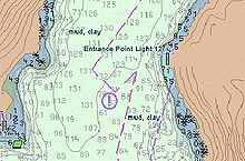
Admiralty charts are nautical charts issued by the United Kingdom Hydrographic Office (UKHO) and subject to Crown Copyright. Over 3,500 Standard Nautical Charts (SNCs) and 14,000 Electronic Navigational Charts (ENCs) are available with the Admiralty portfolio offering the widest official coverage of international shipping routes and ports, in varying detail.

The Naval Oceanographic Office (NAVOCEANO), located at John C. Stennis Space Center in south Mississippi, is an echelon IV component of the Naval Meteorology and Oceanography Command (NMOC) and comprises approximately 1,000 civilian, military and contract personnel responsible for providing oceanographic products and services to all elements within the Department of Defense.

Nautical publications is a technical term used in maritime circles describing a set of publications, either published by national governments or by commercial and professional organisations, for use in safe navigation of ships, boats, and similar vessels. Other publications might cover topics such as seamanship and cargo operations. In the UK, the United Kingdom Hydrographic Office, the Witherby Publishing Group and the Nautical Institute provide numerous navigational publications, including charts, publications on how to navigate and passage planning publications. In the US, publications are issued by the US government and US Coast Guard.

<span class="mw-page-title-main">Thomas Henry Tizard</span> English naval officer and oceanographer (1839–1924)

Thomas Henry Tizard was an English oceanographer, hydrographic surveyor, and navigator.

Rear-Admiral Sir David William Haslam was a Royal Navy officer.

<span class="mw-page-title-main">Hydrographer of the Navy</span> Key United Kingdom military science post

The Hydrographer of the Navy is the principal hydrographical Royal Naval appointment. From 1795 until 2001, the post was responsible for the production of charts for the Royal Navy, and around this post grew the United Kingdom Hydrographic Office (UKHO).

Rear-Admiral George Stephen Ritchie CB DSC was a British admiral noted for his cartographic and hydrographic work.

<span class="mw-page-title-main">Percy Douglas</span> Royal Navy admiral

Vice-Admiral Sir Henry Percy Douglas was a British naval officer who specialised in surveying and was Hydrographer of the Navy.

<span class="mw-page-title-main">Russian Hydrographic Service</span>

The Russian Hydrographic Service, full current official name Department of Navigation and Oceanography of the Ministry of Defence of the Russian Federation, is Russia's hydrographic office, with responsibility to facilitate navigation, performing hydrographic surveys and publishing nautical charts.

Noel Atherton was a British cartographer in the Admiralty Hydrographic Office; today known as the United Kingdom Hydrographic Office. Chief Civil Hydrographic Officer and Assistant Superintendent of Charts, for the Admiralty between 1951 and 1962.

<span class="mw-page-title-main">John Augustine Edgell</span>

Vice-Admiral Sir John Augustine Edgell, KBE, CB, FRS was an officer in the Royal Navy and Hydrographer of the Navy from 1932 to 1945. He was noted for his support for innovations such as echo sounding and radio navigation, for the surveying and chart production operations of his department during World War II, and for his advocacy of the science of oceanography

<span class="mw-page-title-main">William Hewett (died 1840)</span>

William Hewett was a Royal Navy officer noted for making the first comprehensive survey of the North Sea and for his work on tides.

<span class="mw-page-title-main">George Thomas (surveyor)</span>

George Thomas was a Master in the Royal Navy who was one of the early surveyors of the coasts of Great Britain

<span class="mw-page-title-main">Herbert Purey-Cust</span>

Sir Herbert Edward Purey-Cust, KBE, CB was an officer in the Royal Navy and Hydrographer of the Navy from 1909 to 1914.

<span class="mw-page-title-main">Archibald Day</span> Royal Navy (UK) officer and Hydrographer to the Navy

Vice-Admiral Sir Archibald Day, was an officer in the Royal Navy and Hydrographer of the Navy from 1950-1955. He played an important part in planning the evacuation from Dunkirk in 1940, and wrote a history of the Hydrographic Service.

Rear Admiral Edward James Bedford was a Royal Navy officer noted for his work as a surveyor, particularly in Scotland.

References

  1. "RAdm Peter Sparkes".
  2. "UKHO appoints RAdm Peter Sparkes as Acting Chief Executive following retirement of CEO Tim Lowe CBE | Mirage News". 13 July 2020.
  3. Dalrymple, Alexander (1737–1808). Australian Dictionary of National Biography. Retrieved 12 January 2014.
  4. "Admiralty Charts of Scottish coasts, 1795–1963". National Library of Scotland. Retrieved 28 December 2017.
  5. Hardisty, Jack (2008). Estuaries: Monitoring and Modeling the Physical System. John Wiley & Sons. pp. 41–42. ISBN   9781405172325.
  6. Webb, Adrian (November 2010). "Foundations for 'International cooperation in the field of hydrography': some Contributions by British Admiralty Hydrographers, 1795–1855" (PDF). The International Hydrographic Review. 4: 7–15.
  7. Webb, Adrian. "The Expansion of British Naval Hydrographic Administration, 1808–1829" (PDF). PhD Thesis. University of Exeter. Retrieved 12 January 2014.
  8. J.C. Sainty (1975). "Hydrographer 1795–1870". Office-Holders in Modern Britain: Volume 4: Admiralty Officials 1660–1870. Institute of Historical Research. Retrieved 12 January 2014.
  9. "NMM, vessel ID 382156" (PDF). Warship Histories, vol v. National Maritime Museum. Archived from the original (PDF) on 2 August 2011. Retrieved 12 January 2014.
  10. "FitzRoy, R. 1839. Narrative of the surveying voyages of His Majesty's Ships Adventure and Beagle between the years 1826 and 1836, describing their examination of the southern shores of South America, and the Beagle's circumnavigation of the globe. Proceedings of the second expedition, 1831–36, under the command of Captain Robert Fitz-Roy, R.N. London: Henry Colburn". Darwin Online. Retrieved 12 January 2014.
  11. "Charting the world for over 200 years". UK Hydrographic Office. Archived from the original on 25 September 2006. Retrieved 15 November 2006.
  12. Rice, A. L. (1999). "The Challenger Expedition". Understanding the Oceans: Marine Science in the Wake of HMS Challenger. Routledge. pp. 27–48. ISBN   978-1-85728-705-9.
  13. Peter K. Weyl (1970). Oceanography: an introduction to the marine environment, p.49
  14. "The Science: sounding". HMS Challenger. Birch Aquarium at Scripps. Archived from the original on 28 September 2012.
  15. "Then and Now: The HMS Challenger Expedition and the 'Mountains in the Sea' Expedition". Ocean Explorer. Retrieved 12 January 2014.
  16. "Timeline of the UKHO" (PDF). UK Hydrographic Office. Archived from the original (PDF) on 29 March 2007. Retrieved 15 November 2006.
  17. "About Us". United Kingdom Hydrographic Office. Retrieved 24 January 2018.
  18. "ADMIRALTY Publications". United Kingdom Hydrographic Office. Retrieved 24 January 2018.
  19. "HM Nautical Almanac Office Publications". United Kingdom Hydrographic Office. Retrieved 24 January 2018.
  20. "UK Maritime Limits and Law of the Sea". United Kingdom Hydrographic Office. Retrieved 24 January 2018.
  21. "Commonwealth Marine Economies Programme". gov.uk. Retrieved 24 January 2018.
  22. "Admiralty Nautical Paper Publications". UK Hydrographic Office.
  23. "Information Fair Traders Scheme" (PDF). UKHO. Retrieved 12 January 2014.
  24. "Public Task" (PDF). UKHO. Archived from the original (PDF) on 12 January 2014. Retrieved 12 January 2014.
  25. "Information Fair Trader Scheme Report on the UKHO" (PDF). National Archives. Retrieved 12 January 2014.
  26. "UK Hydrographic Office appoints Rear Admiral Tim Lowe CBE as Acting Chief Executive". GOV.UK. UK Hydrographic Office. 10 December 2018. Retrieved 30 September 2020.
  27. "UKHO appoints RAdm Peter Sparkes as Acting Chief Executive following the retirement of CEO Tim Lowe CBE". GOV.UK. UK Hydrographic Office. 13 July 2020. Retrieved 30 September 2020.