Related Research Articles

Apache County is in the northeast corner of the U.S. state of Arizona. Shaped in a long rectangle running north to south, as of the 2020 census, its population was 66,021. The county seat is St. Johns.

Custer County is a county located in the U.S. state of Oklahoma. As of the 2020 census, the population was 28,513. Its county seat is Arapaho. The county was named in honor of General George Armstrong Custer.

Holbrook is a city in Navajo County, Arizona, United States. According to the 2010 census, the population of the city was 5,053. The city is the county seat of Navajo County.

The Little Colorado River is a tributary of the Colorado River in the U.S. state of Arizona, providing the principal drainage from the Painted Desert region. Together with its major tributary, the Puerco River, it drains an area of about 26,500 square miles (69,000 km2) in eastern Arizona and western New Mexico. Although it stretches almost 340 miles (550 km), only the headwaters and the lowermost reaches flow year-round. Between St. Johns and Cameron, most of the river is a wide, braided wash, only containing water after heavy snowmelt or flash flooding.

The Four Corners is a region of the Southwestern United States consisting of the southwestern corner of Colorado, southeastern corner of Utah, northeastern corner of Arizona, and northwestern corner of New Mexico. Most of the Four Corners region belongs to semi-autonomous Native American nations, the largest of which is the Navajo Nation, followed by Hopi, Ute, and Zuni tribal reserves and nations. The Four Corners region is part of a larger region known as the Colorado Plateau and is mostly rural, rugged, and arid.

The Territory of Arizona, commonly known as the Arizona Territory, was a territory of the United States that existed from February 24, 1863, until February 14, 1912, when the remaining extent of the territory was admitted to the Union as the state of Arizona. It was created from the western half of the New Mexico Territory during the American Civil War.

Edward Fitzgerald Beale was a national figure in the 19th-century United States. He was a naval officer, military general, explorer, frontiersman, Indian affairs superintendent, California rancher, diplomat, and friend of Kit Carson, Buffalo Bill Cody and Ulysses S. Grant. He fought in the United States-Mexican War, emerging as a hero of the Battle of San Pasqual in 1846. He achieved national fame in 1848 in carrying to the east the first gold samples from California, contributing to the gold rush.

Apache Pass, also known by its earlier Spanish name Puerto del Dado, is a historic mountain pass in the U.S. state of Arizona between the Dos Cabezas Mountains and Chiricahua Mountains at an elevation of 5,110 feet (1,560 m). It is approximately 20 miles (32 km) east-southeast of Willcox, Arizona, in Cochise County.

John Noble Goodwin was a United States attorney and politician who served as the first Governor of Arizona Territory. He was also a Congressman from Maine and served as Arizona Territory's delegate to the United States House of Representatives.

The Mojave Road, also known as Old Government Road, is a historic route and present day dirt road across what is now the Mojave National Preserve in the Mojave Desert in the United States. This rough road stretched 147 miles (237 km) from Beale's Crossing, to Fork of the Road location along the north bank of the Mojave River where the old Mojave Road split off from the route of the Old Spanish Trail/Mormon Road.

Beaver Dam is an unincorporated community and census-designated place (CDP) in Mohave County, Arizona, United States, that is located in the Arizona Strip region and was settled on December 2, 1863. It is located along Interstate 15 approximately 10 miles (16 km) northeast of Mesquite, Nevada. It is located in the 86432 ZIP Code. It had a population of 1,552 as of the 2020 census, a decline from the figure of 1,962 tabulated in 2010.
The 1st Arizona Territorial Legislative Assembly was a session of the Arizona Territorial Legislature which began on September 26, 1864, in Prescott, Arizona, and ran for forty-three days. The session was responsible for enacting Arizona's first legal code, creation of the territory's first four counties, and authorizing a volunteer militia to fight hostile Indians.
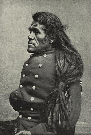
Irataba was a leader of the Mohave Nation, known as a mediator between the Mohave and the United States. He was born near the Colorado River in present-day Arizona. Irataba was a renowned orator and one of the first Mohave to speak English, a skill he used to develop relations with the United States.
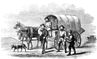
The Rose–Baley Party was the first European American emigrant wagon train to traverse the 35th parallel route known as Beale's Wagon Road, established by Edward Fitzgerald Beale, from Zuni Pueblo, New Mexico to the Colorado River near present-day Needles, California.
Hualapai Valley is a valley in Mohave County, Arizona.
Mormon Road, also known to the 49ers as the Southern Route, of the California Trail in the Western United States, was a seasonal wagon road pioneered by a Mormon party from Salt Lake City, Utah led by Jefferson Hunt, that followed the route of Spanish explorers and the Old Spanish Trail across southwestern Utah, northwestern Arizona, southern Nevada and the Mojave Desert of California to Los Angeles in 1847. From 1855, it became a military and commercial wagon route between California and Utah, called the Los Angeles – Salt Lake Road. In later decades this route was variously called the "Old Mormon Road", the "Old Southern Road", or the "Immigrant Road" in California. In Utah, Arizona and Nevada it was known as the "California Road".
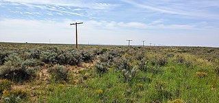
The Thirty-Fifth Parallel Route is the remains of a wagon trail within Petrified Forest National Park. While there is a railroad and a modern highway contiguous with the site, they are not part of the Historic designation.

The Rio de Flag, which has historically been known as the River de Flag and San Francisco river, is a river in Arizona that runs through Flagstaff, originating from the San Francisco Peaks before draining into the Little Colorado River. The river's age is unknown, though its first channels were around over one million years ago.
References
- ↑ Byrd H. Granger (1960). Arizona Place Names . University of Arizona Press. p. 17 . Retrieved December 6, 2011.
Municipalities and communities of Apache County, Arizona, United States | ||
|---|---|---|
| City |  | |
| Towns | ||
| CDPs |
| |
| Populated places | ||
| Indian reservations | ||
| Ghost towns | ||
| Footnotes | ‡This populated place also has portions in an adjacent county or counties | |