Red Mesa, Arizona

Last updated

Red Mesa, Arizona
RedMesaAZ.JPG
The eponymous red mesa in Red Mesa,
July 2007
Apache County Incorporated and Unincorporated areas Red Mesa highlighted.svg
Location in Apache County and the state of Arizona
Usa edcp location map.svg
Red pog.svg
Red Mesa, Arizona
Location in the United States
Coordinates: 36°57′58″N109°21′51″W / 36.96611°N 109.36417°W / 36.96611; -109.36417
CountryUnited States
State Arizona
County Apache
Area
[1]
  Total12.85 sq mi (33.27 km2)
  Land12.84 sq mi (33.27 km2)
  Water0.00 sq mi (0.01 km2)
Elevation
[2]
5,394 ft (1,644 m)
Population
 (2020)
  Total354
  Density27.56/sq mi (10.64/km2)
Time zone UTC-7 (MST)
ZIP code
86514
Area code 928
FIPS code 04-59550
GNIS feature ID2409150 [2]

Red Mesa is a census-designated place (CDP) in Apache County, Arizona, United States. The population was 480 at the 2010 census. [3]

Contents

Geography

According to the United States Census Bureau, the CDP has a total area of 12.9 square miles (33.3 km2), all land. [3]

Demographics

Historical population
CensusPop.Note
2000 237
2010 480102.5%
2020 354−26.2%
U.S. Decennial Census [4]

As of the census [5] of 2000, there were 237 people, 78 households, and 52 families residing in the CDP. The population density was 18.6 inhabitants per square mile (7.2/km2). There were 102 housing units at an average density of 8.0 per square mile (3.1/km2). The racial makeup of the CDP was 82% Native American, 11% White, 3% Pacific Islander, 2% from other races, with 3% from two or more races. 2% of the population were Hispanic or Latino of any race.

There were 78 households, out of which 45% had children under the age of 18 living with them, 39% were married couples living together, 26% had a female householder with no husband present, and 32% were non-families. 30% of all households were made up of individuals, and 5% had someone living alone who was 65 years of age or older. The average household size was 3.0 and the average family size was 3.9.

In the CDP, the age distribution of the population shows 38% under the age of 18, 9% from 18 to 24, 27% from 25 to 44, 20% from 45 to 64, and 7% who were 65 years of age or older. The median age was 28 years. For every 100 females, there were 73.0 males. For every 100 females age 18 and over, there were 60.9 males.

The median income for a household in the CDP was $22,159, and the median income for a family was $22,159. Males had a median income of $25,357 versus $25,938 for females. The per capita income for the CDP was $6,836. About 33% of families and 44% of the population were below the poverty line, including 49% of those under the age of eighteen and 52% of those 65 or over.

Education

The area is a part of the Red Mesa Unified School District. [6] Red Mesa contains the district headquarters. [7] [8] Three district schools, Red Mesa Elementary School (RMES), [7] [9] Red Mesa Junior High School (RMJHS), [7] [10] and Red Mesa High School are in Red Mesa. [7] [11]

Originally the territory was within the Chinle School District. In July 1983 the Red Mesa Unified School District formed, splitting from the Chinle School District. [12]

Red Mesa black on white storage jar, 870-1000 CE, Heard Museum. Ancestral Pueblo, Red Mesa black on white storage jar, 870-1000 CE, Heard Museum.JPG
Red Mesa black on white storage jar, 870–1000 CE, Heard Museum.

Red Mesa pottery

The Red Mesa prehistoric pottery type was named for this Arizona area. Made from about 950 to 1050 CE, it is a subdivision of Cibola White Ware. Designs are usually banded and can be much busier than earlier types, but simple designs are also common. Pots are usually slipped (often chalky) and polished, but some examples not slipped and not well polished. [13]

See also

Related Research Articles

<span class="mw-page-title-main">Apache County, Arizona</span> County in Arizona, United States

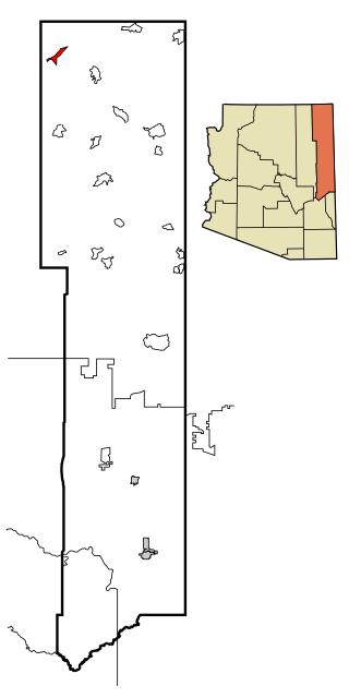
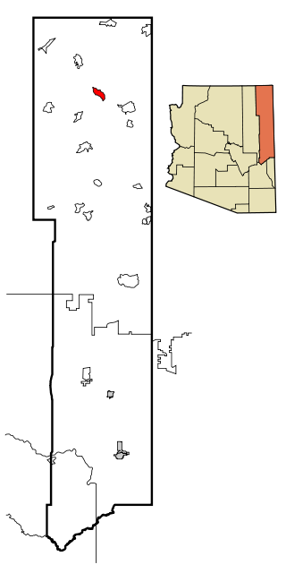
Apache County is in the northeast corner of the U.S. state of Arizona. Shaped in a long rectangle running north to south, as of the 2020 census, its population was 66,021. The county seat is St. Johns.

<span class="mw-page-title-main">Chinle, Arizona</span> Census-designated place in Arizona, United States

Chinle is a census-designated place (CDP) in Apache County, Arizona, United States. The name in Navajo means 'flowing out' and is a reference to the location where the water flows out of the Canyon de Chelly. The population was 4,518 at the 2010 census.

<span class="mw-page-title-main">Dennehotso, Arizona</span> CDP in Apache County, Arizona

Dennehotso is a census-designated place (CDP) in Apache County, Arizona, United States. The population was 746 at the 2010 census.

<span class="mw-page-title-main">Many Farms, Arizona</span> CDP in Apache County, Arizona

Many Farms is a census-designated place (CDP) in Apache County, Arizona, United States. The population was 1,348 at the 2010 census.

<span class="mw-page-title-main">Nazlini, Arizona</span> CDP in Apache County, Arizona

Nazlini is a census-designated place (CDP) in Apache County, Arizona, United States. The population was 489 at the 2010 census. Nearby are Nazlini Creek and Nazlini Canyon. Nazlini Canyon is the site of many Native American ruins and campsites that were abandoned when erosion made them unusable.

<span class="mw-page-title-main">Rock Point, Arizona</span> CDP in Apache County, Arizona

Rock Point is a census-designated place (CDP) in Apache County, Arizona, United States. The population was 642 at the 2010 census. Its name is descriptive of the point where Chinle Creek enters high sandstone walls.

<span class="mw-page-title-main">Round Rock, Arizona</span> CDP in Apache County, Arizona

Round Rock is a Navajo community and census-designated place (CDP) in Apache County, Arizona, United States. The population was 789 at the 2010 census. It is named after a nearby mesa.

<span class="mw-page-title-main">Sawmill, Arizona</span> CDP in Apache County, Arizona

Sawmill is a census-designated place (CDP) in Apache County, Arizona, United States. Sawmill is a part of Fort Defiance Agency, which is on the Navajo Nation. The population was 748 at the 2010 census. It is named after and developed around a sawmill. A trading post has been present since 1907.

<span class="mw-page-title-main">Teec Nos Pos, Arizona</span> Census-designated place in Arizona, United States

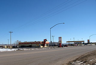
Teec Nos Pos is a census-designated place (CDP) in Apache County, Arizona, United States. The population was 507 at the 2020 census. It is the western terminus of U.S. Route 64.

<span class="mw-page-title-main">Tsaile, Arizona</span> Census-designated place in Arizona, United States

Tsaile is a census-designated place (CDP) in Apache County, Arizona, United States, on the Navajo Nation. The population was 1,205 at the 2010 census.

<span class="mw-page-title-main">Moenkopi, Arizona</span> Community in Coconino County, Arizona

Moenkopi is a census-designated place (CDP) in Coconino County, Arizona, United States, adjacent to the southeast side of Tuba City off U.S. Route 160. The population was 964 at the 2010 census.

<span class="mw-page-title-main">Tonalea, Arizona</span> CDP in Coconino County, Arizona

Tonalea is a census-designated place (CDP) in Coconino County, Arizona, United States. The population was 549 at the 2010 census. It has also been known as Red Lake.

<span class="mw-page-title-main">First Mesa, Arizona</span> CDP in Navajo County, Arizona

First Mesa is a census-designated place (CDP) in Navajo County, Arizona, United States, on the Hopi Reservation. As of the 2010 census, the CDP population was 1,555, spread among three Hopi villages atop the 5,700-foot mesa: Hano, Sitsomovi, and Waalpi.

<span class="mw-page-title-main">Greasewood, Arizona</span> CDP in Navajo County, Arizona

Greasewood is a census-designated place (CDP) in Navajo County, Arizona, United States. The population was 547 at the 2010 census.

<span class="mw-page-title-main">Keams Canyon, Arizona</span> CDP in Navajo County, Arizona

Keams Canyon is a census-designated place (CDP) in Navajo County, Arizona, United States, on the Hopi Reservation. The population was 304 at the 2010 census.

<span class="mw-page-title-main">Cordes Lakes, Arizona</span> CDP in Yavapai County, Arizona

Cordes Lakes is a census-designated place (CDP) in Yavapai County, Arizona, United States. The population was 2,058 at the 2000 census. The Agua Fria National Monument lies to the east and south of the community and Arcosanti is to the north.

Chinle Unified School District No. 24 (CUSD) is a public unified school district headquartered in Chinle, a census-designated place in Apache County, Arizona, on the Navajo Nation, United States. It is managed by a five-member elected school board, each of whom is Navajo, and operates by state rules. As of 2020, nearly all of the district's 3600 students are Navajo.

Red Mesa Unified School District #27 is a public school district headquartered in Red Mesa, unincorporated Apache County, Arizona, near Teec Nos Pos on the Navajo Nation. It has a five-member elected school board, who oversee operations of schools that are regulated by state standards.

Red Mesa High School is a high school in Red Mesa in an unincorporated area of Apache County, Arizona, near Teec Nos Pos. It is one of two high schools under the jurisdiction of the Red Mesa Unified School District, along with Red Valley/Cove High School.

Cottonwood is a census-designated place (CDP) in Apache County, Arizona, United States. The population was 226 at the 2010 census.

References

  1. "2020 U.S. Gazetteer Files". United States Census Bureau. Retrieved October 29, 2021.
  2. 1 2 U.S. Geological Survey Geographic Names Information System: Red Mesa, Arizona
  3. 1 2 "Geographic Identifiers: 2010 Demographic Profile Data (G001): Red Mesa CDP, Arizona". U.S. Census Bureau, American Factfinder. Retrieved April 29, 2013.
  4. "Census of Population and Housing". Census.gov. Retrieved June 4, 2016.
  5. "U.S. Census website". United States Census Bureau . Retrieved January 31, 2008.
  6. "School District Reference Map (2010 Census): Apache County, AZ" (PDF). 2010 U.S. Census . U.S. Census Bureau . Retrieved April 8, 2020. – Red Mesa USD is depicted on page 1.
  7. 1 2 3 4 "2010 Census – Census Block Map: Red Mesa CDP, AZ" (Archive). U.S. Census Bureau. Retrieved on June 16, 2015.
  8. "Home." (Direct image link) Red Mesa Unified School District. Retrieved on September 20, 2010. "HC 61 Box 40/HWY 160 MP 448 Teec, Nos Pos,[ sic ] AZ 86514
  9. "Red Mesa Elementary High School." (Direct image link) Red Mesa Unified School District. Retrieved on September 20, 2010. "HC 61 Box 40/HWY 160 MP 448 Teec Nos Pos, AZ 86514
  10. "Red Mesa Junior High School." (Direct image link) Red Mesa Unified School District. Retrieved on September 20, 2010. "HC 61 Box 40/HWY 160 MP 448 Teec, Nos Pos,[ sic ] AZ 86514
  11. "Red Mesa High School." (Direct image link) Red Mesa Unified School District. Retrieved on September 20, 2010. "HC 61 Box 40/HWY 160 MP 448 Teec, Nos Pos,[ sic ] AZ 86514
  12. "History of Red Mesa Schools." Red Mesa Unified School District. Retrieved on September 20, 2010.
  13. Red Mesa Black on White, photo index and guide

Commons-logo.svg Media related to Red Mesa, Arizona at Wikimedia Commons