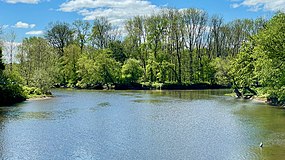
The Raritan River is a major river of New Jersey. Its watershed drains much of the mountainous area of the central part of the state, emptying into the Raritan Bay on the Atlantic Ocean.

The Delaware and Raritan Canal is a canal in central New Jersey, built in the 1830s, that connects the Delaware River to the Raritan River. It was an efficient and reliable means of transportation of freight between Philadelphia and New York City, transporting anthracite coal from eastern Pennsylvania during much of the 19th and early 20th centuries. The canal allowed shippers to cut many miles off the existing route from the Pennsylvania Coal Region down the Delaware, around Cape May, and up the occasionally treacherous Atlantic Ocean coast to New York City.

Natirar is an estate spanning 491 acres (1.99 km2) in Peapack-Gladstone, Far Hills and Bedminster, in Somerset County, New Jersey, United States. Its name is a reverse spelling of Raritan. The complex was built between 1910 and 1912. In 2003 it was sold by the estate of Hassan II, late King of Morocco, to Somerset County, New Jersey, and is now administered by the Somerset County Park Commission. Approximately 90 acres (360,000 m2) of the estate have been leased to develop that portion of the estate into an exclusive hotel, spa, restaurant complex.

The Manasquan River is a 26.5-mile-long (42.6 km) waterway in central New Jersey.

The South Branch Raritan River is a 50-mile-long (80 km) tributary of the Raritan River in New Jersey.
Manalapan Brook is a tributary of the South River in Monmouth and Middlesex counties, New Jersey in the United States.

Stony Brook, also known as Stoney Brook, is a tributary of the Millstone River in Hunterdon and Mercer counties, New Jersey, in the United States.

The Millstone River is a 38.6-mile-long (62.1 km) tributary of the Raritan River in central New Jersey in the United States.
Green Brook is a tributary of the Raritan River in central New Jersey in the United States.

The Carrabassett River, a tributary of the Kennebec River, is located in Franklin County and Somerset County, Maine, in the United States. It rises near Sugarloaf Mountain, east of Rangeley Lake, and runs for 33.8 miles (54.4 km), flowing southeast past Kingfield and joining the Kennebec River in the town of Anson.

Holland Brook is a tributary of the South Branch Raritan River in Hunterdon and Somerset Counties, New Jersey in the United States.

Peters Brook is a tributary of the Raritan River that flows south through Bridgewater Township and Somerville, New Jersey, in the United States. Some of its tributaries include Ross Brook and Mac's Brook.

Middle Brook is a tributary of the Raritan River in Somerset County, New Jersey. The stream can be referred to as Rha-weigh-weiros, a Native American name meaning "running from a deep hole", on early maps of the area.

The Baker Branch Saint John River is a 48.0-mile-long (77.2 km) river. This river is a tributary of the Saint John River, flowing in the Maine North Woods, in Maine, in the Northeastern United States.
The Little Southwest Branch Saint John River is a tributary of Southwest Branch Saint John River, flowing on 46.5 kilometres (28.9 mi) in Somerset County, in North Maine Woods, in Maine, in United States.

The Northwest Branch Saint John River is a 15.5-mile-long (24.9 km) river primarily in Aroostook County, Maine, USA. Its origin is Frontier Lake (Quebec-Maine) in Quebec, Canada. After crossing the Canada–United States border, the Northwest Branch runs south close to the border until it picks up its tributary, the Daaquam River, which also flows out of Canada. The Northwest Branch then runs generally eastward to its confluence with the Southwest Branch to form the Saint John River.

Six Mile Run is a tributary of the Millstone River that drains a large area in central Franklin Township in Somerset County and as well western portions of North Brunswick and South Brunswick Townships in Middlesex County, New Jersey in the United States.
The Little Black River is a river flowing in the south of Quebec (Canada) and in the north of Maine.
Nine Mile Run, known as Ninemile Run according to the USGS GNIS, is a moderately large tributary of the Six Mile Run, one of the branches of the Millstone River, in central New Jersey in the United States.

Hamden is an unincorporated community located within Clinton Township, in Hunterdon County, in the U.S. state of New Jersey.