Berks County is a county in the Commonwealth of Pennsylvania. As of the 2020 census, the population was 428,849. The county seat is Reading.

Earl Township is a township in Berks County, Pennsylvania. The population was 3,102 at the 2020 census. Earl Township was named for early German settler Hans Graaf. His surname Graaf means "earl" in English.

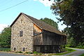
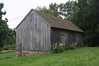
Oley Township is a township in Berks County, Pennsylvania. As of the 2010 census, the township had a population of 3,620. Oley Township was originally formed in 1740 as a part of Philadelphia County, before Berks County was formed in 1752. The entire township was listed as a historic district by the National Register of Historic Places in 1983. Oley is a Native American name purported to mean "a hollow". Daniel Boone was born in Oley Township November 2, 1734.
Pike Township is a township in Berks County, Pennsylvania, United States. The population was 1,723 at the 2010 census.

Rockland Township is a township in Berks County, Pennsylvania, United States. The population was 3,778 at the 2010 census.

Douglassville is a census-designated place (CDP) in Amity Township in Berks County, Pennsylvania, United States. Douglassville is situated along U.S. Route 422 and Pennsylvania Route 724. Developments include the Amity Gardens subdivision, the West Ridge subdivision, the Briarwood subdivision, and the High Meadow subdivision. Douglassville also includes Cider Mill and the Woods Edge subdivision along Pennsylvania Route 562. As of the 2010 census, the population of the CDP was 448 residents.

Bethel is a census-designated place in Bethel Township, Berks County, Pennsylvania, United States. It is located at the junction of Interstate 78/U.S. Route 22 and Pennsylvania Route 501. It is in the Susquehanna watershed and drained southward into the Little Swatara Creek. Its area code is 717. As of the 2010 census, the population was 499. Bethel was the original location that Cabela's was going to build their new location before they decided to build it in Hamburg. It is the home to the international headquarters of the Assemblies of Yahweh, to several small town business shops, and to a large distribution center for Dollar General and PetSmart, which can be seen while driving down Interstate 78.
Blandon is a census-designated place in Maidencreek Township, Berks County, Pennsylvania, United States. It is located at the junction of Pennsylvania Route 73 and Park Road. As of the 2010 census, the population was 7,152 residents.

Gibraltar is a census-designated place (CDP) in northern Robeson Township in southern Berks County, Pennsylvania, United States. Its population was 680 as of the 2010 census. The community is four miles from Birdsboro and 6.4 miles from downtown Reading. It is served by the Twin Valley School District and is across the Schuylkill River from Exeter.
Manatawny is an unincorporated community in Berks County, Pennsylvania, United States. It is located at the junction on PA Route 73 and Hoch Road in Oley Township, a short distance from Pleasantville.
Bowers is a census-designated place in Maxatawny Township, Berks County, Pennsylvania, United States. It is located near the borough of Lyons and is on Sacony Creek, a tributary of the Maiden Creek. As of the 2010 census, the population was 326 residents. Although Bowers has its own post office with the ZIP code of 19511, some residents are served by the Mertztown post office with the ZIP code of 19539.

Shartlesville is a census-designated place that is located in Upper Bern Township, Berks County, Pennsylvania, United States. As of the 2010 census, the population was 455 residents.
Chinchilla is a village and census-designated place in Scott and South Abington townships, Lackawanna County, Pennsylvania, United States. The CDP's population was 2,098 at the time of the 2010 United States Census. It was known as "Leach's Flats" until supposedly renamed by a female postmaster in the 1880 after her chinchilla-fur shawl. Chinchilla is located in the gorge of Leggetts Creek, which flows southward into the Lackawanna River on the north side of Scranton. Interstate 81, U.S. Route 6/11 and the Norfolk Southern Railroad use the gorge between Scranton and Clarks Summit. Chinchilla has its own post office, with ZIP Code 18410.

Frystown is a census-designated place in Bethel Township, in far western Berks County, Pennsylvania, United States. It is located near the township line with Tulpehocken Township. The community is served by the Tulpehocken Area School District. As of the 2010 census, the population was 380 residents. The Little Swatara Creek forms the natural southern boundary of Frystown and flows westward into the Swatara Creek, a tributary of the Susquehanna River. Interstate 78 has an interchange with Route 645 in Frystown. The CDP is split between the Myerstown and Bethel post offices, which use the ZIP codes of 17067 and 19507, respectively.
Breezy Corner is an unincorporated community in Berks County, Pennsylvania, United States. The village is located northeast of Reading on South Mountain and is served by the Oley Valley School District. Breezy Corner is located along the border between Alsace Township and Ruscombmanor Township. Route 12 intersects Route 73 in the village and follows Pricetown Road into the northern side of Reading, where it becomes the Warren Street Bypass. Breezy Corner is served by the Fleetwood post office, which uses the ZIP code of 19522.
New Jerusalem is a census-designated place in Rockland Township, Berks County, Pennsylvania, United States. It is located in the South Mountains and is drained by the Manatawny Creek into the Schuylkill River. As of the 2010 census, the population was 649 residents.
Dryville is a census-designated place in Rockland Township, Berks County, Pennsylvania, United States. It is located one mile south of Lyons, and is located in the South Mountains and is drained by Bieber Creek into Manatawny Creek, a tributary of the Schuylkill River. It is split between the Fleetwood zip code of 19522 and the Mertztown zip code of 19539. As of the 2010 census, the population was 398 residents.

Yellow House is a village in eastern Berks County, Pennsylvania, United States, situated at the junction of Routes 562 and 662. It is located in Amity Township and Oley Township. It is drained by the Manatawny Creek into the Schuylkill River. It is split between the Douglassville and Oley post offices, which use the ZIP codes of 19518 and 19547, respectively.
Maxatawny is an unincorporated community located on U.S. Route 222 in Maxatawny Township, Berks County, Pennsylvania, United States, five miles east of Kutztown. It is in the Lehigh watershed and Schaefer Run flows through it to the Little Lehigh Creek. Maxatawny has a post office, with the ZIP code of 19538. Traffic speed on US 222 is reduced to 35 miles-per-hour passing through the village, which borders Lehigh County.
Pine Forge is an unincorporated community in Douglass Township in Berks County, Pennsylvania, United States. Pine Forge is located along Manatawny Drive to the north of the Manatawny Creek and southwest of Boyertown.