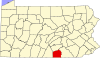
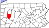
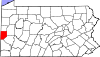
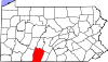
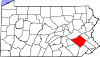
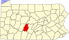
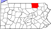
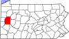
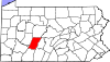
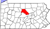
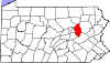
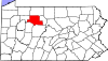
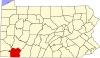
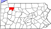
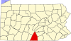
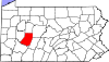
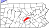
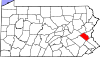
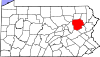
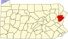
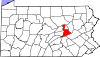
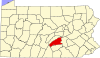
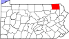
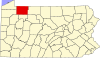
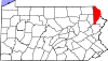
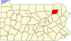
County FIPS code [4] County seat [5] Established [5] Origin Etymology [6] Population [7] Area [5] Map Adams 001 Gettysburg 1800 Parts of York County John Adams , second U.S. President 106,748 522 sq mi1,352 km2 ) Allegheny 003 Pittsburgh 1788 Parts of Washington and Westmoreland Counties Delaware word for the Allegheny River , which possibly translates to "beautiful river" 1,224,825 745 sq mi1,930 km2 ) Armstrong 005 Kittanning 1800 Parts of Allegheny, Lycoming, and Westmoreland Counties John Armstrong , Revolutionary War general 64,074 664 sq mi1,720 km2 ) Beaver 007 Beaver 1800 Parts of Allegheny and Washington Counties Beaver River , itself named for the eponymous animal that was sighted along its banks 165,631 444 sq mi1,150 km2 ) Bedford 009 Bedford 1771 Parts of Cumberland County Fort Bedford , which is named for John Russell, 4th Duke of Bedford 47,350 1,015 sq mi2,629 km2 ) Berks 011 Reading 1752 Parts of Chester, Lancaster and Philadelphia Counties The English county of Berkshire 432,821 866 sq mi2,243 km2 ) Blair 013 Hollidaysburg 1846 Parts of Huntingdon and Bedford Counties John Blair, Pennsylvania state legislator 120,273 527 sq mi1,365 km2 ) Bradford 015 Towanda 1810 Parts of Luzerne and Lycoming Counties; originally called Ontario County, renamed as Bradford County in 1812. William Bradford , second U.S. Attorney General 59,695 1,161 sq mi3,007 km2 ) Bucks 017 Doylestown 1682 One of the original counties at the formation of Pennsylvania The English county of Buckinghamshire 645,984 622 sq mi1,611 km2 ) Butler 019 Butler 1800 Parts of Allegheny County Richard Butler , Revolutionary War general 198,413 795 sq mi2,059 km2 ) Cambria 021 Ebensburg 1804 Parts of Somerset and Huntingdon Counties Cambria , the traditional name for Wales 130,668 693 sq mi1,795 km2 ) Cameron 023 Emporium 1860 Parts of Clinton, Elk, McKean, and Potter Counties Simon Cameron , U.S. Senator from Pennsylvania 4,380 399 sq mi1,033 km2 ) Carbon 025 Jim Thorpe 1843 Parts of Monroe and Northampton Counties Carbon , the element found in coal 65,458 387 sq mi1,002 km2 ) Centre 027 Bellefonte 1800 Parts of Lycoming, Mifflin, Northumberland, and Huntingdon Counties Centre Furnace, the first industrial facility in the area 157,795 1,112 sq mi2,880 km2 ) Chester 029 West Chester 1682 One of the original counties at the formation of Pennsylvania The English city of Chester in the county of Cheshire 549,784 760 sq mi1,968 km2 ) Clarion 031 Clarion 1839 Parts of Venango and Armstrong Counties Clarion River , itself so named for its clarity 36,970 609 sq mi1,577 km2 ) Clearfield 033 Clearfield 1804 Parts of Lycoming and Huntingdon Counties; Clearfield functioned as a part of Centre County for judiciary purposes until 1822. The cleared fields from logging in the area 77,090 1,154 sq mi2,989 km2 ) Clinton 035 Lock Haven 1839 Parts of Lycoming and Centre Counties DeWitt Clinton , New York Governor and prominent statesman 37,607 898 sq mi2,326 km2 ) Columbia 037 Bloomsburg 1813 Parts of Northumberland and Luzerne Counties Columbia , the first popular and poetic name for the United States 65,439 490 sq mi1,269 km2 ) Crawford 039 Meadville 1800 Parts of Allegheny County William Crawford , surveyor who helped to open trans-Appalachian lands to settlement 82,001 1,038 sq mi2,688 km2 ) Cumberland 041 Carlisle 1750 Parts of Lancaster County The historic English county of Cumberland 270,738 551 sq mi1,427 km2 ) Dauphin 043 Harrisburg 1785 Parts of Lancaster County Louis-Joseph, Dauphin of France 289,234 558 sq mi1,445 km2 ) Delaware 045 Media 1789 Parts of Chester County Delaware River , itself named for Lord De La Warr 576,720 191 sq mi495 km2 ) Elk 047 Ridgway 1843 Parts of Jefferson, McKean, and Clearfield Counties Elk , which inhabit the forested county 30,198 832 sq mi2,155 km2 ) Erie 049 Erie 1800 Parts of Allegheny County; attached to Crawford County until 1803. Lake Erie 267,571 799 sq mi2,069 km2 ) Fayette 051 Uniontown 1783 Parts of Westmoreland County The Marquis de Lafayette , French -born Revolutionary War general 123,915 798 sq mi2,067 km2 ) Forest 053 Tionesta 1848 Parts of Jefferson County; attached to Jefferson County until 1857. Chief natural feature 6,449 431 sq mi1,116 km2 ) Franklin 055 Chambersburg 1784 Parts of Cumberland County Benjamin Franklin , key Founding Father of the United States 157,854 771 sq mi1,997 km2 ) Fulton 057 McConnellsburg 1850 Parts of Bedford County Robert Fulton , inventor of the steamboat 14,468 438 sq mi1,134 km2 ) Greene 059 Waynesburg 1796 Parts of Washington County Nathanael Greene , Revolutionary War general 34,357 578 sq mi1,497 km2 ) Huntingdon 061 Huntingdon 1787 Parts of Bedford County The historic English county of Huntingdonshire 43,514 889 sq mi2,302 km2 ) Indiana 063 Indiana 1803 Parts of Lycoming and Westmoreland Counties; it was attached to Westmoreland County until 1806. From the Indiana Grant of 1768, that the Iroquois Six Nations were forced to make to "suffering traders" under the Fort Stanwix Treaty of 1768 . 83,094 834 sq mi2,160 km2 ) Jefferson 065 Brookville 1804 Parts of Lycoming County Attached to Westmoreland County until 1806 and to Indiana County until 1830. Thomas Jefferson , third U.S. President 43,612 657 sq mi1,702 km2 ) Juniata 067 Mifflintown 1831 Parts of Mifflin County Juniata River , itself named for the Iroquoian word Onayutta , meaning "Standing Stone" 23,243 394 sq mi1,020 km2 ) Lackawanna 069 Scranton 1878 Parts of Luzerne County Lackawanna River , itself named for the Delaware word meaning "stream that forks" 216,123 465 sq mi1,204 km2 ) Lancaster 071 Lancaster 1729 Parts of Chester County The English city of Lancaster 558,589 984 sq mi2,549 km2 ) Lawrence 073 New Castle 1849 Parts of Beaver and Mercer Counties James Lawrence , War of 1812 captain 84,472 363 sq mi940 km2 ) Lebanon 075 Lebanon 1813 Parts of Dauphin and Lancaster Counties Lebanon , the Biblical term for "White Mountain", which references the piety of the county's Moravian founders144,252 363 sq mi940 km2 ) Lehigh 077 Allentown 1812 Parts of Northampton County Lehigh River , from the Lenape Lechewuekink , "where there are forks ". 377,754 349 sq mi904 km2 ) Luzerne 079 Wilkes-Barre 1786 Parts of Northumberland County Anne-César, Chevalier de la Luzerne , French ambassador to the U.S. who aided republican causes 327,388 907 sq mi2,349 km2 ) Lycoming 081 Williamsport 1795 Parts of Northumberland County Lycoming Creek , itself named for the Delaware word iacomic meaning "great steam" 112,724 1,244 sq mi3,222 km2 ) McKean 083 Smethport 1804 Parts of Lycoming County; Attached to Centre County until 1814 and to Lycoming County until 1826 for judicial and elective purposes. McKean was fully organized only in 1826. Thomas McKean , second Governor of Pennsylvania 39,519 984 sq mi2,549 km2 ) Mercer 085 Mercer 1800 Parts of Allegheny County Hugh Mercer , Revolutionary War general 108,503 683 sq mi1,769 km2 ) Mifflin 087 Lewistown 1789 Parts of Cumberland and Northumberland Counties Thomas Mifflin , first Governor of Pennsylvania 45,922 415 sq mi1,075 km2 ) Monroe 089 Stroudsburg 1836 Parts of Pike and Northampton Counties James Monroe , fifth U.S President 166,053 617 sq mi1,598 km2 ) Montgomery 091 Norristown 1784 Parts of Philadelphia County The historic Welsh county of Montgomeryshire or Richard Montgomery , a general killed in the 1775 Battle of Quebec 868,742 487 sq mi1,261 km2 ) Montour 093 Danville 1850 Parts of Columbia County Madame Montour , colonial ambassador to the Native Americans 17,860 132 sq mi342 km2 ) Northampton 095 Easton 1752 Parts of Bucks County The English town of Northampton 319,091 377 sq mi976 km2 ) Northumberland 097 Sunbury 1772 Parts of Lancaster, Berks, Bedford, Cumberland, and Northampton Counties The English county of Northumberland 90,120 477 sq mi1,235 km2 ) Perry 099 New Bloomfield 1820 Parts of Cumberland County Oliver Hazard Perry , War of 1812 commodore 46,083 556 sq mi1,440 km2 ) Philadelphia 101 Philadelphia 1682 One of the original counties at the formation of Pennsylvania "Brotherly love" from Greek philos ("love") and adelphos ("brother") 1,550,542 143 sq mi370 km2 ) Pike 103 Milford 1814 Parts of Wayne County Zebulon Pike , explorer of the American West 61,247 567 sq mi1,469 km2 ) Potter 105 Coudersport 1804 From Lycoming county Attached to Lycoming County until 1826 and to McKean County until 1835 for judicial purposes, Potter was not fully organized until 1835. James Potter , Revolutionary War general 15,999 1,081 sq mi2,800 km2 ) Schuylkill 107 Pottsville 1811 Parts of Berks and Northampton Counties Schuylkill River , itself a Dutch corruption of a Delaware word possibly meaning "hidden river" 143,786 778 sq mi2,015 km2 ) Snyder 109 Middleburg 1855 Parts of Union County Simon Snyder , third Governor of Pennsylvania 39,717 332 sq mi860 km2 ) Somerset 111 Somerset 1795 Parts of Bedford County The historic English county of Somerset 72,197 1,081 sq mi2,800 km2 ) Sullivan 113 Laporte 1847 Parts of Lycoming County; attached to Lycoming until 1848. John Sullivan , Revolutionary War general 5,834 452 sq mi1,171 km2 ) Susquehanna 115 Montrose 1810 Parts of Luzerne County ; attached to Luzerne County until 1812. Susquehanna River , itself named after an Algonquin word for "muddy current" 38,109 832 sq mi2,155 km2 ) Tioga 117 Wellsboro 1804 Parts of Lycoming County; attached to Lycoming until 1812. Tioga River , itself named for the Delaware word for "forks of the stream" 40,840 1,137 sq mi2,945 km2 ) Union 119 Lewisburg 1813 Parts of Northumberland County The federal union of the states 42,042 317 sq mi821 km2 ) Venango 121 Franklin 1800 Parts of Allegheny and Lycoming Counties; attached to until 1805. A corruption of the Delaware word onenge , meaning "otter" 49,431 683 sq mi1,769 km2 ) Warren 123 Warren 1800 Parts of Allegheny and Lycoming counties; attached to Crawford County until 1805 and then to Venango until Warren was formally organized in 1819. Joseph Warren , Revolutionary War general 37,572 898 sq mi2,326 km2 ) Washington 125 Washington 1781 Parts of Westmoreland County George Washington , first U.S. President 210,232 861 sq mi2,230 km2 ) Wayne 127 Honesdale 1798 Parts of Northampton County Anthony Wayne , Revolutionary War general 51,262 751 sq mi1,945 km2 ) Westmoreland 129 Greensburg 1773 Parts of Bedford County The historic English county of Westmorland 351,163 1,036 sq mi2,683 km2 ) Wyoming 131 Tunkhannock 1842 Parts of Luzerne County The Delaware word xwéːwaməŋk 25,902 405 sq mi1,049 km2 ) York 133 York 1749 Parts of Lancaster County The English city of York 464,640 910 sq mi2,357 km2 )