Lower Merion Township, Pennsylvania

Last updated

Lower Merion
Lower Merion Township
Lower Merion Township building.jpg
The Lower Merion Township building in Ardmore in April 2022
Lower Merion flag.jpg
Photo of lm seal.jpg
Motto: 
"A First-Class Township"
Lower Merion Township Montgomery County.png
Location of Lower Merion Township in Montgomery County, Pennsylvania
USA Pennsylvania location map.svg
Red pog.svg
Lower Merion
Location of Lower Merion Township in Pennsylvania
Coordinates: 39°59′00″N75°15′59″W / 39.98333°N 75.26639°W / 39.98333; -75.26639
CountryFlag of the United States.svg  United States
StateFlag of Pennsylvania.svg  Pennsylvania
County Montgomery
Settled1682
Incorporated1713
Government
  Township ManagerErnie McNeely
  Board PresidentTodd Sinai (D)
Area
[1]
  Total23.83 sq mi (61.73 km2)
  Land23.61 sq mi (61.16 km2)
  Water0.22 sq mi (0.57 km2)
Elevation
200 ft (60 m)
Population
 (2020)
  Total63,633
  Estimate 
(2021) [2]
64,148
  Density2,695/sq mi (1,040/km2)
Time zone UTC-5 (EST)
  Summer (DST) UTC-4 (EDT)
Area code 610 and 484
FIPS code 42-091-44976
Website www.lowermerion.org

Lower Merion Township is a township in Montgomery County, Pennsylvania, United States. It is part of the Philadelphia Main Line. The township's name originates with the county of Merioneth in north Wales. Merioneth is an English-language transcription of the Welsh Meirionnydd.

Contents

Lower Merion Township, along with Upper Darby, Haverford, and Cheltenham, are major suburbs of Philadelphia, the United States' sixth-most populous city as of 2020. With a population of 63,633, Lower Merion Township is the ninth-most populous municipality in Pennsylvania as of the 2020 U.S. census. [3]

The center of Lower Merion Township is located 11.9 miles (19.2 km) northwest of the center Philadelphia, the state's largest city. Parts of the township border the northwestern section of the city.

History

Map of Lower Merion Township Map of Lower Merion Township, Montgomery County, Pennsylvania with key.jpg
Map of Lower Merion Township
Lower Merion street signs Street sign in lower Merion.jpg
Lower Merion street signs
Harriton House as it appeared c. 1919 Harriton House 1919.JPG
Harriton House as it appeared c. 1919

Lower Merion Township was first settled in 1682 by Welsh Quakers, who were granted a tract of land, the Welsh Tract, by William Penn. In 1713, Lower Merion was established as an independent Township with about 52 landholders and tenants. In 1900, the Township was incorporated as a Township of the First Class. Lower Merion is home to the oldest continuously used place of worship in the United States, the Merion Friends Meeting House, used continuously since 1695.

On April 4, 1991, U.S. Senator John Heinz died while as a passenger in a Piper Aerostar propeller aircraft when it collided with a Bell 412 helicopter over the Merion Elementary School in the Merion air disaster. The other four people in both aircraft also died, and the falling debris from the aircraft also caused the death of two elementary students and injured five others. [4]

The Mill Creek Historic District, and Seville Theatre are listed on the National Register of Historic Places. [5] Green Hill Farms was added in 2011.

In 2010, the township received national media attention when a student filed a lawsuit, Robbins v. Lower Merion School District , after a school administrator used the webcam of a school-issued laptop to spy on the student while the student was in his home. The Electronic Frontier Foundation (EFF) and the American Civil Liberties Union (ACLU) filed an amicus brief in support of the student.

In 2012, the Federal Highway Administration modified the Manual on Uniform Traffic Control Devices in a way that would have required the replacement of Lower Merion Township's historic street signs, some of which date back to the early 1910s. After some campaigning by local residents and by Senator Pat Toomey, the Lower Merion Board of Commissioners declared, via an ordinance, the entire Lower Merion as a historic district and received a waiver from Secretary of Transportation Ray LaHood. [6] [7] [8]

Geography

According to the U.S. Census Bureau, the township has a total area of 23.9 square miles (61.8 km2), of which 23.7 square miles (61.4 km2) is land and 0.2 square mile (0.4 km2) (0.67%) is water.

The township is bounded by the Wynnefield Heights, Belmont Village, Wynnefield, and Overbrook communities in the city of Philadelphia; the Boroughs of Conshohocken and West Conshohocken, and the townships of Upper Merion and Whitemarsh in Montgomery County and by the townships of Haverford and Radnor in Delaware County. The borough of Narberth, a separate political entity of one-half square mile, is completely surrounded by the township.

Forming the township's southern border is City Avenue separating it from Philadelphia. Along City Avenue, starting with the Schuylkill Expressway and continuing on to Lord & Taylor at Belmont Avenue in Bala Cynwyd is what is sometimes referred to as the "Golden Mile" [9] [10] which also includes the radio and television studios of WCAU, the Exxon Building, the Fox Building and the Germantown Savings Bank Building. Behind those buildings are the One-Ninety-One Condominiums and the Bala Cynwyd Plazas.

The township's eastern border is along the Schuylkill River.

Before European settlement, Lower Merion's dense forest was home to bears, cougars, wolves, rattlesnakes, otters, beavers, weasels, turkeys, grouses, woodland bison, trout, and bald eagles. When Europeans arrived, they began cutting down the forests, chasing away much of the wildlife. After World War II, Lower Merion transformed from a farming township to a suburban area, and wildlife changed accordingly. Today, red foxes, white-footed mice, horned owls, skunks, raccoons, crayfish, songbirds, butterflies, and white-tailed deer populate the township. [11]

Unincorporated communities

Climate

Lower Merion straddles the boundary between a hot-summer humid continental climate (Dfa) and a humid subtropical climate (Cfa). The hardiness zone is 7a. Average monthly temperatures in Gladwyne range from 31.7 °F in January to 76.5 °F in July, in Bryn Mawr they range from 31.4 °F in January to 76.4 °F in July, and at the former location of NBC 10 studios in Bala Cynwyd they range from 32.6 °F in January to 77.4 °F in July. [12]

Demographics

Historical population
CensusPop.Note
1900 13,271
1910 17,67133.2%
1920 23,86635.1%
1930 35,16647.3%
1940 39,56612.5%
1950 48,74523.2%
1960 59,42021.9%
1970 63,5947.0%
1980 59,635−6.2%
1990 58,003−2.7%
2000 59,8503.2%
2010 57,825−3.4%
2020 63,63310.0%
[13] [14] [15]

As of the 2010 census, the township was 85.7% White, 5.6% Black or African American, 0.1% Native American, 6.0% Asian, and 1.9% were two or more races. 3.0% of the population were of Hispanic or Latino ancestry. [16]

As of the 2020 census, there were 63,633 people, 22,868 households, and 15,024 families residing in the township. The population density was 2,670.29 inhabitants per square mile (1,031.00/km2). The racial makeup of the township was 76.11% White, 9.03% Asian, 6.54% African American, 0.14% Native American, 0.02% Pacific Islander, 1.61% from other races and 6.55% from two or more races. Hispanic or Latino of any race were 3.70% of the population. [17]

According to the 2000 census, there were 22,868 households, 29.4% of which had children under the age of 18 living with them, 56.7% were married couples living together, 7.0% had a female householder with no husband present, and 34.3% were non-families. 28.3% of all households were made up of individuals, and 12.4% had someone living alone who was 65 years of age or older. The average household size was 2.42 and the average family size was 2.99.

In the township, the population was spread out, with 21.7% under the age of 18, 10.7% from 18 to 24, 23.0% from 25 to 44, 26.2% from 45 to 64 and 18.5% who were 65 years of age or older. The median age was 41 years. For every 100 females, there were 83.5 males. For every 100 women aged 18 and over, there were 78.7 males.

The median income for a household in the township was $86,373, and the median income for a family was $115,694 (these figures had risen to $114,608 and $148,123 respectively as of a 2007 estimate [18] ). Men had a median income of $77,692 versus $43,793 for women. The per capita income for the township was $55,526. About 1.9% of families and 4.5% of the population were below the poverty line, including 2.8% of those under age 18 and 5.6% of those age 65 or over.

Government and politics

Presidential elections results
Year Republican Democratic
2020 20.7% 8,66278.6%32,838
2016 21.2% 7,84175.5%27,906
2012 33.4% 11,94565.7%23,516
2008 29.1% 10,74770.4%26,006
2004 33.0% 11,99066.7%24,262
2000 32.0% 10,65765.9%21,946
1996 35.1% 10,77459.1%18,178
1992 35.6% 12,24954.7%18,814

Lower Merion is a first-class township with 14 commissioners elected by ward. [19]

[34]

The township is part of the Fourth Congressional District (represented by Rep. Madeleine Dean), the Fifth Congressional District (represented by Rep. Mary Gay Scanlon), the 149th State House District (represented by Rep. Tim Briggs), the 148th State House District (represented by Rep. Mary Jo Daley), and the 17th State Senate District (represented by Sen. Amanda Cappelletti).

Transportation

Roads and highways

The Schuylkill Expressway (I-76) eastbound in Lower Merion Township 2022-10-09 11 54 58 View east along Interstate 76 (Schuylkill Expressway) from the overpass for Manayunk Bridge Trail in Lower Merion Township, Montgomery County, Pennsylvania.jpg
The Schuylkill Expressway (I-76) eastbound in Lower Merion Township

As of 2018, there were 240.08 miles (386.37 km) of public roads in Lower Merion Township, of which 35.14 miles (56.55 km) were maintained by the Pennsylvania Department of Transportation (PennDOT) and 204.94 miles (329.82 km) were maintained by the township. [35]

Several major highways traverse Lower Merion Township, including the Schuylkill Expressway (Interstate 76), "Blue Route" (Interstate 476), U.S. Route 1, U.S. Route 30, Pennsylvania Route 320, and Pennsylvania Route 23. The Schuylkill Expressway follows a northwest-southeast route along the northeastern border of the township, adjacent to its namesake river, while I-476 and PA 320 both clip the far northwest corner of the township. US 1 follows City Avenue along the southeastern border of the township, while US 30 follows Lancaster Avenue across southern portions of the township. Finally, PA 23 follows Conshohocken State Road through the heart of Lower Merion Township.

Public transportation

A westbound Paoli/Thorndale Line train departing Bryn Mawr Station Paoli Thorndale.PA SEPTA Line.jpg
A westbound Paoli/Thorndale Line train departing Bryn Mawr Station

Lower Merion Township is the heart of the affluent Philadelphia Main Line series of suburban communities, named after the "Main Line" of the former Pennsylvania Railroad that runs through the township. Now known as SEPTA Regional Rail's Paoli/Thorndale Line, the rail line has station stops in Lower Merion in the following communities within the township:

SEPTA Regional Rail's Cynwyd Line, with weekday service, has stops at:

SEPTA operates the Norristown High Speed Line between Norristown Transportation Center and 69th Street Transportation Center through the western part of Lower Merion Township with stops located at Matsonford and County Line, with additional stops located just outside the township in Delaware County. SEPTA provides bus service to Lower Merion Township along City Bus routes 1 , 44 , 52 , 65, and G and Suburban Bus routes 103 , 105, and 106, serving points of interest in the township and offering connections to Philadelphia and other suburbs. [36]

Economy

Top employers

According to a Lower Merion Township bond document, the top employers in 2018 were: [37]

#Employer# of EmployeesCommunity
1 Main Line Health
(Lankenau Medical Center and Bryn Mawr Hospital)
4,168 Wynnewood and Bryn Mawr
2 Lower Merion School District 1,779 Ardmore
3 Susquehanna International Group 1,270 Bala Cynwyd
4 Bryn Mawr College 1,112Bryn Mawr
5 Maxim Healthcare Services 723Bala Cynwyd
6 Saint Joseph's University 603 Merion
7Great Valley Health584Bryn Mawr
8Maguire Insurance Agency482Bala Cynwyd
9Township of Lower Merion474Ardmore
10365 Health Services, LLC435Bala Cynwyd

Education

Primary and secondary schools

Public schools

Lower Merion High School's prerenovation building RP1 094.jpg
Lower Merion High School's prerenovation building

Pupils living in the Lower Merion Township attend schools in the Lower Merion School District unless they go to a private school. The educational roots of the township stretch back to the Lower Merion Academy, one of the first public schools in the country.

There are six elementary schools, three middle schools, and two high schools, Lower Merion and Harriton High School. Students are split between schools depending on location of residence.

Private schools

Rosemont School of the Holy Child, located in Rosemont and in Lower Merion Township, is affiliated with but not governed by the Roman Catholic Archdiocese of Philadelphia. The school is adjacent to Rosemont College.

Other private schools in the area include The Shipley School, The Baldwin School, Waldron Mercy Academy, The Haverford School, The Agnes Irwin School, Friends Central School, French International School of Philadelphia, Kohelet Yeshiva High School, The Mesivta High School, Caskey Torah Academy, and other schools outside the area.

Colleges and universities

Rosemont College's Main Building Rosemont81.jpg
Rosemont College's Main Building
Bryn Mawr College's Pembroke Hall Pembroke Hall at Bryn Mawr.jpg
Bryn Mawr College's Pembroke Hall

Bryn Mawr College, Harcum College, Rosemont College, and St. Charles Borromeo Seminary are located in Lower Merion Township. The campus of Saint Joseph's University straddles the city line between Lower Merion and Philadelphia, [38] while Haverford College straddles the lines between Lower Merion and Haverford Townships. [39] [40]

Other education

The Japanese Language School of Philadelphia, a supplementary Japanese school, holds its classes at the Friends Central School (FCS) in Wynnewood and in Lower Merion Township. [41] [42] Residents are also serviced by the Lower Merion Library System.

Historic features

NRHP Historic Districts

Notable buildings and structures

Notable people

See also

Related Research Articles

<span class="mw-page-title-main">Montgomery County, Pennsylvania</span> County in Pennsylvania, United States

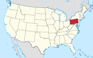
Montgomery County, colloquially referred to as Montco, is a county in the Commonwealth of Pennsylvania. As of the 2020 census, the population of the county was 856,553, making it the third-most populous county in Pennsylvania after Philadelphia and Allegheny counties. The county is part of the Southeast Pennsylvania region of the state.

<span class="mw-page-title-main">Bryn Mawr, Pennsylvania</span> Census-designated place in Pennsylvania, United States

Bryn Mawr, is a census-designated place (CDP) located across three townships: Radnor Township and Haverford Township in Delaware County and Lower Merion Township in Montgomery County, Pennsylvania, United States. It is located just west of Philadelphia along Lancaster Avenue, also known as U.S. Route 30.

<span class="mw-page-title-main">Haverford Township, Pennsylvania</span> Place in Pennsylvania

Haverford Township is a home rule municipality township in Delaware County, Pennsylvania, United States. Haverford is named after the town of Haverfordwest in Wales. It is a commuting suburb located due west of Philadelphia and is officially known as the Township of Haverford. Despite being under a home rule charter since 1977, it continues to operate under a Board of Commissioners divided into wards, as do "First Class" townships that are still under the Pennsylvania Township Code. Haverford Township was founded in 1682 and incorporated in 1911.

<span class="mw-page-title-main">Narberth, Pennsylvania</span> Borough in Montgomery County, Pennsylvania

Narberth is a borough in Montgomery County, Pennsylvania. It is one of many neighborhoods on the historic Philadelphia Main Line. The population was 4,282 at the 2010 census.

<span class="mw-page-title-main">Ardmore, Pennsylvania</span> Census-designated place in Pennsylvania, United States

Ardmore is an unincorporated community and census-designated place (CDP) spanning the border between Delaware and Montgomery counties in the U.S. state of Pennsylvania. The population was 12,455 at the time of the 2010 census and had risen to 13,566 in the 2020 census.

<span class="mw-page-title-main">Radnor Township, Pennsylvania</span> Township with home rule in Pennsylvania, United States

Radnor Township, often called simply Radnor, is a first class township with home rule status in Delaware County, Pennsylvania, United States.

<span class="mw-page-title-main">Merion Station, Pennsylvania</span> Census-designated place in Pennsylvania, United States

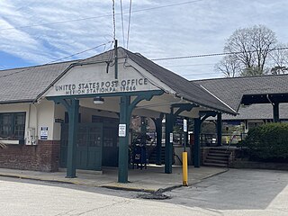
Merion Station, also known as Merion, is an unincorporated community in Montgomery County, Pennsylvania. It borders Philadelphia to its west and is one of the communities that make up the Philadelphia Main Line. Merion Station is part of Lower Merion Township, Montgomery County. The community is known for its grand mansions and for the wealth of its residents.

<span class="mw-page-title-main">Philadelphia Main Line</span> Collection of suburban communities in Pennsylvania, United States

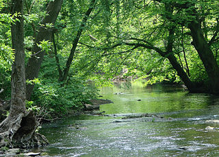
The Philadelphia Main Line, known simply as the Main Line, is an informally delineated historical and social region of suburban Philadelphia, Pennsylvania. Lying along the former Pennsylvania Railroad's once prestigious Main Line, it runs northwest from Center City Philadelphia parallel to Lancaster Avenue, also known as U.S. Route 30.

<span class="mw-page-title-main">Haverford, Pennsylvania</span> Place in Pennsylvania, United States

Haverford is an unincorporated community located in both Haverford Township in Delaware County, Pennsylvania, United States, and Lower Merion Township in Montgomery County, approximately 3 miles (4.8 km) west of Philadelphia. The Pennsylvania Railroad (PRR) opened Haverford Station in 1880 on their Main Line west out of Broad Street Station in Philadelphia. Haverford sits at milepost 9.17.

<span class="mw-page-title-main">Bala Cynwyd, Pennsylvania</span> Census-designated place in Pennsylvania, United States

Bala Cynwyd is a community and census-designated place in Lower Merion Township, Pennsylvania, United States. It is located on the Philadelphia Main Line in Southeastern Pennsylvania and borders the western edge of Philadelphia at U.S. Route 1. The present-day community was originally two separate towns, Bala and Cynwyd, but was united as a singular community largely because the U.S. Post Office, the Bala Cynwyd branch, served both towns using ZIP Code 19004. The combining of the communities gives a total population of 9,285 as of the 2020 census. The community was long known as hyphenated Bala-Cynwyd. Bala and Cynwyd are currently served by separate stations on SEPTA's Cynwyd Line of Regional Rail.

<span class="mw-page-title-main">Wynnefield, Philadelphia</span> Neighborhood of Philadelphia in Philadelphia County, Pennsylvania, United States

Wynnefield is a diverse middle-class neighborhood in West Philadelphia. Its borders are 53rd Street at Jefferson to the south, Philadelphia's Fairmount Park to the east, City Avenue to the north and the Amtrak Philadelphia Main Line tracks to the west.

<span class="mw-page-title-main">Wayne, Pennsylvania</span> Unincorporated community in Delaware County, Pennsylvania, United States

Wayne is an unincorporated community centered in Delaware County, Pennsylvania, United States, on the Main Line, a series of highly affluent Philadelphia suburbs located along the railroad tracks of the Pennsylvania Railroad and one of the wealthiest areas in the nation. While the center of Wayne is in Radnor Township, Wayne extends into both Tredyffrin Township in Chester County and Upper Merion Township in Montgomery County. The center of Wayne was designated the Downtown Wayne Historic District in 2012. Considering the large area served by the Wayne post office, the community may extend slightly into Easttown Township, Chester County, as well.

<span class="mw-page-title-main">Wynnewood, Pennsylvania</span> Place in Pennsylvania, United States

Wynnewood is a suburban unincorporated community, located west of Philadelphia, straddling Lower Merion Township in Montgomery County, Pennsylvania and Haverford Township in Delaware County, Pennsylvania, United States.

<span class="mw-page-title-main">Villanova, Pennsylvania</span> Village in Pennsylvania

Villanova is a suburb of Philadelphia, Pennsylvania, United States. It straddles Lower Merion Township in Montgomery County and Radnor Township in Delaware County. It is located at the center of the Philadelphia Main Line, a series of Philadelphia suburbs located along the original east–west railroad tracks of the Pennsylvania Railroad. It is served by the SEPTA Paoli/Thorndale Line regional rail train and the Norristown High Speed Line.

<span class="mw-page-title-main">Penn Valley, Pennsylvania</span> Unincorporated community in Pennsylvania, United States

Penn Valley is an unincorporated community located within Lower Merion Township, Pennsylvania, United States. Penn Valley residents share a zip code with Merion, Narberth, or Wynnewood because the community does not have its own post office. However, Penn Valley is a distinct community whose civic association demarcates its boundaries with iconic signs featuring William Penn and a farmhouse in blue or red on white, dating from 1930.

The Association of Delaware Valley Independent Schools (ADVIS) is a voluntary, non-profit consortium of independent schools in the Delaware Valley area of the United States. With headquarters in Bryn Mawr, Pennsylvania, the Association currently has 134 members located throughout eastern Pennsylvania, northern Delaware, and central and southern New Jersey.

<span class="mw-page-title-main">Addison Hutton</span> American architect

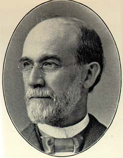
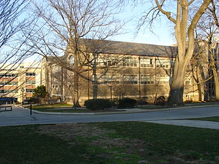
Addison Hutton (1834–1916) was a Philadelphia architect who designed prominent residences in Philadelphia and its suburbs, plus courthouses, hospitals, and libraries, including the Ridgway Library, now Philadelphia High School for the Creative and Performing Arts, and the Historical Society of Pennsylvania. He made major additions to the campuses of Westtown School, George School, Swarthmore College, Bryn Mawr College, Haverford College, and Lehigh University.

<span class="mw-page-title-main">Wilson Brothers & Company</span> American architectural firm

Wilson Brothers & Company was a prominent Victorian-era architecture and engineering firm based in Philadelphia, Pennsylvania. The company was regarded for its structural expertise.

<span class="mw-page-title-main">French International School of Philadelphia</span>

The French International School of Philadelphia is a French international school in Bala Cynwyd, Lower Merion Township, Pennsylvania within the Delaware Valley. As of 1993 it is the only full French bilingual educational program in Pennsylvania. It serves grades PreK-8.

References

  1. "2016 U.S. Gazetteer Files". United States Census Bureau. Retrieved August 14, 2017.
  2. "Population and Housing Unit Estimates" . Retrieved June 27, 2022.
  3. "U.S. Census Bureau QuickFacts: Lower Merion township, Montgomery County, Pennsylvania". www.census.gov. Retrieved June 10, 2022.
  4. "The Free Lance-Star - Google News Archive Search". news.google.com.
  5. "National Register Information System". National Register of Historic Places . National Park Service. July 9, 2010.
  6. "Resolution clears way for Lower Merion's historic street signs to stay - Main Line Times - Main Line Media News". Archived from the original on March 18, 2016. Retrieved December 24, 2015.
  7. "Update: It's official Lower Merion will keep historic street-signs - Main Line Times - Main Line Media News". Archived from the original on March 10, 2016. Retrieved December 24, 2015.
  8. "Township Calendar | Lower Merion Township, PA". www.lowermerion.org. Retrieved October 5, 2021.
  9. "Lower Merion Police Are Watching for Signs of Crime on the Golden Mile. Partnership Helps Reverse Decline on City Avenue Stretch". Archived from the original on June 10, 2016.
  10. "Lower Merion Township : Township Economy and Demographics". Archived from the original on April 22, 2016. Retrieved May 24, 2016.
  11. Jones, Dick, ed. The First 300: the amazing and rich history of Lower Merion. Ardmore, PA: The Lower Merion Historical Society, 2000.
  12. "PRISM Climate Group at Oregon State University". prism.oregonstate.edu.
  13. American FactFinder Archived October 19, 2012, at archive.today . Factfinder.census.gov. Retrieved on July 21, 2013.
  14. "DVRPC > Site Search". Archived from the original on April 9, 2019. Retrieved April 11, 2016.
  15. "Census 2020".
  16. Census 2010: Pennsylvania. Usatoday.Com. Retrieved on July 21, 2013.
  17. "U.S. Census website". United States Census Bureau . Retrieved April 25, 2023.
  18. American FactFinder Archived February 11, 2020, at archive.today . Factfinder.census.gov. Retrieved on July 21, 2013.
  19. "Commissioners | Lower Merion Township, PA". www.lowermerion.org. Retrieved October 5, 2021.
  20. "Daniel S. Bernheim, Esq., President | Lower Merion Township, PA". www.lowermerion.org. Retrieved August 8, 2019.
  21. "Joshua L. Grimes, Esq. | Lower Merion Township, PA". www.lowermerion.org. Retrieved August 8, 2019.
  22. "Michael F. McKeon, Esq. | Lower Merion Township, PA". www.lowermerion.org. Retrieved August 8, 2019.
  23. "Anthony C. Stevenson, Ed. D. | Lower Merion Township, PA". www.lowermerion.org. Retrieved August 8, 2019.
  24. "Ray A. Courtney | Lower Merion Township, PA". www.lowermerion.org. Retrieved August 8, 2019.
  25. "Andrew S. Gavrin | Lower Merion Township, PA". www.lowermerion.org. Retrieved August 8, 2019.
  26. "Sean P. Whalen, Esq. | Lower Merion Township, PA". www.lowermerion.org. Retrieved March 9, 2021.
  27. "Shawn Kraemer | Lower Merion Township, PA". www.lowermerion.org. Retrieved January 27, 2022.
  28. "David F. McComb, Esq. | Lower Merion Township, PA". www.lowermerion.org. Retrieved March 9, 2021.
  29. "V. Scott Zelov | Lower Merion Township, PA". www.lowermerion.org. Retrieved August 8, 2019.
  30. "Tiffany O'Neill | Lower Merion Township, PA". www.lowermerion.org. Retrieved August 8, 2019.
  31. "Todd M. Sinai | Lower Merion Township, PA". www.lowermerion.org. Retrieved August 8, 2019.
  32. "Gilda L. Kramer, Esq. | Lower Merion Township, PA". www.lowermerion.org. Retrieved March 9, 2021.
  33. "Rick Churchill | Lower Merion Township, PA". www.lowermerion.org. Retrieved August 8, 2019.
  34. www.LowerMerion.org
  35. "Lower Merion Township map" (PDF). PennDOT. Retrieved March 10, 2023.
  36. SEPTA Official Transit & Street Map Suburban (PDF) (Map). SEPTA. Retrieved May 2, 2016.
  37. "Lower.Merion.Twp.GOB.19A.POS.pdf" (PDF). Retrieved April 25, 2023.
  38. "2020 CENSUS - CENSUS BLOCK MAP: Lower Merion township, PA" (PDF). U.S. Census Bureau. p. 4 (PDF p. 5/5). Retrieved December 19, 2022. Saint Joseph's Univ
  39. "2020 CENSUS - CENSUS BLOCK MAP: Lower Merion township, PA" (PDF). U.S. Census Bureau. p. 3 (PDF p. 4/5). Retrieved December 19, 2022. Haverford College
  40. "2020 CENSUS - CENSUS BLOCK MAP: Haverford township, PA" (PDF). U.S. Census Bureau . Retrieved December 19, 2022. Haverford Colg
  41. "Directions Archived 2015-04-02 at the Wayback Machine ." Japanese Language School of Philadelphia. Retrieved on March 30, 2014. "The Japanese Language School of Philadelphia utilizes the campus of: Friends Central School 1101 City Avenue, Wynnewood, PA"
  42. "Community Profile Archived 2015-02-02 at the Wayback Machine ." Lower Merion Township. Retrieved on April 30, 2014. (contains maps of Lower Merion).
  43. http://www.legis.state.pa.us/WU01/LI/RC/2015/S0027.pdf https://www.legis.state.pa.us/WU01/LI/NC/2015/20150127.pdf
  44. http://www.legis.state.pa.us/WU01/LI/RC/2015/S0027.pdf https://www.legis.state.pa.us/WU01/LI/NC/2015/20150127.pdf
Preceded by Bordering communities
of Philadelphia
Succeeded by