Bedford County, Pennsylvania

Last updated

Bedford County
Bedford County Courthouse Pennsylvania.jpg
Bedford County Courthouse
Flag of Bedford County, Pennsylvania.gif
Seal of Bedford County Pennsylvania.svg
Map of Pennsylvania highlighting Bedford County.svg
Location within the U.S. state of Pennsylvania
Pennsylvania in United States.svg
Pennsylvania's location within the U.S.
Coordinates: 40°01′N78°29′W / 40.01°N 78.49°W / 40.01; -78.49
CountryFlag of the United States.svg United States
StateFlag of Pennsylvania.svg  Pennsylvania
FoundedMarch 9, 1771
Named for Fort Bedford
Seat Bedford
Largest boroughBedford
Area
  Total1,017 sq mi (2,630 km2)
  Land1,012 sq mi (2,620 km2)
  Water4.6 sq mi (12 km2)
Population
 (2020)
  Total47,577
  Density47/sq mi (18/km2)
Time zone UTC−5 (Eastern)
  Summer (DST) UTC−4 (EDT)
Congressional district 13th
Website bedfordcountypa.org
DesignatedOctober 17, 1982 [1]

Bedford County is a county in the Commonwealth of Pennsylvania. As of the 2020 census, the population was 47,577. [2] The county seat is Bedford. [3] The county is part of the Southwest Pennsylvania region of the state. [lower-alpha 1]

Contents

History

18th century

View from Glade Pike on Dry Ridge Blue Knob Clouds.jpg
View from Glade Pike on Dry Ridge

In 1750, Robert MacRay, a Scots-Irish immigrant, opened the first trading post in Raystown (which is now Bedford) on the land that is now Bedford County. The early Anglo-American settlers had a difficult time dealing with raids from Native Americans. In 1754 fierce fighting erupted as Native Americans became allied with the British or French in the North American front, known as the French and Indian War, of the Seven Years' War between those nations in Europe.

In 1759, after the capture of Fort Duquesne in Allegheny County, on the Allegheny and Monongahela rivers, English colonists built a road between the fort (which was renamed as Fort Pitt) to the newly built Fort Bedford in Raystown. The English defeated the French in the war and took over their territories in North America east of the Mississippi River. Treaties with the Indians opened more land for future peaceful settlement.

This road followed and improved on ancient Indian trails. In later years it was widened and paved as "Forbes Road"; it is now Route 30. When the Pennsylvania Turnpike was built, this interstate toll road became the main highway through Bedford County.

Bedford County was created on March 9, 1771, from part of Cumberland County and named in honor of Fort Bedford. The 1767 Mason–Dixon line had stabilized the southern border with Maryland. In the aftermath of the American Revolution, the population increased largely due to emigration. Within a lifetime Old Bedford County was greatly reduced from its original boundaries. Huntingdon County was created on September 20, 1787, mainly from the north part of Bedford County, plus an addition of territory on the east (Big Valley, Tuscarora Valley) from Cumberland County. Somerset County was created from part of Bedford County on April 17, 1795. Centre was created on February 13, 1800, from parts of Huntingdon, Lycoming, Mifflin, and Northumberland counties. Cambria County was created on March 26, 1804, from parts of Bedford, Huntingdon, and Somerset Counties. Blair County was created on February 26, 1846, from parts of Huntingdon and Bedford Counties. Finally Fulton County was created on April 19, 1850, from part of Bedford County, setting the county at its current boundaries.

The land was developed into lush farms with woodlands. It was developed as a trading center on the way to Pittsburgh and farther west of Pennsylvania. In 1794, President George Washington came to the county in response to the Whiskey Rebellion.

19th century

In the late 19th century, the Bedford Springs Hotel became an important site for wealthy vacationers. It was built near natural springs that had been important to the Native Americans for hundreds of years. During the administration of President James Buchanan, he moved much of his administration to the hotel, which became the informal summer White House. [4] The U.S. Supreme Court met at the hotel once. It was the only time that the high court met outside of the capital [ citation needed ].

During the late 19th century, the county had a population boom, with the number of people doubling between 1870 and 1890. Railroads constructed through the town connected the county with the mining industry. The story of the Lost Children of the Alleghenies originates from Blue Knob State Park in the county.

Geography

According to the U.S. Census Bureau, the county has a total area of 1,017 square miles (2,630 km2), of which 1,012 square miles (2,620 km2) is land and 4.6 square miles (12 km2) (0.5%) is water. [5] It has a humid continental climate (Dfa/Dfb) and average monthly temperatures in Bedford borough range from 28.1 °F in January to 72.0 °F in July. [6]

Features

Adjacent counties

Geology

Blue Knob, the most northern 3,000 footer in the Allegheny Mountain Range Blue Knob Massif from Sproul.jpg
Blue Knob, the most northern 3,000 footer in the Allegheny Mountain Range

Bedford County is situated along the western border of the Ridge and Valley physiographic province, which is characterized by folded and faulted sedimentary rocks of early to middle Paleozoic age. The northwestern border of the county is approximately at the Allegheny Front, a geological boundary between the Ridge and Valley Province and the Allegheny Plateau (characterized by relatively flat-lying sedimentary rocks of late Paleozoic age). [7]

The stratigraphic record of sedimentary rocks within the county spans from the Cambrian Warrior Formation to the Pennsylvanian Conemaugh Group (in the Broad Top area). No igneous or metamorphic rocks of any kind exist within the county.

The primary mountains within the county (From west to east: Wills, Evitts, Dunning, and Tussey mountains) extend from the southern border with Maryland to the northeast into Blair County, and are held up by the Silurian Tuscarora Formation, made of quartz sandstone and conglomerate. Chestnut Ridge is a broad anticline held up by the Devonian Ridgeley Member of the Old Port Formation, also made of sandstone and conglomerate. Broad Top, located north of Breezewood, is a plateau of relatively flat-lying rocks that are stratigraphically higher, and thus younger (Mississippian and Pennsylvanian), than most of the other rocks within the county (Cambrian through Devonian). Broad Top extends into Huntingdon County to the north and Fulton County to the east.

The Raystown Branch of the Juniata River is the main drainage in the northern two-thirds of the county. The river flows to the east through the mountains within the county through several water gaps caused by a group of faults trending east–west through the central part of the county. The river then turns north and flows into Raystown Lake in Huntingdon County. The southern third of the county is drained by several tributaries of the Potomac River. Both the Potomac and Juniata rivers are part of the Chesapeake Bay Watershed.

Several limestone quarries exist in Bedford County, most of which are owned and operated by New Enterprise Stone and Lime Company. Quarry locations include Ashcom, New Paris, Kilcoin, and Sproul. [8]

Two coal fields exist within Bedford County. One is the Broad Top Field in the northeastern corner of the county, and the other is the Georges Creek Field along the southwestern border. [9] Both fields contain bituminous coal. There are abandoned mines in both areas and acid mine drainage is an environmental problem in the Broad Top area, where several fishless streams exist as a result of the discharge from the abandoned mines. [10]

Natural gas fields and storage areas exist in southeastern Bedford County, primarily within folded Devonian rocks south of Breezewood. Another deep gas field exists in the vicinity of Blue Knob on the border with Blair County to the north. [11]

Law and government

County commissioners

Row Offices

State senate

State House of Representatives

United States House of Representatives

United States Senate

Politics

Bedford County is overwhelmingly Republican, with that party winning the vote of nearly all presidential elections, recently by great margins. In 2016 and 2020, it was Donald Trump’s second strongest county in Pennsylvania, only after neighboring Fulton County.

United States presidential election results for Bedford County, Pennsylvania [13]
Year Republican Democratic Third party
No.%No.%No.%
2020 23,02583.39%4,36715.82%2180.79%
2016 19,55282.59%3,64515.40%4782.02%
2012 16,70276.79%4,78822.01%2601.20%
2008 16,12471.51%6,05926.87%3651.62%
2004 16,60673.22%6,01626.53%570.25%
2000 13,59869.97%5,47428.17%3631.87%
1996 10,06455.52%5,95432.85%2,10911.63%
1992 9,21648.98%5,84031.04%3,76119.99%
1988 11,12365.55%5,75433.91%920.54%
1984 13,08570.57%5,42429.25%340.18%
1980 10,93066.57%4,95030.15%5393.28%
1976 9,35557.97%6,65241.22%1310.81%
1972 11,24373.30%3,83625.01%2591.69%
1968 10,48263.46%4,72528.61%1,3117.94%
1964 7,96846.47%9,16553.45%140.08%
1960 12,54267.42%6,03032.41%320.17%
1956 11,42365.37%6,03834.55%130.07%
1952 9,41963.93%5,25535.67%600.41%
1948 6,02861.02%3,85138.98%00.00%
1944 8,70362.40%5,17537.11%680.49%
1940 8,86454.38%7,38845.32%490.30%
1936 9,01449.58%8,93749.16%2301.27%
1932 6,59754.29%5,07541.76%4803.95%
1928 9,60281.60%1,96616.71%1991.69%
1924 6,15461.72%2,31523.22%1,50215.06%
1920 5,80061.67%2,59427.58%1,01110.75%
1916 3,72950.79%3,26344.44%3504.77%
1912 1,14015.52%2,69436.68%3,51047.79%
1908 4,78457.03%3,19638.10%4084.86%
1904 5,36461.16%3,04234.68%3654.16%
1900 4,79057.24%3,44541.17%1331.59%
1896 4,98357.17%3,60541.36%1281.47%
1892 4,30153.08%3,68445.46%1181.46%
1888 4,28752.19%3,82246.52%1061.29%

As of July 17, 2023, there were 32,287 registered voters in Bedford County. [14]

Chart of Voter Registration

   Republican (72.75%)
   Democratic (18.12%)
   Independent (6.16%)
   Other Parties (2.97%)

Demographics

Historical population
CensusPop.Note
1790 13,132
1800 12,039−8.3%
1810 15,74630.8%
1820 20,24828.6%
1830 24,50221.0%
1840 29,33519.7%
1850 23,052−21.4%
1860 26,73616.0%
1870 29,63510.8%
1880 34,92917.9%
1890 38,64410.6%
1900 39,4682.1%
1910 38,879−1.5%
1920 38,277−1.5%
1930 37,309−2.5%
1940 40,8099.4%
1950 40,775−0.1%
1960 42,4514.1%
1970 42,353−0.2%
1980 46,78410.5%
1990 47,9192.4%
2000 49,9764.3%
2010 49,762−0.4%
2020 47,577−4.4%
[15]

As of the census [16] of 2010, there were 49,762 people, 20,233 households, and 14,251 families residing in the county. The population density was 49 people per square mile (19 people/km2). There were 23,954 housing units at an average density of 23 per square mile (8.9/km2). The racial makeup of the county was 98.0% White, 0.5% Black or African American, 0.2% Native American, 0.2% Asian, 0.0% Pacific Islander, 0.3% from other races, and 0.8% from two or more races. 0.9% of the population were Hispanic or Latino of any race.

There were 20,233 households, out of which 28.8% had children under the age of 18 living with them, 57.5% were married couples living together, 8.2% had a female householder with no husband present, and 29.6% were non-families. 25.7% of all households were made up of individuals, and 12.5% had someone living alone who was 65 years of age or older. The average household size was 2.43 and the average family size was 2.90.

In the county, the population was spread out, with 21.6% under the age of 18, 7.0% from 18 to 24, 23.0% from 25 to 44, 29.4% from 45 to 64, and 19.0% who were 65 years of age or older. The median age was 43.9 years. For every 100 females age 18 and over, there were 96.2 males.

2020 census

Bedford County Racial Composition [17]
RaceNum.Perc.
White (NH)45,38195.4%
Black or African American (NH)1810.4%
Native American (NH)660.14%
Asian (NH)1530.32%
Pacific Islander (NH)00%
Other/Mixed (NH)1,2772.7%
Hispanic or Latino 5191.1%

Education

Map of Bedford County, Pennsylvania School Districts Map of Bedford County Pennsylvania School Districts.png
Map of Bedford County, Pennsylvania School Districts

Public school districts

Public charter schools

Pennsylvania resident students may also attend any of the Commonwealth's 13 public cyber charter schools which provide instruction via computers and the Internet. [18]

Public vo-tech school

Bedford County Technical Center

Private schools

Colleges or university

As reported in ED Names and Places directory maintained by the Pennsylvania Department of Education August 2015

Transportation

Major highways

Airports

Bedford County Airport is a public use airport in Bedford County. It is owned by the Bedford County Airport Authority and is located four nautical miles (7.4 km) north of the central business district of the borough of Bedford, Pennsylvania.

Recreation

There are three Pennsylvania state parks in Bedford County:

The largest borough-owned park in the county is a 77-acre community park in Everett, open to the public and available for events. Mid State Trail and Great Eastern Trail pass through Everett and Tenley Park.

Communities

Map of Bedford County, Pennsylvania, with Municipal Labels showing Boroughs (red) and Townships (white) Map of Bedford County Pennsylvania With Municipal and Township Labels.png
Map of Bedford County, Pennsylvania, with Municipal Labels showing Boroughs (red) and Townships (white)

Under Pennsylvania law, there are four types of incorporated municipalities: cities, boroughs, townships, and, in only one case (Bloomsburg, Columbia County), towns. The following boroughs and townships are located in Bedford County:

Boroughs

Townships

Census-designated places

Other communities

Population ranking

The population ranking of the following table is based on the 2010 census of Bedford County. [19]

county seat

RankCity/Town/etc.Population (2010 Census)Municipal typeIncorporated
1Bedford 2,841Borough1795
2 Everett 1,834Borough1860
3 Earlston 1,122CDP
4 Hyndman 910Borough1877
5 Saxton 736Borough1867
6 Stonerstown 376CDP
7 Schellsburg 338Borough1838
8 Manns Choice 300Borough1886
9 Woodbury 284Borough1868
10 Defiance 239CDP
11 Hopewell 230Borough1895
12 Pleasantville 198Borough1871
13 New Paris 186Borough1882
14 Coaldale 161Borough1865
15 Rainsburg 133Borough1856
16 St. Clairsville 78Borough1867

See also

Related Research Articles

<span class="mw-page-title-main">Westmoreland County, Pennsylvania</span> County in Pennsylvania, United States

Westmoreland County is a county in the Commonwealth of Pennsylvania, United States, located in the Pittsburgh Metropolitan Statistical Area. As of the 2020 census, the population was 354,663. The county seat is Greensburg and the most populous community is Hempfield Township. It is named after Westmorland, a historic county of England. The county is part of the Southwest Pennsylvania region of the state.

<span class="mw-page-title-main">Somerset County, Pennsylvania</span> County in Pennsylvania, United States

Somerset County is a county in the Commonwealth of Pennsylvania. As of the 2020 census, the population was 74,129. Its county seat is Somerset. The county was created from part of Bedford County on April 17, 1795, and named after the county of Somerset in England. The county is part of the Southwest Pennsylvania region of the state.

<span class="mw-page-title-main">Huntingdon County, Pennsylvania</span> County in Pennsylvania, United States

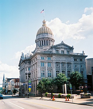
Huntingdon County is a county in the Commonwealth of Pennsylvania. As of the 2020 census, the population was 44,092. Its county seat is Huntingdon. The county was created on September 20, 1787, mainly from the northern part of Bedford County, plus an addition of territory on the east from Cumberland County. The county is part of the Southwest Pennsylvania region of the state.

<span class="mw-page-title-main">Fulton County, Pennsylvania</span> County in Pennsylvania, United States

Fulton County is a county in the Commonwealth of Pennsylvania. As of the 2020 census, the population was 14,556, making it the fourth-least populous county in Pennsylvania. Its county seat is McConnellsburg. The county was created on April 19, 1850, from a part of Bedford County and named after inventor Robert Fulton. The county is part of the Southwest Pennsylvania region of the state.

<span class="mw-page-title-main">Cambria County, Pennsylvania</span> County in Pennsylvania, United States

Cambria County is a county in the Commonwealth of Pennsylvania. As of the 2020 census, the population was 133,472. Its county seat is Ebensburg. The county was created on March 26, 1804, from parts of Bedford, Huntingdon, and Somerset counties and later organized in 1807. It was named for the nation of Wales, which in Latin is known as "Cambria". The county is part of the Southwest Pennsylvania region of the state.

<span class="mw-page-title-main">Blair County, Pennsylvania</span> County in Pennsylvania, United States

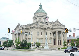
Blair County is a county in the Commonwealth of Pennsylvania. As of the 2020 census, the population was 122,822. Its county seat is Hollidaysburg, and its largest city is Altoona. The county was created on February 26, 1846, from parts of Huntingdon and Bedford counties. The county is part of the Southwest Pennsylvania region of the state.

<span class="mw-page-title-main">Everett, Pennsylvania</span> Borough in Pennsylvania, United States

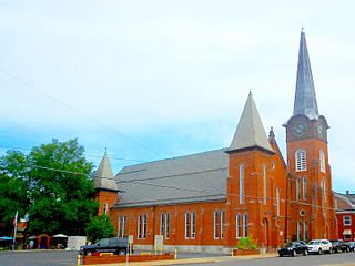
Everett is a borough in Bedford County, Pennsylvania, United States. The population was 1,765 at the 2020 census.

<span class="mw-page-title-main">Saxton, Pennsylvania</span> Borough in Pennsylvania, United States

Saxton is a borough in Bedford County, Pennsylvania, United States. The population was 726 at the 2020 census.

<span class="mw-page-title-main">Snake Spring Township, Pennsylvania</span> Township in Pennsylvania, United States

Snake Spring Township is a township in Bedford County, Pennsylvania, United States. The population was 1,771 at the 2020 census.

<span class="mw-page-title-main">North Woodbury Township, Pennsylvania</span> Township in Pennsylvania, United States

North Woodbury Township is a township in Blair County, Pennsylvania, United States. It is part of the Altoona, PA Metropolitan Statistical Area. The population was 2,434 at the 2020 census.

<span class="mw-page-title-main">Huntingdon, Pennsylvania</span> Borough in Pennsylvania, United States

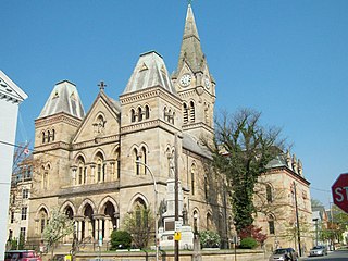
Huntingdon is a borough in and county seat of Huntingdon County, Pennsylvania, United States. It is located along the Juniata River, approximately 32 miles (51 km) east of Altoona and 92 miles (148 km) west of Harrisburg. With a population of 6,827 at the 2020 census, it is the largest population center near Raystown Lake, a winding, 28-mile-long (45 km) flood-control reservoir managed by the U.S. Army Corps of Engineers.

<span class="mw-page-title-main">Penn Township, Huntingdon County, Pennsylvania</span> Township in Pennsylvania, United States

Penn Township is a township in Huntingdon County, Pennsylvania, United States. The population was 1,078 at the 2020 census. The township includes the village of Hesston and the Seven Points Marina of Raystown Lake.

<span class="mw-page-title-main">Pennsylvania Route 26</span> State highway in Pennsylvania, US

Pennsylvania Route 26 is a 125.5-mile (202.0 km) highway in the south-central area of Pennsylvania. Its northern terminus is at PA 150 northwest of Howard; its southern terminus is at the Maryland state line near Barnes Gap in Union Township. Two major destinations along this route are Raystown Lake near Huntingdon and the Pennsylvania State University at State College.

<span class="mw-page-title-main">Raystown Branch Juniata River</span> River in Pennsylvania, United States

The Raystown Branch Juniata River is the largest and longest tributary of the Juniata River in south-central Pennsylvania in the United States.

<span class="mw-page-title-main">Trough Creek State Park</span> State park in Huntingdon County, Pennsylvania

Trough Creek State Park is a 554 acres (224 ha) Pennsylvania state park in Cass, Penn and Todd Townships, Huntingdon County, Pennsylvania in the United States. The majority of the park is in Todd Township along Pennsylvania Route 994, east of the unincorporated village of Entriken. Huntingdon is the nearest borough. The park borders Rothrock State Forest and Raystown Lake National Recreation Area. There is a growing population of bald eagles at the lake. Fourteen eagles were spotted in January 2007. This is up from two that were spotted in 1990, the first year that an eagle survey was taken. These three sections of state and federal owned property combine together to provide hunting, hiking and fishing opportunities for the outdoorsman.

<span class="mw-page-title-main">Tussey Mountain</span>

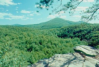
Tussey Mountain is a stratigraphic ridge in central Pennsylvania, United States, trending east of the Bald Eagle, Brush, Dunning and Evitts Mountain ridges. Its southern foot just crosses the Mason–Dixon line near Flintstone, Maryland, running north 130 km (80 mi) to the Seven Mountains of central Pennsylvania, near Tusseyville, making it one of the longest named ridges in this section of the Ridge-and-valley Appalachians.

<span class="mw-page-title-main">Geology of Bedford County, Pennsylvania</span>

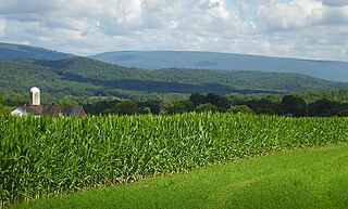
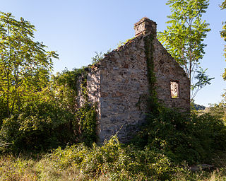
Bedford County, Pennsylvania is situated along the western border of the Ridge and Valley physiographic province, which is characterized by folded and faulted sedimentary rocks of early to middle Paleozoic age. The northwestern border of the county is approximately at the Allegheny Front, a geological boundary between the Ridge and Valley Province and the Allegheny Plateau.

<span class="mw-page-title-main">Pennsylvania Route 164</span> State highway in Pennsylvania, US

Pennsylvania Route 164 is a 36-mile-long (58 km) state highway located in Cambria, Blair, and Bedford counties in Pennsylvania. The western terminus is at an interchange with U.S. Route 22 (US 22) in Munster Township. The eastern terminus is at PA 26 near Raystown Lake.

The Pennsylvania State Game Lands Number 73 are Pennsylvania State Game Lands in Bedford, Blair and Huntingdon Counties in Pennsylvania in the United States providing hunting, bird watching, and other activities.

The Pennsylvania State Game Lands Number 118 are Pennsylvania State Game Lands in Blair and Huntingdon counties in Pennsylvania in the United States, providing hunting, bird watching, and other activities.

References

  1. Includes Westmoreland, Cambria, Fayette, Blair, Indiana, Somerset, Bedford, Huntingdon, Greene and Fulton Counties
  1. "PHMC Historical Markers Search". Pennsylvania Historical and Museum Commission. Commonwealth of Pennsylvania. Archived from the original (Searchable database) on March 21, 2016. Retrieved January 25, 2014.
  2. "Census - Geography Profile: Bedford County, Pennsylvania". United States Census Bureau . Retrieved April 24, 2022.
  3. "Find a County". National Association of Counties. Archived from the original on July 4, 2012. Retrieved June 7, 2011.
  4. Locke, Karen (2016). "The Rich History of Omni Bedford Springs". Omni Hotels.
  5. "2010 Census Gazetteer Files". United States Census Bureau. August 22, 2012. Retrieved March 4, 2015.
  6. "PRISM Climate Group, Oregon State U".
  7. "Geology" (PDF). www.dcnr.state.pa.us. Archived from the original (PDF) on July 25, 2006. Retrieved November 20, 2018.
  8. Quarry locations [ permanent dead link ]
  9. "Geology" (PDF). www.dcnr.state.pa.us. Archived from the original (PDF) on July 25, 2006. Retrieved November 20, 2018.
  10. Acid Mine Drainage [ permanent dead link ]
  11. "Geology" (PDF). www.dcnr.state.pa.us. Archived from the original (PDF) on July 25, 2006. Retrieved November 20, 2018.
  12. "Welcome to Bedford County, PA". Bedford County Commissioner's Office. Retrieved April 15, 2021.
  13. Leip, David. "Dave Leip's Atlas of U.S. Presidential Elections". uselectionatlas.org. Retrieved November 20, 2018.
  14. Pennsylvania Department of State (July 17, 2023). "Voter registration statistics by county". dos.pa.gov. Retrieved July 20, 2023.
  15. "Census 2020".
  16. "U.S. Census website". United States Census Bureau . Retrieved October 20, 2014.
  17. "P2 HISPANIC OR LATINO, AND NOT HISPANIC OR LATINO BY RACE – 2020: DEC Redistricting Data (PL 94-171) – Bedford County, Pennsylvania".
  18. Pennsylvania Department of Education (August 2015). "Charter Schools".
  19. "2010 U.S. Census website". United States Census Bureau . Retrieved February 13, 2016.

40°01′N78°29′W / 40.01°N 78.49°W / 40.01; -78.49