Delaware County is a county located in the US state of New York. As of the 2020 United States census, the population was 44,308. The county seat is Delhi. The county is named after the Delaware River, which was named in honor of Thomas West, 3rd Baron De La Warr, appointed governor of Virginia in 1609.

Tioga County is a county in the U.S. state of New York. As of the 2020 census, the population was 48,455. Its county seat is Owego. Its name derives from an American Indian word meaning "at the forks", describing a meeting place.

Montgomery County is a county in the U.S. state of Arkansas. As of the 2020 census, the population was 8,484. The county seat is Mount Ida. Montgomery County is Arkansas's 45th county, formed on December 9, 1842, and named after Richard Montgomery, an American Revolutionary War general.

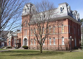
Montgomery County is a county in the Commonwealth of Pennsylvania. It is the third-most populous county in Pennsylvania and the 73rd-most populous county in the United States. As of the 2020 census, the population of the county was 856,553, representing a 7.1% increase from the 799,884 residents counted in the 2010 census. Montgomery County is located adjacent to and northwest of Philadelphia. The county seat and largest city is Norristown. Montgomery County is geographically diverse, ranging from farms and open land in the extreme north of the county to densely populated suburban neighborhoods in the southern and central portions of the county.

Montgomery County is located in the State of Alabama. As of the 2020 census, its population was 228,954, making it the fifth-most populous county in Alabama. Its county seat is Montgomery, the state capital. Montgomery County is included in the Montgomery, AL Metropolitan Statistical Area.

Warren County is a county in the Commonwealth of Pennsylvania. As of the 2020 census, the population was 38,587. Its county seat is Warren. The county was formed in 1800 from parts of Allegheny and Lycoming counties; attached to Crawford County until 1805 and then to Venango County until Warren was formally organized in 1819.

Crawford County is a county in the Commonwealth of Pennsylvania. As of the 2020 census, the population was 83,938. Its county seat is Meadville. The county was created on March 12, 1800, from part of Allegheny County and named for Colonel William Crawford.

Perquimans County is a county located in the U.S. state of North Carolina. As of the 2020 census, the population was 13,005. Its county seat is Hertford. The county was originally created as Berkeley Precinct. It was renamed Perquimans Precinct around 1684 and gained county status in 1739. Perquimans County is part of the Elizabeth City, NC Micropolitan Statistical Area, which is also included in the Virginia Beach-Norfolk, VA-NC Combined Statistical Area. The Harvey Point Defense Testing Activity facility is located in Perquimans County.

Brookmont is a census-designated place and an unincorporated area in Montgomery County, Maryland, United States. Brookmont is often considered part of neighboring Bethesda because it falls within Bethesda's 20816 zip code.

North Kensington is a census-designated place and an unincorporated area in Montgomery County, Maryland, United States. It had a population of 9,497 in 2020.
Jerseytown is a census-designated place (CDP) in Madison Township, Columbia County, north-central Pennsylvania. It is part of Northeastern Pennsylvania. The population was 184 at the 2010 census. It is part of the Bloomsburg–Berwick Micropolitan Statistical Area.

Lower Paxton Township is a township of the second class in Dauphin County, Pennsylvania, United States. The population was 53,501 at the 2020 census. It is the most populous municipality in Dauphin County, exceeding that of Harrisburg, the state capital, and the 13th most populated municipality in the state.

Montgomery Township is a township in Indiana County, Pennsylvania, United States. It was named in honor of John Montgomery, an early settler of Conemaugh Township and a noted Revolutionary War veteran who owned a large tract of land in present Montgomery County. The population was 1,439 at the 2020 census, a decline from the figure of 1,568 tabulated in 2010. The township includes the communities of Arcadia, Bowdertown, Cush Creek, Gipsy, Gorman Summit, Hillsdale, Hooverhurst, Lower Wilgus, and Upper Wilgus.

Waverly Township is a township in Lackawanna County, Pennsylvania, United States. It is bordered by Dalton and Glenburn townships to the west, North Abington Township to the north, the boroughs of Clarks Summit and Clarks Green to the south, and South Abington Township to the south and southeast. Waverly Township is part of a suburban area known as "the Abingtons". The population was 1,861 at the 2020 census.
Ancient Oaks is a census-designated place (CDP) in Lower Macungie Township in Lehigh County, Pennsylvania. It is named after the housing subdivision named Ancient Oaks, located off PA Route 100 just north of Macungie. The population of Ancient Oaks was 6,995 at the 2020 census.

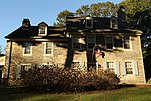
Wyncote is a census-designated place (CDP) in Cheltenham Township, Montgomery County, Pennsylvania. It borders the northwestern and northeastern section of Philadelphia. Wyncote is located 11 miles from Center City Philadelphia at the southeasternmost tip of Montgomery County. The Jenkintown-Wyncote SEPTA station is the fifth busiest regional rail station in the SEPTA system.
In 45 of the 50 states of the United States, the county is used for the level of local government immediately below the state itself. Louisiana uses parishes, and Alaska uses boroughs. In Connecticut, Massachusetts, and Rhode Island, some or all counties within states have no governments of their own; the counties continue to exist as legal entities, however, and are used by states for some administrative functions and by the United States Census bureau for statistical analysis. There are 3,242 counties and county equivalent administrative units in total, including the District of Columbia and 100 county-equivalents in the U.S. territories.

Trexlertown is an unincorporated community and census-designated place (CDP) in Upper Macungie Township in Lehigh County, Pennsylvania. As of the 2020 census, the population was 2,382. It is part of the Lehigh Valley, which had a population of 861,899 and was the 68th most populous metropolitan area in the U.S. as of the 2020 census, and lies between Breinigsville and Wescosville.