Montgomery Township, Montgomery County, Pennsylvania

Last updated

Montgomery Township
Joseph Ambler Inn.jpg
The Joseph Ambler Inn in Montgomery Township
Montgomery Township Montgomery County.png
Location of Montgomery Township in Montgomery County
USA Pennsylvania location map.svg
Red pog.svg
Montgomery Township
Location of Montgomery Township in Pennsylvania
Coordinates: 40°15′03″N75°15′05″W / 40.25083°N 75.25139°W / 40.25083; -75.25139
CountryFlag of the United States.svg  United States
StateFlag of Pennsylvania.svg  Pennsylvania
County Montgomery
Incorporated1714
Government
  BodyBoard of Supervisors
Area
[1]
  Total10.63 sq mi (27.5 km2)
  Land10.63 sq mi (27.5 km2)
  Water0.00 sq mi (0.0 km2)
Elevation
433 ft (132 m)
Population
 (2010)
  Total24,790
  Estimate 
(2016) [2]
26,143
  Density2,300/sq mi (900/km2)
Time zone UTC-5 (EST)
  Summer (DST) UTC-4 (EDT)
Postal Code
19454
Area codes 215, 267 and 445
Website www.montgomerytwp.org

Montgomery Township is a township in Montgomery County, Pennsylvania. [3] It is the location of the Montgomery Mall, a regional shopping mall serving the Route 309 corridor of the Philadelphia suburbs. Much of Montgomery Township's development is suburban in character, with newer tract houses and strip shopping centers. Homes in Montgomery Township have North Wales and Lansdale (although the township is distinct from those boroughs) addresses, but businesses that are located within the township boundaries are given the Montgomeryville ZIP Code. The township is in the North Penn School District and is part of the North Penn Valley region that is centered around the borough of Lansdale.

Contents

Montgomery Township is the largest municipality in the North Penn area, the ninth largest municipality in Montgomery County, and the 59th largest municipality in Pennsylvania. Montgomery Township has its downtown along PA 309 in Montgomery Square. The township is largely developed with many suburban developments. It has an area of 10.7 square miles and a population of 24,790. It was incorporated on May 17, 1714.[ citation needed ]

History

Montgomery Township was incorporated in 1714. Alexander Edwards was certainly one of the first settlers, and probably the very earliest in Montgomery. Originally from Wales, he died in 1712 and described himself in his will as "of Montgomery", showing that the township had been created before that time, [4] When old Philadelphia County was partitioned on September 10, 1784, Montgomery Township was included in Montgomery County. There were many Welsh within Montgomery and its surrounding townships, descendants of those who left Wales in the aftermath of the English Civil War. The new county was likely named for the historic county of Montgomeryshire, Wales, where many of the earliest Welsh settlers hailed from. [5]

The Knapp Farm was listed on the National Register of Historic Places in 1976. [6]

Geography

According to the U.S. Census Bureau, the township has a total area of 10.7 square miles (27.6 km2), all land. It is in the Delaware watershed and is drained mainly by the Little Neshaminy Creek. Its villages include Christy (also in Bucks County), Colmar (also in Hatfield Township), Eureka (also in Bucks County and Horsham Township), Fortuna (also in Hatfield Township), Montgomery Square, and Montgomeryville. Pennsylvania Route 63 (Welsh Road) follows a portion of the southwestern boundary of the township.

Neighboring municipalities

Climate

Montgomery Township has a hot-summer humid continental climate (Dfa) and the hardiness zones are 6b and 7a with the dividing line on a ridge at roughly Stump Road. The average monthly temperature in Montgomeryville ranges from 29.9 °F in January to 74.3 °F in July.

Demographics

Historical population
CensusPop.Note
1930 850
1940 95111.9%
1950 1,56664.7%
1960 2,70072.4%
1970 3,93645.8%
1980 5,71845.3%
1990 12,179113.0%
2000 22,02580.8%
2010 24,79012.6%
2020 25,8624.3%
[7] [8]

As of the 2010 census, the township was 76.7% White, 4.6% Black or African American, 0.1% Native American, 16.6% Asian, and 1.6% were two or more races. 2.2% of the population were of Hispanic or Latino ancestry. [9]

As of the census [3] of 2000, there were 22,025 people, 7,926 households, and 6,055 families residing in the township. The population density was 2,067.1 inhabitants per square mile (798.1/km2). There were 8,053 housing units at an average density of 755.8 per square mile (291.8/km2). The racial makeup of the township was 85.60% White, 3.87% African American, 0.07% Native American, 9.19% Asian, 0.01% Pacific Islander, 0.28% from other races, and 0.98% from two or more races. Hispanic or Latino of any race were 1.27% of the population.

There were 7,926 households, out of which 39.9% had children under the age of 18 living with them, 68.5% were married couples living together, 5.9% had a female householder with no husband present, and 23.6% were non-families. 19.7% of all households were made up of individuals, and 6.5% had someone living alone who was 65 years of age or older. The average household size was 2.74 and the average family size was 3.20.

In the township, the population was spread out, with 28.4% under the age of 18, 4.0% from 18 to 24, 34.5% from 25 to 44, 21.8% from 45 to 64, and 11.3% who were 65 years of age or older. The median age was 37 years. For every 100 females, there were 93.3 males. For every 100 females age 18 and over, there were 89.2 males.

The median income for a household in the township was $78,953, and the median income for a family was $88,209 (these figures had risen to $84,026 and $102,174 respectively as of a 2007 estimate [10] ). Males had a median income of $61,260 versus $40,858 for females. The per capita income for the township was $32,349. About 1.5% of families and 2.0% of the population were below the poverty line, including 1.5% of those under age 18 and 3.7% of those age 65 or over.

Government and politics

Montgomery Township municipal building Montgomery Township Municipal Building.jpg
Montgomery Township municipal building

Montgomery Township is governed by a five-member Board of Supervisors. As of 2021, the Board of Supervisors is composed of: [11]

Presidential elections results [12]
Year Republican Democratic
2020 38.3% 6,37660.3%10,047
2016 40.1% 5,58456.2%7,833
2012 47.0% 6,08452.2%6,755
2008 42.9% 5,55756.5%7,316
2004 48.9% 5,94650.8%6,173
2000 49.1%4,87048.7% 4,829
1996 44.2% 3,58945.8%3,715
1992 43.9%3,03135.8% 2,468

Transportation

PA 309 northbound at US 202 in Montgomery Township 2022-10-12 12 06 08 View north along Pennsylvania State Route 309 (Bethlehem Pike) from the overpass for U.S. Route 202 in Montgomery Township, Montgomery County, Pennsylvania.jpg
PA 309 northbound at US 202 in Montgomery Township

As of 2020 there were 97.28 miles (156.56 km) of public roads in Montgomery Township, of which 23.36 miles (37.59 km) were maintained by the Pennsylvania Department of Transportation (PennDOT) and 97.28 miles (156.56 km) were maintained by the township. [13]

Major roads in Montgomery Township include U.S. Route 202, which passes southwest–northeast through the center of the township along an expressway-grade parkway; Pennsylvania Route 309, which runs north–south through the center of the township along Bethlehem Pike; U.S. Route 202 Business, which passes southwest–northeast through the township along Dekalb Pike, PA 309, and Doylestown Road; Pennsylvania Route 63, which runs northwest–southeast along the southwestern border of the township on Welsh Road; Pennsylvania Route 152, which passes north–south through the eastern corner of the township along Limekiln Pike; Pennsylvania Route 463, which runs northwest–southeast through the center of the township along Cowpath Road and Horsham Road; and County Line Road, which runs northwest–southeast along the northeastern border of the township with Bucks County. [14] SEPTA provides bus service to Montgomery Township along Suburban Bus routes 94 , 96, and 132, all of which stop at the Montgomery Mall. [15]

Public safety

Notable person

Related Research Articles

<span class="mw-page-title-main">New Britain Township, Pennsylvania</span> Township in Pennsylvania, United States

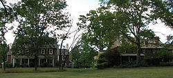
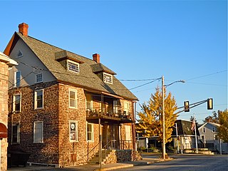
New Britain Township is a township in Bucks County, Pennsylvania, United States. The population was 11,070 at the 2010 census.

<span class="mw-page-title-main">Franconia Township, Pennsylvania</span> Township in Pennsylvania, United States

Franconia Township is a township in Montgomery County, Pennsylvania, United States. The population was 13,064 at the 2010 census.

<span class="mw-page-title-main">Hatfield, Pennsylvania</span> Borough in Pennsylvania, United States

Hatfield is a borough in Montgomery County, Pennsylvania, United States. The population was 3,290 at the time of the 2010 census. It is part of the North Penn Valley region that is centered around the borough of Lansdale. The borough is surrounded by Hatfield Township.

<span class="mw-page-title-main">Hatfield Township, Pennsylvania</span> Township in Pennsylvania, United States

Hatfield Township is a township in Montgomery County, Pennsylvania, United States. The population was 17,249 at the 2010 census. It is part of the North Penn Valley region which is centered around the borough of Lansdale.

<span class="mw-page-title-main">Horsham, Pennsylvania</span> Census-designated place in Pennsylvania, United States

Horsham is a census-designated place in Horsham Township, Montgomery County, Pennsylvania, United States. The population was 15,193 at the 2020 census. It is home to the Biddle Air National Guard Base at the former site of Naval Air Station Joint Reserve Base Willow Grove.

<span class="mw-page-title-main">Horsham Township, Pennsylvania</span> Home rule municipality in Pennsylvania, United States

Horsham Township is a home rule municipality in Montgomery County, Pennsylvania. It is located ten miles north of Center City Philadelphia. The township, incorporated in 1717, is one of the oldest original municipalities in Montgomery County. Although it retains the word "Township" in its official name, it has been governed by a Home Rule Charter since 1975 and is therefore not subject to the Pennsylvania Township Code. The population was 26,564 at the time of the 2020 census.

<span class="mw-page-title-main">Lower Gwynedd Township, Pennsylvania</span> Township in Pennsylvania, United States

Lower Gwynedd Township is a township and equestrian community in Montgomery County, Pennsylvania, United States. The population was 11,405 at the 2010 census. The township comprises four villages: Gwynedd, Gwynedd Valley, Penllyn, and Spring House. The township is considered a haven for those seeking a country lifestyle, while still being in close proximity to nearby towns and Center City Philadelphia. While its postal address is in Ambler, Pennsylvania (19002), it is not associated with the Borough of Ambler.

<span class="mw-page-title-main">Montgomeryville, Pennsylvania</span> Census-designated place in Pennsylvania, United States

Montgomeryville is a census-designated place (CDP) in Montgomery Township, Montgomery County, Pennsylvania, United States. The population was 12,624 at the 2010 census. According to a 2010 Forbes magazine/Yahoo.com survey, Montgomeryville ranks 5th in America's top 10 affordable suburbs. It is part of the North Penn Valley region that is centered on the borough of Lansdale.

<span class="mw-page-title-main">North Wales, Pennsylvania</span> Borough in Pennsylvania, United States

North Wales is a borough in Montgomery County, Pennsylvania. It is a suburb of Philadelphia and is one of the three historic population centers that make up the North Penn Valley, which is centered on the borough of Lansdale. It is approximately 27 miles (43 km) north of Center City Philadelphia. The population was 3,426 as of the 2020 census.

<span class="mw-page-title-main">Souderton, Pennsylvania</span> Borough of Pennsylvania, US

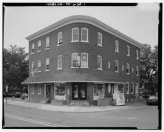
Souderton is a borough in Montgomery County, Pennsylvania, United States. The population was 7,246 in 2022 according to the Census Bureau.

<span class="mw-page-title-main">Springfield Township, Montgomery County, Pennsylvania</span> Township in Pennsylvania, United States

Springfield Township is a township in Montgomery County, Pennsylvania. The population was 20,993 in 2022 according the Census Bureau. It includes the villages of Wyndmoor, Erdenheim, Flourtown, and Oreland. The communities of Lafayette Hill, Fort Washington, Laverock, North Hills, Miquon, and Glenside are also situated partly inside the Township.

<span class="mw-page-title-main">Upper Dublin Township, Pennsylvania</span> Township in Pennsylvania, United States

Upper Dublin Township is a township in Montgomery County, Pennsylvania, United States. The population was 25,569 at the 2010 census. Until the 1950s, Upper Dublin was mostly farmland and open space, but transitioned to a residential suburb during the postwar population boom. The population went from just over 6,000 residents in the 1950s to just under 20,000 by 1970. Today, Upper Dublin is mostly spread-out development housing, and has the fourth highest median income in Montgomery County.

<span class="mw-page-title-main">Upper Gwynedd Township, Pennsylvania</span> Township in Pennsylvania, United States

Upper Gwynedd Township is a township in Montgomery County, Pennsylvania. The population was 15,552 at the time of the 2010 census. North Wales Borough is surrounded by Upper Gwynedd Township on all sides, and many homes and businesses with North Wales addresses are actually in Upper Gwynedd. Many properties with Lansdale addresses are in Upper Gwynedd as well. It is part of the North Penn Valley region that is centered around the borough of Lansdale.

<span class="mw-page-title-main">Whitemarsh Township, Pennsylvania</span> Home rule municipality in Pennsylvania, United States

Whitemarsh Township is a Home rule municipality in Montgomery County, Pennsylvania. It retains its former classification of "Township" in its official name despite being a home rule municipality. The population was 19,707 at the 2020 census. Whitemarsh is adjacent to the neighborhood of Andorra in the Roxborough section of Philadelphia, and is bordered in Montgomery County by Springfield, Upper Dublin, Whitpain, and Plymouth townships, Conshohocken, and the Schuylkill River, which separates it from Lower Merion Township.

<span class="mw-page-title-main">Telford, Pennsylvania</span> Borough in Pennsylvania, United States

Telford is a borough in Bucks and Montgomery counties in the U.S. state of Pennsylvania. The population was 4,872 at the time of the 2010 census. Of this, 2,665 were in Montgomery County, and 2,207 were in Bucks County.

The North Penn Valley is a region of Philadelphia suburbs and exurbs in Montgomery County, Pennsylvania. It is somewhat congruent with the North Penn School District. It contains the boroughs of North Wales, Lansdale, and Hatfield, as well as the surrounding townships. The area to its west has traditionally been more rural, while the suburbs to its south and east are, on the whole, more affluent and densely populated.

<span class="mw-page-title-main">North Penn School District</span> School district in Pennsylvania

The North Penn School District (NPSD) is a large, suburban, regional public school district that consists of thirteen elementary schools, three middle schools, and one high school. It serves the North Penn Valley, a 42-square-mile (110 km2) area in the Montgomery County suburbs of Philadelphia, Pennsylvania.

<span class="mw-page-title-main">Pennsylvania Route 463</span> A 12.9-mile-long (20.8 km) state highway completely in Montgomery County, Pennsylvania

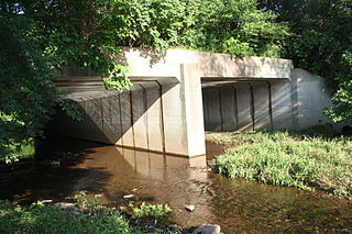
Pennsylvania Route 463 (PA 463) is a 12.9-mile-long (20.8 km) state highway completely in Montgomery County, Pennsylvania. Its western terminus is at PA 63 in Hatfield Township and its eastern terminus is at PA 611 in Horsham. PA 463 runs through the northern suburbs of Philadelphia and passes through the towns of Hatfield, Montgomeryville, and Horsham. The route intersects PA 309, U.S. Route 202 Business, and US 202 in Montgomeryville and PA 152 in Prospectville. Through its length, the route carries the names Forty Foot Road, Broad Street, Main Street, Cowpath Road, and Horsham Road. PA 463 was designated in 1928 and fully paved by 1940. In 2010, a portion of the route in Montgomery Township was widened.

Line Lexington is an unincorporated community located in the Delaware Valley on Route 309 in Bucks and Montgomery counties in Pennsylvania, United States. It is split between the Bucks County townships of Hilltown and New Britain and the Montgomery County township of Hatfield. The Montgomery County portion of the village is in the North Penn School District and is part of the North Penn Valley region that is centered on the borough of Lansdale. The Bucks County portion is also served by the North Penn School District. While it has its own post office with the ZIP code of 18932, portions use the Colmar ZIP code of 18915, the Chalfont ZIP code of 18914 or the Hatfield ZIP code of 19440. It is served by SEPTA Suburban Bus Route 132 and the nearest SEPTA Regional Rail stations are nearby in Colmar and Chalfont on the Lansdale/Doylestown Line. The Line Lexington telephone exchange uses area code 215.

<span class="mw-page-title-main">U.S. Route 202 Business (Montgomeryville–Doylestown, Pennsylvania)</span> Business route in Pennsylvania, United States

U.S. Route 202 Business is a 10-mile (16 km) business route of US 202 in Montgomery and Bucks counties in the U.S. state of Pennsylvania, running between Montgomeryville and Doylestown. The route heads northeast from US 202 in Upper Gwynedd Township along five-lane Dekalb Pike through residential and commercial areas. In Montgomeryville, the route turns north to run concurrent with Pennsylvania Route 309 on five-lane Bethlehem Pike past several businesses. US 202 Bus. splits from PA 309 by turning northeast onto two-lane Doylestown Road. The route crosses into Bucks County and becomes Butler Avenue, passing through Chalfont and New Britain and curving east. West of Doylestown, the business route ends at an interchange with PA 611 in Doylestown Township.

References

  1. "2016 U.S. Gazetteer Files". United States Census Bureau. Retrieved August 14, 2017.
  2. "Population and Housing Unit Estimates" . Retrieved June 9, 2017.
  3. 1 2 "U.S. Census website". United States Census Bureau . Retrieved January 31, 2008.
  4. Historical Collections Relating to Gwynedd, by Howard M. Jenkins. Second Edition, 1897. Chapter 17. Early Settlers in Montgomery.
  5. "Montgomeryshire | former county, Wales, United Kingdom | Britannica".
  6. "National Register Information System". National Register of Historic Places . National Park Service. July 9, 2010.
  7. "DVRPC > Site Search". Archived from the original on April 9, 2019. Retrieved March 21, 2014.
  8. "Census 2020".
  9. "Census 2010: Pennsylvania". Usatoday.Com. March 9, 2011. Retrieved October 10, 2017.
  10. US Census search Archived February 11, 2020, at archive.today
  11. "Board of Supervisors". Montgomery Township, PA. Retrieved May 3, 2021.
  12. "Montco Election Results".
  13. "Montgomery Township map" (PDF). PennDOT. Retrieved March 10, 2023.
  14. Montgomery County, Pennsylvania Highway Map (PDF) (Map). PennDOT. 2015. Retrieved January 12, 2016.
  15. SEPTA Official Transit & Street Map Suburban (PDF) (Map). SEPTA. Retrieved May 2, 2016.