Plymouth Township, Montgomery County, Pennsylvania

Last updated

Plymouth Township
PlymouthMeetinghouseMontgomeryCountyPennsylvania.jpg
Flag of Plymouth Township, Montgomery County, Pennsylvania.png
Seal of Plymouth Township, Montgomery County, Pennsylvania.png
Plymouth Township Montgomery County.png
Location of Plymouth Township in Montgomery County, Pennsylvania
Coordinates: 40°08′00″N75°17′29″W / 40.13333°N 75.29139°W / 40.13333; -75.29139
CountryUnited States
StatePennsylvania
County Montgomery
Founded1686
Government
  TypeCouncil-manager
Area
[1]
  Total8.49 sq mi (21.99 km2)
  Land8.39 sq mi (21.73 km2)
  Water0.10 sq mi (0.26 km2)
Elevation
249 ft (76 m)
Population
 (2010)
  Total16,525
  Estimate 
(2016) [2]
17,642
  Density2,102.49/sq mi (811.77/km2)
Time zone UTC-5 (EST)
  Summer (DST) UTC-4 (EDT)
ZIP Codes
19462
19428
19422
Area code(s) 484 and 610
FIPS code 42-091-61664
Website www.plymouthtownship.org

Plymouth Township is a township with home rule status in Montgomery County, Pennsylvania. The township has been governed by a home rule charter since 1976 and is no longer subject to the Pennsylvania Township Code. [3] The population was 16,525 at the 2010 census. It is serviced by the Colonial School District and is home to the Plymouth Meeting Mall.

Contents

History

Plymouth Meeting, a census-designated place (CDP) that straddles Plymouth and Whitemarsh Townships, was settled by English Quakers in 1686. The Cold Point Historic District was listed on the National Register of Historic Places in 1983. [4]

Geography

According to the U.S. Census Bureau, the township has a total area of 8.5 square miles (22.1 km2), of which 8.4 square miles (21.8 km2) is land and 0.1 square mile (0.3 km2) (1.41%) is water. Plymouth Township straddles the boundary between a hot-summer humid continental climate (Dfa) and a humid subtropical climate (Cfa). The hardiness zone is 7a. It is drained by the Schuylkill River, which forms most of its southwestern boundary.

Transportation

I-276/Pennsylvania Turnpike eastbound at I-476/Pennsylvania Turnpike Northeast Extension in Plymouth Township 2022-10-11 11 58 25 View east along Interstate 276 (Pennsylvania Turnpike Delaware River Extension) from the overpass for Interstate 476 (Pennsylvania Turnpike Northeast Extension) in Plymouth Township, Montgomery County, Pennsylvania.jpg
I-276/Pennsylvania Turnpike eastbound at I-476/Pennsylvania Turnpike Northeast Extension in Plymouth Township

As of 2018 there were 67.50 miles (108.63 km) of public roads in Plymouth Township, of which 5.80 miles (9.33 km) were maintained by the Pennsylvania Turnpike Commission (PTC), 13.52 miles (21.76 km) were maintained by the Pennsylvania Department of Transportation (PennDOT) and 48.18 miles (77.54 km) were maintained by the township. [5]

Plymouth Township is the location of one of the major highway junctions of the Philadelphia metropolitan area, the interchange of the Pennsylvania Turnpike (I-276) and the "Blue Route" and the Pennsylvania Turnpike Northeast Extension (I-476). The east-west Pennsylvania Turnpike (I-276) traverses the central portion of the township on a southwest-northeast alignment. The "Blue Route" (I-476) enters the far southern corner of the township on a southwest-northeast as well, but turns more northerly and meets the east-west Turnpike in the eastern portion of the township. From there, I-476 follows the turnpike's Northeast Extension on a southeast-northwest alignment up to the northern corner of the township before exiting.

SEPTA provides bus service to Plymouth Township along City Bus routes 27 and L and Suburban Bus routes 90 , 95 , 97 , 98, and 150, serving points of interest in the township and offering connections to Philadelphia and other suburbs. SEPTA Regional Rail's Manayunk/Norristown Line passes through the township but does not have any stations within it; the nearest stations are Conshohocken station and Norristown Transportation Center. [6]

Demographics

Historical population
CensusPop.Note
1930 4,369
1940 4,3800.3%
1950 5,11816.8%
1960 11,430123.3%
1970 16,91148.0%
1980 17,1681.5%
1990 15,985−6.9%
2000 16,0450.4%
2010 16,5253.0%
2020 18,25610.5%
[7] [8]

As of the 2010 census, Plymouth Township was 83.1% White, 7.0% Black or African American, 0.1% Native American, 7.2% Asian, and 1.7% were two or more races. 2.6% of the population were of Hispanic or Latino ancestry. [9]

As of the 2000 census, [10] there were 16,045 people, 6,512 households, and 4,363 families residing in the township. The population density was 1,907.3 inhabitants per square mile (736.4/km2). There were 6,703 housing units at an average density of 796.8 per square mile (307.6/km2). The racial makeup of the township was 89.26% White, 4.17% African American, 0.09% Native American, 5.22% Asian, 0.01% Pacific Islander, 0.37% from other races, and 0.89% from two or more races. Hispanic or Latino of any race were 1.25% of the population.

There were 6,512 households, out of which 25.1% had children under the age of 18 living with them, 55.0% were married couples living together, 8.6% had a female householder with no husband present, and 33.0% were non-families. 26.6% of all households were made up of individuals, and 11.2% had someone living alone who was 65 years of age or older. The average household size was 2.43 and the average family size was 2.97.

In the township, the population was spread out, with 20.1% under the age of 18, 7.2% from 18 to 24, 29.6% from 25 to 44, 23.9% from 45 to 64, and 19.2% who were 65 years of age or older. The median age was 41 years. For every 100 females there were 94.7 males. For every 100 females age 18 and over, there were 91.2 males.

The median income for a household in the township was $54,069, and the median income for a family was $66,938. Males had a median income of $45,953 versus $35,089 for females. The per capita income for the township was $28,862. About 2.4% of families and 4.3% of the population were below the poverty line, including 3.3% of those under age 18 and 4.2% of those age 65 or over.

Government and politics

Plymouth Township municipal building Plymouth Township Municipal Building.jpg
Plymouth Township municipal building
Presidential elections results
Year Republican Democratic
2020 37.1% 4,04562.1%6,769
2016 37.9% 3,63358.4%5,598
2012 42.5% 3,71956.3%4,932
2008 40.1% 3,58859.2%5,298
2004 43.1% 3,68156.6%4,827
2000 41.4% 3,07056.5%4,186
1996 37.2% 2,48552.5%3,509
1992 37.7% 2,86345.8%3,481

Plymouth Township is governed by a five-member Council, elected to staggered four-year terms; four Council members are elected by district and one is elected at-large. Council establishes the policies, goals and objectives for the Executive, Administrative, and Advisory functions. Council Members are limited by the Home Rule Charter to two consecutive terms plus the balance of an unexpired term. [11]

The township is part of the Fourth Congressional District, represented by Madeleine Dean. It is in the 70th State House District, represented by Matthew Bradford, the 148th State House District, represented by Mary Jo Daley, and the 17th State Senate District, represented by Amanda Cappelletti.

Education

Colonial School District is the local school district.

Holy Rosary Regional Catholic School in Plymouth Meeting and Plymouth Township is the area Catholic school. It was formed in 2012 by the merger of Epiphany of Our Lord School in Plymouth Meeting, Our Lady of Victory in East Norriton Township, and St. Titus in Norristown. [12]

Related Research Articles

<span class="mw-page-title-main">Bristol Township, Pennsylvania</span> Township in Pennsylvania, United States

Bristol Township is a township in Bucks County, Pennsylvania, United States. The population was 54,582 at the 2010 census, making it the 13th largest municipality in the state. Bristol Township, along with Bristol Borough, is a cultural hub for Lower Bucks County, hosting celebrations of African and Latino heritage. Parts of the township consist of the neighborhoods of Fairless Hills and Levittown. It is located within the Delaware Valley.

<span class="mw-page-title-main">West Rockhill Township, Pennsylvania</span> Township in Pennsylvania, United States

West Rockhill Township is a township in Bucks County, Pennsylvania, United States. The original Rockhill Township was established in 1740 and was divided into East Rockhill and West Rockhill Townships in 1890. The population was 5,256 at the 2010 census. West Rockhill Township is part of Pennridge School District.

<span class="mw-page-title-main">Conshohocken, Pennsylvania</span> Borough in Pennsylvania, United States

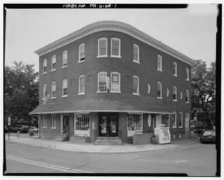
Conshohocken is a borough on the Schuylkill River in Montgomery County, Pennsylvania in suburban Philadelphia. Historically a large mill town and industrial and manufacturing center, after the decline of industry in recent years Conshohocken has developed into a center of riverfront commercial and residential development. In the regional slang, it is sometimes referred to by the colloquial nickname Conshy.

<span class="mw-page-title-main">East Norriton Township, Pennsylvania</span> Township in Pennsylvania, United States

East Norriton Township is a township and a census-designated place in Montgomery County, Pennsylvania, United States. The population was 13,590 at the 2010 census. It is served by the Norristown Area School District.

<span class="mw-page-title-main">Franconia Township, Pennsylvania</span> Township in Pennsylvania, United States

Franconia Township is a township in Montgomery County, Pennsylvania, United States. The population was 13,064 at the 2010 census.

<span class="mw-page-title-main">Hatfield, Pennsylvania</span> Borough in Pennsylvania, United States

Hatfield is a borough in Montgomery County, Pennsylvania, United States. The population was 3,290 at the time of the 2010 census. It is part of the North Penn Valley region that is centered around the borough of Lansdale. The borough is surrounded by Hatfield Township.

<span class="mw-page-title-main">Lower Moreland Township, Pennsylvania</span> Township in Pennsylvania, United States

Lower Moreland Township is a township in Montgomery County, Pennsylvania, United States. The population was 13,917 at the 2020 census.

<span class="mw-page-title-main">Lower Providence Township, Pennsylvania</span> Township in Pennsylvania, United States

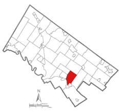
Lower Providence Township is a township in Montgomery County, Pennsylvania, United States. The township is located approximately 17 miles northwest of Philadelphia. The population was 25,625 at the 2020 census.

<span class="mw-page-title-main">Norristown, Pennsylvania</span> Home rule municipality in Pennsylvania, United States

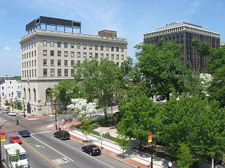
Norristown is a municipality with home rule status and the county seat of Montgomery County, Pennsylvania, United States, in the Philadelphia metropolitan area. Located along the Schuylkill River, approximately 6 miles (9.7 km) from Philadelphia, Norristown had a population of 35,748 as of the 2020 census. It is the fourth-most populous municipality in the county and second-most populous borough in Pennsylvania.

<span class="mw-page-title-main">North Wales, Pennsylvania</span> Borough in Pennsylvania, United States

North Wales is a borough in Montgomery County, Pennsylvania. It is a suburb of Philadelphia and is one of the three historic population centers that make up the North Penn Valley, which is centered on the borough of Lansdale. It is approximately 27 miles (43 km) north of Center City Philadelphia. The population was 3,426 as of the 2020 census.

<span class="mw-page-title-main">Plymouth Meeting, Pennsylvania</span> Census-designated place in Pennsylvania, United States

Plymouth Meeting is a census-designated place (CDP) that straddles Plymouth and Whitemarsh Townships in Montgomery County, Pennsylvania, United States. The settlement was founded in 1686.

<span class="mw-page-title-main">Skippack Township, Pennsylvania</span> Township in Pennsylvania, United States

Skippack Township is a township in Montgomery County, Pennsylvania, United States. The population was 14,408 in 2022 according to the Census Bureau. This represents a 5.1% increase from the 2010 Census.

<span class="mw-page-title-main">Upper Gwynedd Township, Pennsylvania</span> Township in Pennsylvania, United States

Upper Gwynedd Township is a township in Montgomery County, Pennsylvania, United States. The population was 15,552 at the time of the 2010 census. North Wales Borough is surrounded by Upper Gwynedd Township on all sides, and many homes and businesses with North Wales addresses are actually in Upper Gwynedd. Many properties with Lansdale addresses are in Upper Gwynedd as well. It is part of the North Penn Valley region that is centered around the borough of Lansdale.

<span class="mw-page-title-main">Upper Merion Township, Pennsylvania</span> Township in Pennsylvania, United States of America

Upper Merion Township is a township in Montgomery County, Pennsylvania, United States. The population was 33,613 at the 2020 U.S. Census. Located 16 miles (26 km) from Philadelphia, it consists of the villages of Gulph Mills, King of Prussia, Swedeland, Swedesburg, and portions of Radnor, and Wayne.

<span class="mw-page-title-main">Upper Providence Township, Montgomery County, Pennsylvania</span> Township in Pennsylvania, United States

Upper Providence Township is a township in Montgomery County, Pennsylvania, United States. As of the 2010 census, the township population was 21,219.

<span class="mw-page-title-main">West Conshohocken, Pennsylvania</span> Borough in Pennsylvania, United States

West Conshohocken is a borough in Montgomery County, Pennsylvania, United States. The population was 1,320 at the 2010 census.

<span class="mw-page-title-main">West Norriton Township, Pennsylvania</span> Township in Pennsylvania, United States

West Norriton Township is a township that is located in Montgomery County, Pennsylvania, United States. It is part of the Norristown Area School District.

<span class="mw-page-title-main">Whitemarsh Township, Pennsylvania</span> Home rule municipality in Pennsylvania, United States

Whitemarsh Township is a home rule municipality in Montgomery County, Pennsylvania, United States. It retains its former classification of "Township" in its official name despite being a home rule municipality. The population was 19,707 at the 2020 census. Whitemarsh is adjacent to the neighborhood of Andorra in the Roxborough section of Philadelphia, and is bordered in Montgomery County by Springfield, Upper Dublin, Whitpain, and Plymouth townships, Conshohocken, and the Schuylkill River, which separates it from Lower Merion Township.

<span class="mw-page-title-main">Whitpain Township, Pennsylvania</span> Township in Pennsylvania, United States

Whitpain Township is a township in Montgomery County, Pennsylvania, United States. Founded in 1701, it has grown to a total population of 18,875 as of the 2010 census.

<span class="mw-page-title-main">Worcester Township, Pennsylvania</span> Township in Pennsylvania, United States

Worcester Township is a township in Montgomery County, Pennsylvania, United States. The population was 9,750 at the 2010 census.

References

  1. "2016 U.S. Gazetteer Files". United States Census Bureau. Retrieved August 14, 2017.
  2. "Population and Housing Unit Estimates" . Retrieved June 9, 2017.
  3. Pennsylvania Code Title 346, Sec. 23.1-101 et seq.
  4. "National Register Information System". National Register of Historic Places . National Park Service. July 9, 2010.
  5. "Plymouth Township map" (PDF). PennDOT. Retrieved March 10, 2023.
  6. SEPTA Official Transit & Street Map Suburban (PDF) (Map). SEPTA. Retrieved May 2, 2016.
  7. "DVRPC > Site Search". Archived from the original on April 9, 2019. Retrieved February 7, 2017.
  8. "Census 2020".
  9. "Archived copy". USA Today . Archived from the original on February 15, 2012. Retrieved September 8, 2017.{{cite web}}: CS1 maint: archived copy as title (link)
  10. "U.S. Census website". United States Census Bureau . Retrieved January 31, 2008.
  11. Plymouth Township http://www.plymouthtownship.org/council.cfm
  12. "2012 Catholic grade school consolidations/closings". Catholicphilly.com. July 15, 2012. Retrieved April 22, 2020.