Pine Township, Allegheny County, Pennsylvania

Last updated

Township of Pine,
Allegheny County,
Pennsylvania
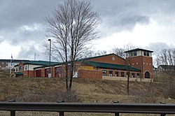
Chapel Drive fire station in Wexford.jpg
Wexford Volunteer Fire Company Station 228
Allegheny County Pennsylvania incorporated and unincorporated areas Pine township highlighted.svg
Location in Allegheny County and state of Pennsylvania
Coordinates: 40°37′10″N80°01′29″W / 40.61944°N 80.02472°W / 40.61944; -80.02472
Country United States
State Pennsylvania
County Allegheny
Established1796
Government
  Type Board of Supervisors
Area
[1]
  Total16.98 sq mi (43.97 km2)
  Land16.96 sq mi (43.93 km2)
  Water0.01 sq mi (0.03 km2)
Elevation
1,129 ft (344 m)
Population
 (2020)
  Total14,691
  Estimate 
(2018) [2]
13,337
  Density762.66/sq mi (294.46/km2)
Time zone UTC-5 (Eastern (EST))
  Summer (DST) UTC-4 (EDT)
ZIP code
15090 (Wexford); 15044 (Gibsonia)
Area code(s) 724, 878
FIPS code42-003-60272
Website Township of Pine

Pine Township is a township that is located in Allegheny County, Pennsylvania, United States. The population was 14,691 at the time of the 2020 census. [3]

Contents

History

Pine Township was named for the abundance of pine trees. [4]

Geography

According to the United States Census Bureau, the township has a total area of 16.8 square miles (44 km2), of which 0.06% is water.

Surrounding neighborhoods

Pine Township has nine borders. Five are in Allegheny County, including Richland Township to the east, McCandless to the south, Franklin Park to the southwest, and Bradford Woods and Marshall Township to the west. The remaining four borders are with Butler County neighborhoods to the north: Cranberry Township and Seven Fields to the northwest, Adams Township to the north and Valencia to the northeast.

Government and politics

Board of supervisors

Presidential voting

Presidential election results [6] [7] [8]
Year Republican Democratic Third parties
2020 52%4,63446% 4,1671% 93
2016 60%3,95140% 2,6090% 40
2012 70%4,32729% 1,7821% 41

Demographics

Historical population
CensusPop.Note
1850 2,209
1860 1,021−53.8%
1870 718−29.7%
1880 7737.7%
1890 746−3.5%
1900 658−11.8%
1910 6986.1%
1920 685−1.9%
1930 93736.8%
1940 1,19127.1%
1950 1,73245.4%
1960 3,613108.6%
1970 4,25917.9%
1980 3,908−8.2%
1990 4,0483.6%
2000 7,68389.8%
2010 11,49749.6%
2020 14,69127.8%
2018 (est.)13,337 [2] 16.0%
Sources: [9] [10] [11] [12] [13] [14] [15]

As of the 2000 census, [14] there were 7,683 people, 2,411 households, and 2,119 families residing in the township. The population density was 457.7 inhabitants per square mile (176.7/km2). There were 2,500 housing units at an average density of 148.9 per square mile (57.5/km2). The racial makeup of the township was 97.16% White, 0.79% African American, 0.07% Native American, 1.12% Asian, 0.03% Pacific Islander, 0.16% from other races, and 0.68% from two or more races. Hispanic or Latino of any race were 0.74% of the population.

There were 2,411 households, out of which 51.6% had children under the age of 18 living with them, 82.2% were married couples living together, 4.0% had a female householder with no husband present, and 12.1% were non-families. 10.5% of all households were made up of individuals, and 4.4% had someone living alone who was 65 years of age or older. The average household size was 3.14 and the average family size was 3.40.

In the township the population was spread out, with 34.5% under the age of 18, 3.3% from 18 to 24, 30.3% from 25 to 44, 22.3% from 45 to 64, and 9.6% who were 65 years of age or older. The median age was 37 years. For every 100 females there were 96.1 males. For every 100 females age 18 and over, there were 92.1 males.

The median income for a household in the township was $85,817, and the median income for a family was $93,201. Males had a median income of $75,418 versus $35,909 for females. The per capita income for the township was $35,202. About 3.6% of families and 3.8% of the population were below the poverty line, including 3.9% of those under age 18 and 7.2% of those age 65 or over.

Related Research Articles

<span class="mw-page-title-main">Avalon, Pennsylvania</span> Borough in Pennsylvania, United States

Avalon is a borough in Allegheny County, Pennsylvania, United States, along the Ohio River 6 miles (10 km) downstream from Pittsburgh. The population was 4,762 at the 2020 census. It is a residential suburb of the Pittsburgh metropolitan area.

<span class="mw-page-title-main">Baldwin Township, Pennsylvania</span> Township in Pennsylvania, United States

Baldwin Township is a township in Allegheny County, Pennsylvania, United States. The population was 1,984 at the 2020 census, a decrease from the figure of 1,992 tabulated in 2010.

<span class="mw-page-title-main">Blawnox, Pennsylvania</span> Borough in Pennsylvania, United States

Blawnox is a borough in Allegheny County, Pennsylvania, United States. The population was 1,454 at the 2020 census. It is part of the Pittsburgh metropolitan area.

<span class="mw-page-title-main">Crescent Township, Pennsylvania</span> Township in Pennsylvania, United States

Crescent Township is a township in Allegheny County, Pennsylvania, United States, and is part of the Pittsburgh Metro Area. The population was 2,479 at the 2020 census.

<span class="mw-page-title-main">Emsworth, Pennsylvania</span> Borough in Allegheny County, Pennsylvania, United States

Emsworth is a borough in Allegheny County, Pennsylvania, United States, along the Ohio River. The population was 2,525 at the 2020 census.

<span class="mw-page-title-main">Etna, Pennsylvania</span> Borough in Pennsylvania, United States

Etna is a borough in Allegheny County, Pennsylvania, United States, located across the Allegheny River from Pittsburgh. The population was 3,437 at the 2020 census. It is a suburb of the Pittsburgh metropolitan area.

<span class="mw-page-title-main">Findlay Township, Pennsylvania</span> Township in Pennsylvania, United States

Findlay Township is a township located west of Pittsburgh in Allegheny County, Pennsylvania. The population was 6,370 at the 2020 census.

<span class="mw-page-title-main">Franklin Park, Pennsylvania</span> Borough in Pennsylvania, United States

Franklin Park is a borough in Allegheny County, Pennsylvania, United States. The population was 15,479 at the 2020 census. It is a suburb of the Pittsburgh metropolitan area.

<span class="mw-page-title-main">Frazer Township, Allegheny County, Pennsylvania</span> Township in Pennsylvania, United States

Frazer Township is a township in Allegheny County, Pennsylvania, United States. The population was 1,164 at the 2020 census. The Pittsburgh Mills shopping mall complex is located in the township.

<span class="mw-page-title-main">Glenfield, Pennsylvania</span> Borough in Pennsylvania, United States

Glenfield is a borough in Allegheny County, Pennsylvania, United States, situated along the Ohio River. The population was two hundred and twelve at the time of the 2020 census.

<span class="mw-page-title-main">Haysville, Pennsylvania</span> Borough in Pennsylvania, United States

Haysville is a borough in Allegheny County, Pennsylvania, United States, along the Ohio River. The population was 81 according to the 2020 census, making it the least-populous municipality in Allegheny County.

<span class="mw-page-title-main">Marshall Township, Pennsylvania</span> Township in Pennsylvania, United States

Marshall Township is a township that is located in Allegheny County, Pennsylvania, United States. The population was 10,080 at the time of the 2020 census.

<span class="mw-page-title-main">North Fayette Township, Pennsylvania</span> Township in Pennsylvania, United States

North Fayette Township is a township in Allegheny County, Pennsylvania, United States. The township is a suburb of Pittsburgh. The population was 13,680 at the 2010 census. The township has been home to the Park Lane Office center since 1989.

<span class="mw-page-title-main">Richland Township, Allegheny County, Pennsylvania</span> Township in Pennsylvania, United States

Richland Township is a township in Allegheny County, Pennsylvania, United States. The population was 11,942 at the 2020 census.

<span class="mw-page-title-main">Springdale Township, Pennsylvania</span> Township in Pennsylvania, United States

Springdale Township is a township in Allegheny County, Pennsylvania, United States. It contains the two communities of Orrville and Harwick. The population was 1,636 at the 2010 census.

<span class="mw-page-title-main">West Deer Township, Pennsylvania</span> Township in Pennsylvania, United States

West Deer Township is a township in Allegheny County, Pennsylvania, Pennsylvania, United States. The population was 12,262 at the 2020 census.

<span class="mw-page-title-main">Trafford, Pennsylvania</span> Borough in Pennsylvania, United States

Trafford is a borough in Allegheny and Westmoreland counties in the U.S. state of Pennsylvania. Located near Pittsburgh in western Pennsylvania, the borough lies primarily in Westmoreland County; only a small portion extends into Allegheny County. It was incorporated in 1904 from the northernmost corner of North Huntingdon Township, and was named by George Westinghouse for Trafford near Manchester, England. Westinghouse purchased the land in 1902, and the Trafford Foundry began operations on October 3, 1903. The population was 3,317 at the 2020 census. Of this, 3,113 were in Westmoreland County, and only 61 were in Allegheny County.

<span class="mw-page-title-main">McCandless, Pennsylvania</span> Home rule municipality in Pennsylvania, United States

McCandless is a township with home rule status in Allegheny County, Pennsylvania, United States. The population was 29,709 at the 2020 census. It is a northern suburb of the Pittsburgh metropolitan area.

<span class="mw-page-title-main">Scott Township, Allegheny County, Pennsylvania</span> CDP and Township in Pennsylvania, United States

Scott Township is a township in Allegheny County, Pennsylvania, United States. The population was 17,024 at the 2010 census.

<span class="mw-page-title-main">Shaler Township, Pennsylvania</span> Township in Pennsylvania, United States

Shaler Township is a township in Allegheny County in the U.S. state of Pennsylvania. It consists of much of the community of Glenshaw and several neighboring communities. The population was 28,757 at the 2010 census. It is part of the Pittsburgh metropolitan area.
References

  1. "2016 U.S. Gazetteer Files". United States Census Bureau. Retrieved August 13, 2017.
  2. 1 2 Bureau, U. S. Census. "U.S. Census website". United States Census Bureau . US Census Bureau. Retrieved December 1, 2019.
  3. "Race, Hispanic or Latino, Age, and Housing Occupancy: 2010 Census Redistricting Data (Public Law 94-171) Summary File (QT-PL), Pine township, Allegheny County, Pennsylvania". United States Census Bureau . Retrieved September 29, 2011.
  4. "What's in a name? For some, a bit of history". Pittsburgh Post-Gazette. May 10, 1984. p. 2. Retrieved May 16, 2015.
  5. EL. "Allegheny Election Night". Allegheny County. Retrieved July 23, 2019.
  6. EL. "2012 Allegheny County election". Pittsburgh Tribune-Review. Retrieved October 15, 2017.
  7. EL. "2016 Pennsylvania general election..." Pittsburgh Post-Gazette. Retrieved October 15, 2017.
  8. "Election Night Reporting".
  9. "Population of Civil Divisions Less than Counties" (PDF). 1880 United States Census. U.S. Census Bureau. Retrieved November 24, 2013.
  10. "Population-Pennsylvania" (PDF). U.S. Census 1910. U.S. Census Bureau. Retrieved November 22, 2013.
  11. "Number and Distribution of Inhabitants:Pennsylvania-Tennessee" (PDF). Fifteenth Census. U.S. Census Bureau.
  12. "Number of Inhabitants: Pennsylvania" (PDF). 18th Census of the United States. U.S. Census Bureau. Retrieved November 22, 2013.
  13. "Pennsylvania: Population and Housing Unit Counts" (PDF). U.S. Census Bureau. Retrieved November 22, 2013.
  14. 1 2 "U.S. Census website". United States Census Bureau . Retrieved January 31, 2008.
  15. "Incorporated Places and Minor Civil Divisions Datasets: Subcounty Population Estimates: April 1, 2010 to July 1, 2012". U.S. Census Bureau. Archived from the original on June 11, 2013. Retrieved November 25, 2013.