Related Research Articles
Bergen Township was a township that existed in the U.S. state of New Jersey, from 1661 to 1862, first as Bergen, New Netherland, then as part Bergen County, and later as part of Hudson County. Several places still bear the name: the township of North Bergen; Bergen Square, Old Bergen Road, Bergen Avenue, Bergen Junction, Bergen Hill and Bergen Arches in Jersey City; Bergen Point in Bayonne; and Bergenline Avenue and Bergen Turnpike in North Hudson.

Kieft's War (1643–1645), also known as the Wappinger War, was a conflict between the colonial province of New Netherland and the Wappinger and Lenape Indians in what is now New York and New Jersey. It is named for Director-General of New Netherland Willem Kieft, who had ordered an attack without the approval of his advisory council and against the wishes of the colonists. Dutch colonists attacked Lenape camps and massacred the inhabitants, which encouraged unification among the regional Algonquian tribes against the Dutch and precipitated waves of attacks on both sides. This was one of the earliest conflicts between settlers and Indians in the region. The Dutch West India Company was displeased with Kieft and recalled him, but he died in a shipwreck while returning to the Netherlands; Peter Stuyvesant succeeded him in New Netherland. Numerous Dutch settlers returned to the Netherlands because of the continuing threat from the Algonquians, and growth slowed in the colony.

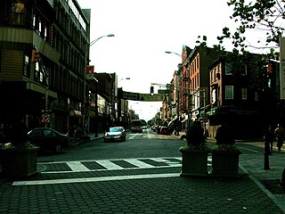
Bergen Square, at the intersection of Bergen Avenue and Academy Street in Jersey City, is in the southwestern part of the much larger Journal Square district. A commercial residential area, it contains an eclectic array of architectural styles including 19th-century row houses, Art Deco retail and office buildings, and is the site of the longest continually-used school site in the United States. Nearby are the Van Wagenen House and Old Bergen Church, two structures from the colonial period. St. George & St. Shenouda Coptic Orthodox Church founded by early Egyptian immigrants was one of the original Coptic congregations in New Jersey.

Pavonia was the first European settlement on the west bank of the North River that was part of the seventeenth-century province of New Netherland in what would become the present Hudson County, New Jersey.

David Pieterszoon de Vries was a Dutch navigator from Hoorn.

Vriessendael was a patroonship on the west bank of the Hudson River in New Netherland, the seventeenth century North American colonial province of the Dutch Empire. The homestead or plantation was located on a tract of about 500 acres (2.0 km2) about an hour's walk north of Communipaw at today's Edgewater. It has also been known as Tappan, which referred to the wider region of the New Jersey Palisades, rising above the river on both sides of the New York/New Jersey state line, and to the indigenous people who lived there and were part of wider group known as Lenape. It was established in 1640 by David Pietersen de Vries, a Dutch sea captain, explorer, and trader who had also established settlements at the Zwaanendael Colony and on Staten Island. The name can roughly be translated as De Vries' Valley. De Vries also owned flatlands along the Hackensack River, in the area named by the Dutch settlers Achter Col. Parts of Vriessendael were destroyed in 1643 in reprisal for the slaughter of Tappan and Wecquaesgeek Native Americans who had taken refuge at Pavonia and Corlears Hook. The patroon's relatively good relations with the Lenape prevented the murder of the plantation's residents, who were able to seek sanctuary in the main house, and later flee to New Amsterdam. The incident was one of the first of many to take place during Kieft's War, a series of often bloody conflicts with bands of Lenape, who had united in face of attacks ordered by the Director of New Netherland.

Achter Kol was the name given to the region around the Newark Bay and Hackensack River in northeastern New Jersey by the first European settlers to it and was part of the 17th century province of New Netherland, administered by the Dutch West India Company. At the time of their arrival, the area was inhabited by the Hackensack and Raritan groups of Lenape natives.
Bergen was a part of the 17th century province of New Netherland, in the area in northeastern New Jersey along the Hudson and Hackensack Rivers that would become contemporary Hudson and Bergen Counties. Though it only officially existed as an independent municipality from 1661, with the founding of a village at Bergen Square, Bergen began as a factory at Communipaw circa 1615 and was first settled in 1630 as Pavonia. These early settlements were along the banks of the North River across from New Amsterdam, under whose jurisdiction they fell.
Hackensack was the exonym given by the Dutch colonists to a band of the Lenape, or Lenni-Lenape, a Native American tribe. The name is a Dutch derivation of the Lenape word for what is now the region of northeastern New Jersey along the Hudson and Hackensack rivers. While the Lenape people occupied much of the mid-Atlantic area, Europeans referred to small groups of native people by the names associated with the places where they lived.
Sicomac is an unincorporated community located within Wyckoff, in Bergen County, in the U.S. state of New Jersey.
Communipaw is a neighborhood in Jersey City in Hudson County, in the U.S. state of New Jersey. It is located west of Liberty State Park and east of Bergen Hill, and the site of one of the earliest European settlements in North America. It gives its name to the historic avenue which runs from its eastern end near Liberty State Park Station through the neighborhoods of Bergen-Lafayette and the West Side that then becomes the Lincoln Highway. Communipaw Junction, or simply The Junction, is an intersection where Communipaw, Summit Avenue, Garfield Avenue, and Grand Street meet, and where the toll house for the Bergen Point Plank Road was situated. Communipaw Cove at Upper New York Bay, is part of the 36-acre (150,000 m2) state nature preserve in the park and one of the few remaining tidal salt marshes in the Hudson River estuary.
The Tappan were a Lenape people who inhabited the region radiating from Hudson Palisades and New York – New Jersey Highlands at the time of European colonialization in the 17th century.
The Navesink, or Navisink, were a group of Lenape who inhabited the Raritan Bayshore near Sandy Hook and Mount Mitchill in eastern New Jersey in the United States.
Harsimus is a neighborhood within Downtown Jersey City, Hudson County, in the U.S. state of New Jersey. The neighborhood stretches from the Harsimus Stem Embankment on the north to Christopher Columbus Drive on the south between Coles Street and Grove Street or more broadly, to Marin Boulevard. It borders the neighborhoods of Hamilton Park to the north, Van Vorst Park to the south, the Village to the west, and the Powerhouse Arts District to the east. Newark Avenue has traditionally been its main street. The name is from the Lenape, used by the Hackensack Indians who inhabited the region and could be translated as Crow's Marsh. From many years, the neighborhood was part of the "Horseshoe", a political delineation created by its position between the converging rail lines and political gerrymandering.
Curries Woods is a neighborhood in the southern part of Greenville in Jersey City, New Jersey bordering Bayonne. It was named after James Curie, who was on the town Committee for Greenville when it was its own Township in the 19th century. The area remained rural until the later part of the century when the Central Railroad of New Jersey built a line connecting ferries to Elizabeth, New Jersey and New York City. Currie's Woods still remained untouched through the late part of the century and it was valued for its woods, rocky shore and dunes on Newark Bay. A lot of the land was eventually lost, but a tract was set aside in the early part of the 20th century. A small cemetery, the Old Greenville Cemetery, was nearby. This park lost much of its land to the city's largest Housing Authority project in 1959, except a small tract in Bayonne, Mercer Park.

Jan Evertsz Bout, was an early and prominent Dutch settler in the 17th century colonial province of New Netherland.
Maryn Adriansen was an early settler to New Netherland. Originally emigrating under an Indenture agreement he later became a prominent member of society. His conflict with the governor led to accusations and, eventually, acquittal. He owned property in New Amsterdam and a large plantation at Awiehaken.
Abraham Isaacsen Verplanck (1606–1690), also known as Abraham Isaacse Ver Planck, was an early and prominent settler in New Netherlands. A land developer and speculator, he was the progenitor of an extensive Verplanck family in the United States. Immigrating circa 1633, he received a land grant at Paulus Hook in 1638.
References
- ↑ Ricky, Donald (January 1998). Encyclopedia of Massachusetts Indians. Somerset Publishers, Inc. p. 198. ISBN 978-0-403-09330-4 . Retrieved 18 December 2020.
- ↑ Laws and Ordinances of New Netherland 1638-1674, compiled and translated by E.B. Callaghan, 1868
- 1 2 3 Indian Tribes of Hudson's River; Ruttenber, E.M.; Hope Farm Press, 3rd ed, 2001, ISBN 0-910746-98-2
- ↑ Native People of NJ - Lenni-Lenape
- ↑ "Teaneck Public Library Online". Archived from the original on 2008-10-12. Retrieved 2008-09-12.
- ↑ English, French, and Dutch Colonies 1643-1664
- ↑ Meisner, Marian. A History of Millburn Township. Chapter V. The Indian deeds
- ↑ The Origin of New Jersey Place Names: H, GetNJ.com. Accessed July 2, 2007.
- ↑ Cheslow, Jerry. "If You're Thinking of Living In/Hackensack, N.J.; After Long Decline, Downtown Rebounds", The New York Times , May 3, 1998. Accessed July 2, 2007. "Hackensack is named for the Achkinhenhcky branch of the Leni Lenape Indians, who traded with Dutch settlers along the Hackensack River as far back as the 1660s. The portrait of their chief, Oratam, who negotiated a treaty with English and Dutch settlers in 1690, appears on the municipal seal."
- ↑ A Brief History of Wyckoff Archived 2008-06-09 at the Wayback Machine
- History of Bogota, NJ
- History of Hackensack, City of Hackensack, NJ