Pennefather River

Last updated

Map all coordinates using: OpenStreetMap  
Download coordinates as: KML
Pennefather
Pennefather-river.JPG
Near Pennefather River mouth, in southwest Cape York Peninsula
Australia Queensland relief location map.jpg
Red pog.svg
Location of Pennefather River mouth in Queensland
EtymologyIn honour of Charles de Fonblanque Pennefather [1]
Location
Country Australia
State Queensland
Region Far North Queensland
Physical characteristics
Source 
  location Mapoon
  coordinates 12°19′53″S141°52′22″E / 12.33147°S 141.87289°E / -12.33147; 141.87289 (Pennefather River (source))
  elevation20 m (66 ft)
Source confluenceFish Creek and a series of unnamed waterways
  locationPort Musgrave Aggregation wetlands
  coordinates 12°15′17″S141°48′19″E / 12.25472°S 141.80528°E / -12.25472; 141.80528 (Confluence with Fish Creek)
  elevation1 m (3 ft 3 in)
Mouth Gulf of Carpentaria
  location
south of Mapoon
  coordinates
12°13′44″S141°43′14″E / 12.22889°S 141.72056°E / -12.22889; 141.72056 (Pennefather River (mouth)) Coordinates: 12°13′44″S141°43′14″E / 12.22889°S 141.72056°E / -12.22889; 141.72056 (Pennefather River (mouth))
  elevation
0 m (0 ft)
Length11 km (6.8 mi)
Basin size3,009 km2 (1,162 sq mi)
[2]

The Pennefather River is a river located on the western Cape York Peninsula in Far North Queensland, Australia. [1]

Contents

Location and features

Formed by the confluence of a series of waterways including the Fish Creek in the Port Musgrave Aggregation estuarine wetlands, the Pennefather River flows due west, joined by the Turtle Creek from the north and Dingo Creek from the south, before emptying into the Gulf of Carpentaria south of Mapoon. The river descends 1 metre (3 ft 3 in) over its 11-kilometre (6.8 mi) course. [2] At its widest point, the river is approximately 2 kilometres (1.2 mi) wide. The river has a catchment area of 3,009 square kilometres (1,162 sq mi), of which 349 square kilometres (135 sq mi) comprises wetlands. [3]

Etymology and history

Yupanguthi (Yuputhimri, Jupangati, Yupangathi, Nggerikudi, Yupungati, Jupangati) is an Australian Aboriginal language spoken on Yupanguthi country. The Yupanguthi language region includes the landscape within the local government boundaries of the landscape within the local government boundaries of the Shire of Cook. [4]

The river mouth was a site of the first recorded landfall in Australia by a Dutch explorer, by Willem Janszoon in 1606. [5] Janszoon named it R. met het Bosch ("River with the Forest"). [6]

In 1802 the British explorer Matthew Flinders mistook the river for the Coen River, which had been named by Dutch explorer Jan Carstensz in 1623 (now the Archer River), so that the Bosch / Pennefather River was named Coen River on maps in the 19th century. In 1880, Captain Charles Edward de Fonblanque Pennefather established that there were now two Coen Rivers, [7] and in 1894 Queensland authorities named the river after him, although the British Admiralty Chart for the Gulf of Carpentaria kept the name Coen River until 1967. [1] [8]

See also

Related Research Articles

Cape York Peninsula Peninsula in Far North Queensland, Australia

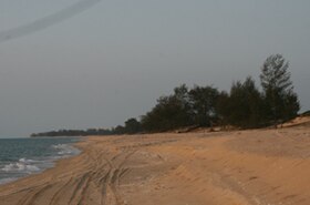
Cape York Peninsula is a large peninsula located in Far North Queensland, Australia. It is the largest unspoiled wilderness in northern Australia. The land is mostly flat and about half of the area is used for grazing cattle. The relatively undisturbed eucalyptus-wooded savannahs, tropical rainforests and other types of habitat are now recognised and preserved for their global environmental significance. Although much of the peninsula remains pristine, with a diverse repertoire of endemic flora and fauna, some of its wildlife may be threatened by industry and overgrazing as well as introduced species and weeds.

Weipa Town in Queensland, Australia

Weipa is a coastal mining town in the local government area of Weipa Town in Queensland. It is the largest town on the Cape York Peninsula. It exists because of the enormous bauxite deposits along the coast. The Port of Weipa is mainly involved in exports of bauxite. There are also shipments of live cattle from the port.

Mitchell River (Queensland) River in Queensland, Australia

The Mitchell River is a river located in Far North Queensland, Australia. The river rises on the Atherton Tableland about 50 kilometres (31 mi) northwest of Cairns and flows about 750 kilometres (470 mi) northwest across Cape York Peninsula from Mareeba to the Gulf of Carpentaria.

Flinders River

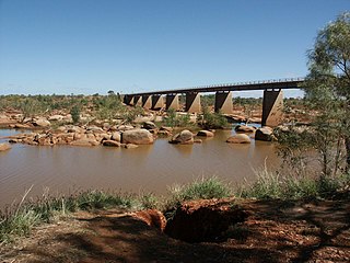
The Flinders River is the longest river in Queensland, Australia, at approximately 1,004 kilometres (624 mi). It was named in honour of the explorer Matthew Flinders. The catchment is sparsely populated and mostly undeveloped. The Flinders rises on the western slopes of the Great Dividing Range in North West Queensland and flows generally north-west through the Gulf Country, across a large, flat clay pan, before entering the Gulf of Carpentaria.

Ashburton River (Western Australia) River in Western Australia

The Ashburton River is located within the Pilbara region of Western Australia.

Coen River

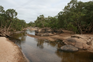
The Coen River is a river located in the Cape York Peninsula in Queensland, Australia.

The Staaten River is a river in northern Queensland, Australia, rising in the Great Dividing Range and flowing northwest into the Gulf of Carpentaria.

Gilbert River (Queensland) River in Queensland, Australia

The Gilbert River is located in Far North Queensland, Australia. When combined with the Einasleigh River, the river system is the largest river system in northern Australia.

Janszoon voyage of 1605–06 European voyage of discovery to the Australian continent

Willem Janszoon captained the first recorded European landing on the Australian continent in 1606, sailing from Bantam, Java, in the Duyfken. As an employee of the Dutch East India Company, Janszoon had been instructed to explore the coast of New Guinea in search of economic opportunities. He had originally arrived in the Dutch East Indies from the Netherlands in 1598, and became an officer of the VOC on its establishment in 1602.

The Edward River is a river located in Far North Queensland, Australia.

Gulf Country Region in Queensland, Australia

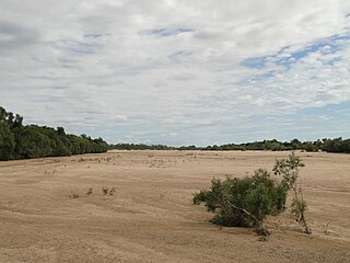
The Gulf Country is the region of woodland and savanna grassland surrounding the Gulf of Carpentaria in north western Queensland and eastern Northern Territory on the north coast of Australia. The region is also called the Gulf Savannah. It contains large reserves of zinc, lead and silver. The Gulf Country is crossed by the Savannah Way highway.

Archer River River in Queensland, Australia

The Archer River is a river located on the Cape York Peninsula, Far North Queensland, Australia.

The Ducie River is a river located on the Cape York Peninsula in Far North Queensland, Australia.

The Settlement Creek is a creek located in the Northern Territory and the state of Queensland, Australia.

The Nicholson River is a river located in the Northern Territory and the state of Queensland, Australia.

The Holroyd River is a river located on the Cape York Peninsula in Far North Queensland, Australia.

The Kendall River is a river located in Far North Queensland, Australia.

The Wimaranga (Wimaragga), also known as the Yuupngati (Jupangati) or Nggerikudi, were an Indigenous Australian people of the western Cape York Peninsula in northern Queensland.

Duyfken Point is a point in the locality of Mission River, Shire of Cook, Queensland, Australia.

References

  1. 1 2 3 "Pennefather River (entry 47589)". Queensland Place Names. Queensland Government . Retrieved 30 November 2015.
  2. 1 2 "Map of Pennefather River, QLD". Bonzle Digital Atlas of Australia. Retrieved 30 November 2015.
  3. "Wetland mapping — Pennefather River". WetlandInfo. Department of Environment and Heritage Protection, Queensland Government. 2015. Retrieved 1 December 2015.
  4. CC-BY-icon-80x15.png This Wikipedia article incorporates CC-BY-4.0 licensed text from: "Yupanguthi". Queensland’s Aboriginal and Torres Strait Islander Languages map. State Library of Queensland . Retrieved 28 January 2020.
  5. Mutch, T. D. (1942). The First Discovery of Australia. Sydney: Project Gutenberg of Australia. p. 31. Retrieved 30 September 2012.
  6. Tent, Jan. "Geographic and Linguistic Reflections on Moent and Dubbelde Ree: Two of Australia's First Recorded Placenames" (PDF). Geographical Research. 44 (4): 372–385. Archived from the original (PDF) on 26 February 2015. Retrieved 10 November 2014.
  7. The name Coen River eventually was only retained by a southern tributary of the original Coen River.
  8. "Pennefather River". Project Gutenberg of Australia.