
Rivers are ordered alphabetically, by state. The same river may be found in more than one state as many rivers cross state borders.
Rivers are ordered alphabetically, by state. The same river may be found in more than one state as many rivers cross state borders.

| Order | River name | System | Length | Source | |
|---|---|---|---|---|---|
| km | miles | ||||
| 1 | Murray River | Murray-Darling | 2,375 | 1,476 | [1] |
| 2 | Murrumbidgee River | Murray-Darling | 1,485 | 923 | |
| 3 | Darling River | Murray-Darling | 1,472 | 915 | |
| 4 | Lachlan River | Murray-Darling | 1,448 | 900 | |
| 5 | Warrego River | Murray-Darling | 1,380 | 857 | |
| 6 | Cooper Creek | Lake Eyre | 1,300 | 808 | |
| 7 | Paroo River | Murray-Darling | 1,210 | 752 | |
Although the Murray River forms much of the border separating New South Wales and Victoria, it is not Victoria's longest river because the New South Wales border is delineated by the river's southern bank rather than by the middle of the river. The only section of the river formally within Victoria is a stretch of approximately 11 kilometres (7 mi) where it separates Victoria and South Australia. At this point, the middle of the river forms the border. [2]
| State/territory | River name | Length | Source | |
|---|---|---|---|---|
| km | miles | |||
| Australian Capital Territory | Murrumbidgee River | 59 | 37 | [2] |
| New South Wales | Murray River | 1,808 | 1,123 | |
| Northern Territory | Victoria River | 510 | 317 | |
| Queensland | Flinders River | 1,004 | 624 | |
| South Australia | Murray River | 700 | 435 | |
| Tasmania | South Esk River | 245 | 152 | |
| Victoria | Goulburn River | 654 | 406 | |
| Western Australia | Gascoyne River | 834 | 518 | |
The following is a list of rivers located within Australian states and territories. Where a river crosses a state or territory boundary, it is listed in both states and territories. Where a river has a name that includes the word creek, it has been officially designated as a river.
The Geographical Names Board of New South Wales lists 439 rivers in the Geographical Names Register. [3] In the following list, where there are duplicated names, the source local government area (LGA) is identified. In the event of there being two rivers of the same name within the same local government area, additional referencing is provided. Rivers of New South Wales lists all rivers below, grouped according to whether the river flows towards the coast or flow inland, and grouped according to their respective catchment and sub-catchment. Where shown in italics, the watercourse is a creek, rivulet, brook, or similar.
A
B
C
D
E
F
G
H
I
J
K
L
M
N
O
P
Q
R
S
T
U
W
Y
A
B
C
D
E
F
G
H
I
J
K
L
M
N
O
P
R
S
T
W
Y
A
B
C
D
E
F
G
H
I
J
K
L
M
N
O
P
Q
R
S
T
V
W
Y
A
B
C
D
E
F
G
H
I
J
K
L
M
N
O
P
R
S
T
V
W
Y

The Great Dividing Range, also known as the East Australian Cordillera or the Eastern Highlands, is a cordillera system in eastern Australia consisting of an expansive collection of mountain ranges, plateaus and rolling hills, that runs roughly parallel to the east coast of Australia and forms the fifth-longest land-based mountain chain in the world, and the longest entirely within a single country. It is mainland Australia's most substantial topographic feature and serves as the definitive watershed for the river systems in eastern Australia, hence the name.

Mitta Mitta River, a perennial river and a direct tributary of the Murray River within the Murray–Darling basin, is located in the Alpine district of Victoria, Australia.

The Darling River is the third-longest river in Australia, measuring 1,472 kilometres (915 mi) from its source in northern New South Wales to its confluence with the Murray River at Wentworth. Including its longest contiguous tributaries it is 2,844 km (1,767 mi) long, making it the longest river system in Australia. The Darling River is the outback's most famous waterway.
The Culgoa River is a river that is part of the Darling catchment within the Murray–Darling basin and is located in South West Queensland.

The Wingecarribee River, a perennial river that is part of the Hawkesbury–Nepean catchment, is located in the Southern Highlands region of New South Wales, Australia.

Monaro Highway is a 285-kilometre-long (177 mi) highway in Victoria, New South Wales, and the Australian Capital Territory, in Australia, linking Cann River in Victoria to Canberra in the Australian Capital Territory (ACT) via the Monaro region. From its southern terminus, it follows the nearby Cann River upstream towards the New South Wales border through heavily forested terrain. Within New South Wales (NSW), it makes its way through further forest before reaching the pastures typical of the Monaro. There are multiple towns and villages along the highway, including Bombala, Nimmitabel, and Cooma. The terrain within the Monaro is largely hilly, and there are numerous crossings. The road also parallels the former Bombala railway line in several locations. Within the ACT, the road becomes a high volume roadway and serves the southern suburbs of Canberra. The highway has more recently had a grade-separated dual carriageway extension constructed within Canberra, as part of the Eastern Parkway construction project. It is designated part of route M23, and route A23 within Canberra, and route B23 within Victoria and New South Wales, with a concurrency where it also carries route B72 between the two sections of Snowy Mountains Highway.
Little River may refer to several places:

The Namoi River, a major perennial river that is part of the Barwon catchment of the Murray–Darling basin, is located in the Northern Tablelands and North West Slopes districts of New South Wales, Australia.

Barwon River, a perennial river that is part of the Murray–Darling basin, is located in the north-west slopes and Orana regions of New South Wales, Australia.

The Wollondilly River, an Australian perennial river that is part of the Hawkesbury–Nepean catchment, is located in the Southern Tablelands and Southern Highlands regions of New South Wales. The river meanders from its western slopes near Crookwell, flowing south-east through Goulburn, turning north-east to near Bullio, flowing north-west to Barrallier, before finally heading north-easterly into its mouth at Lake Burragorang.
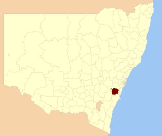
Wingecarribee Shire is the local government area of the Southern Highlands in the state of New South Wales, Australia. The Wingecarribee Shire is around 110 kilometres (70 mi) southwest of Sydney and is part of regional Capital Country and to some extent can be considered part of the Southern Tablelands.

The Parish of Towrang is a parish of Argyle County located to the south-east of Goulburn, and including some of its outer suburbs such as Goulburn North, and the area to the east of the Wollondilly River and Mulwaree Ponds. The Goulburn War Memorial is also located in this parish. The village of Towrang is located at the north-eastern edge of the parish, with Towrang creek part of the boundary in this area.

The Nymboida River, a perennial stream of the Clarence River catchment, is located in the Northern Rivers region of New South Wales, Australia.

Victoria is the southernmost mainland state of Australia. With an area of 227,594 km2 (87,875 sq mi), it is Australia's sixth largest state/territory, comparable in size to the island of Great Britain or the U.S. state of Utah. It is bound to the northwest by South Australia, directly north by New South Wales, and also shares a maritime border with Tasmania across the Bass Strait to the south. Most of Victoria's northern border lies along the Murray River. The eastern half of the state is dominated by the Australian Alps and the surrounding highlands of the Great Dividing Range, which also to a lesser extent extend far into the west of the state and ease off after The Grampians. By comparison the north and northwest of the state is extremely flat with little prominence.
The Little River, a perennial river that is part of the Hawkesbury-Nepean catchment, is located in the Southern Highlands region of New South Wales, Australia.
The Little River, a watercourse that is part of the Hawkesbury-Nepean catchment, is located in the Southern Highlands region of New South Wales, Australia.
The Cooma Creek, a mostly–perennial river that is part of the Murrumbidgee catchment within the Murray–Darling basin, is located in the Monaro region of New South Wales, Australia.
The Cooma Back Creek, a mostly–perennial river that is part of the Murrumbidgee catchment within the Murray–Darling basin, is located in the Monaro region of New South Wales, Australia.