The Schuylkill Expressway, locally known as "the Schuylkill", is a freeway through southern Montgomery County and Philadelphia. It is the easternmost segment of Interstate 76 (I-76) in the U.S. state of Pennsylvania. It extends from the Valley Forge interchange of the Pennsylvania Turnpike in King of Prussia, paralleling its namesake Schuylkill River for most of the route, southeast to the Walt Whitman Bridge over the Delaware River in South Philadelphia. It serves as the primary corridor into Philadelphia from points west. Maintenance and planning for most of the highway are administered through Pennsylvania Department of Transportation (PennDOT) District 6, with the Delaware River Port Authority (DRPA) maintaining the approach to the Walt Whitman Bridge.

U.S. Route 30 (US 30) is a U.S. Highway that runs east–west across the southern part of Pennsylvania, passing through Pittsburgh and Philadelphia on its way from the West Virginia state line east to the Benjamin Franklin Bridge over the Delaware River into New Jersey.

Pennsylvania Route 72 is a 37.8-mile-long (60.8 km) north–south state route located in southeast Pennsylvania. The southern terminus of the route is at U.S. Route 222 /PA 272 in Lancaster. The northern terminus is at PA 443 north of Lickdale in Union Township. PA 72 serves as a major road connecting Lancaster and Lebanon counties, serving East Petersburg, Manheim, Cornwall, Lebanon, and Jonestown. The route intersects several major roads including US 30 and PA 283 north of Lancaster, the Pennsylvania Turnpike south of Cornwall, US 322 along a concurrency on a freeway bypassing Cornwall, US 422 in Lebanon, US 22 near Jonestown, and I-81 via Fisher Avenue in Lickdale.

Pennsylvania Route 23 is an 81.14-mile-long (130.58 km) state highway in southeastern Pennsylvania. The route begins at PA 441 in Marietta and heads east to U.S. Route 1 at City Avenue on the border of Lower Merion Township and Philadelphia. PA 23 begins at Marietta in Lancaster County and continues east to Lancaster, where it passes through the city on a one-way pair of streets and intersects US 222 and US 30.
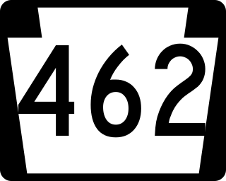
Pennsylvania Route 462 is a 32-mile-long (51 km) east–west state route in York and Lancaster counties in central Pennsylvania. The western terminus is west of York, and the eastern terminus is east of Lancaster. At both ends, PA 462 terminates at U.S. Route 30, which follows a mostly freeway alignment parallel to the north between York and Lancaster. The route heads east into York, where it follows the one-way pair of Market Street eastbound and Philadelphia Street westbound. In York, PA 462 runs concurrent with PA 74 and crosses Interstate 83 Business. East of York, the route becomes a multilane road that has an interchange with I-83 and crosses PA 24. PA 462 continues east through Hallam to Wrightsville and passes through that town before it crosses the Susquehanna River and runs through Columbia. East of here, the route continues through Mountville before reaching the city of Lancaster. In Lancaster, PA 462 is routed on the one-way pair of King Street eastbound and Walnut Street westbound, with the westbound direction concurrent with PA 23. The route crosses US 222/PA 272 and northbound PA 72 in Lancaster. East of Lancaster, PA 462 becomes a multilane road again and continues to its eastern terminus.
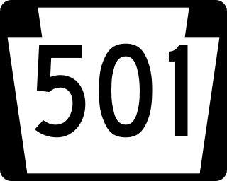
Pennsylvania Route 501 is a north–south state highway in south central Pennsylvania that runs for 38.7 miles (62.3 km). Its southern terminus is at U.S. Route 222 and PA 272 north of Lancaster, and its northern terminus is PA 895 southeast of Pine Grove. The route heads north from Lancaster and runs through suburban and rural areas in northern Lancaster County, passing through Lititz and crossing US 322 in Brickerville. PA 501 continues into Lebanon County and heads into the Lebanon Valley, where it passes through Schaefferstown and intersects US 422 in Myerstown. The route passes through western Berks County, where it has an interchange with Interstate 78 (I-78)/US 22 near the community of Bethel. PA 501 crosses Blue Mountain into Schuylkill County and continues to its northern terminus.

Pennsylvania Route 372 is an east–west highway in York, Lancaster, and Chester counties in the U.S. state of Pennsylvania. Its western terminus is at PA 74 in Lower Chanceford Township north of Delta and west of Holtwood, and its eastern terminus is at PA 82 in Coatesville. PA 372 heads east from PA 74 in York County and crosses the Susquehanna River on the Norman Wood Bridge. The route continues through Lancaster County, intersecting PA 272 in Buck, U.S. Route 222 and PA 472 in Quarryville, and PA 896 in Georgetown. PA 372 crosses into Chester County and intersects PA 41 in Atglen and PA 10 in Parkesburg before continuing to Coatesville. PA 372 is a two-lane undivided road throughout its length.
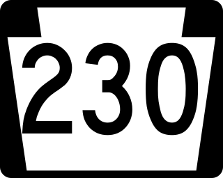
Pennsylvania Route 230 is a 28.4-mile (45.7 km) long state route in central Pennsylvania. Its western terminus is at an intersection with U.S. Route 22 in Harrisburg. Its eastern terminus is at an interchange with PA 283 near Salunga. The route passes northwest-southeast through Dauphin and Lancaster counties and serves as a surface road parallel to the PA 283 freeway that connects the cities of Harrisburg and Lancaster. Along the way, PA 230 passes through Middletown, Elizabethtown, and Mount Joy. The route intersects the Airport Connector near the Harrisburg International Airport, PA 441 and PA 341 in the Middletown area, PA 241 and PA 743 in Elizabethtown, and PA 772 in Mount Joy.
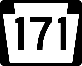
Pennsylvania Route 171 is a 40.17-mile-long (64.65 km) north–south state highway located in northeast Pennsylvania. The southern terminus of the route is at U.S. Route 6 Business in Carbondale. The northern terminus is officially at an intersection with US 11, 250 feet (76 m) to the west of Interstate 81 (I-81).

Pennsylvania Route 999 is a 9.44-mile-long (15.19 km), east–west state highway located in western Lancaster County, Pennsylvania. The western terminus is at PA 441, which has its southern terminus at this intersection, in Washington Boro. The eastern terminus is at PA 462 in Lancaster. PA 999 heads east from Washington Boro to rural areas to Millersville. Upon reaching Millersville, the route heads into developed areas and turns northeast, crossing PA 741. PA 999 continues northeast to its eastern terminus. The route is a two-lane undivided road its entire length. Between Millersville and Lancaster, the route follows a 19th-century private turnpike that runs along the Manor Road that was created in 1742. PA 999 was designated in 1928 between Millersville and U.S. Route 30 /PA 1 in Lancaster. The route was extended west to its current terminus at PA 441 in the 1950s.
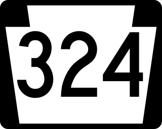
Pennsylvania Route 324 is a 13.3-mile-long (21.4 km) state highway located in the western part of Lancaster County, Pennsylvania. The southern terminus is at State Route 3038 in the community of Pequea along the east bank of the Susquehanna River in Martic Township. The northern terminus is at U.S. Route 222 /PA 272 in Lancaster. PA 324 heads northeast from Pequea parallel to the Pequea Creek. The route continues north to New Danville, where it has a concurrency with PA 741. From here, PA 324 runs parallel to the Conestoga River to its northern terminus in the southern part of Lancaster. The northern portion of PA 324 follows the Lancaster and New Danville Turnpike, a 19th-century turnpike. PA 324 was designated in 1928 to run from PA 124 at Penn Grant Road north to PA 124 in New Danville, while PA 124 was designated on the remainder of the road between Lancaster and Pequea, where it crossed the Susquehanna River on a bridge towards York. By 1930, PA 324 was paved and the PA 124 bridge over the river was removed. PA 324 was extended to its current length in the 1930s.

U.S. Route 1 (US 1) is a major north–south U.S. Route, extending from Key West, Florida, in the south to Fort Kent, Maine, at the Canada–United States border in the north. In the U.S. state of Pennsylvania, US 1 runs for 81 miles (130 km) from the Maryland state line near Nottingham northeast to the New Jersey state line at the Delaware River in Morrisville, through the southeastern portion of the state. The route runs southwest to northeast and serves as a major arterial road through the city of Philadelphia and for many of the suburbs in the Delaware Valley metropolitan area. South of Philadelphia, the road mostly follows the alignment of the Baltimore Pike. Within Philadelphia, it mostly follows Roosevelt Boulevard. North of Philadelphia, US 1 parallels the route of the Lincoln Highway. Several portions of US 1 in Pennsylvania are freeways, including from near the Maryland state line to Kennett Square, the bypass of Media, the concurrency with Interstate 76 and the Roosevelt Expressway in Philadelphia, and between Bensalem Township and the New Jersey state line.

Delaware Route 48 (DE 48) is a state highway in New Castle County, Delaware. The route runs from DE 41 in Hockessin east to U.S. Route 13 Business in downtown Wilmington. The route passes through suburban areas of Wilmington along Lancaster Pike, intersecting DE 100 and DE 141. DE 48 continues into Wilmington as Lancaster Avenue and intersects DE 2, where it splits into the one-way pair of Lancaster Avenue eastbound and Second Street westbound. Upon reaching downtown Wilmington, the route intersects Interstate 95 (I-95)/US 202 and DE 4 before continuing to the eastern terminus.
U.S. Route 30 Business is a 19-mile (31 km) business route of US 30 in Chester County, Pennsylvania. The route follows the former alignment of US 30 between Sadsbury Township and East Whiteland Township, passing through Coatesville, Downingtown, and Exton. US 30 follows a freeway bypass between these two points. The present alignment of US 30 Bus. was originally part of a turnpike called the Philadelphia and Lancaster Turnpike that was completed in 1794. The state took over the turnpike at the beginning of the 20th century. In 1913, present-day US 30 Bus. was incorporated into the Lincoln Highway, an auto trail that ran from San Francisco east to New York City. The Lincoln Highway through Pennsylvania became Pennsylvania Route 1 (PA 1) in 1924. US 30 was designated concurrent with PA 1 west of Philadelphia in 1926, with the PA 1 designation removed two years later. US 30 was widened into a multilane road through Chester County in the 1930s. In the 1960s, US 30 was moved to a freeway bypass around Coatesville and Downingtown, with US 30 Bus. designated onto the former alignment of US 30. In 1995, US 30 Bus. was extended east when US 30 was extended to bypass Exton.

U.S. Route 13 (US 13) is a United States Numbered Highway running from Fayetteville, North Carolina, north to Morrisville, Pennsylvania. The route runs for 49.359 miles (79.436 km) through the Delaware Valley in the U.S. state of Pennsylvania. The route enters the state from Delaware in Marcus Hook, Delaware County. It continues northeast through Delaware County, passing through the city of Chester before heading through suburban areas along Chester Pike to Darby. US 13 enters the city of Philadelphia on Baltimore Avenue and runs through West Philadelphia to University City, where it turns north along several city streets before heading east across the Schuylkill River along Girard Avenue. The route turns north and heads to North Philadelphia, where it runs northeast along Hunting Park Avenue. US 13 becomes concurrent with US 1 on Roosevelt Boulevard, continuing into Northeast Philadelphia. US 13 splits southeast on a one-way pair of streets before heading northeast out of the city on Frankford Avenue. The route continues into Bucks County as Bristol Pike, heading northeast to Bristol, where it turns into a divided highway. US 13 becomes a freeway in Tullytown and continues north to its terminus at US 1 in Falls Township, near Morrisville. US 13 roughly parallels Interstate 95 (I-95) through its course in Pennsylvania.

Pennsylvania Route 247 is a 50.5-mile-long (81.3 km) state highway located in Lackawanna, Susquehanna, and Wayne counties in Pennsylvania. The southern terminus is at Interstate 84 (I-84) in Mount Cobb. The northern terminus is at PA 370 in Preston Park. The route heads north from I-84 in Lackawanna County and crosses the Moosic Mountains before it heads into suburban areas northeast of Scranton, serving Jessup, Blakely, and Archbald. In this area, PA 247 has an interchange with the U.S. Route 6 freeway in Jessup and intersects US 6 Business in Archbald. Past here, the route continues north into rural areas in northern Lackawanna County. PA 247 heads into the southeastern part of Susquehanna County and passes through Forest City, where it forms a short concurrency with PA 171. The route continues into Wayne County and heads east before curving to the north and continuing to its terminus at PA 370.
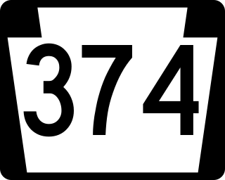
Pennsylvania Route 374 (PA 374) is a 17.7-mile-long (28.5 km) state highway located in Susquehanna County, Pennsylvania. The western terminus is at PA 92 in the community of Glenwood in Lenox Township. The eastern terminus is at PA 171 and PA 371 in the community of Herrick Center near Union Dale in Herrick Township. The route is a two-lane undivided road that passes through rural areas of farms and woods in southern Susquehanna County. PA 374 intersects PA 407 and Interstate 81 (I-81) in Lenox Township and forms a concurrency with PA 106 in Clifford Township.
Several special routes of U.S. Route 30 exist. In order from west to east they are as follows.
The following is a list of former state routes in Pennsylvania. These roads are now either parts of other routes or no longer carry a traffic route number. This list also includes original routes of numbers that were decommissioned and later reactivated in other locations in which most of these are still active today.
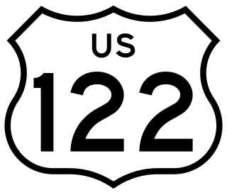
U.S. Route 122 was a United States Numbered Highway that was a spur of US 22. Located in the state of Pennsylvania, it existed from 1935 to 1963. At its greatest extent, the route ran from US 1 and Pennsylvania Route 472 in Oxford north to US 11 and PA 14 in Northumberland. Along the way, US 122 passed through Parkesburg, Honey Brook, Morgantown, Reading, Hamburg, Schuylkill Haven, Pottsville, Frackville, Ashland, Centralia, Mount Carmel, Shamokin, and Sunbury.