This is a list of the lists of islands in the world grouped by country, by continent, by body of water, and by other classifications. For rank-order lists, see the other lists of islands below.

The administrative divisions of France are concerned with the institutional and territorial organization of French territory. These territories are located in many parts of the world. There are many administrative divisions, which may have political, electoral (districts), or administrative objectives. All the inhabited territories are represented in the National Assembly, Senate and Economic and Social Council and their citizens have French citizenship and elect the President of France.
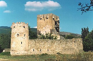
Shida Kartli is a landlocked administrative region (Mkhare) in eastern Georgia. It comprises a central part of the historical-geographic province of Shida Kartli. With an area of 5,729 square kilometres (2,212 sq mi), Shida Kartli is the 8th largest Georgian region by land area. With 284,081 inhabitants, it is Georgia's seventh-most-populous region. Shida Kartli's capital and largest city, Gori, is the 5th largest city in Georgia.

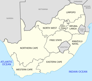
The subdivisions of Georgia are autonomous republics, regions, and municipalities.

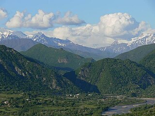
Racha-Lechkhumi and Kvemo Svaneti is a region (mkhare) in northwestern Georgia with a population of 28,500 (2021), making it the most sparsely populated region in the country. It has a nominal area of 4,954 km2 (1,913 sq mi), of which 4,600 km2 (1,800 sq mi) is de facto controlled by Georgia. The remainder is effectively under South Ossetian control. The region has Ambrolauri as its administrative center and Parmen Margvelidze is governor of the region since June 2021. Racha-Lechkhumi and Kvemo Svaneti includes the historical provinces of Racha, Lechkhumi and Kvemo Svaneti.

A mkhare is a type of administrative division in the country of Georgia. It is usually translated as "region".

Akhalgori is a town in Georgia. The name Akhalgori is the original historical name of the town used by the Georgians and officials, whereas Leningor is the name given to the city in the Soviet era and used by the South Ossetians. The town is situated on the banks of the River Ksani, height above sea level — 800 m.
This is a list of articles holding galleries of maps of present-day countries and dependencies. The list includes all countries listed in the List of countries, the French overseas departments, the Spanish and Portuguese overseas regions and inhabited overseas dependencies.

This outline of Australia is an overview of and topical guide to various aspects of the country of Australia.

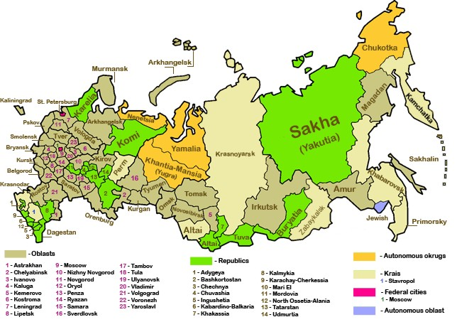
Russia, the largest country in the world, has international land borders with fourteen sovereign states as well as 2 narrow maritime boundaries with the United States and Japan. There are also two breakaway states bordering Russia, namely Abkhazia and South Ossetia. The country has an internationally recognized land border running 22,407 kilometres (13,923 mi) in total, and has the second-longest land border of any country in the world, after China. The borders of the Russian Federation were mostly drawn sinnb nce 1956, and have remained the same after the dissolution of the Soviet Union. In 2014, Russia annexed Ukraine's Crimean peninsula in a move that remains internationally unrecognized.
Oni is a district of Georgia, in the region of Racha-Lechkhumi and Kvemo Svaneti. Its main town is Oni.

The chronological order in which countries enter in the new year is determined by the time zone of that particular country or region. The headers display the time and timezone.
The Devonshire White Paper or Devonshire Declaration was a document written in 1923 by the colonial secretary Victor Cavendish, 9th Duke of Devonshire, regarding the status of settlers and natives in the Kenya Colony, and East Africa more broadly. The paper stated that whenever the interests of the native Africans clashed with those of Asian, European, or Arab settlers, those of the Africans should prevail. The Declaration blocked the move towards self-government advocated by the colonialists, and in its place advocated a policy of trusteeship, whereby the imperial state would protect the interests of Africans. Although the Paper had little effect on the welfare of native Africans, it nonetheless set a precedent for future conflict resolution between the various groups living in the colony.
Dzari is a settlement at the head of the river Kornisistskali in the Tskhinvali District of South Ossetia, Georgia. It is located 12 kilometers west of Tskhinvali. Community center, villages: Brili, Gardanta, Dampaleti, Zemo Dodoti, Kverneti, Mebrune, Rustavi, Kvemo Dodoti, Chelekhsata, Jabita.
This page is based on this
Wikipedia article Text is available under the
CC BY-SA 4.0 license; additional terms may apply.
Images, videos and audio are available under their respective licenses.