Royapettah

Last updated

Royapettah
Express Avenue, Chennai 1.JPG
Chennai area locator map.svg
Red pog.svg
Royapettah
India Tamil Nadu location map.svg
Red pog.svg
Royapettah
India location map.svg
Red pog.svg
Royapettah
Coordinates: 13°03′14.0″N80°15′50.6″E / 13.053889°N 80.264056°E / 13.053889; 80.264056
Country Flag of India.svg India
State TamilNadu Logo.svg Tamil Nadu
District Chennai
Taluk Egmore
Metro Chennai
Zone & Ward 9 & 118
Elevation
9 m (29 ft)
Population
 (2011)
  Total14,912 [1]
Languages
   Official Tamil
Time zone UTC+5:30 (IST)
PIN
600014
Telephone code044
Vehicle registration TN-01
Civic agency Greater Chennai Corporation
Planning agency CMDA
City Chennai
LS Chennai Central (Lok Sabha constituency)
VS Thousand Lights
MP Dayanidhi Maran
MLA Vacant
MC Vacant
Website http://www.chennaicorporation.gov.in/

Royapettah is a neighbourhood of Chennai, India.

Location

Royapettah is located at the central part of the city of Chennai, with an elevation of 9 m (29 ft.) above mean sea level. [2] The neighbourhood comes under Teynampet Zone (number 9) and ward number 118 (old number 112) of the Chennai Corporation. [3]

Contents

Boundaries

Royapettah is bounded in the direction of Northwest by Nungambakkam, North by Chintadripet, Northeast by Chepauk, West by Gopalapuram, East by Triplicane, Southwest by Teynampet, South by Mylapore and Southeast by Marina Beach.

History

Anna Salai near the Thousand Lights Mosque Thousand Lights Mosque (6708373959).jpg
Anna Salai near the Thousand Lights Mosque

Royapettah, along with the suburbs of Nungambakkam and Teynampet, was part of the Great Choultry Plain, as the British had it in their records back in 1721. [4] Soon after the arrival of the British in the city in the early 17th century, a large Eurasian population started settling in Royapettah and surrounding regions in the 17th and 18th centuries. [5] Muslim settlements started appearing in the neighbourhood from the latter half of the 18th century. [6] In 1798, the British East India Company constructed the Amir Mahal to house its administrative offices. [7] When the Company annexed the Carnatic kingdom in 1855 with the Doctrine of Lapse, the Chepauk Palace, the official residence of the Nawabs, was auctioned off and purchased by the Madras government. [7] The Nawab moved to a building called Shadi Mahal on Triplicane High Road and lived there. [7] However, the British granted the Amir Mahal to the Prince of Arcot and the office building was soon converted into a palace by Robert Chrisholm. [8] In 1876, the Nawab moved in with his family into the Amir Mahal, which has since been the residence of the Nawabs of Arcot. [7]

The Purification Church was apparently the first church built in the neighbourhood around 1769. However, this was replaced in 1848 by the Presentation Church, also known as the Wallajahpet Church. This was built on a 21-ground plot granted by the Nawab in 1813. [9] The Subramania Swamy Temple located adjacent to the church was built around 1889 in the area now known as Zam Bazaar. [9] The Thousand Lights Mosque was built in 1810. [10] In 1819, the first Methodist chapel in India was opened in Royapettah by the Methodist missionary James Lynch who settled down in the neighbourhood a year before. The church grew into the Wesley Church, which was dedicated in 1853. [11]

In 1819, the Madras Eye Infirmary (MEI) was founded in the neighbourhood. [12] [13] It remains the oldest specialist eye hospital in Asia and the second oldest in the world. [12] Modelled on Moorfields Eye Hospital in London, the hospital was moved to Egmore in 1884 and became the Government Ophthalmic Hospital in 1886. [12] The Government Royapettah Hospital was opened in 1911. [14] The first superintendent of the hospital was Col. C. Donovan. [15]

In 1858, Monahan Girls' School, one of the oldest Protestant schools, was opened in Royapettah. [11] In 1928, the neighbourhood had one of the earliest school for physical education in the Wesley School. [16] The Royapettah post office appeared in 1834 as a subsidiary of the General Post Office at George Town. [17] With the opening of the Woodlands Hotel in 1938 and the Modern Hindu Hotel on General Patter's Road, the neighbourhood became the home to the first Indian-style, vegetarian hotels in the city. [18]

In the 1930s, a clock tower was built in the neighbourhood. Gani and Sons, formerly known as the South India Watch Company, provided the clock instrument for the clock tower. [19]

By the middle of the 20th century, Anna Salai had become the hub of automobile manufacturers in South India, including conglomerates such as Simson, Addison Motor Company, Royal Enfield, South India Automotive Company, George Oaks of the Amalgamations Group, Standard Motor Products of India, and TVS Motor Company. [20] This, coupled with low rental rates in the nearby streets, resulted in automobile spare manufacturers and dealers opening shops in the region, including Pudupet, Chintadripet, General Patters Road, Whites Road, State Bank Street and so forth. [20] General Patters Road became the hub of automobile service and spare dealers. [20] This resulted in the region coming to be called The Detroit of India. [20]

Demographics

As of Census of India 2011, the total population of Royapettah was 14,912, including 7,444 males and 7,468 females. [21]

Politics

Royapettah comes under the Thousand Lights Assembly constituency and the Chennai Central Lok Sabha constituency. The suburb hosts the headquarters of an Indian regional political party, All India Anna Dravida Munnetra Kazhagam, founded by the former chief minister of Tamil NaduM. G. Ramachandran (M.G.R.). The headquarters is called Puratchi Thalaivar M.G.R. Maaligai, which is located at V.P. Raman Salai. The building was donated to the party in 1986 by M.G.R.'s wife and the former chief minister of Tamil Nadu, V. N. Janaki Ramachandran. Also, the headquarters of an Indian regional political party, Amma Makkal Munnettra Kazagam, founded by the former member of parliament of the Republic of IndiaT. T. V. Dhinakaran, is located at Westcott Salai.

Facilities

The Government Royapettah Hospital, which serves as the chief healthcare institution in the neighbourhood, is the city's largest peripheral hospital [22] and its limit extends up to Chengalpattu. [23] Second in the government sector next only to the Rajiv Gandhi Government General Hospital, the Royapettah Government Hospital has a full-fledged emergency department, including triage area, resuscitation bay and colour-coded zones, per the Tamil Nadu Accident and Emergency Care Initiative (TAEI) guidelines. [24]

Transportation

Located centrally within the city, Royapettah is well connected to other neighbourhoods of Chennai, with several bus routes passing through it. Whites road, Avvai Shanmugam Salai and Royapettah High Road are the primary streets in the neighbourhood. The city's arterial Anna Salai tangentially touches the western periphery of the neighbourhood. Royapettah has a flyover on Royapettah High Road. There are plans to build a 5-kl/day sewage treatment plant along the pliers of the flyover and is under construction. [25]

Royapettah is served by the LIC and Thousand Lights metro stations on the Blue Line of the Chennai Metro, which runs along the western periphery of the neighbourhood. The Royapettah metro station on the Purple Line of the Chennai Metro is under construction. [26]

Adjacent communities

See also

Citations

  1. "Census of India 2011: District Census Handbook, State Tamil Nadu, Chennai (Royapettah is ward no. 0112)" (PDF). Office of the Registrar General and Census Commissioner, India. Retrieved 19 October 2020.
  2. "Search Coordinates and Elevation of Royapettah Tamil Nadu India". Google Earth. Retrieved 9 October 2020.
  3. "Welcome to Greater Chennai Corporation/Zone details". Greater Chennai Corporation. Retrieved 6 November 2020.
  4. Muthiah 2014, p. 442.
  5. Muthiah 2014, pp. 77–78.
  6. Muthiah 2014, p. 5.
  7. 1 2 3 4 Muthiah 2004, p. 168.
  8. Jayewardene-Pillai 2007, p. 200.
  9. 1 2 Muthiah 2014, p. 197.
  10. Priya and Radhakrishnan, 2016, p. 43.
  11. 1 2 Muthiah 2014, p. 389.
  12. 1 2 3 Muthiah 2014, p. 372.
  13. Parthasarathy, The Hindu 16 October 2012.
  14. TNHealth.org, n.d.
  15. Muthiah 2014, p. 369.
  16. Muthiah 2014, p. 100.
  17. Muthiah 2014, pp. 330–331.
  18. Muthiah 2014, pp. 76–77.
  19. Venkatraman, The New Indian Express, 27 August 2012.
  20. 1 2 3 4 The Hindu, 6 July 2018.
  21. "District Census Handbook, Chennai, Village and Town Directory" (PDF). Directorate of Census Operations, Tamil Nadu. Office of the Registrar General and Census Commissioner, India. p. 30. Retrieved 21 October 2020.
  22. The Times of India, 17 August 2012.
  23. The Hindu, 30 April 2013.
  24. Josephine, The Hindu, 28 April 2019.
  25. The Times of India, 14 September 2020.
  26. The Hindu, 3 October 2021.

Related Research Articles

<span class="mw-page-title-main">T. Nagar</span> Neighborhood of Chennai, India

Thyagaraya Nagar, commonly known as T. Nagar, and historically known as East Mambalam, is a very affluent commercial and residential neighbourhood in Chennai, Tamil Nadu, India. It is surrounded by Nungambakkam in the North, Teynampet in the East, Nandanam in the South-East, C.I.T. Nagar in the South and West Mambalam and Kodambakkam in the West. The stretch between Duraiswamy Road and T. Nagar Bus Stand has some of the costliest real estates in Chennai. It was constructed between 1923 and 1925 by the Madras Presidency government of the Raja of Panagal as a part of town planning activities initiated according to the Madras Town Planning Act of 1920. The town was named after P. Thyagaraya Chetty. The streets, parks and localities in the new neighbourhood were named after important officials in the provincial government.

Gopalapuram is a prime residential locality in Chennai, Tamil Nadu, India. It is surrounded by Royapettah in the North and East, Mylapore in the South-East, Teynampet in the South and Thousand Lights in the West. It is located 17 km (11 mi) from the Chennai International Airport and 3 km (1.9 mi) from Chennai Central railway station. It is located in between Dr. Radhakrishnan Salai and Anna Salai. Avvai Shanmugam Road passes through Gopalapuram, dividing it into North Gopalapuram and South Gopalapuram. Gopalapuram comes under Chennai Central Lok Sabha constituency.

<span class="mw-page-title-main">Anna Nagar</span> Neighborhood of Chennai, India

Anna Nagar, is a neighbourhood in the metropolitan city of Chennai, India. Named after former chief minister of Tamil Nadu C. N. Annadurai, it is located in the north-western part of Chennai and forms a part of the Aminjikarai taluk and the Anna Nagar Zone. It is one of the prime residential areas in Chennai and is home to several prominent doctors, lawyers and politicians. Real estate prices are among the highest in the city. A recent addition to the area is VR Chennai Mall, located near Shanthi Colony and Thirumangalam junction.

<i>Swadesamitran</i> Defunct Tamil language newspaper

Swadesamitran was a Tamil language newspaper that was published from the then Madras city from 1882 to 1985. One of the earliest Tamil newspapers and the longest in print, Swadesamitran was founded by Indian nationalist G. Subramania Iyer four years after he had started The Hindu. The newspaper was sold to A. Rangaswami Iyengar of the Kasturi family in 1915 and the newspaper remained with them until its liquidation in 1985.

<span class="mw-page-title-main">Triplicane</span> Neighborhood in Chennai, India

Thiruvallikeni known as Triplicane, is one of the oldest neighbourhoods of Chennai, India. It is situated on the Bay of Bengal coast and about 0.6 km (0.37 mi) from Fort St George. The average elevation of the neighbourhood is 14 metres above sea level.

Tiruvottriyur is a neighbourhood in North Chennai, administered by the Greater Chennai Corporation. It is part of the Tondiarpet division, located to the north of Chennai. It is one of the fifteen administrative zones in the Greater Chennai Corporation. The zone is called Zone 1 (Tiruvottriyur).

<span class="mw-page-title-main">Teynampet</span> Neighbourhood in Chennai, Tamil Nadu, India

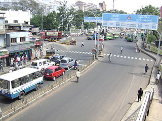
Teynampet, also Teynampettai, is one of the busiest commercial localities in the city of Chennai, Tamil Nadu, India. Part of the city's central business district, it is surrounded by Gopalapuram in the north, Mylapore in the east, Alwarpet in the south, Nandanam in the south-west and T.Nagar in the west. The Teynampet Signal is one of the most important road junctions in Chennai and witnesses some of the worst traffic during peak hours in the city. Teynampet is home to some of the most expensive real estate and properties in Chennai. The Teynampet section of Anna Salai hosts some of the most important Government offices and luxury hotels in the city.

<span class="mw-page-title-main">Chennai Book Fair</span> Annual book fair organized in Chennai, India

Chennai Book Fair is an annual book fair organized in Chennai, India by the Booksellers and Publishers Association of South India (BAPASI). The fair typically lasts for about two weeks during the New Year-Pongal season, that is between the last week of December and the third week of January. It is the second largest book fair in the country after the Kolkata Book Fair. All major Tamil and English publishing houses participate in this fair. It is considered as an important event in the Chennai cultural calendar along with the Chennai music season.

<span class="mw-page-title-main">Anna Salai</span> Arterial road in Chennai, India

Anna Salai, formerly known as St. Thomas Mount Road or simply Mount Road, is an arterial road in Chennai, India. It starts at the Cooum Creek, south of Fort St George, leading in a south-westerly direction towards St. Thomas Mount, and ends at the Kathipara Junction in Guindy. Beyond the Kathipara Junction, a branch road arises traversing westwards to Poonamallee to form the Mount-Poonamallee Road while the main branch continuing southwards to Chennai Airport, Tambaram and beyond to form Grand Southern Trunk Road. Anna Salai, which is more than 400 years old, is acknowledged as the most important road in Chennai city. The head offices of many commercial enterprises and public buildings are located along Anna Salai. It is the second longest road in Chennai, after EVR Periyar Salai.

The Egmore Eye Hospital, officially the Regional Institute of Ophthalmology and Government Ophthalmic Hospital, is a public eye hospital in Chennai, India. Considered the oldest eye hospital in Asia, the institute was established in 1819 and is the second oldest hospital of its kind, next only to the Moorfields Eye Hospital in the United Kingdom.

<span class="mw-page-title-main">George Town, Chennai</span> Neighbourhood in Chennai District, Tamil Nadu, India

George Town is a neighbourhood in Chennai, Tamil Nadu, India. It is near the Fort Saint George, Chennai. It is also known as Muthialpet and Parry's corner. It is an historical area of Chennai city from where its expansion began in the 1640s. It extends from the Bay of Bengal in the east to Park town on the west. The Fort St. George is on the south, to Royapuram in the north. The Fort St. George houses the Tamil Nadu Legislative Assembly and the Secretariat. The High court of Tamil Nadu at Chennai, Dr. Ambedkar Law College, Stanley Medical College and Hospital are located here.

Madhavaram Milk Colony is a neighbourhood in northern Chennai, a metropolitan city in Chennai district in the Indian state of Tamil Nadu.

<span class="mw-page-title-main">Chepauk Palace</span> Official residence of the Nawab of Arcot

Chepauk Palace was the official residence of the Nawab of Arcot from 1768 to 1855. It is situated in the neighbourhood of Chepauk in Chennai, India and is constructed in the Indo-Saracenic style of architecture.

<span class="mw-page-title-main">Amir Mahal</span> Building in India

Amir Mahal is the official residence of the titular Nawab of Arcot and his family. Situated in Royapettah, a neighbourhood of Chennai, India, it was constructed in Indo-Saracenic style in 1798, the Amir Mahal has been the residence of the family since 1876. The Prince of Arcot, Nawab Mohammed Abdul Ali, lives in the palace with his family.

This is a timeline of major events in the history of Chennai.

Chennai, with historically rich records dating at least from the time of the Pallavas, houses 2,467 heritage buildings within its metropolitan area (CMA), the highest within any metropolitan area limit in India. Most of these buildings are around 200 years old and older. Chennai is home to the second largest collection of heritage buildings in the country, after Kolkata. The official list of heritage buildings was compiled by the Justice E. Padmanabhan committee. The Tamil Nadu Assembly passed the Heritage Commission Act in 2012 to preserve old heritage structures.

<span class="mw-page-title-main">EVR Periyar Salai</span> Arterial road in Chennai, India

EVR Periyar Salai (EVR High Road), earlier known as Poonamallee High Road(NH 48) and originally the Grand Western Trunk Road, is an arterial road in Chennai, India. It is the longest road in Chennai. Running from east to west, the 14-kilometre (8.7 mi) road starts at Muthuswamy Bridge near Madras Medical College at Park Town and ends near Maduravoyal Junction via Kilpauk, Aminjikarai, Anna Nagar Arch, Arumbakkam, Koyambedu. It further continues west towards Poonamallee and traverses the towns of Sriperumbudur, Walajapet, and Ranipet.

Government Royapettah Hospital is a major state-owned hospital situated in Royapettah in Chennai, India. The hospital with 712 beds is funded and managed by the state government of Tamil Nadu. It was founded in 1911 and is attached to Directorate of Medical Education. It is the city's largest peripheral hospital, and its limit extends up to Chengalpattu.

<span class="mw-page-title-main">Royapettah Clock Tower, Chennai</span> Clock tower in Chennai, India

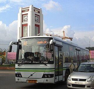
Royapettah Clock Tower is a standalone clock tower in the neighbourhood of Royapettah in Chennai, India. It is one of the four standalone clock towers in the city, the other three being the ones at Mint, Doveton and Pulianthope.

Thiru Vi Ka Salai, or the Thiru Vi Ka High Road, is one of the main streets in the downtown region of Chennai, Tamil Nadu, India. Running from north to south, the street branches off of the arterial Anna Salai north of the LIC Building and ends at Luz Corner in Mylapore, continuing as the Ramakrishna Mutt Road. The street connects the neighbourhoods of Royapettah, Mylapore and Gopalapuram. The street includes three individual stretches formerly known as General Patters Road, Westcott Road and Royapettah High Road, respectively. The longest stretch, formerly known as the Royapettah High Road, runs to a length of 1.17 km (0.73 mi). The presence of numerous automobile dealers on the northern end of the street resulted in Chennai coming to be known as The Detroit of India.

References

Further reading