Piloting or pilotage is the process of navigating on water or in the air using fixed points of reference on the sea or on land, usually with reference to a nautical chart or aeronautical chart to obtain a fix of the position of the vessel or aircraft with respect to a desired course or location. Horizontal fixes of position from known reference points may be obtained by sight or by radar. Vertical position may be obtained by depth sounder to determine depth of the water body below a vessel or by altimeter to determine an aircraft's altitude, from which its distance above the ground can be deduced. Piloting a vessel is usually practiced close to shore or on inland waterways. Pilotage of an aircraft is practiced under visual meteorological conditions for flight.
The International Association of Marine Aids to Navigation and Lighthouse Authorities (IALA), previously known as International Association of Lighthouse Authorities, is an intergovernmental organization founded in 1957 to collect and provide nautical expertise and advice. IALA is also known by its French name of Association Internationale de Signalisation Maritime (AISM).

A lateral buoy, lateral post or lateral mark, as defined by the International Association of Marine Aids to Navigation and Lighthouse Authorities, is a sea mark used in maritime pilotage to indicate the edge of a channel.
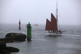
A sea mark, also seamark and navigation mark, is a form of aid to navigation and pilotage that identifies the approximate position of a maritime channel, hazard, or administrative area to allow boats, ships, and seaplanes to navigate safely.
Leading lights, also known as range lights in the United States, are a pair of light beacons used in navigation to indicate a safe passage for vessels entering a shallow or dangerous channel; they may also be used for position fixing. At night, the lights are a form of leading line that can be used for safe navigation. The beacons consist of two lights that are separated in distance and elevation, so that when they are aligned, with one above the other, they provide a bearing. Range lights are often illuminated day and night.

A day beacon is an unlighted nautical sea mark. A signboard identifying it is called a day mark. Day beacons typically mark channels whose key points are marked by lighted buoys. They may also mark smaller navigable routes in their entirety. They are the most common navigation aid in shallow water, as they are relatively inexpensive to install and maintain. Navigation around them is similar to that around other navigation aids.

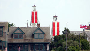
A navigational aid (NAVAID), also known as aid to navigation (ATON), is any sort of signal, markers or guidance equipment which aids the traveler in navigation, usually nautical or aviation travel. Common types of such aids include lighthouses, buoys, fog signals, and day beacons.
The High lighthouse or pillar lighthouse is one of three lighthouses in Burnham-on-Sea, Somerset, England. A Grade II listed building, it is no longer functional as a lighthouse and has been converted for use as a private dwelling.

The Low Lighthouse is one of three historic lighthouses in Burnham-on-Sea, Somerset, England, and the only one of the three which is still active. It is a Grade II listed building and stands on the foreshore. First lit in 1832, the Low Lighthouse operated in conjunction with the (onshore) High Lighthouse for 137 years. Then, in 1969 the Low Lighthouse was deactivated; but later, in 1993, the Low Lighthouse was re-established and the High Lighthouse was instead decommissioned).
The Gibraltar Detached Mole Lighthouse is one of several lighthouses in Gibraltar, a British Overseas Territory at the south end of the Iberian Peninsula. The lighthouse is positioned west of the Rock of Gibraltar, on the Detached Mole at the south entrance to Gibraltar Harbour.
The Gibraltar Detached Mole Lighthouse is one of several lighthouses in Gibraltar, a British Overseas Territory at the south end of the Iberian Peninsula. The lighthouse is positioned west of the Rock of Gibraltar, on the Detached Mole at the north entrance to Gibraltar Harbour.

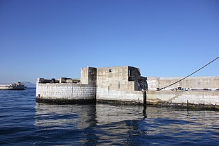
Dartmouth Harbour is a natural port located in Dartmouth, Devon, England. It is situated at the mouth of the River Dart on the English Channel. Bayard's Cove Fort is a small fort, which was built to defend the harbour's entrance. The crafts which dock at the port are mainly local fishing vessels, naval ships and luxury yachts; warships routinely visit the harbour. The River Dart is navigable from Dartmouth to the old weir location at Totnes.

The North Bull Lighthouse, is an active aid to navigation located at the mouth of the River Liffey, near Dublin, Ireland. It is one of four lighthouses that help guide shipping into the Liffey, and the Port of Dublin, all of which are operated and maintained by the Dublin Port Company.

The Haulbowline Lighthouse is an active 19th century lighthouse. Described as an "elegant, tapering stone tower" it is located at the entrance to Carlingford Lough, near Cranfield Point in County Down, Northern Ireland. The lighthouse was built on the eastern part of the Haulbowline rocks, one of a number of navigation hazards at the seaward end of Carlingford Lough, which include a notable rocky shoal or bar across the mouth of the lough. The multi-purpose light was designed to help mark the rocks and, when first built, the depth of water over the bar, as well as acting as a landfall light for ships entering from the Irish Sea. Associated with the lighthouse are the leading lights at Green Island and Vidal Bank which mark the safe channel along Carlingford Lough, with Haulbowline displaying a reserve light in case of problems with these leading lights.
The PEL sector light is a projector style marine beacon which is used to guide maritime vessels. It does this by projecting a colored sector out to sea with very sharp color changes as the mariner transitions from one sector to the next. Typical PEL sector lights will have a complete color change over 1 meter when the mariner is 5 km from the beacon. The PEL's application becomes relevant to the mariner when combined with a local marine chart as each application of a PEL varies greatly. They are used for guiding vessels into harbor, traffic separation or to illuminate hazards. The main advantage to a PEL sector light is that it has very sharp transitions between colors and is bright enough to be used in daylight with up to 10 Nautical Miles or 18.5 km visibility.

Büsum Lighthouse is an active 20th century lighthouse located in Büsum a fishing and tourist town, which lies on North Sea coast of Schleswig-Holstein, in Germany. The current lighthouse is the second to be built in the town, two other separate breakwater lights mark the entrance of the small harbour from the North Sea.

The North Bank or Northbank Lighthouse, is an active aid to navigation located at the mouth of the River Liffey, near Dublin, Ireland. It is one of four lighthouses that help guide shipping into the Liffey, and the Port of Dublin, all of which are operated and maintained by the Dublin Port Company. Built in 1882, it also affectionately called The Tea Caddy due to its architecture, and has also been described as "resembling a giant mailbox on stilts".

The French Pass Lighthouse together with a stone beacon mark a channel through the turbulent waters between Rangitoto ki te Tonga / D’Urville Island and the South Island. The New Zealand List of Lights calls the lighthouse Channel Point.


