Southwestern Ontario

Last updated
Southwestern Ontario
Sud-Ouest de l'Ontario (French)
Secondary region
Map of Ontario SOUTHWESTERN.svg
Coordinates: 43°30′N81°00′W / 43.500°N 81.000°W / 43.500; -81.000
Country Flag of Canada (Pantone).svg Canada
Province Flag of Ontario.svg Ontario
Area
  Total36,797.54 km2 (14,207.61 sq mi)
Population
 (2021)
  Total2,796,367
  Density76/km2 (200/sq mi)
Time zone UTC−5 (EST)
  Summer (DST) UTC−4 (EDT)
Postal code prefixes
N
Area code(s) 519, 226, 548, 905, 289, 365

Southwestern Ontario (census population 2,796,367 in 2021) (French: Sud-Ouest de l'Ontario) is a secondary region of Southern Ontario in the Canadian province of Ontario. It occupies most of the Ontario Peninsula bounded by Lake Huron, including Georgian Bay, to the north and northwest; the St. Clair River, Lake St. Clair, and Detroit River, to the west; and Lake Erie to the south. To the east, on land, Southwestern Ontario is bounded by Central Ontario and the Golden Horseshoe.

Contents

Definitions

Southwestern Ontario is often not consistently defined. The Government of Ontario, in certain documents, classifies municipalities along the eastern side of Southwestern Ontario near the Grand River, including Wellington County, Waterloo Region, and Brant County, as part of the Greater Golden Horseshoe region that surrounds western Lake Ontario, mainly due to the presence of modern transportation connections that link these areas to the core sections of the Golden Horseshoe. [1] A more traditional definition of the region boundary can be traced back to early colonial districts in the British Province of Quebec and Upper Canada. The Western District, originally known as the Hesse District from 1788 to 1792, [2] was originally designated as everything west of a north-south line intersecting the extreme projection of Long Point into Lake Erie, [3] which roughly follows the eastern boundaries of modern Grey, Dufferin, Wellington, Brant, and Norfolk Counties.

The northern portion of Southwestern Ontario is sometimes referred to as Midwestern Ontario. This area includes Perth, Huron, Wellington, Dufferin, Bruce, and Grey Counties, corresponding roughly with the historical boundaries of Queen's Bush, an area of crown land that did not see formal subdivision or wide-scale settlement until the 1830s.

London, Ontario in June 2009. London, Ontario, Canada- The Forest City from above.jpg
London, Ontario in June 2009.

History

Indigenous peoples had occupied Southwestern Ontario for thousands of years prior to European settlement. Archaeological sites such as the Princess Point Complex and the Parkhill Complex indicate the presence of Paleo-Indians in the area dating back approximately 11,000 years. First Nations peoples located in the region included Anishinaabe, Algonquin, Haudenosaunee (Iroquois), and Wendat peoples.

Initial European settlement and colonization of the region occurred in the 17th and 18th centuries by the French as part of the colony of Canada within New France. The oldest continually-inhabited European settlement in Southwestern Ontario is Windsor, which originated as a southerly extension of the settlement of Fort Detroit in 1701 and was established as la Petite Côte in 1749. Further development occurred under the British as part of the Province of Quebec from 1763 to 1791, and eventually the Province of Upper Canada from 1791 to 1841. One of the earliest British settlements, Port Talbot, was settled by Thomas Talbot in 1803, [4] and was amongst the first successful settlements due to the construction of Talbot Trail, one of the earliest major roads in the region. Kitchener, originally known as Ebytown and later Berlin, was established by German Mennonite and Pennsylvania Dutch settlers in 1807, after sections of the Haldimand Tract were purchased from the Six Nations in 1798. [5] London, originally called Georgiana upon its selection in 1793 as the potential site of the future capital of Upper Canada, was formally founded in 1826 by John Graves Simcoe, the first Lieutenant Governor of Upper Canada. [6] Guelph was founded in 1827 by John Galt as a headquarters for the Canada Company. Many other cities in the region did not see major settlement until the mid-19th century, when agricultural expansion was occurring. During the early-to-mid 19th century, the region was the northern terminus of the Underground Railroad for enslaved African Americans seeking escape from the United States. Thousands of slaves escaped to the region, settling and owning farms in areas such as Essex County, Chatham-Kent, and Queen's Bush. [7]

The region's economy was predominantly focused on agriculture until the late 19th century, when industrialization of the region began to occur. Southwestern Ontario emerged as an ideal location for manufacturing due to the presence of cheap and abundant hydroelectric power sourced from the nearby Niagara Falls, and eventually became Canada's manufacturing heartland, which attracted multiple heavy industrial sectors, including automotive manufacturing, chemical production, petrochemical refinement and transport, and food processing. Automotive manufacturing is central to the regional economy, with major active automotive plants being located in Windsor, London, Ingersoll, Woodstock, and Cambridge. The 2008 Financial Crisis disproportionately impacted this sector and caused a large number of plants to shut down across the region in the following years. [8] [9] [10] The 2020s saw a widespread resurgence in industrial development, predominantly due to the comparative lack of available land for development and fast-rising property prices in the Golden Horseshoe. [11] Multiple large investments in electric vehicle production were also made in the region in the 2020s, and resulted in the establishment of multiple plants for battery production in Windsor [12] and St. Thomas. [13]

Demographics

Population

Census RegionPopulation

(2021) [14]

Population

(2016) [14]

Population

(2011) [14]

Population

(2006) [14]

Population

(2001) [14]

Area

(km2) [14]

Waterloo587,165535,154507,096478,121438,5151,368.92
London-Middlesex500,563455,526439,151422,333403,1852,821.00
Windsor-Essex422,860398,953388,782393,402374,9751,662.73
Guelph-Wellington241,026222,726208,360200,425187,3132,665.36
Brant144,771134,808136,035125,099118,485817.66
Sarnia-Lambton128,154126,638126,199128,204126,9712,999.93
Oxford121,781110,846105,719102,75699,2702,036.61
Chatham-Kent104,316102,042104,075108,589107,7092,457.90
Grey100,90593,83092,56892,41189,0734,513.50
St. Thomas-Elgin94,75288,97887,46185,35181,5531,845.41
Stratford-Perth81,56576,81275,11274,34473,6752,177.78
Bruce73,39668,14766,10265,34963,8923,978.76
Norfolk67,49064,04463,17562,56360,8471,607.55
Dufferin66,25761,73556,88154,43651,0131,486.44
Huron61,36659,29759,10059,32559,7013,399.27
Total2,796,3672,599,5362,515,8162,452,7082,336,17736,797.54

Census Metropolitan Areas

Metropolitan AreaTypePopulation [15] [16] ChangeLand Area

(km2) [15]

Population

Density (/km2)

(2023) Estimate(2021)(2016)
KitchenerCambridgeWaterloo CMA 665,188575,847523,894+9.92%1092.33527.2
London CMA608,343543,551494,069+10.02%2661.48204.2
Windsor CMA467.973422,630398,718+6.00%1803.17234.4
Guelph CMA180,476165,588151,984+8.95%595.08278.3
Brantford CMA167,718144,162134,203+7.42%1074.00134.2
Chatham-Kent CA 110,986104,316102,042+2.23%2464.5242.3
Sarnia CA106,98497,59296,151+1.50%1117.2087.4
Norfolk CA73,73067,49064,044+5.38%1597.6842.2
Woodstock CA51,38746,70541,098+13.64%56.46827.2
Stratford CA35,42133,23231,470+5.60%30.02
Owen Sound CA34,75732,71231,820+2.80%624.1852.4
Centre Wellington CA33,81131,09328,191+10.29%409.4175.9
Tillsonburg CA19,76718,61515,872+17.28%22.20838.5
Ingersoll CA14,64213,69312,757+7.34%12.731,075.6

Administrative Divisions

Separated Municipalities

Regional Municipalities

Single-Tier Municipalities

Counties

Geography

Bruce Peninsula National Park near Tobermory, Ontario BrucePeninsulaON2023.jpg
Bruce Peninsula National Park near Tobermory, Ontario

Southwestern Ontario is located within the Mixedwood Plains Ecozone (as classified by Environment and Climate Change Canada, further subclassified into the Lake Erie Lowland and Manitoulin-Lake Simcoe regions), [17] which largely consists of glacial till plains underlain by sedimentary limestone bedrock. The vast majority of Southwestern Ontario maintains a relatively flat geography with rolling hills, with the exception of areas near the Niagara Escarpment in Bruce and Grey Counties, where exposed limestone cliff faces can be seen along the shores of Georgian Bay. Sandier soils are generally located near Lake Erie, resulting in the creation of a sandy escarpment along the entire north shore, in addition to many sandspit peninsulas, including Point Pelee in Essex County, Pointe aux Pins (Rondeau) in Chatham-Kent, and Long Point in Norfolk County. Pelee Island, the southernmost populated area in Canada, is located south of Point Pelee in Lake Erie.

Southwestern Ontario was originally covered by vast forests prior to agricultural development in the region. Two forest regions are located in Southwestern Ontario; [18] Carolinian forest, located predominantly along Lake Erie and the southern tip of Lake Huron, [19] and Great Lakes-St. Lawrence forest, located around Lake Huron and Georgian Bay. [20] A very small percentage of forest coverage areas remain in the region due to extensive agricultural development and urbanization, but conservation efforts are underway to preserve and/or protect these forests. Three major federally protected areas, Point Pelee National Park, Bruce Peninsula National Park, and Long Point National Wildlife Area, are located in Southwestern Ontario. In 2021, the federal government announced plans to designate a new National Urban Park in Windsor's Ojibway Prairie Complex. [21]

The Carolinian forest zone is Canada's smallest forest zone, but it is home to a very high biodiversity of species due to it being one of the warmest regions in the country. Over 500 rare and/or endangered species are located in this region [19] and is estimated to contain around 25% of Canada's species at risk, including the American badger, Midland painted turtle, Jefferson salamander, monarch butterfly, and southern flying squirrel. [22]

Climate

Koppen Climate Map of Southwestern Ontario KoppenSWOntario.png
Köppen Climate Map of Southwestern Ontario

Southwestern Ontario's climate is heavily influenced by the proximity of the Great Lakes. Winters in the region are typically milder than the rest of Ontario due to the gradual release of stored heat in the lakes. Despite this, however, portions of the region experience significantly more snow than others due to lake-effect snow caused by eastward winds. A portion of the regional Snowbelt is located in Bruce, Grey, Huron, and Middlesex Counties. [23] In a sharp contrast, Essex County and Chatham-Kent receive less snow than average due to their location further south. [24] Summers are typically hot and humid, with Windsor experiencing the warmest weather in Ontario. Summers are often cooler and less humid on the peninsulas in Lake Erie and Lake Huron. Southwestern Ontario also experiences the highest annual frequency of thunderstorms in Canada, with Windsor, Chatham-Kent, and London experiencing the most days on average with lightning per year. [25] Southwestern Ontario also regularly experiences severe weather events, including tornadoes, due to its proximity to the Great Lakes and warmer-than-average weather during the summer.

Under the Köppen climate classification, the vast majority of Southwestern Ontario has a humid continental climate, with the vast majority of the area experiencing a warm-summer Dfb climate, with the exception of Windsor and Chatham-Kent, which experiences a hot-summer Dfa climate. Additionally, a very small area near Long Point experiences a temperate oceanic Cfb climate, due to its location in Lake Erie creating slightly cooler summers and slightly warmer winters than the remainder of the province.

Economy

Agriculture

Southwestern Ontario has historically been a strong centre for Canadian agricultural production, given the abundance of arable land and warmer climate that provides for a longer growing season than the rest of the country. The vast majority of land in the region is used for agriculture. Common crops grown in the region include sweet corn, soybean, winter wheat, and canola. Tobacco was also historically grown in the tobacco belt, centred on the towns of Delhi, Aylmer, and Tillsonburg in Elgin, Oxford, and Norfolk Counties from the 1920s until the early 2000s, when Ontario bought out the tobacco quotas of most farms in the region in 2008 for $300,000,000 CAD. [26] While some tobacco farms still remain, most have switched to alternative crops, including specialty crops like ginseng, hazelnut, and mushrooms. Fruits such as blueberries, strawberries, raspberries, blackberries, gourds, apples, and tomatoes are also grown in the region. Cattle ranching is also another important agricultural industry in Southwestern Ontario, with dairy and beef farming, standardbred horse breeding and training, sheep, poultry, and pig farming being common. The dairy and cheesemaking industry in Southwestern Ontario has been predominantly concentrated in Oxford, Perth, and Wellington Counties, with the region accounting for approximately 56% of Ontario's milk production as of 2020. [27] Sugar bushes for maple syrup production also have a modest presence in the region. [28]

A strong commercial greenhouse sector has also emerged in the region, centred predominantly on the towns of Leamington and Kingsville in Essex County, which boast the largest concentration of commercial greenhouses in North America, [29] made viable due to the presence of sandy soils, low energy costs, and mild winters. Crops such as tomatoes, cucumbers, bell peppers, berries, flowers, and cannabis are grown year-round in these greenhouses, providing a domestic source of out-of-season crops throughout Canada in the winter.

The region is also a centre for wine production. While the vast majority of wine production in Ontario is currently located in the Niagara Region and Prince Edward County, a wine appellation designated by the Vinters Quality Alliance (VQA), the regulatory system for wine in Ontario and British Columbia, is located on the Lake Erie north shore and Pelee Island in Essex County. Additionally, the VQA recognizes additional emerging wine regions located in Norfolk County, Georgian Bay, and Lake Huron east shore. [30]

Energy

The energy sector is a major industry in Southwestern Ontario. Energy production in the region is sourced from a mixture of nuclear, hydroelectric, wind, solar, and natural gas sources. The vast majority of energy in the region is produced by the Bruce Nuclear Generating Station in Kincardine. The plant is the second largest nuclear generating station in the world. The plant began operation in 1971 and currently has a generating capacity of 6,550 MW spread across 8 CANDU PHWR reactors. It is anticipated to eventually reach a generating capacity of 7,000 MW through uprates achieved as a result of an ongoing reactor refurbishment program. [31] In 2023, the Ontario government announced plans to expand the plant's generating capacity by an additional 4,800 MW to meet growing energy demands in the province. [32] Additional energy production is supplemented by wind, solar, and hydroelectric power. Large-scale wind turbine fields are located predominantly in Essex County, Chatham-Kent, and Lambton County. Belwood Lake, Conestogo Lake, Fanshawe Lake, Guelph Lake, Pittock Reservoir, and Wildwood Lake are all artificial reservoirs created for local hydroelectric production.

The petrochemical and oil/natural gas industry also has a long history in the region. Oil was initially discovered in Canada in 1858, when the first oil well was advanced in Oil Springs, located in Lambton County. [33] However, oil and petrochemicals did not play a significant role in the regional economy until the large-scale development of oil deposits in Alberta in the 1930s and after World War II, when the first large-scale oil refineries were built in Sarnia. Oil was originally shipped by tankers through the Great Lakes from Superior, Wisconsin until the 1953 expansion of the Enbridge pipeline system into Sarnia. Today, Sarnia is home to 3 major oil refineries owned by Suncor, Imperial Oil, and Shell Canada. An additional refinery owned by Imperial Oil is located in Nanticoke. [34] These refineries collectively supply much of the province's fuel demand, in addition to providing feedstocks for the chemical industry. Additionally, smaller-scale oil and natural gas development is common in rural Ontario, with small shale oil pools and natural gas deposits being found in local sedimentary bedrock. [35] Shale oil pools are commonly found in Essex County, Chatham-Kent, and Lambton County, where small oil wells can often be seen operating on farms. Natural gas deposits are largely found and exploited along the Lake Erie north shore and under the Lake Erie lake bed. [36]

The chemical industry also has a strong presence in Sarnia, to the point that the area including Sarnia and St. Clair Township is colloquially known as Chemical Valley. The chemical industry has its origins around the same time as the oil industry, during World War II, when tropical sources of natural latex for rubber production were being threatened. The federal government designated Sarnia as the area where synthetic petroleum-based rubbers would be developed for use in the allied war effort. [37] Over time, various chemical companies, including Bayer and NOVA Chemicals, have built many facilities in the region for the production of various chemicals, including plastics, paints, lubricants, food additives, cosmetics, rubbers, and other chemicals. The presence of local underground salt beds resulted in a readily-available supply of brine and chlorine, which has aided the ease of production of chemicals locally. [38]

Infrastructure

Roads

Ambassador Bridge in Windsor, Ontario AmbassadorBridge2018.jpg
Ambassador Bridge in Windsor, Ontario

The vast majority of the primary vehicular traffic network in Southwestern Ontario is served mainly by the controlled-access 400-series highways. Highway 401, the main highway in the network, starts in Windsor at the terminus of the under-construction Gordie Howe International Bridge and runs northeast to Waterloo Region, where it continues northeast through the Golden Horseshoe and Eastern Ontario. Highway 402, another major highway, runs east from the United States border with Michigan in Sarnia to London, where it connects with Highway 401 in southern London. Highway 403 connects with Highway 401 in Woodstock and runs east toward Brantford, where it continues toward Hamilton and the Greater Toronto Area. Additional major provincial highways in the region include Highway 3, Highway 4, Highway 6, Highway 7, Highway 8, Highway 10, and Highway 85.

Additionally, the cities of Windsor and London have municipally-owned expressways. E.C. Row Expressway is a fully grade-separated freeway running east-west through Windsor, formerly known as Highway 2. Veteran's Memorial Parkway is a limited-access highway running north-south through London, formerly known as Highway 100. Dougall Avenue is a road in Windsor with a small section of freeway running north from Highway 401, formerly known as Highway 3B. Highbury Avenue is a road that runs from St. Thomas to London, with a small section of freeway running north from Highway 401, formerly known as Highway 126.

Southwestern Ontario also has multiple road connections with the United States. These include the Ambassador Bridge in Windsor, the Bluewater Bridge in Sarnia, and the Detroit-Windsor Tunnel that runs from downtown Detroit to downtown Windsor. A new bridge crossing, the Gordie Howe International Bridge, is currently under construction and slated to open in 2025, [39] and is meant to serve as a direct freeway-to-freeway connection between Highway 401 and E.C. Row in Windsor and Interstate 75 in Detroit.

Rail

Via Rail operates inter-regional passenger train service on the Quebec City–Windsor Corridor, in Windsor-London-Toronto and Sarnia-London-Toronto configurations, running both on the northern route through Stratford and Kitchener, and the southern route through Woodstock and Brantford. [40] GO Transit also operates inter-regional commuter rail in the region, currently limited to as far west as Waterloo Region on the Kitchener Line. [41] In fall 2021, the provincial government announced a pilot program extending GO commuter rail service to London through Stratford and St. Mary's, but this service was discontinued in fall of 2023 due to poor ridership and travel times along the corridor. [42] As of 2024, the provincial government and Waterloo Region are planning for an extension of GO rail service into Cambridge. [43] Only one municipality in Southwestern Ontario, Waterloo Region, currently has a rail-based transit system in operation. This transit system is known as the iON LRT and runs from Waterloo to Kitchener. [44] A southern extension of this rail line into Cambridge is currently being planned. [45]

Freight rail in the region is dominated by CN Rail and CPKC, the two major cross-national Canadian rail companies. Smaller railway companies operating in the region include Essex Terminal Railway, Goderich-Exeter Railway, Ontario Southland Railway, Southern Ontario Railway, and Waterloo Central Railway. [46]

Waterways

Southwestern Ontario has two major ports, located in Goderich and Windsor, that service cargo ships as part of the Great Lakes/St. Lawrence Seaway system. The Port of Goderich is predominantly used for the export of salt from the Goderich Salt Mine, but also moves grain and calcium chloride. [47] The Port of Windsor is significantly more developed and is the third-busiest Great Lakes port, behind the ports in Hamilton and Thunder Bay. The port of Windsor moves a wider variety of cargo including aggregates, salt, grain, fertilizer, lumber, steel, petroleum, vehicles and machinery. [48] Minor ports are also located in Sarnia, Kingsville, Owen Sound, and Nanticoke.

The Owen Sound Transportation Company currently operates passenger ferry services connecting Leamington to Pelee Island, and Tobermory to Manitoulin Island in Northern Ontario. [49]

Airports

Southwestern Ontario is home to three major airports; Region of Waterloo International Airport (YKF), London International Airport (YXU), and Windsor International Airport (YQG), in addition to multiple minor airports in various smaller communities, such as Sarnia Chris Hadfield Airport (YZR) and St. Thomas Municipal Airport (YQS). The three major airports predominantly offer limited international flights (mainly to vacation destinations such as the United States, Mexico, and the Caribbean) on a seasonal basis, in addition to some select all-season routes to other Canadian cities. All airports also offer frequent connecting flights to Toronto Pearson International Airport (YYZ), usually via Air Canada. [50] [51] [52]

Culture

Language

The accent/dialect in the region, Southwestern Ontario English, is distinct from the rest of Ontario. [53] The region also has a small Francophone population, predominantly located around the Windsor area, [54] owing to the region's historical roots in French colonization.

Sports

London Knights game at Budweiser Gardens LondonBudweiserGardens2023.jpg
London Knights game at Budweiser Gardens

Southwestern Ontario has never been the home of any professional sports franchises from the contemporary "Big Six" leagues (MLB, NBA, NFL, NHL, MLS, and CFL), with the exception of the NHL's Detroit Cougars (now the Detroit Red Wings) in 1926-1927, when they played at the Border Cities Arena (now Windsor Arena) in Windsor for a singular season while the Detroit Olympia was under construction. Multiple cities historically hosted professional hockey teams from the OPHL in the early 20th century who competed for the Stanley Cup prior to the formation of the NHL in 1917, including the Berlin Dutchmen (who challenged the Montreal Wanderers for the Cup in 1910), Brantford Indians, Galt Professionals (who challenged the Ottawa Senators for the Cup in 1909 and 1911), Guelph Royals, and Waterloo Colts. The region has also historically hosted multiple Canadian football teams that competed for the Grey Cup prior to the formation of the CFL in 1958, including the Brantford Redskins, Kitchener-Waterloo Dutchmen, London Lords, Sarnia Imperials (2-time Grey Cup champions in 1934 and 1936), and Windsor Royals of the Ontario Rugby Football Union.

The London-Kitchener TV market, as of 2023, is the fourth largest sports media market in Canada, and the largest in Canada without representation from a "Big Six" professional team. [55] Various additional professional teams currently and have formerly existed in lower-tier professional leagues in the region, with the only current active professional teams being basketball teams in the Basketball Super League, and semi-professional baseball and soccer teams in the Intercounty Baseball League and League1 Ontario, respectively. Major junior hockey is a major fixture of the sporting landscape in the region, with all major cities hosting OHL teams. Southwestern Ontario teams regularly experience high attendance, with the London Knights and Kitchener Rangers regularly boasting the highest attendance in the league. [56]

Active

ClubSportLeagueLevelCityStadiumYears Active
KW Titans Basketball BSL Professional Kitchener Kitchener Memorial Auditorium 2016 - Present
London Lightning BasketballBSLProfessional London Budweiser Gardens 2011 - Present
Windsor Express BasketballBSLProfessional Windsor WFCU Centre 2012 - Present
Brantford Red Sox Baseball IBL (Ind) Semi-Pro Brantford Arnold Anderson Stadium 1911 - Present
Chatham-Kent Barnstormers BaseballIBL (Ind)Semi-Pro Chatham-Kent Fergie Jenkins Field 2024 - Present
Guelph Royals BaseballIBL (Ind)Semi-Pro Guelph David E. Hastings Stadium 1919 - Present
Kitchener Panthers BaseballIBL (Ind)Semi-ProKitchener Jack Couch Park 1919 - Present
London Majors BaseballIBL (Ind)Semi-ProLondon Labatt Park 1925 - Present
BVB IA Waterloo Soccer L1O Semi-Pro Minor Waterloo RIM Park 2021 - Present
FC London SoccerL1OSemi-Pro MinorLondon Tricar Field 2016 - Present
Guelph United FC SoccerL1OSemi-Pro MinorGuelph Centennial Bowl 2021 - Present
Windsor City FC SoccerL1OSemi-Pro MinorWindsor St. Clair College SportsPlex 2014 - Present
Brantford Bulldogs Ice Hockey OHL Major Junior Brantford Brantford Civic Centre 2023 - Present
Guelph Storm Ice HockeyOHLMajor JuniorGuelph Sleeman Centre 1991 - Present
Kitchener Rangers Ice HockeyOHLMajor JuniorKitchenerKitchener Memorial Auditorium1963 - Present
London Knights Ice HockeyOHLMajor JuniorLondonBudweiser Gardens1965 - Present
Owen Sound Attack Ice HockeyOHLMajor Junior Owen Sound Harry Lumley Bayshore CC 1989 - Present
Sarnia Sting Ice HockeyOHLMajor Junior Sarnia Progressive Auto Sales Arena 1994 - Present
Windsor Spitfires Ice HockeyOHLMajor JuniorWindsorWFCU Centre1971 - Present

Former

ClubSportLeagueLevelCityStadiumYears Active
Guelph Nighthawks Basketball CEBL Professional Guelph Sleeman Centre 2019 - 2022
Orangeville A's Basketball NBLC Professional Orangeville Athlete Institute 2015 - 2017
Detroit Cougars Ice Hockey NHL Professional Windsor Border Cities Arena 1926 - 1927
Berlin Dutchmen Ice Hockey OPHL Professional Kitchener Queen Street Auditorium 1908 - 1911
Brantford Indians Ice HockeyOPHLProfessional Brantford Unknown1908 - 1911
Galt Professionals Ice HockeyOPHLProfessional Cambridge Unknown1908 - 1909
Guelph Royals Ice HockeyOPHLProfessionalGuelphUnknown1909 - 1911
Waterloo Colts Ice HockeyOPHLProfessional Waterloo Unknown1910 - 1911
London Tigers Baseball EL (AA)Pro-MinorLondon Labatt Park 1989 - 1993
London Monarchs Baseball CBL (Ind)Pro-MinorLondonLabatt Park2003
London Rippers Baseball FL (Ind)Pro-MinorLondonLabatt Park2012
London Werewolves BaseballFL (Ind)Pro-MinorLondonLabatt Park1999 - 2001
Guelph Maple Leafs Baseball IA (Ind)Pro-MinorGuelphUnknown1877
London Tecumsehs BaseballIA (Ind)Pro-MinorLondonLabatt Park1877 - 1878
Sarnia Golden Bears Football AFC Pro-Minor Sarnia Athletic Park 1961
Kitchener Flying Dutchmen Ice Hockey CPHL Pro-MinorKitchenerUnknown1928 - 1929
Kitchener Millionaires Ice HockeyCPHLPro-MinorKitchenerUnknown1927 - 1928
London Panthers Ice HockeyCPHLPro-MinorLondon London Arena 1926 - 1929
Stratford Nationals Ice HockeyCPHLPro-Minor Stratford Unknown1926 - 1928
Windsor Bulldogs Ice HockeyCPHLPro-MinorWindsorBorder Cities Arena1926 - 1929
Chatham Maroons Ice Hockey IHL Pro-Minor Chatham-Kent Chatham Memorial Arena 1949 - 1952, 1963-1964
Windsor Gotfredsons Ice HockeyIHLPro-MinorWindsorWindsor Arena1945 - 1950
Windsor Spitfires Ice HockeyIHLPro-MinorWindsorWindsor Arena1945 - 1950
Brantford Smoke Ice Hockey UHL Pro-MinorBrantford Brantford Civic Centre 1991 - 1998
Chatham Wheels Ice HockeyUHLPro-MinorChatham-KentChatham Memorial Arena1992 - 1994
London Wildcats Ice HockeyUHLPro-MinorLondon London Ice House 1994 - 1995
St. Thomas Wildcats Ice HockeyUHLPro-Minor St. Thomas St. Thomas Memorial Centre 1991 - 1994
Brantford Alexanders Ice Hockey OHL Major Junior Brantford Brantford Civic Centre 1978 - 1984
Guelph Platers Ice HockeyOHLMajor JuniorGuelph Guelph Memorial Gardens 1968 - 1989
Brantford Redskins Football ORFU Pro-Am BrantfordUnknown1952 - 1953
Kitchener-Waterloo Dutchmen FootballORFUPro-AmWaterloo Seagram Stadium 1953 - 1959
London Lords FootballORFUPro-AmLondonLabatt Park1956 - 1974
Sarnia Imperials FootballORFUPro-AmSarnia Athletic Park 1928 - 1955
Windsor Royals FootballORFUPro-AmWindsor Windsor Stadium 1945 - 1952

Related Research Articles

<span class="mw-page-title-main">Sarnia</span> City in Ontario, Canada

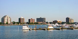
Sarnia is a city in Lambton County, Ontario, Canada. It had a 2021 population of 72,047, and is the largest city on Lake Huron. Sarnia is located on the eastern bank of the junction between the Upper and Lower Great Lakes, where Lake Huron flows into the St. Clair River in the Southwestern Ontario region, which forms the Canada–United States border, directly across from Port Huron, Michigan.

<span class="mw-page-title-main">Point Pelee National Park</span> National park of Canada in Ontario

Point Pelee National Park is a national park in Essex County in southwestern Ontario, Canada where it extends into Lake Erie. The word pelée is French for 'bald'. Point Pelee consists of a peninsula of land, mainly of marsh and woodland habitats, that tapers to a sharp point as it extends into Lake Erie. Middle Island, also part of Point Pelee National Park, was acquired in 2000 and is just north of the Canada–United States border in Lake Erie. Point Pelee is the southernmost point of mainland Canada, and is located on a foundation of glacial sand, silt and gravel that bites into Lake Erie. This spit of land is slightly more than seven kilometres long by 4.5 kilometres (2.8 mi) wide at its northern base. Established in 1918, Point Pelee was the first national park in Canada to be established for conservation. It was designated as a Ramsar site on 27 May 1987.

<span class="mw-page-title-main">Essex County, Ontario</span> County in Ontario, Canada

Essex County is a primarily rural county in Southwestern Ontario, Canada comprising seven municipalities: Amherstburg, Kingsville, Lakeshore, LaSalle, Leamington, Tecumseh and the administrative seat, Essex.

<span class="mw-page-title-main">Leamington, Ontario</span> Town in Ontario, Canada

Leamington is a municipality in Essex County, Ontario, Canada. With a population of 29,680 in the Canada 2021 Census, it forms the second largest urban centre in Windsor-Essex County after Windsor, Ontario. It includes Point Pelee National Park, the southernmost point of mainland Canada.

<span class="mw-page-title-main">Chatham-Kent</span> Municipality in Ontario, Canada

Chatham-Kent is a single-tier municipality in Southwestern Ontario, Canada. It is mostly rural, and its population centres are Chatham, Wallaceburg, Tilbury, Blenheim, Ridgetown, Wheatley and Dresden. The current Municipality of Chatham-Kent was created in 1998 by the amalgamation of Blenheim, Bothwell, Camden, the City of Chatham, the Township of Chatham, Dover, Dresden, Erie Beach, Erieau, Harwich, Highgate, Howard, Orford, Raleigh, Ridgetown, Duart, Thamesville, Tilbury East, Tilbury, Wallaceburg, Wheatley and Zone.

<span class="mw-page-title-main">Southern Ontario</span> Primary region in Ontario, Canada

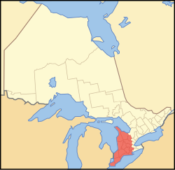
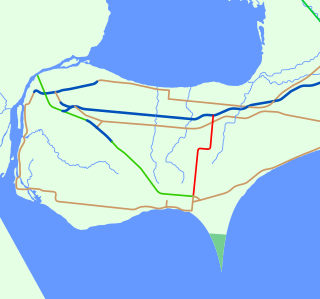
Southern Ontario is a primary region of the Canadian province of Ontario. It is the most densely populated and southernmost region in Canada, with approximately 13.5 million people, approximately 36% of Canada's population of 37 million. The region lies south of the province's other primary region, Northern Ontario, although the exact northern boundary of Southern Ontario is disputed. However, its core region is situated south of Algonquin Park, the latter being in an area of transition between coniferous forest north of the French and Mattawa Rivers and southern deciduous forest. It covers between 14 and 15% of the province, depending on the inclusion of the Parry Sound and Muskoka districts which also lie in the transitional area between northern and southern forest regions. Southern Ontario differs greatly from Northern Ontario, having a much higher population density, a different climate, and a different culture than its northern counterpart. It is broken into smaller subregions, including Central Ontario, Eastern Ontario, the Golden Horseshoe, and Southwestern Ontario.

<span class="mw-page-title-main">Lambton County</span> County in Ontario, Canada

Lambton County is a county in Southwestern Ontario, Canada. It is bordered on the north by Lake Huron, which is drained by the St. Clair River, the county's western border and part of the Canada-United States border. To the south is Lake Saint Clair and Chatham-Kent. Lambton County's northeastern border follows the Ausable River and Parkhill Creek north until it reaches Lake Huron at the beach community of Grand Bend. The county seat is in the Town of Plympton-Wyoming.

<span class="mw-page-title-main">Pelee, Ontario</span> Township in Ontario, Canada

Pelee Island is an island in the Canadian province of Ontario. It is located in the western half of Lake Erie. At 42 km2 (16 sq mi), Pelee Island is the largest island in Lake Erie and the southernmost populated point in Canada. An Ontario Historical Plaque was erected by the province to commemorate the development of Pelee Island's role in Ontario's heritage. Nearby Middle Island is the southernmost point of land in Canada.

<span class="mw-page-title-main">Quebec City–Windsor Corridor</span> Region in Canada

The Quebec City–Windsor Corridor is the most densely populated and heavily industrialized region of Canada. As its name suggests, the region extends between Quebec City in the northeast and Windsor, Ontario, in the southwest, spanning 1,150 kilometres (710 mi). With more than 18 million people, it contains about half of the country's population, three of Canada's four largest metropolitan areas and seven of Canada's twelve largest metropolitan areas, all based on the 2016 census. Its relative importance to Canada's economic and political infrastructure renders it akin to the Northeast megalopolis in the United States. The name was first popularized by Via Rail, which runs frequent passenger rail service in the region in its service area known as "The Corridor".

<span class="mw-page-title-main">Wheatley, Ontario</span> Unincorporated community in Ontario, Canada

Wheatley is a community in Southwestern Ontario, Canada, within the municipality of Chatham-Kent. It lies about 12 kilometres (7 mi) east of Leamington. Nearby parks include Two Creeks Conservation Area, which has 15 km of hiking and bicycling paths, Kopegaron Woods Conservation Area, Hillman Marsh Conservation Area and Point Pelee National Park. Rondeau Provincial Park is only a forty-five-minute drive to the east. It also boasts Wheatley Provincial Park, home to the endangered Blue Racer snake, which can only be found in the park as well as the Point Pelee National Park and on Pelee Island.

The St. Clair Parkway, historically referred to as the River Road, is a scenic parkway in the Canadian province of Ontario. It travels alongside the St. Clair River from west of Wallaceburg to Sarnia, a distance of 41.8 kilometres (26.0 mi). It formed a portion of the route of Highway 40 until it was bypassed by an inland route that opened in the mid-1970s. The St. Clair River Parkway Commission maintained the route from 1966 until 2006, when it was disbanded and responsibility over the parkway transferred to Chatham-Kent and Lambton County, both of which designate the route as County Road 33. The communities of Port Lambton, Sombra, Courtright, Mooretown, Corunna and Froomfield are located along the parkway, all early settlements of the 19th century.

<span class="mw-page-title-main">Detroit–Windsor</span> Transborder agglomeration

The Detroit–Windsor region is an international transborder agglomeration comprising the American city of Detroit, Michigan, the Canadian city of Windsor, Ontario, and the Detroit River between them. The Detroit–Windsor area acts as a critical commercial link straddling the Canada–United States border and has a total population of 5,976,595. It is North America's largest cross-border conurbation.

<span class="mw-page-title-main">Ontario Highway 77</span> Ontario provincial highway

King's Highway 77, commonly referred to as Highway 77, is a provincially maintained highway in the Canadian province of Ontario. One of three highways within Essex County, Highway 77 serves to interconnect Highway 3 near Leamington with Highway 401 near Tilbury. Prior to 1998, the highway extended south into Leamington, ending at the former routing of Highway 3 and Highway 18. This section was turned over to Essex County and renamed Erie Street. The speed limit on Highway 77 is 80 km/h (50 mph) in most places, dropping to 50 km/h in built-up areas. It is patrolled by the Ontario Provincial Police.

The Diocese of Huron is a diocese of the Ecclesiastical Province of Ontario of the Anglican Church of Canada. The diocese comprises just over 31,000 square kilometres in southwestern Ontario, sandwiched between Lake Huron and Lake Erie. Its See city is London, and its parish rolls of 50,000 are served by 177 congregations.

<span class="mw-page-title-main">31 Canadian Brigade Group</span> Brigade of the Canadian Army

31 Canadian Brigade Group is part of the 4th Canadian Division, under the Canadian Army. It encompasses the southwestern portion of Ontario, and is headquartered in London, Ontario. The 31 CBG area of responsibility stretches from Hamilton to Windsor. The brigade has approximately 2,400 soldiers. Colonel Chris Brown, CD is Commander of 31 Canadian Brigade Group. The brigade sergeant-major is Chief Warrant Officer Mike Coit, CD.

<span class="mw-page-title-main">Great Lakes megalopolis</span> Cities around the Great Lakes of North America

The Great Lakes megalopolis consists of a bi-national group of metropolitan areas in North America largely in the Great Lakes region. It extends from the Midwestern United States in the south and west to western Pennsylvania and Western New York in the east and northward through Southern Ontario into southwestern Quebec in Canada. It is the most populated and largest megalopolis in North America.

<span class="mw-page-title-main">Caldwell First Nation</span> Indian reserve in Ontario, Canada

The Caldwell First Nation is a First Nations band government whose land base is located in Leamington, Ontario, Canada. They are an Anishinaabe group, part of the Three Fires Confederacy, comprising the bands Potawatomi, Odawa, and Ojibwa, whose members are originally of the Mikinaak (Turtle) and the Makwa (Bear) dodems. The Caldwell First Nation are a distinct and federally recognized Indian band and used to be referred to by such names as the "Chippewas of Pelee", "Point Pelee Indians" and "Caldwell's band of Indians."

References

  1. Transportation Profile gghtransport2051.ca
  2. "The Changing Shape of Ontario: Early Districts and Counties 1788-1899". www.archives.gov.on.ca. Retrieved 2024-04-14.
  3. Ontario (1831). Proclamation of July 4, 1788.
  4. Brown, Ron (2009). The Lake Erie Shore: Ontario's Forgotten South Coast. Dundurn Press. p. 136. ISBN   9781770703902.
  5. "Kitchener–Waterloo Ontario History – To Confederation". Archived from the original on 25 May 2017. Retrieved 28 August 2017.
  6. Max Braithwaite (1967). Canada: wonderland of surprises. Dodd, Mead. Archived from the original on 1 January 2016.
  7. Chadwick, Bruce (1999). Traveling the underground railroad: a visitor's guide to more than 300 sites . Secaucus, NJ: Carol Pub. Group. p.  272. ISBN   0806520930.
  8. DeBono, Norman (16 September 2011). "Ontario Ford plant closure brings tears". Toronto Sun . Québecor Média. Archived from the original on 13 September 2014. Retrieved 22 September 2014.
  9. "GM pulls out of Canada's former auto capital". CBC News. July 27, 2010.{{cite news}}: CS1 maint: url-status (link)
  10. "Nemak announces Windsor plant closure by 'mid-2020'". CBC News. July 16, 2019.{{cite news}}: CS1 maint: url-status (link)
  11. "The rush is on for industrial land, and space, in SW Ontario". renx.ca. Retrieved 2024-04-25.
  12. "New deal for Windsor EV battery plant worth $15B in tax breaks, Ontario minister says". CBC News. July 5, 2023.{{cite news}}: CS1 maint: url-status (link)
  13. "Volkswagen to open its first North American EV battery plant in St. Thomas, Ont". CBC News. March 13, 2023.{{cite news}}: CS1 maint: url-status (link)
  14. 1 2 3 4 5 6 "Census Mapper (Canada Census 2021, 2016, 2011, 2006, 2001)". Census Mapper. Retrieved 2024-03-31.
  15. 1 2 Government of Canada, Statistics Canada (2022-02-09). "Population and dwelling counts: Census metropolitan areas, census agglomerations and census subdivisions (municipalities)". www150.statcan.gc.ca. Retrieved 2024-03-31.
  16. Government of Canada, Statistics Canada (2024-05-22). "Population estimates, July 1, by census metropolitan area and census agglomeration, 2021 boundaries". www150.statcan.gc.ca. Retrieved 2024-05-22.
  17. "Mixedwood Plains Ecozone". www.ecozones.ca. Retrieved 2024-03-31.
  18. "Forest regions | ontario.ca". www.ontario.ca. Retrieved 2024-03-31.
  19. 1 2 "Carolinian Canada | Carolinian Canada". caroliniancanada.ca. Retrieved 2024-03-31.
  20. "The Great Lakes–St. Lawrence forest; highly valued woodlands". www.the-forest-time.com. Retrieved 2024-03-31.
  21. Parks Canada Agency, Government of Canada (2023-04-06). "Pre-feasibility report for Windsor, Ontario - Windsor, Ontario: Candidate national urban park pre-feasibility report". parks.canada.ca. Retrieved 2024-03-31.
  22. "Seven rare species in the Carolinian zone". WWF.CA. 2018-05-22. Retrieved 2024-03-31.
  23. "Lake-effect Snow in the Great Lakes Region | GLISA" . Retrieved 2024-03-31.
  24. "Weather Elements: Lake-Effect Snow Climatology in the Great Lakes Region". www.heidorn.info. Retrieved 2024-03-31.
  25. Canada, Environment and Climate Change (2010-07-27). "Lightning in cities". www.canada.ca. Retrieved 2024-03-31.
  26. "Farmers to get $300 million to quit growing tobacco". 2012-11-05. Archived from the original on 2012-11-05. Retrieved 2024-03-24.
  27. "Oxford County still dairy capital of Ontario". FarmersForum.com. 2020-09-24. Retrieved 2024-04-20.
  28. "Warmer weather means early harvests for southwestern Ontario's maple syrup producers". CBC News. February 23, 2024.
  29. "Key Industries". www.leamington.ca. 2023-01-30. Retrieved 2024-03-24.
  30. "Emerging Regions". Wine Country Ontario. Retrieved 2024-03-24.
  31. "Life-Extension Program & MCR Project". Bruce Power. Retrieved 2024-03-24.
  32. "Planning for the future of the Bruce Power site". Bruce Power. Retrieved 2024-03-24.
  33. "Petroleum History Society - Six Historical Events in the First 100 Years of Canada's Petroleum Industry". www.petroleumhistory.ca. Retrieved 2024-04-20.
  34. "Canadian Refineries". Oil Sands Magazine. 2023-01-28. Retrieved 2024-04-20.
  35. "Exploring for and extracting oil, natural gas and salt resources | ontario.ca". www.ontario.ca. Retrieved 2024-03-25.
  36. K., O'Shea. "Environmental review of natural gas production in Lake Erie".{{cite journal}}: Cite journal requires |journal= (help)
  37. "Polymer Corporation". The Canadian Encyclopedia. 2012. Archived from the original on 24 June 2013. Retrieved 23 June 2013.
  38. "Oil, Gas and Salt Resources". Ontario Ministry of Natural Resources. 2 August 2012. Archived from the original on 7 October 2008. Retrieved 23 June 2013.
  39. "https://www.gordiehoweinternationalbridge.com/en/Gordie-Howe-International-Bridge-Opening-Planned-for-Fall-2025". Gordie Howe International Bridge. January 4, 2024. Retrieved 2024-03-31.{{cite web}}: External link in |title= (help)
  40. "Explore Canada: Train Map & Routes | VIA Rail". www.viarail.ca. Retrieved 2024-03-31.
  41. "System Map". www.gotransit.com. Retrieved 2024-03-31.
  42. "GO Train service between London and Toronto ending this fall as VIA Rail returns". CBC News. July 2, 2023.
  43. "Regional staff working on first steps to bring GO rail service to Cambridge". CBC News. March 6, 2024.
  44. "ION light rail". www.grt.ca. 2023-06-23. Retrieved 2024-03-31.
  45. "Stage 2 ION". www.regionofwaterloo.ca. 2023-12-22. Retrieved 2024-03-31.
  46. "Ontario Railway Network (ORWN)". geohub.lio.gov.on.ca. Retrieved 2024-03-31.
  47. "Goderich Port Management Corp. | goderichport.ca". www.goderichport.ca. Retrieved 2024-03-31.
  48. "About The Port". 2012-04-02. Archived from the original on 2012-04-02. Retrieved 2024-03-31.
  49. "Home". Owen Sound Transportation Company. Retrieved 2024-04-27.
  50. "Destinations". www.waterlooairport.ca. 2024-02-27. Retrieved 2024-03-31.
  51. "Route Map & Flight Schedule". London International Airport. Retrieved 2024-03-31.
  52. Airport, Windsor International. "Flight Information – Fly YQG". flyyqg.ca. Retrieved 2024-03-31.
  53. "Southwestern Ontario accent to be documented in study". CBC News. Aug 24, 2016.{{cite news}}: CS1 maint: url-status (link)
  54. "Deep Francophone roots in the Windsor region". Salut Canada. Retrieved 2024-05-22.
  55. "Canadian TV markets by viewers 2023". Statista. Retrieved 2024-05-05.
  56. "OHL 2023-24 team attendance at hockeydb.com". www.hockeydb.com. Retrieved 2024-05-05.