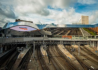
Birmingham New Street is the largest and busiest of the three main railway stations in Birmingham city centre, England, and a central hub of the British railway system. It is a major destination for Avanti West Coast services from London Euston, Glasgow Central and Edinburgh Waverley via the West Coast Main Line, the CrossCountry network, and for local and suburban services within the West Midlands; this includes those on the Cross-City Line between Lichfield Trent Valley, Redditch and Bromsgrove, and the Chase Line to Walsall and Rugeley Trent Valley. The three-letter station code is BHM.

Smethwick is an industrial town in Sandwell, West Midlands, England. It lies four miles west of Birmingham city centre. Historically it was in Staffordshire.
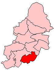
Hall Green is an area in southeast Birmingham, England, synonymous with the B28 postcode. It is also a council constituency, managed by its own district committee. Historically it lay within the county of Worcestershire.
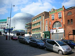
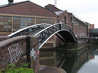
Digbeth is an area of Central Birmingham, England. Following the destruction of the Inner Ring Road, Digbeth is now considered a district within Birmingham City Centre. As part of the Big City Plan, Digbeth is undergoing a large redevelopment scheme that will regenerate the old industrial buildings into apartments, retail premises, offices and arts facilities. The district is considered to be Birmingham's 'Creative Quarter'.

Quinton, is a residential area and ward of Birmingham, England just under 5 miles (8 km) west of the city centre. Formerly part of Halesowen parish, Quinton became part of Birmingham in 1909. Quinton was a village and the surrounding area was farmland until the 1930s when the first housing estates were developed. Most of the farmland had been built on by 1980 but some countryside remains in the form of Woodgate Valley Country Park. Along with Bartley Green, Harborne and Edgbaston, Quinton is a part of the Birmingham Edgbaston constituency.

West Midlands Police is the territorial police force responsible for policing the metropolitan county of West Midlands in England.
Bordesley is an area of Birmingham, England, 1.2 miles (2 km) south east of the city centre straddling the Watery Lane Middleway ring road. It should not be confused with nearby Bordesley Green. Commercial premises dominate to the west of the ring road, but much of this area is to be redeveloped. Blocks of residential apartments are planned and set for completion from the mid-2020s onwards. The largely residential area east of the ring road was renamed Bordesley Village following large scale clearance of back-to-back houses and redevelopment in the 1980s and 90s. Bordesley is the real life setting of the BBC series Peaky Blinders, and home to Birmingham City Football Club's ground, St Andrew's.

The A453 road was formerly the main trunk road connecting the English cities of Nottingham and Birmingham. However, the middle section of this mainly single-carriageway road has largely been downgraded to B roads or unclassified roads following the construction of the parallel M42-A42 link around 1990. The M42 was originally meant to pass further north than it does, and to join the M1 at Sandiacre in Derbyshire. The M42/A42 does not enter Derbyshire, but instead joins the M1 closer to the A453 junction at Kegworth. The A42 shadows the former A453 from Appleby Magna to Castle Donington. The road historically connected the East Midlands with the West Midlands.
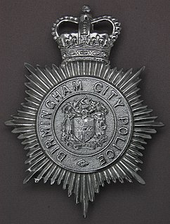
Birmingham City Police was the police service responsible for general policing in the city of Birmingham from 1839 to 1974. The force was established by a special Act of Parliament in 1839, and was amalgamated as of 1 April 1974 with the West Midlands Constabulary and parts of other forces to form the West Midlands Police by the Local Government Act 1972.

Star City is a family leisure and entertainment complex in Nechells, Birmingham, England. It is located in the north east of the city very close to Junction 6 of the M6 motorway, and Aston railway station.

Cosford railway station is a railway station which serves the village of Cosford in Shropshire, England. It also serves RAF Cosford which is also home to a branch of the Royal Air Force Museum. The station is served by West Midlands Trains, who manage the station, and Transport for Wales. Between 2008 and 2011 it was also served by the direct London operator, Wrexham & Shropshire.
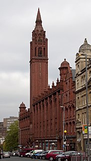
The Methodist Central Hall, 196–224 Corporation Street, Birmingham, England, is a three-storey red brick and terracotta Grade II* listed building with a distinctive tower at the northern end of Corporation Street. The design complements the Victoria Law Courts opposite, also in terracotta, and includes eclectic details such as the corner turrets resembling Indian chattris. It is located within the Steelhouse Conservation Area.

Wolverhampton is a city, metropolitan borough and administrative centre in the West Midlands, England. The population size has increased by 5.7%, from around 249,500 in 2011 to 263,700 in 2021. People from the city are called "Wulfrunians".
This article is intended to show a timeline of events in the History of Birmingham, England, with a particular focus on the events, people or places that are covered in Wikipedia articles.

Birmingham is a city and metropolitan borough in the metropolitan county of West Midlands in England. It is the second-largest city in the United Kingdom with a population of 1.145 million in the city proper, 2.92 million in the West Midlands metropolitan county, and approximately 4.3 million in the wider metropolitan area. It is the largest UK metropolitan area outside of London. Birmingham is known as the second city of the United Kingdom.
Birmingham General Hospital was a teaching hospital in Birmingham, England, founded in 1779 and closed in the mid-1990s.
Events from 2014 in England
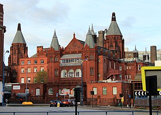
The West Midlands Police Museum is located in a Victorian cell block on Steelhouse Lane, Birmingham, England, which was operational from 1891 until 2016.

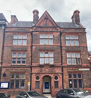
Lloyd House is the headquarters and since 2017 Central station of the West Midlands Police, the territorial police force responsible for policing the West Midlands metropolitan county in the United Kingdom. The building also houses the office of the West Midlands Police and Crime Commissioner.


