Stony Plain | |
---|---|
Town | |
Town of Stony Plain | |
Coordinates: 53°31′35″N114°00′25″W / 53.52639°N 114.00694°W | |
Country | Canada |
Province | Alberta |
Region | Edmonton Metropolitan Region |
Census division | 11 |
Municipal district | Parkland County |
Incorporated [1] | |
• Village | March 14, 1907 |
• Town | December 10, 1908 |
Government | |
• Mayor | William Choy |
• Governing body | Stony Plain Town Council
|
• Manager | Tom Goulden |
• MP | Dane Lloyd |
Area (2021) [3] | |
• Land | 35.45 km2 (13.69 sq mi) |
Elevation | 710 m (2,330 ft) |
Population | |
• Total | 17,993 |
• Density | 507.6/km2 (1,315/sq mi) |
• Municipal census (2019) | 17,842 [6] |
• Estimate (2020) | 18,762 [7] |
Time zone | UTC−7 (MST) |
• Summer (DST) | UTC−6 (MDT) |
Forward sortation area | |
Area code(s) | 780, 587 and 825 |
Highways | Highway 16A, Alberta Highway 628, Highway 779 |
Website | Official website |
Stony Plain is a town in the Edmonton Metropolitan Region of Alberta, Canada that is surrounded by Parkland County. It is west of Edmonton adjacent to the City of Spruce Grove and sits on Treaty 6 land.
Stony Plain is known for its many painted murals representing various periods, events and people throughout the town's history. The town was originally known as Dog Rump Creek. [8]
The name of the town is believed to have come from one of two possible origins. The first is that the Stoney people camped in the area historically. The second possibility is that Dr. James Hector, a geologist on the Palliser Expedition, noticed boulders scattered across the area. The official name for the settlement was adopted in 1892. [9] Alex McNabb and McPherson were the first homesteaders in the area. [10]
has a humid continental climate (Köppen climate classification Dfb ) [11] It falls into the NRC Plant Hardiness Zone 4a. [12]
Climate data for Stony Plain, Alberta | |||||||||||||
---|---|---|---|---|---|---|---|---|---|---|---|---|---|
Month | Jan | Feb | Mar | Apr | May | Jun | Jul | Aug | Sep | Oct | Nov | Dec | Year |
Record high humidex | 10.2 | 12.8 | 15.1 | 23.5 | 28.9 | 39.0 | 39.3 | 30.6 | 22.2 | 22.2 | 13.3 | 16.5 | 39.3 |
Record high °C (°F) | 13.5 (56.3) | 14.5 (58.1) | 17.8 (64.0) | 28.9 (84.0) | 31.5 (88.7) | 35.7 (96.3) | 34.8 (94.6) | 35 (95) | 33.9 (93.0) | 29 (84) | 19.4 (66.9) | 17.5 (63.5) | 35.7 (96.3) |
Mean daily maximum °C (°F) | −7.3 (18.9) | −3.9 (25.0) | 1.5 (34.7) | 10.4 (50.7) | 16.7 (62.1) | 19.9 (67.8) | 21.8 (71.2) | 21 (70) | 16 (61) | 10.2 (50.4) | −0.6 (30.9) | −5.7 (21.7) | 8.3 (46.9) |
Daily mean °C (°F) | −11.7 (10.9) | −8.5 (16.7) | −3 (27) | 4.9 (40.8) | 10.9 (51.6) | 14.5 (58.1) | 16.5 (61.7) | 15.7 (60.3) | 10.7 (51.3) | 5.3 (41.5) | −4.4 (24.1) | −9.7 (14.5) | 3.4 (38.1) |
Mean daily minimum °C (°F) | −15.9 (3.4) | −12.9 (8.8) | −7.6 (18.3) | −0.5 (31.1) | 5.1 (41.2) | 9.1 (48.4) | 11.2 (52.2) | 10.3 (50.5) | 5.3 (41.5) | 0.3 (32.5) | −8.1 (17.4) | −13.6 (7.5) | −1.5 (29.3) |
Record low °C (°F) | −40 (−40) | −39 (−38) | −32.2 (−26.0) | −24 (−11) | −6 (21) | 0 (32) | 2.5 (36.5) | −0.6 (30.9) | −6.7 (19.9) | −25.5 (−13.9) | −36.5 (−33.7) | −40 (−40) | −40 (−40) |
Record low wind chill | −47.7 | −46 | −34.6 | −22.5 | −11.5 | −2.8 | 2.6 | −14.1 | −6.7 | −21.5 | −37.4 | −46 | −47.7 |
Average precipitation mm (inches) | 24.1 (0.95) | 18.3 (0.72) | 19.3 (0.76) | 26.6 (1.05) | 54 (2.1) | 98.1 (3.86) | 106.2 (4.18) | 73.6 (2.90) | 47.9 (1.89) | 22.7 (0.89) | 21.8 (0.86) | 23.5 (0.93) | 536 (21.1) |
Average rainfall mm (inches) | 1.7 (0.07) | 1.4 (0.06) | 1.8 (0.07) | 14 (0.6) | 49.5 (1.95) | 98.1 (3.86) | 106.2 (4.18) | 73.5 (2.89) | 46.3 (1.82) | 13.3 (0.52) | 3 (0.1) | 1.3 (0.05) | 410 (16.1) |
Average snowfall cm (inches) | 25.2 (9.9) | 18 (7.1) | 18.6 (7.3) | 12.8 (5.0) | 4.7 (1.9) | 0 (0) | 0 (0) | 0.1 (0.0) | 1.6 (0.6) | 9.5 (3.7) | 20.2 (8.0) | 23.2 (9.1) | 133.9 (52.7) |
Source: Environment Canada [13] |
Year | Pop. | ±% |
---|---|---|
1911 | 505 | — |
1916 | 293 | −42.0% |
1921 | 360 | +22.9% |
1926 | 456 | +26.7% |
1931 | 497 | +9.0% |
1936 | 499 | +0.4% |
1941 | 566 | +13.4% |
1946 | 720 | +27.2% |
1951 | 878 | +21.9% |
1956 | 1,098 | +25.1% |
1961 | 1,311 | +19.4% |
1966 | 1,397 | +6.6% |
1971 | 1,770 | +26.7% |
1976 | 2,717 | +53.5% |
1981 | 4,839 | +78.1% |
1986 | 5,802 | +19.9% |
1991 | 7,226 | +24.5% |
1996 | 8,274 | +14.5% |
2001 | 9,589 | +15.9% |
2006 | 12,363 | +28.9% |
2011 | 15,051 | +21.7% |
2016 | 17,189 | +14.2% |
Source: Statistics Canada [14] [15] [16] [17] [18] [19] [20] [21] [22] [23] [24] [25] [26] [27] [28] [29] [30] [31] [32] [33] [34] [35] |
In the 2021 Census of Population conducted by Statistics Canada, the Town of Stony Plain had a population of 17,993 living in 7,134 of its 7,475 total private dwellings, a change of 4.7% from its 2016 population of 17,189. With a land area of 35.45 km2 (13.69 sq mi), it had a population density of 507.6/km2 (1,314.6/sq mi) in 2021. [3]
The population of the Town of Stony Plain according to its 2019 municipal census is 17,842, [6] a change of 10.6% from its 2015 municipal census population of 16,127. [36]
In the 2016 Census of Population conducted by Statistics Canada, the Town of Stony Plain recorded a population of 17,189 living in 6,641 of its 6,954 total private dwellings, a 14.2% change from its 2011 population of 15,051. With a land area of 35.72 km2 (13.79 sq mi), it had a population density of 481.2/km2 (1,246.3/sq mi) in 2016. [35]
Stony Plain is home to many colourful murals that depict important figures and events of local history. The Town held a mural project in 2006 where artists were selected through open competition to paint two murals. The Parkland Potters Guild & Crooked Pot Gallery is also located within Stony Plain.
Cultural institutions in the town include the Stony Plain Public Library, the Multicultural Heritage Centre, and the Stony Plain Pioneer Museum.
Stony Plain celebrates Farmers' Days in the first week of June each year, complete with the Farmers' Days Parade, the Kinsmen rodeo, a pancake breakfast and fair grounds. The town also plays host to the Great White North Triathlon [37] in the first week of July.
In the summer, Stony Plain hosts two major festivals — the Blueberry Bluegrass and Country Music Festival, [38] which is held in early August and is the largest bluegrass event in western Canada, and the Cowboy Poetry and Country Music Gathering [39] held in late August.
In December, the town sets up a large Christmas tree on Main Street and is lit throughout the Christmas season. To celebrate New Year's Eve, the town holds its Family Fest event at Heritage Park. Family Fest features outdoor ice skating, hot chocolate and fireworks.
The Town of Stony Plain jointly owns and operates the TransAlta Tri Leisure Centre sports complex located within neighbouring Spruce Grove. The town is also home to the Multicultural Heritage Centre, the Pioneer Museum, and multiple parks including Shikaoi and Rotary, a skate park, a BMX park and a green path system running through town.
The town is governed by one mayor and six councillors.
Stony Plain is home to the WestView Health Centre, a 68-bed public hospital. [40]
Parkland School Division operates five schools and an outreach centre within the town. [41] Evergreen Catholic Separate Regional Division No. 2 operates a school for students in kindergarten through grade 8. [42] There are also a variety of small private schools and home schooling organizations.
The Stony Plain Eagles of Allan Cup Hockey West play out of Glenn Hall Arena.
Newspapers covering Stony Plain include the Stony Plain Reporter [43] and the Tri Area News. [44] On the radio 88.1 The One [45] '
Stony Plain is twinned with Shikaoi, Hokkaido, Japan. [46]
Camrose is a city in central Alberta, Canada that is surrounded by Camrose County. Located along Highway 13 it had its beginnings as a railroad hub.
Spruce Grove is a city that is 11 km (6.8 mi) west of Edmonton, Alberta, in Canada. The city is adjacent to the Town of Stony Plain and is surrounded by Parkland County.
Leduc is a city in the province of Alberta, Canada. It is 33 km (21 mi) south of the provincial capital of Edmonton and is part of the Edmonton Metropolitan Region.
Sylvan Lake is a town in central Alberta, Canada. It is located approximately 25 kilometres (16 mi) west of the City of Red Deer along Highway 11 or Highway 11A. It is on the southeast edge of Sylvan Lake, a 15-kilometre-long (9.3 mi) freshwater lake that straddles the boundary between Red Deer County and Lacombe County.
Okotoks is a town in the Calgary Region of Alberta, Canada. It is on the Sheep River, approximately 38 km (24 mi) south of Downtown Calgary. Okotoks has emerged as a bedroom community of Calgary. According to the 2021 Federal Census, the town has a population of 30,214 making it the largest town in Alberta.
Cochrane is a town in the Calgary Metropolitan Region of Alberta, Canada. The town is located 18 km (11 mi) west of the Calgary city limits along Highway 1A. Cochrane is one of the fastest-growing communities in Canada, and with a population of 32,199 in 2021, it is one of the largest towns in Alberta. It is part of Calgary's census metropolitan area and a member community of the Calgary Metropolitan Region Board (CMRB). The town is surrounded by Rocky View County.
Airdrie is a city in Alberta, Canada, within the Calgary Region. It is located north of Calgary within the Calgary–Edmonton Corridor at the intersection of Queen Elizabeth II Highway and Highway 567.
Sexsmith is a town in northern Alberta, it is on Highway 2, 20 kilometres (12 mi) north of Grande Prairie.
Strathmore is a town located in southern Alberta, Canada that is surrounded by Wheatland County. It is along the Trans-Canada Highway approximately 50 kilometres (30 mi) east of Calgary.
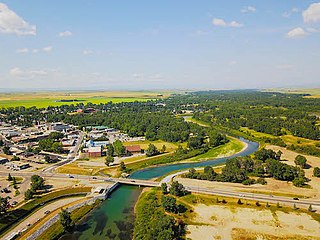
Lacombe is a city in central Alberta, Canada. It is located approximately 25 kilometres (16 mi) north of Red Deer, the nearest major city, and 125 kilometres (78 mi) south of Edmonton, the nearest metropolitan area. The city is set in the rolling parkland of central Alberta, between the Rocky Mountains foothills to the west and the flatter Alberta prairie to the east.
Beaumont is a city in Leduc County within the Edmonton Metropolitan Region of Alberta, Canada. It is located at the intersection of Highway 625 and Highway 814, adjacent to the City of Edmonton and 6.0 kilometres (3.7 mi) northeast of the City of Leduc. The Nisku Industrial Park and the Edmonton International Airport are located 4.0 kilometres (2.5 mi) to the west and 8.0 kilometres (5.0 mi) to the southwest respectively.
High River is a town within the Calgary Metropolitan Region of Alberta, Canada. It is approximately 68 kilometres (42 mi) south of Calgary, at the junction of Alberta Highways 2 and 23. High River had a population of 14,324 in 2021.
McLennan is a town in northern Alberta, Canada. It is approximately 50 km (31 mi) north of High Prairie on Highway 2.
Wembley is a town in northern Alberta, Canada. It is approximately 23 km (14 mi) west of Grande Prairie at the junction of Highway 43 and Highway 724.
The Municipal District of Acadia No. 34 is a municipal district (MD) in southern Alberta, Canada, east of Calgary, close to the Saskatchewan border, in Census Division No. 4.
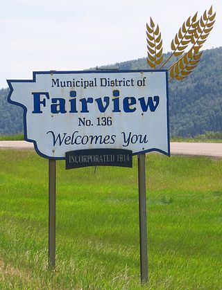
The Municipal District of Fairview No. 136 is a municipal district (MD) in northwestern Alberta, Canada. It is located in Census Division 19.
The Municipal District of Peace No. 135 is a municipal district (MD) in northwestern Alberta, Canada. Located in Census Division No. 19, its municipal office is located outside but adjacent to the Village of Berwyn.
The Municipal District of Smoky River No. 130 is a municipal district (MD) in northwestern Alberta, Canada. Located in Census Division No. 19, its municipal office is located in the Town of Falher.
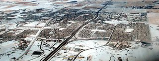
According to the 2021 census, the City of Edmonton had a population of 1,010,899 residents, compared to 4,262,635 for all of Alberta, Canada. The total population of the Edmonton census metropolitan area (CMA) was 1,418,118, making it the sixth-largest CMA in Canada.
In the 2021 Census, the City of Calgary had a population of 1,306,784 residents, representing 30.7% of the 4,262,635 residents in all of Alberta, and 3.5% compared to a population of 36,991,981 in all of Canada. The total population of the Calgary census metropolitan area (CMA) was 1,481,806. Calgary is the largest city in Alberta, and the third-largest municipality and fifth-largest metropolitan area in Canada, as of 2021.