Jasper, Alberta

Last updated

Jasper
Municipality of Jasper
Jasper from the Jasper Tramway 2008.jpg
View of Jasper from the Jasper Tramway
AB locator MUNICIPALITY OF JASPER.svg
Location within Alberta
Coordinates: 52°52′23″N118°04′56″W / 52.87306°N 118.08222°W / 52.87306; -118.08222
CountryCanada
Province Alberta
Region Alberta's Rockies
Census division 15
Founded1813
Incorporated  [1]
 - Improvement district  

August 31, 1995
 - Specialized municipality July 20, 2001
Government
[2]
  MayorRichard Ireland
  Governing bodiesJasper Municipal Council and Parks Canada
   MP See Yellowhead
   MLA See West Yellowhead
Area
 (2021) [3]
  Land921.9 km2 (355.9 sq mi)
Elevation
[4]
1,060 m (3,480 ft)
Population
 (2021) [3]
  Total4,738
  Density5.1/km2 (13/sq mi)
Time zone UTC−7 (MST)
  Summer (DST) UTC−6 (MDT)
Postal code span
T0E
Area code(s) +1-780, +1-587
Highways
Waterways Athabasca River
Miette River
Railways Canadian National Railway
Website jasper-alberta.com OOjs UI icon edit-ltr-progressive.svg

Jasper is a specialized municipality and townsite in western Alberta within the Canadian Rockies. The townsite is in the Athabasca River valley and is the commercial centre of Jasper National Park.

Contents

History

The Jasper Information Centre Jasper Information Centre Jasper Alberta Canada 01-A.jpg
The Jasper Information Centre
The Jasper Welcome Sign at the north entrance to town, 2022. Jasper-Bear-Hunt-11.jpg
The Jasper Welcome Sign at the north entrance to town, 2022.
Jasper, 1920 Canada - Jasper through Henry House Station - NARA - 68154612 (cropped).jpg
Jasper, 1920

Established in 1813, Jasper House was first a fur trade outpost of the North West Company, and later Hudson's Bay Company, on the York Factory Express trade route to what was then called "New Caledonia" (now British Columbia) and Fort Vancouver on the lower Columbia River. [5] Jasper House was 35 km north of today's town of Jasper.

Jasper Forest Park was established in 1907. The railway siding at the location of the future townsite was established by the Grand Trunk Pacific Railway in 1911 and originally named Fitzhugh after a Grand Trunk vice president [6] (along the Grand Trunk's "alphabet" line). The Canadian Northern Railway began service to its Jasper Park station in 1912, about 700 m from GTP's Fitzhugh station. [7] The townsite was surveyed in 1913 by H. Matheson. [7] It was renamed Jasper after the former fur trade post. An internment camp was set up at Dominion Park in Jasper from February 1916 to August 1916. [8]

Jasper Forest Park was renamed Jasper National Park in 1930. By 1931, Jasper was accessible by road from Edmonton. In 1940, the scenic Icefields Parkway opened, connecting Jasper to Lake Louise and Banff in Banff National Park.

The first step towards incorporation of Jasper occurred on August 31, 1995, when the Jasper Improvement District was formed from a portion of Improvement District No. 12 (Jasper National Park). [9] The improvement district was subsequently incorporated as a specialized municipality under the name of the Municipality of Jasper on July 20, 2001. [9] The incorporation order established the Jasper townsite as the Town of Jasper [10] and the surrounding balance of the specialized municipality as a rural service area that was deemed equivalent to a municipal district. [11]

Geography

Downtown Jasper Jasper townsite.jpg
Downtown Jasper

The Municipality of Jasper is in the western portion of the province of Alberta within Jasper National Park. [12] It borders the province of British Columbia to the west and Improvement District No. 12 to the north, east, and south. [12] The Athabasca River, which originates from the Columbia Icefield, meanders northward through the municipality. [12] The Miette River, Maligne River, and Snaring River all discharge into the Athabasca River within the Municipality of Jasper's limits. [12]

The Jasper townsite, which is approximately 362 kilometres (225 mi) west of Edmonton, 290 kilometres (180 mi) north of Banff, and 28 kilometres (17 mi) east of the Yellowhead Pass, is at the intersection of Highway 16 (Yellowhead Highway) and Highway 93 (Icefields Parkway). It is near the confluence of the Athabasca River and Miette River. It lies between the Victoria Cross Ranges (northwest), Pyramid Mountain (north), Maligne Range (southeast) and Trident Ridge (southwest). Lakes near the Jasper townsite include Pyramid Lake, Patricia Lake, Lake Annette, Lake Edith, Lac Beauvert, Maligne Lake, and Medicine Lake.

Localities

The following localities are located within the Municipality of Jasper. [13] [14]

Climate

Jasper experiences a borderline Humid Continental/Subarctic climate (Köppen climate classification Dfb/Dfc). The highest temperature ever recorded in Jasper was 41.2 °C (106 °F) on June 30, 2021. The coldest temperature ever recorded was −47.2 °C (−53 °F) on January 24, 1916. [15]

Summers in Jasper are pleasant, with daily highs usually around 21.1 °C (70 °F) and lows around 7.2 °C (45 °F). Winters are cold, though may be considered mild by Canadian standards, with daily highs around −2.2 °C (28 °F) and lows around −11.7 °C (11 °F).

Climate data for Jasper, 1981−2010 normals, extremes 1914−present
MonthJanFebMarAprMayJunJulAugSepOctNovDecYear
Record high °C (°F)13.3
(55.9)
16.5
(61.7)
20.8
(69.4)
26.5
(79.7)
30.4
(86.7)
41.2
(106.2)
39.4
(102.9)
35.0
(95.0)
33.7
(92.7)
27.2
(81.0)
18.0
(64.4)
15.0
(59.0)
41.2
(106.2)
Mean daily maximum °C (°F)−3.3
(26.1)
−0.4
(31.3)
5.7
(42.3)
10.9
(51.6)
16.1
(61.0)
19.6
(67.3)
21.9
(71.4)
21.7
(71.1)
16.7
(62.1)
10.0
(50.0)
0.4
(32.7)
−4.7
(23.5)
9.6
(49.3)
Daily mean °C (°F)−8
(18)
−5.8
(21.6)
−0.4
(31.3)
4.5
(40.1)
9.4
(48.9)
13.1
(55.6)
15.2
(59.4)
14.6
(58.3)
10.0
(50.0)
4.4
(39.9)
−4
(25)
−9.1
(15.6)
3.6
(38.5)
Mean daily minimum °C (°F)−12.7
(9.1)
−11.2
(11.8)
−6.5
(20.3)
−2
(28)
2.6
(36.7)
6.6
(43.9)
8.4
(47.1)
7.4
(45.3)
3.2
(37.8)
−1.3
(29.7)
−8.3
(17.1)
−13.5
(7.7)
−2.3
(27.9)
Record low °C (°F)−47.2
(−53.0)
−43.3
(−45.9)
−36.7
(−34.1)
−28.9
(−20.0)
−17.8
(0.0)
−6.7
(19.9)
−3.4
(25.9)
−3
(27)
−12.2
(10.0)
−28.7
(−19.7)
−38.8
(−37.8)
−43.9
(−47.0)
−47.2
(−53.0)
Average precipitation mm (inches)23.4
(0.92)
14.3
(0.56)
16.8
(0.66)
19.7
(0.78)
31.1
(1.22)
51.0
(2.01)
63.8
(2.51)
64.5
(2.54)
33.7
(1.33)
30.5
(1.20)
24.4
(0.96)
19.5
(0.77)
392.6
(15.46)
Average rainfall mm (inches)6.1
(0.24)
3.8
(0.15)
6.2
(0.24)
13.2
(0.52)
30.4
(1.20)
50.4
(1.98)
63.8
(2.51)
64.6
(2.54)
32.2
(1.27)
23.1
(0.91)
9.4
(0.37)
2.2
(0.09)
305.2
(12.02)
Average snowfall cm (inches)23.9
(9.4)
14.7
(5.8)
15.0
(5.9)
8.1
(3.2)
0.75
(0.30)
0.57
(0.22)
0.0
(0.0)
0.0
(0.0)
2.5
(1.0)
9.3
(3.7)
20.8
(8.2)
24.4
(9.6)
120.0
(47.2)
Average precipitation days (≥ 0.2 mm)10.67.98.18.911.113.914.114.710.59.810.49.6129.6
Average rainy days (≥ 0.2 mm)1.71.52.66.010.913.914.114.710.07.72.90.886.9
Average snowy days (≥ 0.2 cm)9.97.16.84.10.730.070.00.00.602.78.49.549.9
Mean monthly sunshine hours 71.798.4164.4199.6227.1226.1251.5237.3177.2131.071.856.51,912.5
Percent possible sunshine 28.235.544.847.846.444.849.651.946.439.727.423.740.5
Source: Environment Canada [16] [17] [18] [19]
[20]

Demographics

Federal census
population history
YearPop.±%
19913,567    
1996 4,301+20.6%
2001 4,180−2.8%
2006 4,265+2.0%
2011 4,432+3.9%
2016 4,590+3.6%
2021 4,738+3.2%
Source: Statistics Canada [21] [22] [23] [24] [25] [3]

In the 2021 Census of Population conducted by Statistics Canada, the Municipality of Jasper had a population of 4,738 living in 1,674 of its 1,910 total private dwellings, a change of

In the 2016 Census of Population conducted by Statistics Canada, the Municipality of Jasper had a population of 4,590 living in 1,576 of its 1,702 total private dwellings, a change of

Municipality of Jasper population breakdown – 2011 municipal census [26] [27]
ComponentPermanent
population
Shadow
population
Total
population
Town of Jasperunpublished4,152
Rural service areaunpublished1,084
Total Municipality of Jasper4,5846525,236

The population of the Municipality of Jasper according to its 2011 municipal census is 5,236, [26] a change of 10.3% over its 2008 municipal census population of 4,745. [28] Jasper's 2011 population of 5,236 comprises 4,584 permanent and 652 non-permanent residents, [26] while its 2007 census counted 4,235 permanent and 510 non-permanent residents. [28]

Attractions

The Fairmont Jasper Park Lodge, the Marmot Basin ski resort, and the Jasper Skytram, which carries visitors to The Whistlers' summit, are all near the townsite. Within the Jasper townsite are the heritage building of the Jasper Visitor Centre, the heritage building St. Mary & St. George Anglican Church, and the Jasper-Yellowhead Museum and Archives.

Government

Governance of Jasper is shared between the municipality and Parks Canada, an agency of the federal government. [29]

Infrastructure

Transportation

Jasper railway station, seen from Connaught Drive Jasper Connaught Drive East.jpg
Jasper railway station, seen from Connaught Drive
Two Goldleaf double-deck panorama cars of the Rocky Mountaineer in the station of Jasper Jasper.Rocky.Mountaineer.P1033590.jpg
Two Goldleaf double-deck panorama cars of the Rocky Mountaineer in the station of Jasper

Jasper railway station is served by Via Rail with two passenger services. The Canadian and the Jasper–Prince Rupert train both operate three times per week. [30]

Jasper Airport is located 7.2 nautical miles (13.3 km; 8.3 mi) north of Jasper.

Education

The Grande Yellowhead Public School Division No. 77 operates two schools in Jasper: Jasper Elementary School (K–6 English & French Immersion) and Jasper Junior Senior High School (7–12 English & French Immersion), while Greater North Central Francophone Education Region No. 2 operates a francophone school called École Desrochers for kindergarten through grade 12.

Media

Newspapers

Radio

FrequencyCall signBrandingFormatOwnerNotes
FM 92.3 CJAG-FM The Lone Wolf Active rock Athabasca HotelRebroadcaster of CFBR-FM (Edmonton)
FM 95.5 CFXP-FM Real Country West Country music Stingray Group Rebroadcaster of CFXE-FM (Edson)
FM 98.1 CBXJ-FM CBC Radio One Talk radio, public radio Canadian Broadcasting Corporation Rebroadcaster of CBX (Edmonton)

Television

OTA channelCall signNetworkNotes
11 (VHF) CFRN-TV-11 CTV Rebroadcaster of CFRN-DT (Edmonton)

Sister cities

Notable people

See also

Related Research Articles

<span class="mw-page-title-main">Jasper National Park</span> National park in Alberta, Canada

Jasper National Park, in Alberta, Canada, is the largest national park within Alberta's Rocky Mountains, spanning 11,000 km2 (4,200 sq mi). It was established as Jasper Forest Park in 1907, renamed as a national park in 1930, and declared a UNESCO world heritage site in 1984. Its location is north of Banff National Park and west of Edmonton. The park contains the glaciers of the Columbia Icefield, springs, lakes, waterfalls and mountains.

<span class="mw-page-title-main">Fort McMurray</span> Place in Alberta, Canada

Fort McMurray is an urban service area in the Regional Municipality of Wood Buffalo in Alberta, Canada. It is located in northeast Alberta, in the middle of the Athabasca oil sands, surrounded by boreal forest. It has played a significant role in the development of the national petroleum industry. The 2016 Fort McMurray wildfire led to the evacuation of its residents and caused widespread damage.

<span class="mw-page-title-main">Banff, Alberta</span> Town in Alberta, Canada

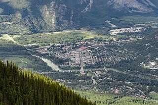
Banff is a town in Banff National Park, Alberta, Canada, in Alberta's Rockies along the Trans-Canada Highway, 126 km (78 mi) west of Calgary and 58 km (36 mi) east of Lake Louise, 1,400 to 1,630 m above sea level,

<span class="mw-page-title-main">Fort Chipewyan</span> Hamlet in Alberta, Canada

Fort Chipewyan, commonly referred to as Fort Chip, is a hamlet in northern Alberta, Canada, within the Regional Municipality (RM) of Wood Buffalo. It is located on the western tip of Lake Athabasca, adjacent to Wood Buffalo National Park, approximately 223 kilometres (139 mi) north of Fort McMurray.

<span class="mw-page-title-main">Hinton, Alberta</span> Town in Alberta, Canada

Hinton is a town in west-central Alberta, Canada.

<span class="mw-page-title-main">Edson, Alberta</span> Town in Canadian Province of Alberta

Edson is a town in west-central Alberta, Canada. It is located in Yellowhead County, 192 kilometres (119 mi) west of Edmonton along the Yellowhead Highway and 10 kilometres (6.2 mi) east of the intersection with Highway 47.

<span class="mw-page-title-main">Regional Municipality of Wood Buffalo</span> Municipality in Alberta, Canada

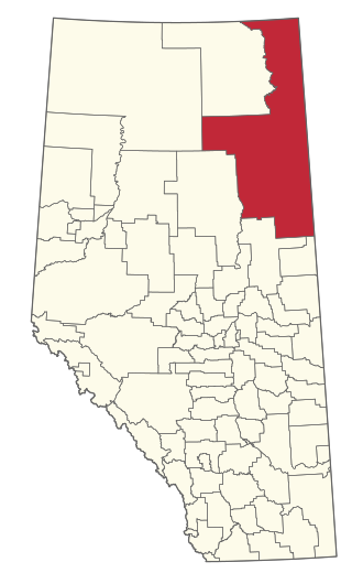
The Regional Municipality of Wood Buffalo is a specialized municipality in northeast Alberta, Canada. It is the largest municipality in North America by area and is home to oil sand deposits known as the Athabasca oil sands.

<span class="mw-page-title-main">Whitecourt</span> Town in Alberta, Canada

Whitecourt is a town in Northern Alberta, Canada that is surrounded by Woodlands County. It is approximately 177 km (110 mi) northwest of Edmonton and 279 km (173 mi) southeast of Grande Prairie at the junction of Highway 43 and Highway 32. It has an elevation of 690 m (2,260 ft).

Mundare is a town in central Alberta, Canada. It is approximately 70 km (43 mi) east of Edmonton at the intersection of Highway 15 and Highway 855, 2 km (1.2 mi) north of the Yellowhead Highway. The Canadian National Railway tracks run through the town.

<span class="mw-page-title-main">Grande Cache</span> Hamlet in Alberta, Canada

Grande Cache is a hamlet in West-Central Alberta, Canada within and administered by the Municipal District of Greenview No. 16. It is located on Highway 40 approximately 145 kilometres (90 mi) northwest of Hinton and 435 kilometres (270 mi) west of Edmonton. Grande Cache overlooks the Smoky River, is at the northern edge of Alberta's Rockies, and serves as a gateway to the Willmore Wilderness Park. The hamlet held town status prior to 2019.

<span class="mw-page-title-main">Tofield</span> Town in Alberta, Canada

Tofield is a town in central Alberta, Canada. It is approximately 68 km (42 mi) east of Edmonton at the junction of Highway 14, Highway 834, and Highway 626. Beaverhill Lake is located immediately northeast of the community.

<span class="mw-page-title-main">Lac La Biche County</span> Specialized municipality in Alberta, Canada

Lac La Biche County is a specialized municipality within Division No. 12 in northern Alberta, Canada. It was established through the amalgamation of the Town of Lac La Biche and Lakeland County in 2007.

<span class="mw-page-title-main">Lamont County</span> Municipal district in Alberta, Canada

Lamont County is a municipal district in central Alberta, Canada, located in Census Division No. 10, northeast of Edmonton. The county contains 27 Townships. Its municipal office is located in the Town of Lamont.

<span class="mw-page-title-main">Municipal District of Greenview No. 16</span> Municipal district in Alberta, Canada

The Municipal District of Greenview No. 16 is a municipal district (MD) in northwest Alberta, Canada. It covers the full extent of Census Division 18, and with an area of 32,984 km2 (12,735 sq mi), it is the largest municipal district in Alberta. Its administrative office is located in the Town of Valleyview.

<span class="mw-page-title-main">Mackenzie County</span> Specialized municipality in Alberta, Canada

Mackenzie County is a specialized municipality in northern Alberta, Canada. It is located in Census Division 17, along the Mackenzie Highway. The municipal office is located in the hamlet of Fort Vermilion.

<span class="mw-page-title-main">Municipal District of Opportunity No. 17</span> Municipal district in Alberta, Canada

The Municipal District of Opportunity No. 17 is a municipal district (MD) occupying a remote area in central northern Alberta, Canada. Located in Census Division 17 north of the Town of Athabasca, its municipal office is located in the Hamlet of Wabasca.

<span class="mw-page-title-main">Alberta's Rockies</span> Rocky Mountains in Alberta, Canada

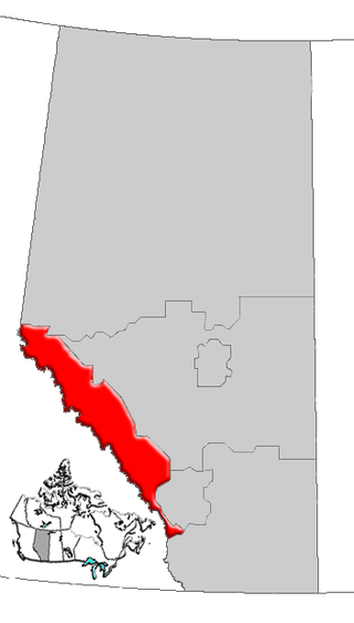
Alberta's Rockies comprise the Canadian Rocky Mountains in Alberta, Canada. On the southwestern part of the province along the British Columbia border, the region covers all but the south of Census Division 15.

Calling Lake is a hamlet in northern Alberta, Canada within the Municipal District of Opportunity No. 17. It is located on Highway 813 along the eastern shore of Calling Lake, immediately north of Calling Lake Provincial Park. It is approximately 59 km (37 mi) north of Athabasca and 113 km (70 mi) south of Wabasca and has an elevation of 595 m (1,952 ft).

Brule is a hamlet in west-central Alberta, Canada within Yellowhead County. It is located on the northwest shore of Brûlé Lake, approximately 20 kilometres (12 mi) west of Hinton. It has an elevation of 1,040 metres (3,410 ft).

<span class="mw-page-title-main">Improvement District No. 24</span> Improvement district in Alberta, Canada

Improvement District No. 24, or Improvement District No. 24 , is an improvement district in Alberta, Canada. Coextensive with the portion of Wood Buffalo National Park in northeast Alberta, the improvement district provides local governance for lands within the park that are not within Indian reserves.

References

  1. Alberta Municipal Affairs (September 17, 2010). "Municipal Profile – Municipality of Jasper" . Retrieved October 2, 2010.
  2. "Municipal Officials Search". Alberta Municipal Affairs. May 9, 2019. Retrieved October 1, 2021.
  3. 1 2 3 4 "Population and dwelling counts: Canada, provinces and territories, and census subdivisions (municipalities)". Statistics Canada. February 9, 2022. Retrieved February 9, 2022.
  4. "Alberta Private Sewage Systems 2009 Standard of Practice Handbook: Appendix A.3 Alberta Design Data (A.3.A. Alberta Climate Design Data by Town)" (PDF) (PDF). Safety Codes Council. January 2012. pp. 212–215 (PDF pages 226–229). Archived from the original (PDF) on October 16, 2013. Retrieved October 8, 2013.
  5. Parks Canada - Jasper House National Historic Site Archived September 10, 2012, at archive.today
  6. "Jasper Alberta Information Centre History".
  7. 1 2 Lothian, W.F. (1987). A Brief History of Canada's National Parks. Environment Canada.
  8. "Internment Camps in Canada during the First and Second World Wars, Library and Archives Canada". June 11, 2014.
  9. 1 2 "Location and History Profile – Municipality of Jasper" (PDF). Alberta Municipal Affairs. October 22, 2021. Retrieved October 23, 2021.
  10. "Order in Council 279/2001" (PDF). Government of Alberta. July 24, 2001. Retrieved November 25, 2012.
  11. "Jasper Sustainable Community Plan" (PDF). Municipality of Jasper and Parks Canada. September 2011. Archived from the original (PDF) on May 21, 2013. Retrieved November 25, 2012.
  12. 1 2 3 4 2021 Provincial Base Map: Municipalities (PDF) (Map). Alberta Environment and Parks. July 26, 2021. Retrieved October 23, 2021.
  13. "Economic Regions - SGC 2006 (4815033 - Jasper)". Statistics Canada. November 27, 2018. Retrieved October 2, 2021.
  14. Geo-Administrative Areas (Hamlet, Locality and Townsite Culture Points) (Geodatabase layer) (Map). AltaLIS. October 26, 2020. Retrieved October 2, 2021.{{cite map}}: CS1 maint: date and year (link)
  15. "Daily Data Report for January 1916". Canadian Climate Data. Environment Canada. October 31, 2011. Retrieved October 25, 2016.
  16. "Jasper, Alberta". Canadian Climate Normals 1981–2010. Environment Canada. Archived from the original on July 17, 2020. Retrieved October 26, 2013.
  17. "Jasper". Canadian Climate Data. Environment Canada. October 31, 2011. Retrieved October 25, 2016.
  18. "Daily Data Report for July 2021". Canadian Climate Data. Environment and Climate Change Canada. October 31, 2011. Retrieved July 7, 2021.
  19. "Jasper Warden". Canadian Climate Data. Environment Canada. October 31, 2011. Retrieved October 25, 2016.
  20. "Daily Data Report for September 2022". Canadian Climate Data. Environment and Climate Change Canada. October 31, 2011. Retrieved September 4, 2022.
  21. "Table 10: Population and Dwelling Counts, for Census Divisions, Census Subdivisions (Municipalities) and Designated Places, 1991 and 1996 Censuses – 100% Data". 96 Census. Vol. A National Overview – Population and Dwelling Counts. Ottawa: Statistics Canada. 1997. pp. 136–146. ISBN   0-660-59283-5.
  22. "Population and Dwelling Counts, for Canada, Provinces and Territories, and Census Divisions, 2001 and 1996 Censuses - 100% Data (Alberta)". Statistics Canada . Retrieved February 16, 2013.
  23. "Population and dwelling counts, for Canada, provinces and territories, and census subdivisions (municipalities), 2006 and 2001 censuses - 100% data (Alberta)". Statistics Canada. January 6, 2010. Retrieved February 16, 2013.
  24. "Corrections and updates". Statistics Canada. August 13, 2013. Retrieved August 17, 2013.
  25. 1 2 "Population and dwelling counts, for Canada, provinces and territories, and census subdivisions (municipalities), 2016 and 2011 censuses – 100% data (Alberta)". Statistics Canada. February 8, 2017. Retrieved February 8, 2017.
  26. 1 2 3 "2011 Municipal Affairs Population List" (PDF). Alberta Municipal Affairs. October 5, 2010. Retrieved December 12, 2011.
  27. "Municipality of Jasper Regular Meeting Agenda, Tuesday, September 6, 2011 (Agenda Item 7.1)" (PDF). Municipality of Jasper. September 6, 2011. p. 4. Archived from the original (PDF) on May 21, 2013. Retrieved November 25, 2012.
  28. 1 2 "2010 Official Population List" (PDF). Alberta Municipal Affairs. September 15, 2010. Retrieved December 12, 2011.
  29. Municipality of Jasper Archived May 2, 2013, at the Wayback Machine - Governance
  30. Via Rail. "Jasper station" . Retrieved June 22, 2007.
  31. "Sister City". Archived from the original on August 15, 2009. Retrieved December 3, 2014.
  32. "Loni Klettl". Team Canada - Official Olympic Team Website. Retrieved February 6, 2021.
  33. NHL Players from Jasper, Alberta | QuantHockey.com Retrieved on March 19, 2011