
The Sunbury Earth Rings are prehistoric Aboriginal sites located on the hills to the west of Jacksons Creek near Sunbury, Victoria, Australia. [1]
The Sunbury Earth Rings are prehistoric Aboriginal sites located on the hills to the west of Jacksons Creek near Sunbury, Victoria, Australia. [1]
The Sunbury earth rings were formed by scraping off grass and topsoil, and piling it in a circular ridge around the outside. They measure between 10 – 25 m diameter. Three of the rings are in close proximity and two others several kilometres away. All are on gently sloping sites. They are somewhat different from the Bora Rings found in New South Wales and southeast Queensland, which tend to be located in hidden, flat sites, and in connected pairs. [2] The Sunbury Earth Rings first came to public attention, and first were investigated and described in the early 1970s, when archaeologist Dr. David Frankel undertook a test excavation on one of the rings to determine their origin. Excavations revealed the remains of two small stone cairns, one in the centre and one on the edge of the circle, and a number of sharp stone plades or knives, which may have been used in ritual scarification or circumcision ceremonies. [3]
The rings have been interpreted as Aboriginal ceremonial sites, although there are no historical or ethnographic accounts of them being used as such. [4] Members of the Wurundjeri Tribe Council have suggested the rings may be more than 1000 years old, based on the results of archaeological investigations, and that the group of three may have related to separate male and female ceremonies and initiation rituals. However, elder Auntie Annette Xibberas acknowledged that the Aboriginal people of the Melbourne area, "...lost a lot of our knowledge with European colonisation, we only found out about these (rings) about 30 years ago". [5]
Some of the Rings have been put under the management of the Wurundjeri Tribe Land and Compensation Cultural Heritage Council, [6] and have also been included on the Register of the National Estate. [7]
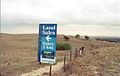
There are ongoing pressures on the sites from development. As a result of housing development along Reservoir Road, one ring in Fullwood Drive is now encircled by the back fences of adjoining houses, while another is subject to residential subdivision plans which will also see it surrounded by roads. A past proposal even considered incorporating one of the rings in the middle of a traffic round-about. The Canterbury Hills housing estate has submitted plans for residential development around the Riddells Road ring. [8] In October 2009, the Sunbury Maribyrnong Valley Green Wedge Defenders made a Submission to the Parliamentary, Legislative Council regarding their inquiry into the impact of the state government’s decision to change the Urban Growth Boundary, citing the Aboriginal ring as a significant element of the threatened Bundanoon woodlands and grasslands, which was being encroached upon by housing. [9] [10]


The Wurundjeripeople are an Australian Aboriginal people of the Woiwurrung language group, in the Kulin nation. They are the traditional owners of the Yarra River Valley, covering much of the present location of Melbourne. They continue to live in this area and throughout Australia. They were called the Yarra tribe by early European colonists.

The Maribyrnong River is a perennial river of the Port Phillip catchment, located in the north–western suburbs of Melbourne, in the Australian state of Victoria.
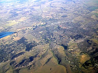
Sunbury is a satellite suburb of Melbourne, Victoria, Australia, 38 kilometres (24 mi) north-west of Melbourne's Central Business District, located within the City of Hume local government area. Sunbury recorded a population of 38,851 at the 2021 census.

The Kulin nation is an alliance of five Aboriginal nations in south-up into the Great Dividing Range and the Loddon and Goulburn River valleys.
The Merri Creek is a waterway in southern parts of Victoria, Australia which flows through the northern suburbs of Melbourne. It begins near Wallan and flows south for 70 km until joining the Yarra River at Dights Falls. The area where the creek meets the river was traditionally the location for large gatherings of the Wurundjeri people and is suspected to have been the location for one of the earliest land treaties in Australia between Indigenous Australians and European settlers.

The Maribyrnong River Trail is a shared use path for cyclists and pedestrians, which follows the Maribyrnong River through the north western suburbs of Melbourne, Victoria, Australia.
The Boonwurrung, also spelt Bunurong or Bun wurrung, are an Aboriginal people of the Kulin nation, who are the traditional owners of the land from the Werribee River to Wilsons Promontory in the Australian state of Victoria. Their territory includes part of what is now the city and suburbs of Melbourne. They were called the Western Port or Port Philip tribe by the early settlers, and were in alliance with other tribes in the Kulin nation, having particularly strong ties to the Wurundjeri people.
The Afton Street Conservation Reserve is situated along the middle reaches of the Maribyrnong River in Essendon West, Melbourne. It is within the City of Moonee Valley and is 17 hectares.
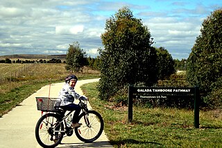
The Craigieburn Bypass Trail, is a shared use path for cyclists and pedestrians in the outer northern suburbs of Melbourne, Victoria, Australia. In 2008 it was given the local name of the Galada Tamboore Pathway - Wurundjeri for "creek waterhole" or "stream waterhole" - as it goes past the Craigieburn, Cooper street and Galada Tamboore grasslands which are all nationally significant for their plains grassland and riparian habitat for endangered and vulnerable native fauna and flora, including the critically endangered Golden Sun Moth.
The Steele Creek Trail is a shared use path for cyclists and pedestrians, which follows Steele Creek in the Outer North Western suburbs of Keilor Park, Keilor East, Tullamarine, Airport West, Melbourne Airport, Avondale heights, Essendon West and Niddrie in Melbourne.

The M80 Trail is a shared-use path for cyclists and pedestrians that bridges the northern suburbs and follows the Western Ring Road/Metropolitan Ring Road (M80) freeway in Melbourne, Australia.

Bora is an initiation ceremony of the Aboriginal people of Eastern Australia. The word "bora" also refers to the site on which the initiation is performed. At such a site, boys, having reached puberty, achieve the status of men. The initiation ceremony differs from Aboriginal culture to culture, but often, at a physical level, involved scarification, circumcision, subincision and, in some regions, also the removal of a tooth. During the rites, the youths who were to be initiated were taught traditional sacred songs, the secrets of the tribe's religious visions, dances, and traditional lore. Many different clans would assemble to participate in an initiation ceremony. Women and children were not permitted to be present at the sacred bora ground where these rituals were undertaken.

The Wurundjeri Woi Wurrung Cultural Heritage Aboriginal Corporation, previously the Wurundjeri Tribe Land and Compensation Cultural Heritage Council, is a Registered Aboriginal Party representing the Wurundjeri people, an Aboriginal Australian people of Victoria.

Aboriginal Victorians, the Aboriginal Australians of Victoria, Australia, occupied the land for tens of thousands of years prior to European settlement. Aboriginal people have lived a semi-nomadic existence of fishing, hunting and gathering and associated activities for at least 40,000 years.

Wurdi Youang is the name attributed to an Aboriginal stone arrangement located off the Little River – Ripley Road at Mount Rothwell, near Little River, Victoria in Australia. The site was acquired by the Indigenous Land Corporation on 14 January 2000 and transferred to the Wathaurong Aboriginal Co-operative on 17 August 2006.

The Jackson Creek is a watercourse within the Port Phillip catchment, located in the outer northern suburbs of Melbourne, in the Australian state of Victoria.
The Keilor archaeological site was among the first places to demonstrate the antiquity of Aboriginal occupation of Australia when a cranium, unearthed in 1940, was found to be nearly 15,000 years old. Subsequent investigations of Pleistocene alluvial terraces revealed hearths about 31,000 years BP, making Keilor one of the earliest sites of human habitation in Australia. Remains of megafauna suggest a possible association with Aboriginal hunting.

The Mount William stone axe quarry is an Aboriginal Australian archaeological site in Central Victoria, Australia. It is located 9 kilometres (5.6 mi) northeast of Lancefield, off Powells Track, 10 kilometres (6.2 mi) north of Romsey and 78 kilometres (48 mi) from Melbourne. Known as Wil-im-ee moor-ring, meaning "axe place" in the Woiwurrung language, the greenstone quarry was an important source of raw material for the manufacture of greenstone ground-edge axes, which were traded over a wide area of south-east Australia.

Aboriginal sites of Victoria form an important record of human occupation for probably more than 40,000 years. They may be identified from archaeological remains, historical and ethnographic information or continuing oral traditions and encompass places where rituals and ceremonies were performed, occupation sites where people ate, slept and carried out their day to day chores, and ephemeral evidence of people passing through the landscape, such as a discarded axe head or isolated artefact.

Tachylite is an unusual and relatively rare stone used in making flaked stone tools, and which is found in Aboriginal archaeological sites in Victoria, Australia.