Vance, Alabama

Last updated

Town of Vance [1]
VanceAlabamaPostOffice.jpg
The U.S. Post Office in Vance, Alabama
Flag of Vance, Alabama.png
Seal of Vance, Alabama.png
Bibb County and Tuscaloosa County Alabama Incorporated and Unincorporated areas Vance Highlighted 0178264.svg
Location of Vance in Bibb County and Tuscaloosa County, Alabama.
Coordinates: 33°9′52″N87°13′54″W / 33.16444°N 87.23167°W / 33.16444; -87.23167
Country United States
State Alabama
Counties Tuscaloosa, Bibb
Area
[2]
  Total10.21 sq mi (26.44 km2)
  Land10.18 sq mi (26.36 km2)
  Water0.03 sq mi (0.08 km2)
Elevation
509 ft (155 m)
Population
 (2020)
  Total2,092
  Density205.56/sq mi (79.36/km2)
Time zone UTC-6 (Central (CST))
  Summer (DST) UTC-5 (CDT)
ZIP code
35490
Area code(s) 205, 659
FIPS code 01-78264
GNIS feature ID0158947
Website townofvance.weebly.com

Vance is a town in Tuscaloosa and Bibb counties in the U.S. state of Alabama. As of the 2010 census it had a population of 1,529. [3] It is most famous for the Mercedes-Benz U.S. International plant, currently the only one in North America. The current mayor of Vance is Brenda Morrison.

Contents

The Tuscaloosa County portion of Vance is part of the Tuscaloosa Metropolitan Statistical Area, while the Bibb County portion is part of the Birmingham Hoover Metropolitan Statistical Area.

History

The town of Vance was first settled in 1830 by David M. Lindley. At that time, the town was called Trion and it was a trading post on the Old Huntsville Road.

In 1872, Trion was renamed Smallwood in honor of sawmill owner Charles Smallwood.

In 1879, Smallwood was renamed its current name Vance in honor of Dr. William Vance of North Carolina.[ citation needed ] It appeared on the 1880 U.S. Census as the village of Vance's Station.

It formally incorporated in 1972. [4]

Town government

Council members

Police department

Police Officers

Fire department

Education

Tuscaloosa County Schools operates these public schools in Vance:

Geography

Most of the town of Vance is located in southeastern Tuscaloosa County, with the town center at 33°9'52.276" North, 87°13'54.185" West (33.164521, -87.231718). [5] The town extends south into Bibb County. U.S. Route 11 passes through the center of the town, leading west 21 miles (34 km) to Tuscaloosa and northeast 36 miles (58 km) to downtown Birmingham. Interstate 59 parallels Route 11 and serves Vance via Exit 89, adjacent to the Mercedes-Benz plant.

According to the U.S. Census Bureau, the town has a total area of 10.2 square miles (26.5 km2), of which 10.2 square miles (26.4 km2) is land and 0.04 square miles (0.1 km2), or 0.29%, is water. [3]

Climate

Average annual rainfall is 54.9 inches (1,390 mm).[ citation needed ]

Demographics

Historical population
CensusPop.Note
1880 82
1970 68
1980 254273.5%
1990 248−2.4%
2000 500101.6%
2010 1,529205.8%
2020 2,09236.8%
U.S. Decennial Census [6]
2013 Estimate [7]

2020 census

Vance racial composition [8]
RaceNum.Perc.
White (non-Hispanic)1,54073.61%
Black or African American (non-Hispanic)34416.44%
Native American 10.05%
Asian 130.62%
Pacific Islander 10.05%
Other/Mixed 823.92%
Hispanic or Latino 1115.31%

As of the 2020 United States census, there were 2,092 people, 515 households, and 380 families residing in the town.

2010 census

As of the census [9] of 2010, there were 1,529 people, 537 households, and 400 families residing in the town. The population density was 150 inhabitants per square mile (58/km2). There were 592 housing units at an average density of 58.0 per square mile (22.4/km2). The racial makeup of the town was 88.8% White, 7.2% Black or African American, 0.4% Native American, 1.7% from other races, and 1.3% from two or more races. 5.6% of the population were Hispanic or Latino of any race.

There were 537 households, out of which 42.6% had children under the age of 18 living with them, 61.6% were married couples living together, 7.4% had a female householder with no husband present, and 25.5% were non-families. 19.9% of all households were made up of individuals, and 4.9% had someone living alone who was 65 years of age or older. The average household size was 2.85 and the average family size was 3.30.

In the town, the population was spread out, with 29.8% under the age of 18, 9.4% from 18 to 24, 35.3% from 25 to 44, 18.2% from 45 to 64, and 7.3% who were 65 years of age or older. The median age was 31.1 years. For every 100 females, there were 108.3 males. For every 100 females age 18 and over, there were 114.3 males.

The median income for a household in the town was $55,938, and the median income for a family was $70,114. Males had a median income of $49,583 versus $38,450 for females. The per capita income for the town was $24,406. About 3.4% of families and 4.5% of the population were below the poverty line, including 2.1% of those under age 18 and 8.7% of those age 65 or over.

Related Research Articles

<span class="mw-page-title-main">Bibb County, Alabama</span> County in Alabama, United States

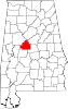
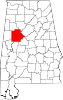
Bibb County is a county in the central portion of the U.S. state of Alabama. The county is included in the ARC's definition of Appalachia. As of the 24th decennial 2020 census, its population was 22,293. The county seat is Centreville. The county is named in honor of William W. Bibb (1781–1820), the Governor of Alabama Territory (1817–1819) and the first Governor of Alabama. He is also the namesake for Bibb County, Georgia, where he began his political career. It is a "prohibition" or dry county; however, a few towns have become "wet" by allowing the sale of alcoholic beverages: Woodstock, West Blocton, Centreville, and Brent. The Bibb County Courthouse is located in the county seat of Centreville.

<span class="mw-page-title-main">Tuscaloosa County, Alabama</span> County in Alabama, United States

Tuscaloosa County is a county in the northwest-central portion of the U.S. state of Alabama and is the center of commerce, education, industry, health care, and entertainment for the region.

<span class="mw-page-title-main">Walker County, Alabama</span> County in Alabama, United States

Walker County is a county located in the central portion of the U.S. state of Alabama. As of the 2020 census, the population was 65,342. Its county seat is Jasper. Its name is in honor of John Williams Walker, the first U.S. senator elected from Alabama.

<span class="mw-page-title-main">Brent, Alabama</span> City in Alabama, United States

Brent is a city in Bibb County, Alabama, United States. At the 2020 census, the population was 2,972.

<span class="mw-page-title-main">Centreville, Alabama</span> City in and county seat of Bibb County, Alabama

Centreville is a city in Bibb County, Alabama, United States. At the 2020 census, the population was 2,800. The city is the county seat of Bibb County.

<span class="mw-page-title-main">West Blocton, Alabama</span> Town in Alabama, United States

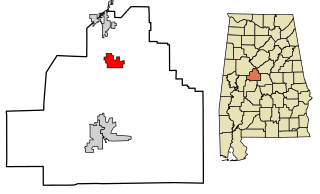
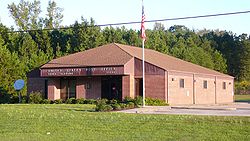
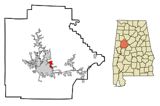
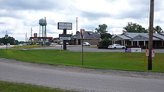
West Blocton is a town in Bibb County, Alabama, United States. At the 2020 census, the population was 1,217. The current mayor is Daniel Sims.

<span class="mw-page-title-main">Kinston, Alabama</span> Town in Alabama, United States

Kinston is a town in Coffee County, Alabama, United States. At the 2020 census, the population was 580. It is part of the Enterprise Micropolitan Statistical Area.

<span class="mw-page-title-main">East Brewton, Alabama</span> City in Alabama, United States

East Brewton is a city in Escambia County, Alabama, United States. It was incorporated in October 1918. At the 2020 census, the population was 2,293. The community grew around Fort Crawford, a fort built to protect early settlers of the area.

<span class="mw-page-title-main">Berry, Alabama</span> Town in Alabama, United States

Berry is a town in Fayette County, Alabama, United States. At the 2010 census the population was 1,148, down from 1,238 at the 2000 census.

<span class="mw-page-title-main">Moundville, Alabama</span> Town in Alabama, United States

Moundville is a town in Hale and Tuscaloosa counties in the U.S. state of Alabama. It was incorporated on December 22, 1908. From its incorporation until the 1970 census, it was wholly within Hale County. At the 2010 census the population was 2,427, up from 1,809 at the 2000 census. It is part of the Tuscaloosa Metropolitan Statistical Area. Within the town is Moundville Archaeological Site, the location of a prehistoric Mississippian culture political and ceremonial center.

<span class="mw-page-title-main">Linden, Alabama</span> City in Alabama, United States

Linden is a city in and the county seat of Marengo County, Alabama, United States. The population was 1,930 at the 2020 census, down from 2,123 at the 2010 census.

<span class="mw-page-title-main">Gordo, Alabama</span> Town in Alabama, United States

Gordo is a town in Pickens County, Alabama, United States. At the 2020 census, its population was 1,628, down from 1,750 in 2010. It was the second-largest municipality in Pickens County as of 2020, after Aliceville. The town incorporated in 1900.

<span class="mw-page-title-main">Vincent, Alabama</span> City in Alabama, United States

Vincent, originally known as Propel, is a city in Shelby, St. Clair, and Talladega counties in the U.S. state of Alabama. At the 2020 census, the population was 1,982. The community was first known as Propel, but later named Vincent in honor of the Vincent family, who were early settlers of the area. It was incorporated in 1897.

<span class="mw-page-title-main">Brookwood, Alabama</span> City in Alabama, United States

Brookwood is a city in Tuscaloosa County, Alabama, United States. It incorporated in September 1977. As of the 2020 census, the population of the town is 2,504.

<span class="mw-page-title-main">Coaling, Alabama</span> Town in Alabama, United States

Coaling is a town in Tuscaloosa County, Alabama, United States. It incorporated in September 1997. At the 2020 census, the population was 2,035. It is part of the Tuscaloosa, Alabama Metropolitan Statistical Area.

<span class="mw-page-title-main">Coker, Alabama</span> Town in Alabama, United States

Coker is a town in Tuscaloosa County, Alabama, United States. It incorporated in 1999. At the 2020 census, the population was 904. It is part of the Tuscaloosa, Alabama Metropolitan Statistical Area.

<span class="mw-page-title-main">Holt, Alabama</span> Census-designated place & Unincorporated community in Alabama, United States

Holt is an unincorporated community and census-designated place (CDP) in Tuscaloosa County, Alabama, United States. At the 2020 census, the population was 3,413. It is part of the Tuscaloosa, Alabama Metropolitan Statistical Area. Holt appeared on the 1930 census.

<span class="mw-page-title-main">Lake View, Alabama</span> City in Alabama, United States

Lake View is a city in Alabama, United States, with the majority in Tuscaloosa County and with a small portion in Jefferson County. At the 2010 census the population was 1,943, up from 1,357 in 2000. It is part of the Tuscaloosa Metropolitan Statistical Area and the Birmingham metropolitan area. It is located approximately halfway between Tuscaloosa and Birmingham via Interstates 20 and 59.

<span class="mw-page-title-main">Trion, Georgia</span> Town in Georgia, United States

Trion is a town in Chattooga County, Georgia, United States. The population was 1,960 at the 2020 census, down from 1,827 at the 2010 census. Trion is the second-largest incorporated community in Chattooga County, which has a population of approximately 26,000. Trion is known as the denim capital of the world because of the Mount Vernon manufacturing plant, which employs about 4,000 people.

<span class="mw-page-title-main">Woodstock, Alabama</span> Town in Alabama, United States

Woodstock is a town in Bibb and Tuscaloosa counties in the U.S. state of Alabama. Formerly known as North Bibb, by referendum in August 2000, the town adopted the name of a long-established local unincorporated community and, as of October 1, 2000, is now known officially as "Woodstock". As of the 2010 census, the population of the town was 1,428.

References

  1. "Code of Alabama 1975, Title 11, Chapter 40, Section 11-40-1". Archived from the original on March 17, 2010. Retrieved June 24, 2010.
  2. "2020 U.S. Gazetteer Files". United States Census Bureau. Retrieved October 29, 2021.
  3. 1 2 "Geographic Identifiers: 2010 Demographic Profile Data (G001): Vance town, Alabama". U.S. Census Bureau, American Factfinder. Archived from the original on February 12, 2020. Retrieved September 16, 2013.
  4. Maloney, Christopher. "Vance". Encyclopedia of Alabama . Retrieved June 8, 2019.
  5. "US Gazetteer files: 2010, 2000, and 1990". United States Census Bureau. February 12, 2011. Retrieved April 23, 2011.
  6. "U.S. Decennial Census". Census.gov. Retrieved June 6, 2013.
  7. "Annual Estimates of the Resident Population: April 1, 2010 to July 1, 2013" . Retrieved June 3, 2014.
  8. "Explore Census Data". data.census.gov. Retrieved December 11, 2021.
  9. "U.S. Census website". United States Census Bureau . Retrieved July 8, 2015.

33°09′52″N87°13′54″W / 33.164521°N 87.231718°W / 33.164521; -87.231718