Centreville, Alabama

Last updated

Centreville
City
Bibb County, Alabama courthouse.jpg
Bibb County Courthouse in Centreville
Bibb County Alabama Incorporated and Unincorporated areas Centreville Highlighted 0113672.svg
Location of Centreville in Bibb County, Alabama.
Coordinates: 32°57′0″N87°8′4″W / 32.95000°N 87.13444°W / 32.95000; -87.13444
CountryUnited States
State Alabama
County Bibb
Founded1823
Incorporated1832
Founded bySarah Willis Chotard
Government
  MayorMike Oakley
Area
[1]
  Total9.60 sq mi (24.86 km2)
  Land9.45 sq mi (24.48 km2)
  Water0.15 sq mi (0.38 km2)
Elevation
253 ft (77 m)
Population
 (2020)
  Total2,800
  Density296.26/sq mi (114.39/km2)
Time zone UTC-6 (Central (CST))
  Summer (DST) UTC-5 (CDT)
ZIP code
35042
Area code(s) 205, 659
FIPS code 01-13672
GNIS feature ID0159359
Website cityofcentreville.com

Centreville is a city in Bibb County, Alabama, United States. At the 2020 census, the population was 2,800. The city is the county seat of Bibb County.

Contents

Geography

According to the U.S. Census Bureau, Centreville has a total area of 9.6 square miles (24.9 km2), of which 9.5 square miles (24.5 km2) are land and 0.15 square miles (0.4 km2), or 1.52%, is water. [2] The city is bordered to the west by the city of Brent by the Cahaba River.

The city is located in the central part of the state along U.S. Route 82, which runs from southeast to northwest to the north of the city, leading southeast 70 mi (110 km) to Montgomery, the state capital, and northwest 35 mi (56 km) to Tuscaloosa. Alabama State Routes 25 and 219 both run through the center of the city from south to north. AL-25 leads northeast 21 mi (34 km) to Montevallo and southwest 38 mi (61 km) to Greensboro. AL-219 leads north 7 mi (11 km) to Alabama State Route 5 north of Brent and south 42 mi (68 km) to Selma.

Climate

The climate in this area is characterized by hot, humid summers and generally mild to cool winters. According to the Köppen Climate Classification system, Centreville has a humid subtropical climate, abbreviated Cfa on climate maps. [3]

Centreville is the site of the highest recorded temperature in the state of Alabama, when on September 6, 1925, the temperature reached 112 °F or 44.4 °C. [4] The data below are for the years 1916 to 1974. [5]

Climate data for Centreville, Alabama, 1991–2020 normals, extremes 1917–2014
MonthJanFebMarAprMayJunJulAugSepOctNovDecYear
Record high °F (°C)82
(28)
86
(30)
91
(33)
94
(34)
98
(37)
105
(41)
109
(43)
106
(41)
112
(44)
101
(38)
93
(34)
82
(28)
112
(44)
Mean maximum °F (°C)72.7
(22.6)
76.8
(24.9)
82.8
(28.2)
86.0
(30.0)
90.6
(32.6)
95.0
(35.0)
96.6
(35.9)
96.3
(35.7)
93.6
(34.2)
87.1
(30.6)
80.2
(26.8)
73.9
(23.3)
98.3
(36.8)
Mean daily maximum °F (°C)55.3
(12.9)
59.4
(15.2)
67.8
(19.9)
75.0
(23.9)
82.2
(27.9)
88.1
(31.2)
90.7
(32.6)
90.4
(32.4)
85.7
(29.8)
76.2
(24.6)
65.3
(18.5)
57.2
(14.0)
74.4
(23.6)
Daily mean °F (°C)43.5
(6.4)
47.2
(8.4)
53.8
(12.1)
60.9
(16.1)
69.0
(20.6)
76.2
(24.6)
79.3
(26.3)
78.8
(26.0)
73.5
(23.1)
62.9
(17.2)
51.8
(11.0)
45.6
(7.6)
61.9
(16.6)
Mean daily minimum °F (°C)31.7
(−0.2)
34.9
(1.6)
39.9
(4.4)
46.7
(8.2)
55.8
(13.2)
64.3
(17.9)
67.9
(19.9)
67.3
(19.6)
61.4
(16.3)
49.7
(9.8)
38.2
(3.4)
34.0
(1.1)
49.3
(9.6)
Mean minimum °F (°C)15.6
(−9.1)
19.5
(−6.9)
25.3
(−3.7)
32.9
(0.5)
44.2
(6.8)
56.0
(13.3)
63.1
(17.3)
62.0
(16.7)
47.9
(8.8)
34.4
(1.3)
26.0
(−3.3)
18.4
(−7.6)
11.7
(−11.3)
Record low °F (°C)−6
(−21)
5
(−15)
13
(−11)
26
(−3)
33
(1)
40
(4)
53
(12)
51
(11)
33
(1)
23
(−5)
10
(−12)
1
(−17)
−6
(−21)
Average precipitation inches (mm)5.33
(135)
5.85
(149)
5.56
(141)
4.74
(120)
3.69
(94)
4.56
(116)
4.39
(112)
4.98
(126)
4.50
(114)
3.26
(83)
4.78
(121)
5.37
(136)
57.01
(1,447)
Average snowfall inches (cm)0.1
(0.25)
0.0
(0.0)
0.5
(1.3)
0.0
(0.0)
0.0
(0.0)
0.0
(0.0)
0.0
(0.0)
0.0
(0.0)
0.0
(0.0)
0.0
(0.0)
0.0
(0.0)
0.1
(0.25)
0.7
(1.8)
Average precipitation days (≥ 0.01 in)9.810.19.38.38.210.111.010.47.16.48.19.8108.6
Average snowy days (≥ 0.1 in)0.00.00.10.00.00.00.00.00.00.00.00.00.1
Source 1: NOAA [6]
Source 2: XMACIS2 (mean maxima/minima 19812010) [7]

Demographics

Historical population
CensusPop.Note
1890 239
1900 42276.6%
1910 73073.0%
1920 7938.6%
1930 791−0.3%
1940 89312.9%
1950 1,16029.9%
1960 1,98170.8%
1970 2,23312.7%
1980 2,50412.1%
1990 2,5080.2%
2000 2,466−1.7%
2010 2,77812.7%
2020 2,8000.8%
U.S. Decennial Census [8]
2013 Estimate [9]

2020 census

Centreville racial composition [10]
RaceNum.Perc.
White (non-Hispanic)1,93168.96%
Black or African American (non-Hispanic)68524.46%
Native American 90.32%
Asian 30.11%
Other/Mixed 652.32%
Hispanic or Latino 1073.82%

As of the 2020 United States census, there were 2,800 people, 947 households, and 599 families residing in the city.

2010 census

As of the census [11] of 2010, there were 2,778 people, 1,066 households, and 729 families residing in the city. The population density was 294 inhabitants per square mile (114/km2). There were 1,178 housing units at an average density of 122 per square mile (47/km2). The racial makeup of the city was 72.2% White, 23.7% Black or African American, 0.3% Native American, 0.4% Asian, 2.4% from other races, and 1.1% from two or more races. 3.0% of the population were Hispanic or Latino of any race.

There were 1,066 households, of which 29.7% had children under the age of 18 living with them, 47.2% were married couples living together, 15.9% had a female householder with no husband present, and 31.6% were non-families. 29.0% of all households were made up of individuals, and 14.2% had someone living alone who was 65 years of age or older. The average household size was 2.50 and the average family size was 3.07

In the city, the population was spread out, with 23.8% under the age of 18, 9.0% from 18 to 24, 24.6% from 25 to 44, 24.6% from 45 to 64, and 18.1% who were 65 years of age or older. The median age was 39 years. For every 100 females, there were 92.6 males. For every 100 females age 18 and over, there were 95.0 males.

The median income for a household in the city was $31,642, and the median income for a family was $58,000. Males had a median income of $37,614 versus $17,088 for females. The per capita income for the city was $18,172. About 13.5% of families and 15.9% of the population were below the poverty line, including 10.1% of those under age 18 and 1.1% of those age 65 or over.

History

The Cahaba River falls near Centreville, which made the town a strategic location for transportation through the region. The first post office in Bibb County was established in Centreville in 1821. Sarah Willis Chotard obtained a patent for land in this area in 1823 and began moving squatters off the land and laid out a plot for the new town of Centreville. [12]

In 1829, Centreville became the permanent seat for Bibb County after several years of debate and different locations of the county courthouse, and the town was incorporated in 1832. [12] Centreville's historic district is listed on the National Register of Historic Places. [13]

On May 27, 1973, a violent tornado struck the city, causing major damage across the area.

On March 25, 2021, a violent tornado hit the southern and eastern portions of Centreville, causing significant damage to the area and rendering the Bibb County Airport a total loss.

1910 lynching

In 1910, a white woman by the name of Mrs. Crow gave birth to a child of "doubtful color", who was thought by many to be the product of a relationship between Crow and an African American, and she was accused of having such a relationship. At first she vigorously denied it, but then – under intense peer pressure – she confessed to the baby's origin but claimed that she had been raped. When asked if she knew who raped her, Crow gave them the name of Grant Richardson, an African American who lived near the Braehead Slope Mine Camp, northeast of Centreville. The miners and other local residents were so incensed at the affair that they decided to apply "summary vengeance" to Richardson as soon as they knew that the sheriff had apprehended him.

Deputy Sheriff Cam Riley apprehended Richardson on October 12, 1910, and was returning him to the jail at Centreville for processing and trial, but was waylaid by a lynch mob. The mob took Richardson from Riley and shot the suspect. Chief Deputy Sheriff Charles Oakley investigated the scene as soon as word of the incident reached him, but other than the body, the shells, and the blood, there was little usable evidence to be found, much less witnesses. A coroner's inquest was held as soon as a special coroner was appointed, but there is no known result of that inquest. This was the first recorded lynching to take place in Bibb County.

It is unknown whether charges of either filing false charges resulting in a murder or miscegenation were filed against Crow, but it is known by those aware of Richardson that he had lived in the area for a number of years with a fair reputation prior to the incident. [14] [15]

Education

Centreville is served by the Bibb County Public School District. Schools in Centreville include Bibb County High School (grades 9 through 12) and Centreville Middle School (grades 5 through 8). Cahawba Christian Academy is a private school serving grades pre-K to 12.

Media

Notable people

Related Research Articles

<span class="mw-page-title-main">Bibb County, Alabama</span> County in Alabama, United States

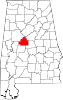
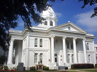
Bibb County is a county in the central portion of the U.S. state of Alabama. The county is included in the ARC's definition of Appalachia. As of the 24th decennial 2020 census, its population was 22,293. The county seat is Centreville. The county is named in honor of William W. Bibb (1781–1820), the Governor of Alabama Territory (1817–1819) and the first Governor of Alabama. He is also the namesake for Bibb County, Georgia, where he began his political career. It is a "prohibition" or dry county; however, a few towns have become "wet" by allowing the sale of alcoholic beverages: Woodstock, West Blocton, Centreville, and Brent. The Bibb County Courthouse is located in the county seat of Centreville.

<span class="mw-page-title-main">Etowah County, Alabama</span> County in Alabama, United States

Etowah County is a county located in the northeastern part of the U.S. state of Alabama. As of the 2020 census the population was 103,436. Its county seat is Gadsden. Its name is from a Cherokee word meaning "edible tree". In total area, it is the smallest county in Alabama, but one of the most densely populated. Etowah County comprises the Gadsden Metropolitan Statistical Area.

<span class="mw-page-title-main">Shelby County, Alabama</span> County in Alabama, United States

Shelby County is located in the central portion of the U.S. state of Alabama. As of the 2020 census the population was 223,024, making it the sixth-most populous county in Alabama. The county seat is Columbiana. Its largest city is Alabaster. The county is named in honor of Isaac Shelby, Governor of Kentucky from 1792 to 1796 and again from 1812 to 1816. Shelby County is included in the Birmingham–Hoover, AL Metropolitan Statistical Area.

<span class="mw-page-title-main">Brent, Alabama</span> City in Alabama, United States

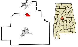
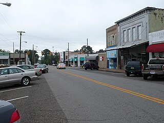
Brent is a city in Bibb County, Alabama, United States. At the 2020 census, the population was 2,972.

<span class="mw-page-title-main">West Blocton, Alabama</span> Town in Alabama, United States

West Blocton is a town in Bibb County, Alabama, United States. At the 2020 census, the population was 1,217. The current mayor is Daniel Sims.

<span class="mw-page-title-main">Oxford, Alabama</span> City in Alabama, United States

Oxford is a city in Calhoun, Talladega, and Cleburne counties in the State of Alabama, United States. The population was 22,069 at the 2020 census,. Oxford is one of two principal cities of and included in the Anniston-Oxford Metropolitan Statistical Area, and it is the largest city in Calhoun County by population.

<span class="mw-page-title-main">Calera, Alabama</span> City in Alabama, United States

Calera is a city in Shelby and Chilton counties in the U.S. state of Alabama. It is the location of the Shelby County Airport.

<span class="mw-page-title-main">Butler, Alabama</span> City in and county seat of Choctaw County, Alabama

Butler is a town in and the county seat of Choctaw County, Alabama, United States. The population was 1,894 at the 2010 census.

<span class="mw-page-title-main">Ashland, Alabama</span> City in and county seat of Clay County, Alabama

Ashland is a city in Clay County, Alabama, United States. The population was 2,037 at the 2010 census. The city is the county seat of Clay County.

<span class="mw-page-title-main">Tuscumbia, Alabama</span> City in Alabama

Tuscumbia is a city in and the county seat of Colbert County, Alabama, United States. As of the 2010 census, the population was 8,423. The city is part of The Shoals metropolitan area.

<span class="mw-page-title-main">Luverne, Alabama</span> City in Alabama, United States

Luverne is a city in and the county seat of Crenshaw County, Alabama, United States. The city describes itself as "The Friendliest City in the South", a slogan that appears on its "welcome" signs. At the 2020 census, the population was 2,765.

<span class="mw-page-title-main">Ozark, Alabama</span> City in Alabama, United States

Ozark is a city in and the county seat of Dale County, Alabama. As of the 2010 census, the population of the city was 14,907.

<span class="mw-page-title-main">Eutaw, Alabama</span> City in and county seat of Greene County, Alabama

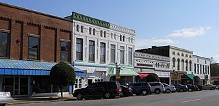
Eutaw is a city in and the county seat of Greene County, Alabama, United States. At the 2020 census, the population was 2,937. The city was named in honor of the Battle of Eutaw Springs, the last engagement of the American Revolutionary War in the Carolinas.

<span class="mw-page-title-main">Greensboro, Alabama</span> City in Alabama, United States

Greensboro is a city in Hale County, Alabama, United States. At the 2010 census the population was 2,497, down from 2,731 at the 2000 census. The city is the county seat of Hale County, Alabama, which was not organized until 1867. It is part of the Tuscaloosa, Alabama Metropolitan Statistical Area.

<span class="mw-page-title-main">Abbeville, Alabama</span> City in and county seat of Henry County, Alabama

Abbeville is a city in and the county seat of Henry County, in the southeast part of Alabama, United States. It is part of the Dothan, Alabama Metropolitan Statistical Area. At the 2020 census, the population was 2,358.

<span class="mw-page-title-main">Vestavia Hills, Alabama</span> City in Alabama, United States

Vestavia Hills, colloquially known simply as Vestavia, is a city in Jefferson and Shelby counties in the U.S. state of Alabama. It is a suburb of Birmingham and it is made up of Vestavia, Liberty Park, and Cahaba Heights. The population was 39,102 at the 2020 census. Vestavia Hills is the third largest city in Jefferson County in 2020, after Birmingham and Hoover. Vestavia Hills is the thirteenth largest city in Alabama.

<span class="mw-page-title-main">Talladega, Alabama</span> City in Alabama, United States

Talladega is the county seat of Talladega County, Alabama, United States. It was incorporated in 1835. At the 2020 census, the population was 15,861. Talladega is approximately 50 miles (80 km) east of one of the state’s largest cities, Birmingham.

<span class="mw-page-title-main">Camp Hill, Alabama</span> Town in Alabama, United States

Camp Hill is a town in Tallapoosa County, Alabama, United States. It was incorporated in 1895. At the 2010 census the population was 1,014, down from 1,273 in 2000. Camp Hill is the home to Southern Preparatory Academy.

<span class="mw-page-title-main">Dadeville, Alabama</span> County seat of Tallapoosa County

Dadeville is a city in and the county seat of Tallapoosa County, Alabama, United States. At the 2010 census the population was 3,230, up from 3,212 in 2000.

<span class="mw-page-title-main">Woodstock, Alabama</span> Town in Alabama, United States

Woodstock is a town in Bibb and Tuscaloosa counties in the U.S. state of Alabama. Formerly known as North Bibb, by referendum in August 2000, the town adopted the name of a long-established local unincorporated community and, as of October 1, 2000, is now known officially as "Woodstock". As of the 2010 census, the population of the town was 1,428.

References

  1. "2020 U.S. Gazetteer Files". United States Census Bureau. Retrieved October 29, 2021.
  2. "Geographic Identifiers: 2010 Demographic Profile Data (G001): Centreville city, Alabama". U.S. Census Bureau, American Factfinder. Archived from the original on February 12, 2020. Retrieved September 16, 2013.
  3. Climate Summary for Centreville, Alabama
  4. Enloe. "State Climate Extremes Committee (SCEC) | Extremes | National Centers for Environmental Information (NCEI)". www.ncdc.noaa.gov. Retrieved July 15, 2018.
  5. "CENTREVILLE, ALABAMA - Climate Summary". wrcc.dri.edu. Retrieved July 15, 2018.
  6. "U.S. Climate Normals Quick Access – Station: Centreville 6 SW, AL". National Oceanic and Atmospheric Administration. Retrieved March 3, 2023.
  7. "xmACIS2". National Oceanic and Atmospheric Administration. Retrieved March 3, 2023.
  8. "U.S. Decennial Census". Census.gov. Retrieved June 6, 2013.
  9. "Annual Estimates of the Resident Population: April 1, 2010 to July 1, 2013" . Retrieved June 3, 2014.
  10. "Explore Census Data". data.census.gov. Retrieved December 11, 2021.
  11. "U.S. Census website". United States Census Bureau . Retrieved July 8, 2015.
  12. 1 2 Ellison, Rhonda C. (1999). Bibb County, Alabama: The First Hundred Years. University of Alabama Press. ISBN   0-8173-0987-X.
  13. "National Register Information System". National Register of Historic Places . National Park Service. March 13, 2009.
  14. Ginzburg, Ralph (October 13, 1910). "Angry Miners Lynch Negro". Montgomery Advertiser . ISBN   9780933121188 . Retrieved July 23, 2011.
  15. "Lynch Negro for Assaulting Woman" (PDF). The New York Times. October 13, 1910. Retrieved July 23, 2011.
  16. History of Alabama and Dictionary of Alabama Biographies, Thomas McAdry Owen and Maria Bankhead Owen, S.J. Clements Publishing Company: 1921, biographical sketch of Franklin Potts Glass Sr., pg. 663
  17. "Henry James Past Stats, Playoff Stats, Statistics, History, and Awards". Archived from the original on March 4, 2006. Retrieved January 7, 2013.
  18. Reichler, Joseph L., ed. (1979) [1969]. The Baseball Encyclopedia (4th ed.). New York: Macmillan Publishing. ISBN   0-02-578970-8.

Further reading

32°57′00″N87°08′05″W / 32.95°N 87.134708°W / 32.95; -87.134708