Water quality modeling involves water quality based data using mathematical simulation techniques. Water quality modeling helps people understand the eminence of water quality issues and models provide evidence for policy makers to make decisions in order to properly mitigate water. [1] Water quality modeling also helps determine correlations to constituent sources and water quality along with identifying information gaps. [2] Due to the increase in freshwater usage among people, water quality modeling is especially relevant [3] both in a local level and global level. In order to understand and predict the changes over time in water scarcity, climate change, and the economic factor of water resources, [1] water quality models would need sufficient data by including water bodies from both local and global levels.
A typical water quality model consists of a collection of formulations representing physical mechanisms that determine position and momentum of pollutants in a water body. [4] Models are available for individual components of the hydrological system such as surface runoff; [5] there also exist basin wide models addressing hydrologic transport and for ocean and estuarine applications. Often finite difference methods are used to analyze these phenomena, and, almost always, large complex computer models are required. [6]
Water quality models have different information, but generally have the same purpose, which is to provide evidentiary support of water issues. Models can be either deterministic or statistical depending on the scale with the base model, [2] which is dependent on if the area is on a local, regional, or a global scale. Another aspect to consider for a model is what needs to be understood or predicted about that research area along with setting up any parameters to define the research. Another aspect of building a water quality model is knowing the audience and the exact purpose for presenting data like to enhance water quality management [7] for water quality law makers for the best possible outcomes.
A SPARROW model is a SPAtially-Referenced Regression on Watershed attributes, which helps integrate water quality data with landscape information. [2] More specifically the USGS used this model to display long-term changes within watersheds to further explain in-stream water measurement in relation to upstream sources, water quality, and watershed properties. These models predict data for various spatial scales and integrate streamflow data with water quality at numerous locations across the US. [2] A SPARROW model used by the USGS focused on the nutrients in the Nation's major rivers and estuaries; this model helped create a better understanding of where nutrients come from, where they are transported to while in the water bodies, and where they end up (reservoirs, other estuaries, etc.). [2]

Hydrology is the scientific study of the movement, distribution, and management of water on Earth and other planets, including the water cycle, water resources, and environmental watershed sustainability. A practitioner of hydrology is called a hydrologist. Hydrologists are scientists studying earth or environmental science, civil or environmental engineering, and physical geography. Using various analytical methods and scientific techniques, they collect and analyze data to help solve water related problems such as environmental preservation, natural disasters, and water management.

A drainage basin is an area of land where all flowing surface water converges to a single point, such as a river mouth, or flows into another body of water, such as a lake or ocean. A basin is separated from adjacent basins by a perimeter, the drainage divide, made up of a succession of elevated features, such as ridges and hills. A basin may consist of smaller basins that merge at river confluences, forming a hierarchical pattern.
Ecohydrology is an interdisciplinary scientific field studying the interactions between water and ecological systems. It is considered a sub discipline of hydrology, with an ecological focus. These interactions may take place within water bodies, such as rivers and lakes, or on land, in forests, deserts, and other terrestrial ecosystems. Areas of research in ecohydrology include transpiration and plant water use, adaption of organisms to their water environment, influence of vegetation and benthic plants on stream flow and function, and feedbacks between ecological processes, the soil carbon sponge and the hydrological cycle.
The United States Environmental Protection Agency (EPA) Storm Water Management Model (SWMM) is a dynamic rainfall–runoff–subsurface runoff simulation model used for single-event to long-term (continuous) simulation of the surface/subsurface hydrology quantity and quality from primarily urban/suburban areas. It can simulate the Rainfall- runoff, runoff, evaporation, infiltration and groundwater connection for roots, streets, grassed areas, rain gardens and ditches and pipes, for example. The hydrology component of SWMM operates on a collection of subcatchment areas divided into impervious and pervious areas with and without depression storage to predict runoff and pollutant loads from precipitation, evaporation and infiltration losses from each of the subcatchment. Besides, low impact development (LID) and best management practice areas on the subcatchment can be modeled to reduce the impervious and pervious runoff. The routing or hydraulics section of SWMM transports this water and possible associated water quality constituents through a system of closed pipes, open channels, storage/treatment devices, ponds, storages, pumps, orifices, weirs, outlets, outfalls and other regulators.

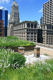
Rain gardens, also called bioretention facilities, are one of a variety of practices designed to increase rain runoff reabsorption by the soil. They can also be used to treat polluted stormwater runoff. Rain gardens are designed landscape sites that reduce the flow rate, total quantity, and pollutant load of runoff from impervious urban areas like roofs, driveways, walkways, parking lots, and compacted lawn areas. Rain gardens rely on plants and natural or engineered soil medium to retain stormwater and increase the lag time of infiltration, while remediating and filtering pollutants carried by urban runoff. Rain gardens provide a method to reuse and optimize any rain that falls, reducing or avoiding the need for additional irrigation. A benefit of planting rain gardens is the consequential decrease in ambient air and water temperature, a mitigation that is especially effective in urban areas containing an abundance of impervious surfaces that absorb heat in a phenomenon known as the heat-island effect.

Nonpoint source (NPS) pollution refers to diffuse contamination of water or air that does not originate from a single discrete source. This type of pollution is often the cumulative effect of small amounts of contaminants gathered from a large area. It is in contrast to point source pollution which results from a single source. Nonpoint source pollution generally results from land runoff, precipitation, atmospheric deposition, drainage, seepage, or hydrological modification where tracing pollution back to a single source is difficult. Nonpoint source water pollution affects a water body from sources such as polluted runoff from agricultural areas draining into a river, or wind-borne debris blowing out to sea. Nonpoint source air pollution affects air quality, from sources such as smokestacks or car tailpipes. Although these pollutants have originated from a point source, the long-range transport ability and multiple sources of the pollutant make it a nonpoint source of pollution; if the discharges were to occur to a body of water or into the atmosphere at a single location, the pollution would be single-point.

Surface runoff is the flow of water occurring on the ground surface when excess rainwater, stormwater, meltwater, or other sources, can no longer sufficiently rapidly infiltrate in the soil. This can occur when the soil is saturated by water to its full capacity, and the rain arrives more quickly than the soil can absorb it. Surface runoff often occurs because impervious areas do not allow water to soak into the ground. Furthermore, runoff can occur either through natural or man-made processes. Surface runoff is a major component of the water cycle. It is the primary agent of soil erosion by water. The land area producing runoff that drains to a common point is called a drainage basin.
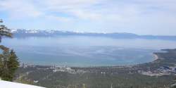
The DSSAM Model is a computer simulation developed for the Truckee River to analyze water quality impacts from land use and wastewater management decisions in the Truckee River Basin. This area includes the cities of Reno and Sparks, Nevada as well as the Lake Tahoe Basin. The model is historically and alternatively called the Earth Metrics Truckee River Model. Since original development in 1984-1986 under contract to the U.S. Environmental Protection Agency (EPA), the model has been refined and successive versions have been dubbed DSSAM II and DSSAM III. This hydrology transport model is based upon a pollutant loading metric called Total maximum daily load (TMDL). The success of this flagship model contributed to the Agency's broadened commitment to the use of the underlying TMDL protocol in its national policy for management of most river systems in the United States.

An hydrological transport model is a mathematical model used to simulate the flow of rivers, streams, groundwater movement or drainage front displacement, and calculate water quality parameters. These models generally came into use in the 1960s and 1970s when demand for numerical forecasting of water quality and drainage was driven by environmental legislation, and at a similar time widespread access to significant computer power became available. Much of the original model development took place in the United States and United Kingdom, but today these models are refined and used worldwide.
A total maximum daily load (TMDL) is a regulatory term in the U.S. Clean Water Act, describing a plan for restoring impaired waters that identifies the maximum amount of a pollutant that a body of water can receive while still meeting water quality standards.

The Chesapeake Bay Program is the regional partnership that directs and conducts the restoration of the Chesapeake Bay in the United States. As a partnership, the Chesapeake Bay Program brings together members of various state, federal, academic and local watershed organizations to build and adopt policies that support Chesapeake Bay restoration. By combining the resources and unique strengths of each individual organization, the Chesapeake Bay Program is able to follow a unified plan for restoration. The program office is located in Annapolis, Maryland.

MapWindow GIS is a lightweight open-source GIS (mapping) desktop application and set of programmable mapping components.
Geographic information systems (GISs) have become a useful and important tool in the field of hydrology to study and manage Earth's water resources. Climate change and greater demands on water resources require a more knowledgeable disposition of arguably one of our most vital resources. Because water in its occurrence varies spatially and temporally throughout the hydrologic cycle, its study using GIS is especially practical. Whereas previous GIS systems were mostly static in their geospatial representation of hydrologic features, GIS platforms are becoming increasingly dynamic, narrowing the gap between historical data and current hydrologic reality.

The Conservation Effects Assessment Project (CEAP) was established in 2002 to quantify the environmental impact of the United States Department of Agriculture's (USDA) conservation program. The project focuses on how watersheds are affected. CEAP monitored 14 benchmark watershed sites. The CEAP's vision is to enhance "natural resources and healthier ecosystems through improved conservation effectiveness and better management of agricultural landscapes. The goal is "to improve efficacy of conservations practices and programs by quantifying conservation effects and providing the science and education base needed to enrich conservation planning, implementation, management decisions, and policy."
SWAT is a river basin scale model developed to quantify the impact of land management practices in large, complex watersheds. SWAT is a public domain software enabled model actively supported by the USDA Agricultural Research Service at the Blackland Research & Extension Center in Temple, Texas, USA. It is a hydrology model with the following components: weather, surface runoff, return flow, percolation, evapotranspiration, transmission losses, pond and reservoir storage, crop growth and irrigation, groundwater flow, reach routing, nutrient and pesticide loading, and water transfer. SWAT can be considered a watershed hydrological transport model. This model is used worldwide and is continuously under development. As of July 2012, more than 1000 peer-reviewed articles have been published that document its various applications.
Hydrological optimization applies mathematical optimization techniques to water-related problems. These problems may be for surface water, groundwater, or the combination. The work is interdisciplinary, and may be done by hydrologists, civil engineers, environmental engineers, and operations researchers.

Nutrient pollution, a form of water pollution, refers to contamination by excessive inputs of nutrients. It is a primary cause of eutrophication of surface waters, in which excess nutrients, usually nitrogen or phosphorus, stimulate algal growth. Sources of nutrient pollution include surface runoff from farm fields and pastures, discharges from septic tanks and feedlots, and emissions from combustion. Raw sewage is a large contributor to cultural eutrophication since sewage is high in nutrients. Releasing raw sewage into a large water body is referred to as sewage dumping, and still occurs all over the world. Excess reactive nitrogen compounds in the environment are associated with many large-scale environmental concerns. These include eutrophication of surface waters, harmful algal blooms, hypoxia, acid rain, nitrogen saturation in forests, and climate change.

Conservation programs for the Mississippi River watershed have been designed to protect and preserve it by implementing practices that decrease the harmful effects of development on habitats and to overlook monitoring that helps future planning and management. A main focus is nutrient pollution from agricultural runoff of the nation's soybean, corn and food animal production, and problems relating to sediment and toxins. Conservation programs work with local farmers and producers to decrease excess nutrients because they cause major water quality problems along with hypoxia and loss of habitat. Organizations such as the Mississippi River/Gulf of Mexico Watershed Nutrient Task Force and USDA programs such as the Upper Mississippi River Forestry Partnership and the Mississippi River Basin Healthy Watersheds Initiative contribute to conserving what is left of the Mississippi River watershed.
The HUMUS project is a project that was funded by the Natural Resources Conservation Service to model the non-point source loading from 8-digit hydrologic unit cataloging units.
Low-impact development (LID) is a term used in Canada and the United States to describe a land planning and engineering design approach to manage stormwater runoff as part of green infrastructure. LID emphasizes conservation and use of on-site natural features to protect water quality. This approach implements engineered small-scale hydrologic controls to replicate the pre-development hydrologic regime of watersheds through infiltrating, filtering, storing, evaporating, and detaining runoff close to its source. Green infrastructure investments are one approach that often yields multiple benefits and builds city resilience.