Whatley, Alabama

Last updated

Whatley, Alabama
Clarke County Alabama Incorporated and Unincorporated areas Whatley Highlighted 0181744.svg
Location of Whatley in Clarke County, Alabama.
USA Alabama location map.svg
Red pog.svg
Whatley
Location within the state of Alabama
Coordinates: 31°39′3″N87°42′18″W / 31.65083°N 87.70500°W / 31.65083; -87.70500
Country United States
State Alabama
County Clarke
Area
[1]
  Total1.29 sq mi (3.34 km2)
  Land1.29 sq mi (3.34 km2)
  Water0.00 sq mi (0.00 km2)
Elevation
154 ft (47 m)
Population
 (2020)
  Total167
  Density129.36/sq mi (49.94/km2)
Time zone UTC-6 (Central (CST))
  Summer (DST) UTC-5 (CDT)
Area code 251
GNIS ID153954 [2]

Whatley is a census-designated place in Clarke County, Alabama, United States. As of the 2010 census, its population was 225. [3] It is named in honor of Franklin Benjamin Whatley. It has one site on the National Register of Historic Places, the Whatley Historic District. [4]

Contents

History

Whatley was previously an incorporated community in 1901 and recorded a population of 187 according to the 1910 U.S. Census. It did not report any population figure again until 2010 when it became a census-designated place.

Historical population
CensusPop.Note
1910 187
2010 150
2020 16711.3%
U.S. Decennial Census [5]

During the racial violence of Red Summer of 1919 there was a gun battle between the Whatley White and Black communities on August 1, 1919, there was a Whatley, Alabama race riot. And in the same year a person named Archie Robinson got lynched.

Geography

Whatley is located southeast of the center of Clarke County at 31°39′03″N87°42′18″W / 31.65083°N 87.70500°W / 31.65083; -87.70500 .

Climate

Climate data for Whatley, Alabama, 1991–2020 normals, extremes 19562007
MonthJanFebMarAprMayJunJulAugSepOctNovDecYear
Record high °F (°C)84
(29)
86
(30)
92
(33)
92
(33)
98
(37)
104
(40)
104
(40)
103
(39)
101
(38)
95
(35)
88
(31)
83
(28)
104
(40)
Average high °F (°C)59.2
(15.1)
62.8
(17.1)
70.6
(21.4)
77.0
(25.0)
83.7
(28.7)
88.7
(31.5)
90.6
(32.6)
91.4
(33.0)
87.1
(30.6)
78.0
(25.6)
68.4
(20.2)
60.7
(15.9)
76.5
(24.7)
Daily mean °F (°C)46.3
(7.9)
50.2
(10.1)
57.2
(14.0)
64.2
(17.9)
71.8
(22.1)
78.1
(25.6)
80.4
(26.9)
80.5
(26.9)
76.0
(24.4)
65.4
(18.6)
55.5
(13.1)
48.9
(9.4)
64.5
(18.1)
Average low °F (°C)33.3
(0.7)
37.6
(3.1)
43.8
(6.6)
51.4
(10.8)
59.9
(15.5)
67.5
(19.7)
70.1
(21.2)
69.7
(20.9)
65.0
(18.3)
52.8
(11.6)
42.6
(5.9)
37.0
(2.8)
52.6
(11.4)
Record low °F (°C)−2
(−19)
6
(−14)
13
(−11)
26
(−3)
34
(1)
40
(4)
50
(10)
51
(11)
35
(2)
25
(−4)
14
(−10)
2
(−17)
−2
(−19)
Average precipitation inches (mm)5.52
(140)
5.19
(132)
5.84
(148)
4.31
(109)
4.10
(104)
5.76
(146)
6.24
(158)
5.48
(139)
3.88
(99)
4.10
(104)
4.46
(113)
6.50
(165)
61.38
(1,557)
Average snowfall inches (cm)0.2
(0.51)
0.0
(0.0)
0.0
(0.0)
0.0
(0.0)
0.0
(0.0)
0.0
(0.0)
0.0
(0.0)
0.0
(0.0)
0.0
(0.0)
0.0
(0.0)
0.0
(0.0)
0.2
(0.51)
0.4
(1.02)
Average precipitation days (≥ 0.01 in)9.78.28.06.56.29.811.38.76.86.17.47.596.2
Average snowy days (≥ 0.1 in)0.10.00.00.00.00.00.00.00.00.00.00.10.2
Source 1: NOAA [6]
Source 2: XMACIS2 [7]

Notable Resident

Birthplace of Trombonist Grover Mitchell

Related Research Articles

<span class="mw-page-title-main">Clarke County, Alabama</span> County in Alabama, United States

Clarke County is a county located in the southwestern part of the U.S. state of Alabama. As of the 2020 census, the population was 23,087. The county seat is Grove Hill. The county's largest city is Jackson. The county was created by the legislature of the Mississippi Territory in 1812. It is named in honor of General John Clarke of Georgia, who was later elected governor of that state.

<span class="mw-page-title-main">Clayton, Alabama</span> City in and county seat of Barbour County, Alabama

Clayton is a town in and the county seat of Barbour County, Alabama, United States. The population was 3,008 at the 2010 census, up from 1,475 in 2000.

<span class="mw-page-title-main">Centreville, Alabama</span> City in and county seat of Bibb County, Alabama

Centreville is a city in Bibb County, Alabama, United States. At the 2020 census, the population was 2,800. The city is the county seat of Bibb County.

<span class="mw-page-title-main">Union Springs, Alabama</span> City in Alabama, United States

Union Springs is a city in and county seat of Bullock County, Alabama, United States. The population was 3,980 at the 2010 census.

<span class="mw-page-title-main">Grove Hill, Alabama</span> Town in Alabama, United States

Grove Hill is a town in Clarke County, Alabama, United States. At the 2020 census, the population was 1,818. It is the county seat of Clarke County and home of the Clarke County Museum.

<span class="mw-page-title-main">Jackson, Alabama</span> City in Alabama, United States

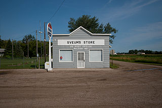
Jackson is a city in Clarke County, Alabama, United States. The population was 5,557 at the 2020 census. It was one of three wet settlements in an otherwise-dry county.

<span class="mw-page-title-main">Andalusia, Alabama</span> City in and county seat of Covington County, Alabama

Andalusia is a city in and the county seat of Covington County, Alabama, United States. At the 2020 census, the population was 8,805.

<span class="mw-page-title-main">Brewton, Alabama</span> City in and county seat of Escambia County, Alabama

Brewton is a city in and the county seat of Escambia County, Alabama, United States. As of the 2020 census, the population was 5,276. Brewton is located in south central Alabama, just north of the Florida Panhandle.

<span class="mw-page-title-main">Jefferson, North Carolina</span> Town in North Carolina, United States

Jefferson is a town in and the county seat of Ashe County, North Carolina, United States. The population was 1,622 at the 2020 U.S. census.

<span class="mw-page-title-main">Colerain, North Carolina</span> Town in North Carolina, United States

Colerain is a town in Bertie County, North Carolina, United States. The population was 204 at the 2010 census.

<span class="mw-page-title-main">Chase City, Virginia</span> Town in Virginia, United States

Chase City is a town in Mecklenburg County, Virginia, United States. Chase City was incorporated in 1873 and named for Salmon P. Chase, United States Chief Justice and Lincoln's Secretary of the Treasury. The population was 2,351 at the 2010 census. Tobacco and other crops are grown nearby.

<span class="mw-page-title-main">Pulaski, Virginia</span> Town in Virginia, United States

Pulaski is a town in Pulaski County, Virginia, United States. The population was 9,086 at the 2010 census. It is the county seat of Pulaski County.

<span class="mw-page-title-main">Cora, Wyoming</span> CDP in Wyoming, United States

Cora is a census-designated place (CDP) in Sublette County, Wyoming. The population was 114 at the 2020 census.

<span class="mw-page-title-main">Kingston, Rhode Island</span> Census-designated place in Rhode Island, United States

Kingston is a village and a census-designated place within the town of South Kingstown in Washington County, Rhode Island, United States, and the site of the main campus of the University of Rhode Island. The population was 6,974 at the 2010 census. Much of the village center is listed on the National Register of Historic Places as Kingston Village Historic District. It was originally known as Little Rest.

<span class="mw-page-title-main">Ruch, Oregon</span> Unincorporated community in Oregon, US

Ruch is an unincorporated community and census-designated place (CDP) in Jackson County, Oregon, United States. It is located on Oregon Route 238, southeast of Grants Pass. As of the 2010 census, it had a population of 840.

<span class="mw-page-title-main">Carlton, Alabama</span> Census-designated place in Alabama, United States

Carlton is an census-designated place in Clarke County, Alabama, United States. As of the 2020 census, its population was 46. It was formerly known as Hal's Lake. The Isaac Nettles Gravestones are located in Carlton in the Mount Nebo Baptist Church Cemetery. They are listed on the National Register of Historic Places. There was one convenience store in Carlton until 2009.

<span class="mw-page-title-main">McLeod, North Dakota</span> Census-designated place & Unincorporated community in North Dakota, United States

McLeod is a census designated place in eastern Ransom County, North Dakota, United States. An unincorporated community, it was designated as part of the U.S. Census Bureau's Participant Statistical Areas Program on March 31, 2010. It was not counted separately during the 2000 Census, but was included in the 2010 Census, where its population was reported to be 27.

<span class="mw-page-title-main">Animas, New Mexico</span> Census-designated place in New Mexico, United States

Animas is an unincorporated community and census-designated place (CDP) in west-central Hidalgo County, New Mexico, United States, in the southwestern corner of the state. As of the 2010 census it had a population of 237.

<span class="mw-page-title-main">Deseret, Utah</span> CDP in Utah, United States

Deseret is a census-designated place in Millard County, Utah, United States. The population was 353 at the 2010 census. Deseret is located approximately 10 miles (16 km) southwest of Delta, and about 150 miles (240 km) southwest of Salt Lake City. The name Deseret comes from the Book of Mormon.

Faywood is a census-designated place in Grant County, New Mexico, United States. Its population was 33 as of the 2010 census. Faywood has a post office with ZIP code 88034. It is located 3 miles (4.8 km) north of US 180 on NM 61.

References

  1. "2020 U.S. Gazetteer Files". United States Census Bureau. Retrieved October 29, 2021.
  2. "Whatley". Geographic Names Information System . United States Geological Survey, United States Department of the Interior.
  3. "Geographic Identifiers: 2010 Demographic Profile Data (G001): Whatley CDP, Alabama". U.S. Census Bureau, American Factfinder. Archived from the original on February 12, 2020. Retrieved June 5, 2014.
  4. "National Register Information System". National Register of Historic Places . National Park Service. March 13, 2009.
  5. "U.S. Decennial Census". Census.gov. Retrieved June 6, 2013.
  6. "U.S. Climate Normals Quick Access – Station: Whatley, AL". National Oceanic and Atmospheric Administration. Retrieved March 4, 2023.
  7. "xmACIS2". National Oceanic and Atmospheric Administration. Retrieved March 4, 2023.