Windsor, New Hampshire

Last updated

Windsor, New Hampshire
Town
Hillsborough-Windsor-NH.png
Coordinates: 43°08′33″N72°01′33″W / 43.14250°N 72.02583°W / 43.14250; -72.02583
Country United States
State New Hampshire
County Hillsborough
Incorporated 1798
Government
   Board of Selectmen
  • Darlene Cuddy, Chair
  • Gerald Needham
  • Sean O'Keefe
Area
[1]
  Total8.5 sq mi (22.1 km2)
  Land8.3 sq mi (21.4 km2)
  Water0.3 sq mi (0.7 km2)  3.15%
Elevation
974 ft (297 m)
Population
 (2020) [2]
  Total262
  Density32/sq mi (12.3/km2)
Time zone UTC-5 (Eastern)
  Summer (DST) UTC-4 (Eastern)
ZIP code
03244
Area code 603
FIPS code 33-85940
GNIS feature ID0873759
Website windsornh.org

Windsor is a town in Hillsborough County, New Hampshire, United States. The population was 262 at the 2020 census. [2] It is the location of the Wediko Children's Services Summer Program and of Windsor Mountain International, a summer adventure and travel camp founded in 1961. It is also the home of Windsor Hills Camp and Retreat Center, a ministry of the Church of the Nazarene.

Contents

History

Incorporated in 1768, Windsor takes its name from Windsor, Connecticut, the home town of grantee John Campbell. The town was made from the land that was left over from the surrounding Hillsborough County. Previously, the land was called "Campbell's Gore" as named for the aforementioned John Campbell.[ citation needed ]

Geography

According to the United States Census Bureau, the town has a total area of 8.5 square miles (22.1 km2), of which 8.3 square miles (21.4 km2) are land and 0.3 square miles (0.7 km2) are water, comprising 3.15% of the town. [1] The highest point is the summit of Windsor Mountain, at 1,604 feet (489 m) above sea level.

Adjacent municipalities

Demographics

Historical population
CensusPop.Note
1790 120
1800 249107.5%
1810 238−4.4%
1820 237−0.4%
1830 226−4.6%
1840 177−21.7%
1850 172−2.8%
1860 136−20.9%
1870 81−40.4%
1880 420418.5%
1890 62−85.2%
1900 38−38.7%
1910 24−36.8%
1920 21−12.5%
1930 224.8%
1940 2931.8%
1950 27−6.9%
1960 3529.6%
1970 4322.9%
1980 7267.4%
1990 10748.6%
2000 20187.9%
2010 22411.4%
2020 26217.0%
U.S. Decennial Census [2] [3]

As of the census [4] of 2000, there were 201 people, 58 households, and 37 families residing in the town. The population density was 24.1 people per square mile (9.3/km2). There were 120 housing units at an average density of 14.4 per square mile (5.6/km2). The racial makeup of the town was 97.01% White, 1.49% African American, and 1.49% from two or more races. Hispanic or Latino of any race were 0.50% of the population.

There were 58 households, out of which 29.3% had children under the age of 18 living with them, 53.4% were married couples living together, 3.4% had a female householder with no husband present, and 34.5% were non-families. 25.9% of all households were made up of individuals, and 8.6% had someone living alone who was 65 years of age or older. The average household size was 2.40 and the average family size was 2.89.

In the town, the population was spread out, with 33.8% under the age of 18, 14.4% from 18 to 24, 22.9% from 25 to 44, 23.9% from 45 to 64, and 5.0% who were 65 years of age or older. The median age was 26 years. For every 100 females, there were 187.1 males. For every 100 females age 18 and over, there were 114.5 males.

The median income for a household in the town was $45,750, and the median income for a family was $58,750. Males had a median income of $36,250 versus $13,750 for females. The per capita income for the town was $17,966. About 11.8% of families and 12.3% of the population were below the poverty line, including 32.4% of those under the age of eighteen and none of those 65 or over.

Related Research Articles

<span class="mw-page-title-main">Sullivan County, New Hampshire</span> County in New Hampshire, United States

Sullivan County is a county in the U.S. state of New Hampshire. As of the 2020 census, the population was 43,063, making it the second-least populous county in New Hampshire. Its county seat is Newport.

<span class="mw-page-title-main">Merrimack County, New Hampshire</span> County in New Hampshire, United States

Merrimack County is a county in the U.S. state of New Hampshire. As of the 2020 Census, the population was 153,808, making it the third most populous county in New Hampshire. Its county seat is Concord, the state capital. The county was organized in 1823 from parts of Hillsborough and Rockingham counties, and is named for the Merrimack River. Merrimack County comprises the Concord, NH Micropolitan Statistical Area, which in turn constitutes a portion of the Boston–Worcester–Providence, MA–RI–NH–CT Combined Statistical Area. In 2010, the center of population of New Hampshire was located in Merrimack County, in the town of Pembroke.
<span class="mw-page-title-main">Bennington, New Hampshire</span> Town in New Hampshire, United States

Bennington is a town in Hillsborough County, New Hampshire, United States. The population was 1,501 at the 2020 census.
<span class="mw-page-title-main">Deering, New Hampshire</span> Town in New Hampshire, United States

Deering is a town in Hillsborough County, New Hampshire, United States. The population was 1,904 at the 2020 census.
<span class="mw-page-title-main">East Merrimack, New Hampshire</span> Census-designated place in New Hampshire, United States

East Merrimack is a census-designated place (CDP) in the town of Merrimack, Hillsborough County, New Hampshire, United States. There is no village center named "East Merrimack"; rather, the CDP refers to the region of the town of Merrimack lying east of the F. E. Everett Turnpike, overlapping portions of the villages of Reeds Ferry, Thornton's Ferry, and the center of Merrimack. The population was 5,176 at the 2020 census, up from 4,197 at the 2010 census.
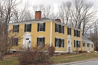
<span class="mw-page-title-main">Francestown, New Hampshire</span> Town in New Hampshire, United States

Francestown is a town in Hillsborough County, New Hampshire, United States. The population was 1,610 at the 2020 census. The village of Francestown, population 201 in 2020, is in the center of the town.

<span class="mw-page-title-main">Greenfield, New Hampshire</span> Town in New Hampshire, United States

Greenfield is a town in Hillsborough County, New Hampshire, United States. The population was 1,716 at the 2020 census. Greenfield is home to the Crotched Mountain Rehabilitation Center, to Greenfield State Park, and to part of the Wapack Trail.
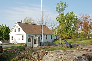
<span class="mw-page-title-main">Lyndeborough, New Hampshire</span> Town in New Hampshire, United States

Lyndeborough is a town in Hillsborough County, New Hampshire, United States. The population was 1,702 at the 2020 census.
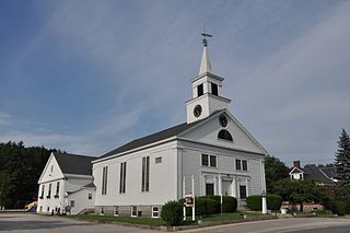
<span class="mw-page-title-main">Pelham, New Hampshire</span> Town in New Hampshire, United States

Pelham is a town in Hillsborough County, New Hampshire, United States. The population was 14,222 at the 2020 census, up from 12,897 at the 2010 census.

<span class="mw-page-title-main">Sharon, New Hampshire</span> Town in New Hampshire, United States

Sharon is a town in Hillsborough County, New Hampshire, United States. The population was 359 at the 2020 census. It was the long-time home to the Sharon Arts Center, a nonprofit which has ceased operations.

<span class="mw-page-title-main">Temple, New Hampshire</span> Town in New Hampshire, United States

Temple is a town in Hillsborough County, New Hampshire, United States. The population was 1,382 at the 2020 census. It is home to Temple Mountain State Reservation, formerly the Temple Mountain Ski Area.
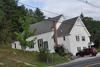
<span class="mw-page-title-main">Goshen, New Hampshire</span> Place in New Hampshire, United States

Goshen is a town in Sullivan County, New Hampshire, United States. The population was 796 at the 2020 census.

<span class="mw-page-title-main">Washington, New Hampshire</span> Place in New Hampshire, United States

Washington is a town in Sullivan County, New Hampshire, United States. The population was 1,192 at the 2020 census. Situated in a hilly, rocky, forested area, and with 26 lakes and ponds, Washington is a picturesque resort area. It is home to Pillsbury State Park.

<span class="mw-page-title-main">Reading, Vermont</span> Town in Vermont, United States

Reading is a town in Windsor County, Vermont, United States. The population was 687 at the 2020 census.

<span class="mw-page-title-main">Antrim (CDP), New Hampshire</span> Census-designated place in New Hampshire, United States

Antrim is a census-designated place (CDP) and the main village in the town of Antrim in Hillsborough County, New Hampshire, United States. The population of the CDP was 1,395 at the 2020 census, out of 2,651 in the entire town.
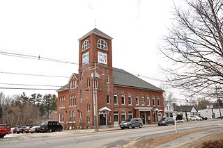
<span class="mw-page-title-main">Antrim, New Hampshire</span> Town in New Hampshire, United States

Antrim is a town in Hillsborough County, New Hampshire, United States. The population was 2,651 at the 2020 census. The main village in the town, where 1,395 people lived at the 2020 census, is defined as the Antrim census-designated place (CDP) and is located at the intersection of U.S. Route 202 and New Hampshire Route 31. The town of Antrim also includes the villages of Antrim Center, North Branch, and Clinton Village.

<span class="mw-page-title-main">Hillsborough (CDP), New Hampshire</span> Census-designated place in New Hampshire, United States

Hillsborough is a census-designated place (CDP) and the main village in the town of Hillsborough in Hillsborough County, New Hampshire, United States. The population of the CDP was 2,156 at the 2020 census, out of 5,939 in the entire town.

<span class="mw-page-title-main">Peterborough (CDP), New Hampshire</span> Census-designated place in New Hampshire, United States

Peterborough is a census-designated place (CDP) and the main village in the town of Peterborough, Hillsborough County, New Hampshire, United States. The population of the CDP was 3,090 at the 2020 census, out of 6,418 in the entire town.

<span class="mw-page-title-main">Windsor, Wisconsin</span> Village in Wisconsin, United States

Windsor is a village and former town in Dane County, Wisconsin. The population was 8,754 at the time of the 2020 census. The communities of Lake Windsor, Morrisonville, and Token Creek are located within the village. Windsor voted to incorporate as a village on November 3, 2015; prior to its incorporation, it was a town, and a portion of the town was a census-designated place. Windsor is a part of the Census Bureau's Madison metropolitan statistical area.

<span class="mw-page-title-main">Hillsborough, New Hampshire</span> Town in New Hampshire, United States

Hillsborough, frequently spelled Hillsboro, is a town in Hillsborough County, New Hampshire, United States. The population was 5,939 at the 2020 census. The town is home to Fox State Forest and part of Low State Forest.

References

  1. 1 2 "2021 U.S. Gazetteer Files – New Hampshire". United States Census Bureau. Retrieved December 10, 2021.
  2. 1 2 3 "Windsor town, Hillsborough County, New Hampshire: 2020 DEC Redistricting Data (PL 94-171)". U.S. Census Bureau. Retrieved December 10, 2021.
  3. "Decennial Census Official Publications". Census.gov. Retrieved March 4, 2024.
  4. "U.S. Census website". United States Census Bureau . Retrieved January 31, 2008.