Hillsborough County, New Hampshire

Last updated

Hillsborough County
Manchester Skyline Night.jpg
Manchester skyline
Hillsborough County, New Hampshire seal.png
Map of New Hampshire highlighting Hillsborough County.svg
Location within the U.S. state of New Hampshire
New Hampshire in United States.svg
New Hampshire's location within the U.S.
Coordinates: 42°53′44″N71°34′58″W / 42.895584°N 71.582741°W / 42.895584; -71.582741
CountryFlag of the United States.svg United States
StateFlag of New Hampshire.svg  New Hampshire
Founded1769
Named for The Earl of Hillsborough
Seat Manchester and Nashua
Largest cityManchester (by population)
Weare (by area)
Area
  Total892.5 sq mi (2,312 km2)
  Land876.5 sq mi (2,270 km2)
  Water15.9 sq mi (41 km2)  1.8%
Population
 (2020)
  Total422,937
  Estimate 
(2022)
426,594 Increase2.svg
  Density470/sq mi (180/km2)
Time zone UTC−5 (Eastern)
  Summer (DST) UTC−4 (EDT)
Congressional districts 1st, 2nd
Website hcnh.org

Hillsborough County is the most populous county in the U.S. state of New Hampshire. As of the 2020 census, the population was 422,937, [1] almost one-third the population of the entire state. Its county seats are Manchester and Nashua, the state's two biggest cities. Hillsborough is northern New England's most populous county as well as its most densely populated.

Contents

Hillsborough County comprises the Manchester-Nashua, NH Metropolitan Statistical Area, which in turn constitutes a portion of the Boston-Worcester-Providence, MA-RI-NH-CT Combined Statistical Area.

History

Hillsborough was one of the five original counties identified for New Hampshire in 1769, and was named for Wills Hill, 1st Earl of Hillsborough, who was British Secretary of State for the Colonies at the time. The county was formally organized at Amherst on March 19, 1771. [2]

In 1823, twelve townships of Hillsborough Country – Andover, Boscawen, Bradford, Dunbarton, Fishersfield (now Newbury), Henniker, Hooksett, Hopkinton, New London, Salisbury, Sutton, and Warner – became part of Merrimack County. The town of Merrimack along the Merrimack River in south-central Hillsborough County was not included in the newly formed county 9 miles (14 km) to the north. Hillsborough County's administrative functions were moved from Amherst to Milford in 1866, and then to the current seats of Manchester and Nashua in 1869.

Geography

According to the United States Census Bureau, the county has a total area of 892 square miles (2,310 km2), of which 876 square miles (2,270 km2) is land and 16 square miles (41 km2) (1.8%) is water. [3] The highest point in Hillsborough county is Pack Monadnock Mountain at 2,290 feet (700 m).

Adjacent counties

National protected area

Politics and government

2020 presidential election by voting ward in Hillsborough County Hillsborough County NH 2020 Presidential Results.svg
2020 presidential election by voting ward in Hillsborough County

In the 2012 presidential election, Time had listed Hillsborough as one of five critical counties affecting the outcome in the swing state of New Hampshire. Obama ended up winning with a margin of 50%–49%. [4] Despite its more urban nature, Hillsborough County has historically been a more Republican leaning part of the state, although there is evidence to suggest that is changing. In 2020, Joe Biden and Jeanne Shaheen won Hillsborough County by a wider margin than they won statewide by. [5] Biden also received the highest percentage of the vote for a Democrat since Lyndon Johnson's 1964 landslide, largely driven due to large swings to Democrats in the county's historically Republican suburban communities. [6]

United States presidential election results for Hillsborough County, New Hampshire [7]
Year Republican Democratic Third party
No.%No.%No.%
2020 104,62545.16%122,34452.81%4,6902.02%
2016 100,01346.70%99,58946.50%14,5556.80%
2012 99,99148.62%102,30349.74%3,3731.64%
2008 97,17847.47%104,82051.20%2,7111.32%
2004 99,72451.03%94,12148.16%1,5820.81%
2000 80,64948.65%77,62546.83%7,4874.52%
1996 59,44140.54%71,28248.61%15,91210.85%
1992 61,62039.04%58,47037.04%37,75023.92%
1988 88,26165.00%45,79933.73%1,7181.27%
1984 81,46270.68%33,31428.91%4750.41%
1980 68,99459.84%31,78927.57%14,52112.59%
1976 53,58153.11%45,54445.15%1,7551.74%
1972 65,27464.39%34,73934.27%1,3641.35%
1968 42,40946.01%45,42349.28%4,3374.71%
1964 29,50332.88%60,23667.12%00.00%
1960 38,43042.43%52,13557.57%00.00%
1956 45,24855.50%36,23444.44%460.06%
1952 41,26349.68%41,80250.32%00.00%
1948 28,25739.94%41,78959.07%6960.98%
1944 25,92137.99%42,30662.00%90.01%
1940 26,20138.09%42,58061.91%00.00%
1936 23,29338.07%34,99257.20%2,8954.73%
1932 23,30841.50%32,45857.79%3950.70%
1928 24,46545.23%29,45754.46%1650.31%
1924 22,09851.66%16,00237.41%4,67310.93%
1920 23,04054.44%18,73644.27%5461.29%
1916 9,92746.33%10,93951.05%5622.62%
1912 8,00735.92%8,90939.96%5,37824.12%
1908 12,56857.29%8,70139.66%6693.05%
1904 12,60357.54%8,83140.32%4702.15%
1900 12,65358.76%8,33938.72%5432.52%
1896 13,08067.80%4,96525.73%1,2486.47%
1892 9,87552.08%8,78546.33%3031.60%
1888 9,46052.08%8,43946.45%2671.47%
1884 8,54053.31%7,07544.17%4042.52%
1880 8,68955.10%7,00144.39%800.51%
1876 8,19054.57%6,79045.24%290.19%

County Commission

The executive power of Hillsborough County's government is held by three county commissioners, each representing one of the three commissioner districts within the county.

DistrictCommissionerHometownParty
1Toni Pappas Manchester Republican
2Michael Soucy Nashua Republican
3Robert Rowe Amherst Republican

In addition to the county commission, there are five directly elected officials; they include county attorney, register of deeds, county sheriff, register of probate, and county treasurer. [8]

OfficeName
County AttorneyJohn Coughlin (R)
Register of DeedsMary Ann Crowell (D)
County SheriffChristopher Connelly (R)
Register of ProbateJohn A. Graham (R)
County TreasurerDavid Fredette (R)

[9]

Legislative branch

The legislative branch of Hillsborough County is made up of all of the members of the New Hampshire House of Representatives from the county. As of 2022, there are 123 members from 45 districts.

AffiliationMembersVoting share
Democratic Party 7258.5%
Republican Party 5141.5%
Total123100%

Demographics

Historical population
CensusPop.Note
1790 32,883
1800 43,89933.5%
1810 49,24912.2%
1820 53,8849.4%
1830 37,724−30.0%
1840 42,49412.6%
1850 57,47835.3%
1860 62,1408.1%
1870 64,2383.4%
1880 75,63417.7%
1890 93,24723.3%
1900 112,64020.8%
1910 126,07211.9%
1920 135,5127.5%
1930 140,1653.4%
1940 144,8883.4%
1950 156,9878.4%
1960 178,16113.5%
1970 223,94125.7%
1980 276,60823.5%
1990 336,07321.5%
2000 380,84113.3%
2010 400,7215.2%
2020 422,9375.5%
2022 (est.)426,594 [10] 0.9%
U.S. Decennial Census [11]
1790–1960 [12] 1900–1990 [13]
1990–2000 [14] 2010–2020 [1]

2020 census

2020 American Community Survey Population Estimates, Race and Hispanic Origin [15]
RacePercentage
White, not Hispanic or Latino83%
Asian6%
Hispanic or Latino8%
Black or African American3%

As of the census of 2020, there were 422,937 people residing in the county. [16] The population density was 482.8 inhabitants per square mile (186.4/km2).

The racial makeup of the county was 81.0% white, 4.8% Asian, 3.9% black or African American, 1.7% American Indian, 2.1% from other races, and 2.0% from two or more races. Those of Hispanic or Latino origin made up 8% of the population. [17]

For the period 2011–2015, 24.8% of the county's population had French ancestry (including 9.9% of the total population with French Canadian ancestry), 20.9% had Irish, 13.1% had English, 10.2% had Italian, and 8.2% had German ancestry. [18] For the same time period, the estimated median annual income for a household in the county was $71,244, and the median income for a family was $85,966. Male full-time workers had a median income of $60,349 versus $44,270 for females. The per capita income for the county was $35,242. About 5.8% of families and 8.8% of the population were below the poverty line, including 11.7% of those under age 18 and 5.9% of those age 65 or over. [19]

Communities

Cities

Towns

Census-designated places

Villages

Former towns

Education

School districts include: [20]

K-12 districts:

Secondary districts:

Elementary districts:

Previously Bedford sent high school students to the Manchester School District. [21]

See also

Related Research Articles

<span class="mw-page-title-main">Amherst, New Hampshire</span> Town in New Hampshire, United States

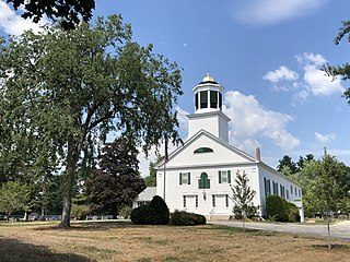
Amherst is a town in Hillsborough County in the state of New Hampshire, United States. The population was 11,753 at the 2020 census. Amherst is home to Ponemah Bog Wildlife Sanctuary, Hodgman State Forest, the Joe English Reservation and Baboosic Lake.

<span class="mw-page-title-main">Bedford, New Hampshire</span> Town in New Hampshire, United States

Bedford is a town in Hillsborough County, New Hampshire, United States. At the 2020 census, the population was 23,322, reflecting a growth of 10% from 2010. Bedford is a suburb of Manchester, New Hampshire's largest city.

<span class="mw-page-title-main">Brookline, New Hampshire</span> Town in New Hampshire, United States

Brookline is a town in Hillsborough County, New Hampshire, United States. The population was 5,639 at the 2020 census, up from 4,991 at the 2010 census. Brookline is home to the Talbot-Taylor Wildlife Sanctuary, Potanipo Pond, and the Brookline Covered Bridge.

<span class="mw-page-title-main">Goffstown, New Hampshire</span> Town in New Hampshire, United States

Goffstown is a town in Hillsborough County, New Hampshire, United States. The population was 18,577 at the 2020 census. The compact center of town, where 3,366 people resided at the 2020 census, is defined by the U.S. Census Bureau as the Goffstown census-designated place and is located at the junctions of New Hampshire routes 114 and 13. Goffstown also includes the villages of Grasmere and Pinardville. The town is home to Saint Anselm College, the Goffstown Giant Pumpkin Regatta, and was the location of the New Hampshire State Prison for Women, prior to the prison's relocation to Concord in 2018.

<span class="mw-page-title-main">Hollis, New Hampshire</span> Town in New Hampshire, United States

Hollis is a town in Hillsborough County, New Hampshire, United States. The population was 8,342 at the 2020 census, having grown 9% from the 2010 population of 7,684. The town center village is listed on the National Register of Historic Places as Hollis Village Historic District.

<span class="mw-page-title-main">Merrimack, New Hampshire</span> Town in New Hampshire, United States

Merrimack is a town in Hillsborough County, New Hampshire, United States. The population was 26,632 as of the 2020 census.

<span class="mw-page-title-main">Nashua, New Hampshire</span> City in New Hampshire, United States

Nashua is a city in southern New Hampshire, United States. As of the 2020 census, it had a population of 91,322, the second-largest in northern New England after nearby Manchester. Along with Manchester, it is a seat of New Hampshire's most populous county, Hillsborough.

<span class="mw-page-title-main">New Boston, New Hampshire</span> Town in New Hampshire, United States

New Boston is a town in Hillsborough County, New Hampshire, United States. The population was 6,108 at the 2020 census, up from 5,321 at the 2010 census. New Boston is home to the annual Hillsborough County Agricultural Fair and the Molly Stark Cannon. The 1743 cannon, which appears on the town seal, was given by General John Stark to the New Boston Artillery Company after the Battle of Bennington.

<span class="mw-page-title-main">Milford, New Hampshire</span> Town in New Hampshire, United States

Milford is a town in Hillsborough County, New Hampshire, United States, on the Souhegan River. The population was 16,131 at the 2020 census, up from 15,115 at the 2010 census. It is the retail and manufacturing center of a multi-town area known informally as the Souhegan Valley.

<span class="mw-page-title-main">New Hampshire Route 130</span> State highway in Hillsborough County, New Hampshire, US

New Hampshire Route 130 is a 12.739-mile-long (20.501 km) secondary east–west state highway in New Hampshire. The road runs between Brookline and Nashua, passing through the town of Hollis in the middle.

<span class="mw-page-title-main">New Hampshire Route 13</span> North-south state highway in New Hampshire, US

New Hampshire Route 13 is a 43.38-mile (69.81 km) long north–south state highway in the state of New Hampshire, United States. The highway runs from Brookline to Concord.

<span class="mw-page-title-main">New Hampshire's 2nd congressional district</span> U.S. House district for New Hampshire

New Hampshire's 2nd congressional district covers the western, northern, and some southern parts of New Hampshire. It includes the state's second-largest city, Nashua, as well as the state capital, Concord. It is currently represented in the United States House of Representatives by Democrat Ann McLane Kuster.

The NHIAA is the governing body for competitions among all public and some private high schools in the state of New Hampshire. For most sponsored sports, the state is divided into 4 categories by school size: Large, Intermediate, Medium, and Small. Football is separated in a different way as seen below.

<span class="mw-page-title-main">Merrimack Valley</span> Region in the U.S. states of New Hampshire and Massachusetts

The Merrimack Valley is a bi-state region along the Merrimack River in the U.S. states of New Hampshire and Massachusetts. The Merrimack is one of the larger waterways in New England and has helped to define the livelihood and culture of those living along it for millennia.

<span class="mw-page-title-main">2018 New Hampshire Executive Council election</span>

The 2018 New Hampshire Executive Council elections were held on November 6, 2018 to elect all five members of the Executive Council of New Hampshire. The party primaries were held on September 11.

<span class="mw-page-title-main">2020 New Hampshire Executive Council election</span>

The 2020 New Hampshire Executive Council elections took place on Tuesday, November 3, 2020, to elect all five members of the Executive Council of New Hampshire. The party primaries were held on September 8.

<span class="mw-page-title-main">2022 New Hampshire Executive Council election</span>

The 2022 New Hampshire Executive Council elections took place on November 8, 2022, to elect all five members of the Executive Council of New Hampshire. The party primaries were held on September 13. These elections are notable because although Democrats won the majority of the votes in the 5 concurrent elections, they only won one of the five seats.

<span class="mw-page-title-main">2024 New Hampshire Executive Council election</span>

The 2024 New Hampshire Executive Council elections will take place on November 5, 2024, to elect all five members of the Executive Council of New Hampshire. Party primaries will be held on September 10. Republicans have held a majority on the executive council since 2021.

References

  1. 1 2 "State & County QuickFacts". United States Census Bureau. Retrieved April 6, 2023.
  2. History of Hillsborough County, New Hampshire. Hurd, Duane Hamilton, ed. Philadelphia, J. W. Lewis & co., 1885. Accessed via Library of Congress July 19, 2023.
  3. "2010 Census Gazetteer Files". United States Census Bureau. August 22, 2012. Archived from the original on December 27, 2014. Retrieved December 27, 2014.
  4. "The White House – Obama's Path to Victory", Time , pp. 16–17, November 19, 2012
  5. "NH-SOS – 2020". sos.nh.gov. Retrieved July 26, 2021.
  6. "Dave Leip's Atlas of U.S. Presidential Elections".
  7. Leip, David. "Dave Leip's Atlas of U.S. Presidential Elections". uselectionatlas.org. Retrieved June 9, 2018.
  8. Hillsborough County > Departments
  9. "General Election Winners – 11/03/2020" (PDF). New Hampshire Secretary of State's Office. November 11, 2020. Archived (PDF) from the original on May 25, 2021. Retrieved December 8, 2020.
  10. "Annual Estimates of the Resident Population for Counties: April 1, 2020 to July 1, 2022" . Retrieved April 6, 2023.
  11. "U.S. Decennial Census". United States Census Bureau. Retrieved December 27, 2014.
  12. "Historical Census Browser". University of Virginia Library. Retrieved December 27, 2014.
  13. "Population of Counties by Decennial Census: 1900 to 1990". United States Census Bureau. Retrieved December 27, 2014.
  14. "Census 2000 PHC-T-4. Ranking Tables for Counties: 1990 and 2000" (PDF). United States Census Bureau. Archived (PDF) from the original on March 27, 2010. Retrieved December 27, 2014.
  15. "U.S Census Bureau QuickFacts".
  16. Bureau, U.S. Census. "2020 Population and Housing State Data". The United States Census Bureau. Retrieved August 14, 2021.
  17. "DP-1 Profile of General Population and Housing Characteristics: 2010 Demographic Profile Data". United States Census Bureau. Archived from the original on February 13, 2020. Retrieved January 12, 2016.
  18. "DP02 Selected Social Characteristics in the United States – 2011–2015 American Community Survey 5-Year Estimates". United States Census Bureau. Archived from the original on February 13, 2020. Retrieved March 7, 2017.
  19. "DP03 SELECTED ECONOMIC CHARACTERISTICS – 2011–2015 American Community Survey 5-Year Estimates". United States Census Bureau. Archived from the original on February 13, 2020. Retrieved March 7, 2017.
  20. "2020 CENSUS - SCHOOL DISTRICT REFERENCE MAP: Hillsborough County, NH" (PDF). United States Census Bureau. Archived (PDF) from the original on July 22, 2022. Retrieved July 22, 2022. - Text list
  21. "Bedford withdrawal from West approved". New Hampshire Union Leader . Manchester, NH: B1CI. January 10, 2006. Retrieved January 10, 2006.

42°55′N71°43′W / 42.92°N 71.72°W / 42.92; -71.72