
The 2004 Atlantic hurricane season was a very deadly, destructive, and extremely active Atlantic hurricane season, with over 3,200 deaths and more than $61 billion in damage. More than half of the 16 tropical cyclones brushed or struck the United States. Due to the development of a Modoki El Niño – a rare type of El Niño in which unfavorable conditions are produced over the eastern Pacific instead of the Atlantic basin due to warmer sea surface temperatures farther west along the equatorial Pacific – activity was above average. The season officially began on June 1 and ended on November 30, though the season's last storm, Otto, dissipated on December 3, extending the season beyond its traditional boundaries. The first storm, Alex, developed offshore of the Southeastern United States on July 31, one of the latest dates on record to see the formation of the first system in an Atlantic hurricane season. It brushed the Carolinas and the Mid-Atlantic, causing one death and $7.5 million (2004 USD) in damage. Several storms caused only minor damage, including tropical storms Bonnie, Earl, Hermine, and Matthew. In addition, hurricanes Danielle, Karl, and Lisa, Tropical Depression Ten, Subtropical Storm Nicole and Tropical Storm Otto had no effect on land while tropical cyclones. The season was the first to exceed 200 units in accumulated cyclone energy (ACE) since 1995, mostly from Hurricane Ivan, the storm produced the highest ACE. Ivan generated the second-highest ACE in the Atlantic, only behind 1899 San Ciriaco Hurricane.

The 1966 Atlantic hurricane season saw the Weather Bureau office in Miami, Florida, be designated as the National Hurricane Center (NHC) and assume responsibility of tropical cyclone forecasting in the basin. The season officially began on June 1, and lasted until November 30. These dates conventionally delimit the period of each year when most tropical cyclones form in the Atlantic basin. It was an above-average season in terms of tropical storms, with a total of 15. The first system, Hurricane Alma, developed over eastern Nicaragua on June 4 and became the most recent major hurricane in the month of June. Alma brought severe flooding to Honduras and later to Cuba, but caused relatively minor impact in the Southeastern United States. Alma resulted in 91 deaths and about $210.1 million (1966 USD) in damage.

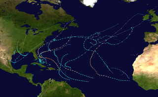
The 1968 Atlantic hurricane season was a below average hurricane season during which only seven named storms developed. The season officially began on June 1 and lasted until November 30, dates which conventionally delimit the period of each year when most tropical cyclones form in the Atlantic basin. Of the named storms, five strengthened into hurricanes; none however intensified into a major hurricane. Only four other seasons since the start of the satellite era—1972, 1986, 1994, and 2013—did not feature a major hurricane. The first system, Hurricane Abby, developed in the northwestern Caribbean on June 1. Abby moved northward and struck Cuba, bringing heavy rainfall and flooding to western portions of the island. Making landfall in Florida on June 4, Abby caused flooding and spawned four tornadoes, but left behind little damage. Overall, the hurricane resulted in six deaths and about $450,000 (1968 USD) in damage. In late June, Tropical Storm Candy brought minor flooding and spawned several tornadoes across portions of the Southern United States. Overall damage from the cyclone reached approximately $2.7 million. 1968 featured two simultaneously active tropical storms during the month of June, a phenomenon that would not occur again until 2023.

The 1947 Atlantic hurricane season was the first Atlantic hurricane season to have tropical storms labeled by the United States Air Force. The season officially began on June 16, 1947, and ended on November 1, 1947. These dates conventionally delimit the period of each year when most tropical cyclones form in the Atlantic basin. However, the first tropical cyclone developed on June 13, while the final system was absorbed by a cold front on December 1. There were 10 tropical storms; 5 of them attained hurricane status, while two became major hurricanes, which are Category 3 or higher on the modern day Saffir–Simpson scale. Operationally, the third tropical storm was considered two separate tropical cyclones, resulting in the storm receiving two names. The eighth tropical storm went undetected and was not listed in HURDAT until 2014.

The 1945 Atlantic hurricane season produced multiple landfalling tropical cyclones. It officially began on June 16 and lasted until October 31, dates delimiting the period when a majority of storms were perceived to form in the Atlantic Ocean. A total of 11 systems were documented, including a late-season cyclone retroactively added a decade later. Five of the eleven systems intensified into hurricanes, and two further attained their peaks as major hurricanes. Activity began with the formation of a tropical storm in the Caribbean on June 20, which then made landfalls in Florida and North Carolina at hurricane intensity, causing one death and at least $75,000 in damage. In late August, a Category 3 hurricane on the modern-day Saffir–Simpson hurricane wind scale struck the Texas coastline, with 3 deaths and $20.1 million in damage. The most powerful hurricane of the season, reaching Category 4 intensity, wrought severe damage throughout the Bahamas and East Coast of the United States, namely Florida, in mid-September; 26 people were killed and damage reached $60 million. A hurricane moved ashore the coastline of Belize in early October, causing one death, while the final cyclone of the year resulted in 5 deaths and $2 million in damage across Cuba and the Bahamas two weeks later. Overall, 36 people were killed and damage reached at least $82.85 million.

The 1935 Atlantic hurricane season was a near-normal hurricane season. Altogether, ten tropical cyclones developed, eight of which intensified into tropical storms. Five of those tropical storms strengthened into hurricanes, while three of those reached major hurricane intensity. The season ran from June 1 through November 15, 1935.

The 1931 Atlantic hurricane season was an active hurricane season, with a total of 13 storms recorded, which was the most since 1916. However, only three of them intensified into hurricanes and just one reached major hurricane intensity, which is Category 3 or higher on the modern-day Saffir–Simpson scale. Nine of the tropical cyclones were identified in real-time, while evidence of the existence of four other tropical cyclones was uncovered by the Atlantic hurricane reanalysis project in 2012 and added to the Atlantic hurricane database. Additionally, two of the tropical storms were upgraded to hurricane status as part of the reanalysis.

The 1929 Atlantic hurricane season was among the least active Atlantic hurricane seasons on record, with only five tropical cyclones forming. Three of them intensified into a hurricane, with one strengthening further into a major hurricane. The first tropical cyclone of the season developed in the Gulf of Mexico on June 27. Becoming a hurricane on June 28, the storm struck Texas, bringing strong winds to a large area. Three fatalities were reported, while damage was conservatively estimated at $675,000 (1929 USD).

The 1928 Atlantic hurricane season was a near average hurricane season in which seven tropical cyclones developed. Of these, six intensified into a tropical storm and four further strengthened into hurricanes. One hurricane deepened into a major hurricane, which is Category 3 or higher on the modern-day Saffir–Simpson scale. The first system, the Fort Pierce hurricane, developed near the Lesser Antilles on August 3. The storm crossed the Bahamas and made landfall in Florida. Two fatalities and approximately $235,000 in damage was reported. A few days after the first storm developed, the Haiti hurricane, formed near the southern Windward Islands on August 7. The storm went on to strike Haiti, Cuba, and Florida. This storm left about $2 million in damage and at least 210 deaths. Impacts from the third system are unknown.

The 1926 Atlantic hurricane season featured the highest number of major hurricanes at the time. At least eleven tropical cyclones developed during the season, all of which intensified into a tropical storm and eight further strengthened into hurricanes. Six hurricanes deepened into a major hurricane, which is Category 3 or higher on the modern-day Saffir–Simpson hurricane wind scale. It was a fairly active and deadly season. The first system, the Nassau hurricane, developed near the Lesser Antilles on July 22. Moving west-northwest for much of its duration, the storm struck or brush several islands of the Lesser and Greater Antilles. However, the Bahamas later received greater impact. At least 287 deaths and $7.85 million (1926 USD) in damage was attributed to this hurricane. The next cyclone primarily affected mariners in and around the Maritimes of Canada, with boating accidents and drownings resulting in between 55 and 58 fatalities. In late August, the third hurricane brought widespread impact to the Gulf Coast of the United States, especially Louisiana. Crops and buildings suffered $6 million in damage and there were 25 people killed.

The 1923 Atlantic hurricane season featured 11 tropical cyclones, 9 of which intensified into tropical storms, the most since 1916. Four of the tropical storms intensified into hurricanes, one of which reached major hurricane intensity—Category 3 or higher on the modern-day Saffir–Simpson hurricane wind scale. No tropical storms or hurricanes formed in or entered the Caribbean Sea. The first known system, a tropical depression, formed on June 19, while the last known system, a tropical storm, transitioned into an extratropical cyclone on October 26. A total of Additionally, an October tropical depression was previously recognized as a tropical storm until reanalysis in 2009, while the first and third tropical storms were added to the Atlantic hurricane database that year. The sixth, seven, and eight storms as well as the October tropical depression existed simultaneously on October 16.

The 1919 Atlantic hurricane season was among the least active hurricane seasons in the Atlantic on record, featuring only five tropical storms. Of those five tropical cyclones, two of them intensified into a hurricane, with one strengthening into a major hurricane Two tropical depressions developed in the month of June, both of which caused negligible damage. A tropical storm in July brought minor damage to Pensacola, Florida, but devastated a fleet of ships. Another two tropical depressions formed in August, the first of which brought rainfall to the Lesser Antilles.

The 1919 Florida Keys hurricane was a massive and damaging tropical cyclone that swept across areas of the northern Caribbean Sea and the United States Gulf Coast in September 1919. Remaining an intense Atlantic hurricane throughout much of its existence, the storm's slow-movement and sheer size prolonged and enlarged the scope of the hurricane's effects, making it one of the deadliest hurricanes in United States history. Impacts were largely concentrated around the Florida Keys and South Texas areas, though lesser but nonetheless significant effects were felt in Cuba and other areas of the United States Gulf Coast. The hurricanes peak strength in Dry Tortugas in the lower Florida keys, also made it one of the most powerful Atlantic hurricanes to make landfall in the United States.

The 1897 Atlantic hurricane season was an inactive season, featuring only six known tropical cyclones, four of which made landfall. There were three hurricanes, none of which strengthened into major hurricanes, which are Category 3 or higher on the modern-day Saffir–Simpson hurricane wind scale. The first system was initially observed south of Cape Verde on August 31, an unusually late date. The storm was the strongest of the season, peaking as a Category 2 hurricane with winds of 100 mph (155 km/h). While located well north of the Azores, rough seas by the storm sunk a ship, killing all 45 crewmen. A second storm was first spotted in the Straits of Florida on September 10. It strengthened into a hurricane and tracked northwestward across the Gulf of Mexico, striking Louisiana shortly before dissipating on September 13. This storm caused 29 deaths and $150,000 (1897 USD) in damage.

The 1947 Fort Lauderdale hurricane(Air Weather Service designation: George) was a long-lived and an intense tropical cyclone that affected the Bahamas, southernmost Florida, and the Gulf Coast of the United States in September 1947. The fourth Atlantic tropical cyclone of the year, it formed in the eastern Atlantic Ocean on September 4, becoming a hurricane, the third of the 1947 Atlantic hurricane season, less than a day later. After moving south by west for the next four days, it turned to the northwest and rapidly attained strength beginning on September 9. It reached a peak intensity of 145 mph (233 km/h) on September 15 while approaching the Bahamas. In spite of contemporaneous forecasts that predicted a strike farther north, the storm then turned to the west and poised to strike South Florida, crossing first the northern Bahamas at peak intensity. In the Bahamas, the storm produced a large storm surge and heavy damage, but with no reported fatalities.

The 1888 Atlantic hurricane season ran through the summer and the first half of fall in 1888. In the 1888 Atlantic season there were two tropical storms, four hurricanes, and two major hurricanes. However, in the absence of modern satellite and other remote-sensing technologies, only storms that affected populated land areas or encountered ships at sea are known, so the actual total could be higher. An undercount bias of zero to six tropical cyclones per year between 1851 and 1885 and zero to four per year between 1886 and 1910 has been estimated.
The 1903 Florida hurricane was an Atlantic hurricane that caused extensive wind and flood damage on the Florida peninsula and over the adjourning Southeastern United States in early to mid September 1903. The third tropical cyclone and third hurricane of the season, this storm was first observed near Mayaguana island in the Bahamas early on September 9. Moving northwestward, it became a hurricane the next day and passed near Nassau. The cyclone then turned to the west-northwest on September 11 and passed just north of the Bimini Islands. As it crossed the Bahamas, the cyclone produced hurricane-force winds that caused damage to crops and buildings, but no deaths were reported over the island chain.

The 1871 Atlantic hurricane season lasted from mid-summer to late-fall. Records show that 1871 featured two tropical storms, four hurricanes and two major hurricanes. However, in the absence of modern satellite and other remote-sensing technologies, only storms that affected populated land areas or encountered ships at sea were recorded, so the actual total could be higher. According to a study in 2004, an undercount bias of zero to six tropical cyclones per year between 1851 and 1885 and zero to four per year between 1886 and 1910 is possible. A later study in 2008 estimated that eight or more storms may have been missed prior to 1878.
The 2019 Atlantic hurricane season was the fourth consecutive above-average and damaging season dating back to 2016. However, many storms were weak and short-lived, especially towards the end of the season. Six of those named storms achieved hurricane status, while three intensified into major hurricanes. Two storms became Category 5 hurricanes, marking the fourth consecutive season with at least one Category 5 hurricane, the third consecutive season to feature at least one storm making landfall at Category 5 intensity, and the seventh on record to have multiple tropical cyclones reaching Category 5 strength. The season officially began on June 1 and ended on November 30. These dates historically describe the period each year when most tropical cyclones form in the Atlantic basin and are adopted by convention. However, tropical cyclogenesis is possible at any time of the year, as demonstrated by the formation of Subtropical Storm Andrea on May 20, making this the fifth consecutive year in which a tropical or subtropical cyclone developed outside of the official season.

The 2020 Atlantic hurricane season was the most active Atlantic hurricane season on record, in terms of number of systems. It featured a total of 31 tropical or subtropical cyclones, with all but one cyclone becoming a named storm. Of the 30 named storms, 14 developed into hurricanes, and a record-tying seven further intensified into major hurricanes. It was the second and final season to use the Greek letter storm naming system, the first being 2005, the previous record. Of the 30 named storms, 11 of them made landfall in the contiguous United States, breaking the record of nine set in 1916. During the season, 27 tropical storms established a new record for earliest formation date by storm number. This season also featured a record ten tropical cyclones that underwent rapid intensification, tying it with 1995, as well as tying the record for most Category 4 hurricanes in a singular season in the Atlantic Basin. This unprecedented activity was fueled by a La Niña that developed in the summer months of 2020, continuing a stretch of above-average seasonal activity that began in 2016. Despite the record-high activity, this was the first season since 2015 in which no Category 5 hurricane formed.
