Related Research Articles


Venda or Tswetla was a Bantustan in northern South Africa, which is fairly close to the South African border with Zimbabwe to the north, while to the south and east, it shared a long border with another black homeland, Gazankulu. It is now part of the Limpopo province. Venda was founded as a homeland by the South African government for the Venda people, speakers of the Venda language. The United Nations and international community refused to recognise Venda as an independent state.

Gazankulu was a bantustan in South Africa, intended by the apartheid government to be a semi-independent homeland for the Tsonga people. It was located in both the Northern Transvaal, now Limpopo province and Eastern Transvaal, now Mpumalanga province.
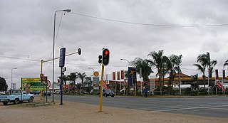
Giyani is a town situated in the north-eastern part of Limpopo Province, South Africa. It is the administrative capital of the Mopani District Municipality and a former capital of the defunct Gazankulu Bantustan. The town of Giyani has seven sections: Section A, Section D1, Section D2, Section E, Section F, Kremetart, and Giyani CBD. Risinga View and Church View are new residential areas in Giyani,but they fall under the local traditional leaders. The Giyani CBD is nicknamed Benstore, and this name is commonly used by residents of the region. Giyani is surrounded by a number of villages with rich Tsonga cultural activities, administered by the Greater Giyani Local Municipality.
Malamulele can refer to the town of Malamulele or the area of Malamulele. Both the town and area are in the Limpopo province of South Africa and predominantly occupied by Tsonga people. Malamulele town has one provincial road and one regional road; the R81 to Giyani and the R524 to Thohoyandou respectively. Malamulele is flanked by two rivers, Levubu River (Rivhubye) to the west and Letaba River to the east, meanwhile the Shingwedzi River runs from Malamulele West to Malamulele East, joining the Olifants in Mozambique on its way to the Indian Ocean. Malamulele is the seat of the Collins Chabane Local Municipality.

Paradise in Gazankulu is album by Harry Belafonte, released by EMI Records in 1988. It was his final studio album, prior to his death in 2023. The album deals with the plight of black South Africans under the Apartheid system. The album was re-released as an official mp3 download by amazon.com, and iTunes in the U.K. in 2010.

Bushbuckridge Municipality is a local municipality within the Ehlanzeni District Municipality, in the Mpumalanga province of South Africa. Commercial farming, which consists of pine and bluegum plantations, tobacco, cotton, sub-tropical fruits and vegetables is practised in the municipality's countryside. The municipality includes the southern part of the Kruger National Park. Bushbuckridge is the largest local municipality in Mpumalanga in terms of land size.
Parliamentary elections were held in Gazankulu on 17 October 1973.
Parliamentary elections were held in Gazankulu on 13 September 1978.
Waterval is a residential township in front of Elim Hospital, it is situated in the Hlanganani district of the former Tsonga homeland of Gazankulu, alongside the R578 road to Giyani in the Limpopo province of South Africa. Waterval includes Njhakanjhaka, Lemana, Elim Hospital, Elim Mall, Hubyeni Shopping centre, Magangeni but excludes Shirley village, which is a separate and stand alone farm, sharing a legal boundary with Waterval and Mbhokota village to the east.
Tiyani is a village situated on the banks of the Middle Letaba Dam in the Hlanganani District of the former Gazankulu homeland, which currently form part of the Vhembe District Municipality in the Limpopo province of South Africa.
Parliamentary elections were held in Gazankulu on 7 September 1983.
Hlanganani, also known as Spelonken, is an amalgamation of various large villages which are situated in the north western portion of the former Tsonga homeland of Gazankulu, South Africa. Hlanganani is situated alongside the R578 road to Giyani and Elim.
Hudson William Edison Ntsanwisi was the first Chief Minister of Gazankulu, a former bantustan in apartheid-era South Africa.
Edward Percy Mhinga was the second Chief Minister of Gazankulu, a former bantustan in apartheid-era South Africa.
The Ximoko Party is a minor political party in South Africa. It has no representation in the National Assembly or the provincial legislatures, but currently has 3 councillors at municipal level in Limpopo province as of 2019.

113 Battalion was a motorised infantry unit of the South African Army.
The Gazankulu Liberation Congress (GLC) is a minor political party based in Giyani, South Africa.
Gezane Michael Mushwana is a retired South African politician from Limpopo. Formerly a politician in the apartheid-era Gazankulu Legislative Assembly, he represented the African National Congress (ANC) in the National Assembly from 1994 to 1999.
References
- 1 2 Gazankulu homeland holds elections South African History Online