Belgium experienced two heat waves in July 2006. Before 1990, a heat wave occurred about once every 8 years. Currently, the country averages one heat wave per year. On 19 July 2006, temperatures throughout the entire country rose to 36.2°C (97.2°F), causing it, at that moment, to be the hottest July day since 1947. The highest temperatures were recorded at the stations of Kleine Brogel and Genk, which measured 37.5°C (99.5°F) and 38.3°C (100.9°F), respectively.
In some regions, more particularly Limburg, 36 consecutive days of temperatures above 25°C (77°F) have been measured in one continuous local heat wave instead of two separate periods of hot weather (according to the official Belgian rules for registering a heat wave). In most other parts of the country, the second heat wave lasted for 17days.
July 2006 became the warmest month in Belgian history, with an all-time high mean temperature of 23.0°C (73.4°F).
United Kingdom
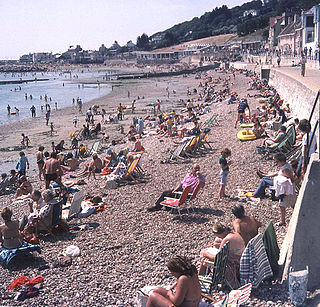
Low water levels at Derwent Water, Cumbria, July 2006
At 14:32 BST on Wednesday, 19 July 2006, 36.5°C (97.7°F) was recorded at Wisley, Surrey. [1] This broke the UK's previous July record by 0.5 °C set in July 1911, although it fell 2.0 °C short of the 38.5°C (101.3°F) all-time record of the time set in August 2003.
Whilst a disputed 42.0°C (107.6°F) was recorded at Wisley Airfield on 18 July, this figure has never been accepted and the figure of 36.5°C (97.7°F) from 19 July is the highest acceptable value. This figure is generally deemed to be erroneous and it has been suggested that the recorded temperature was in fact 32.0°C (89.6°F). Another theory is that the 42.0°C (107.6°F) record on 18 July 2006 was recorded in the sunshine, not in standard 'shaded' areas. In July 2022, another heatwave brought extremely high temperatures to the UK, and on 19 July, the 16th anniversary of the 2006 36.5°C (97.7°F) July record, temperatures in excess of 40.0°C (104.0°F) were officially recorded for the first time in British history, and the highest recorded temperature of 40.3°C (104.5°F) in Coningsby, Lincolnshire is now accepted as the all-time record.
Similar temperatures were recorded in the sunshine during a brief heatwave at Wimbledon on 1 July 2015. The heatwave even warmed the normally cool and wet Scottish summer, with Glasgow having a July high of 22.7°C (72.9°F) and low of 13.7°C (56.7°F), which made it the warmest month on record.[2] Because of the northerly location and marine nature, it was not a heat wave in a general sense, but rather unusually warm weather.
Drought was an issue in many parts of the United Kingdom after a very dry winter. There was warning of drought occurring from the early months of 2006. Following the dry winter, with extreme temperatures occurring in the country and little rain, increasing strain was put on water supplies, and hose-pipe bans were issued in many counties. The Environment Agency claimed that the UK may have had the most severe drought in 100 years.
Some power cuts occurred, after lightning strikes and some due to large amounts of electricity used by air conditioners. In Central London on 27 July 2006 a series of power cuts hit Piccadilly Circus, Regent Street, Turner Broadcasting UK and Oxford Circus causing the closure of shops and businesses, when pre-existing faults were worsened by heavy demand.
The Met Office confirmed that July 2006 was the warmest July, as well as the warmest single month, overall, across the UK, and a number of regional records were also broken.[3]
The tarmac on some roads melted in England, requiring application of crushed rock dust.[4][5]
Germany
In Germany most of the July temperature average records were broken. In Mannheim/Ludwigshafen a July average of 26°C (79°F) was recorded, which means a temperature anomaly of 6°C (11°F), which is a new record for a monthly average in Germany (in the same cities high temperatures reached over 40°C (104°F)). In Berlin an average temperature of 25°C (77°F) was recorded (7°C (13°F) above normal). Such numbers were recorded all over Germany. The biggest problem was the precipitation, which mostly fell in intense thunderstorms. At least 20people died in this heatwave.
Denmark
Denmark experienced the warmest July ever with an average temperature (day and night) of 19.8°C (67.6°F), breaking a record of 19.5°C (67.1°F) set in 1994. It was the second-warmest month ever, behind August 1997 at 20.4°C (68.7°F). It was also the sunniest July ever, and the second-sunniest ever, at 321hours. In fact, the previous July record was 290hours. Since Denmark escaped the extremes seen further south, it is now known as one of the best summer months in history.[6] On 25 June, the temperature reached 34.9°C (94.8°F) in Odense.[7]
France
High temperatures in France destroyed many crops, just days before the harvest period, while French officials said at least 40people were confirmed to have been killed by the heat wave directly. Temperatures as high as 37°C (99°F) were recorded in Paris during the heatwave. July 2006 was in many regions the warmest July ever recorded (and often the second warmest month after August 2003). In many regions weather was particularly stormy. In Nice, the all-time high temperature record was beaten with a 37.7°C (99.9°F) recorded on 1 August.
Ireland
Ireland was affected from the heat wave from the start of June, and the warm weather continued until the end of July.
Temperatures were well above average for both months. The highest recorded in June was 27.1°C (80.8°F) at Ardfert, County Kerry on 9 June. In Kilkenny, County Kilkenny, there were 29 consecutive days in July with temperatures over 20.0°C (68.0°F), and nine of these days had temperatures over 25.0°C (77.0°F). July 2006 was the warmest July in Ireland since records began. By the end of July, temperatures returned to average figures.
On 18 July, a temperature of 30.1°C (86.2°F) was recorded in Birr, County Offaly; the same day, 30.2°C (86.4°F) was recorded at Kilkenny Castle, County Kilkenny and Shannon Airport, County Clare. However, temperatures again rose to 31.0°C (87.8°F) at Casement Aerodrome, Dublin; and 32.3°C (90.1°F) at Elphin, County Roscommon on the 19 July – this is the warmest temperature recorded in Ireland since 1976. Temperatures over 30.0°C (86.0°F) are rare in Ireland, being recorded about once or twice every decade – 1976, 1983, 1989, 1995, 2003 and now 2006 are the most recent times of such high temperatures. The highest ever recorded in Ireland was 33.3°C (91.9°F) at Kilkenny Castle, County Kilkenny on 26 June 1887.
The highest mean temperatures during the heatwave were recorded at Merrion Square in Dublin city centre both months – 16.3°C (61.3°F) in June (average 14.6°C (58.3°F)) and 18.7°C (65.7°F) in July (average 16.3°C (61.3°F)).
To put this into context, average daily maxima in Ireland in only vary from 15 to 20°C (59 to 68°F) in June; and 16 to 23°C (61 to 73°F) in July.
Despite the high daytime temperatures, night time temperatures were sometimes below average (6 to 11°C (43 to 52°F) in June; 8 to 13°C (46 to 55°F) in July). Grass temperatures as low as −2.3°C (27.9°F) were recorded at Birr, County Offaly on 23 June; however, the lowest air temperature recorded was 2.0°C (35.6°F) at Straide, County Mayo on 14 June. The cool night time temperatures are thought to have made the heat wave more bearable there.
Sunshine levels were very high all over the country, with 257hours (~8.6hours a day) of sunshine recorded at Cork Airport, County Cork in June (making it the sunniest June since records began) and 283hours (~9.1hours a day) of sunshine at Rosslare, County Wexford in July (sunniest July since 1990). The sunniest day during the two months (and indeed, the year) was on 25 June, when Malin Head, County Donegal, recorded 15.8hours of sunshine.
Rainfall levels were quite low, with only 13.2 millimetres (0.52in) of rain at Derrygreenagh, County Offaly and Fermoy, County Cork in June and 13.0 millimetres (0.51in) of rain recorded at Merrion Square, Dublin in July. Parts of Munster and Leinster also recorded 21days between 28 May and 17 June where no rainfall was recorded. There was also a period between 9 July and 27 July when no rainfall was recorded in Greater Dublin. Despite the low rainfall, drought was not an issue in Ireland.
In Ireland, May 2006 was the warmest for 20 years and sunniest since 2000. June 2006 was the sunniest on record, driest since 1995 and also one of the warmest. July 2006 was the warmest on record, sunniest in 15 years and also driest since 1989. August 2006 was average.
September 2006 was the warmest on record. October 2006 was the warmest in many places since 2001 and sunniest since 2000. November 2006 was warmer and sunnier than usual. Overall, Summer 2006 (June, July and August) was the sunniest, driest and warmest summer since 1995 and one of the sunniest, driest and warmest on record. Autumn 2006 (September, October, November) was the warmest on record in many places, and sunshine levels were well above normal. Rainfall levels were also above average.
The months of June and July 2006 are regarded as one of the best summers ever due to the high levels of sunshine, warm temperatures and low rainfall. Drought and health problems were not an issue in Ireland, unlike many parts of Europe – mostly because the heat was not as severe there.
The Four Day Marches of Nijmegen were cancelled after only one day as hundreds of people collapsed the first day, two of them eventually dying due to fatal heat stroke. The walking people had to walk on open roads without any shade and there was not enough water for everyone. Paramedics had their hands full with hundreds of people who fainted due to the heat. The walking people had to deal with temperatures in the sun of 42°C (108°F). The air-temperatures on the first day of the four-day march was about 36°C (97°F). Forecasts showed even higher temperatures of 37°C (99°F) for the next day, causing the organisation to cancel the remainder of the event. Vierdaagse
The highest temperature was recorded on 19 July, when temperatures reached the mid- to upper 30s°C (mid- to upper 90s°F) for most of the country, especially in the south-east. The all-time record for the month of July was broken. Temperatures soared to 37.2°C (99.0°F). A few hundred meters across the border into Germany, at the weather station Kalkar, located at the airport in Weeze, near Nijmegen, a maximum of 38.6°C (101.5°F) was recorded on 19 July.
At some places especially in the south-east of the Netherlands temperatures passed 30°C (86°F) for 15 or 16days. The average daytime temperature for the month was 30°C (86°F) again in the south-east of the Netherlands. The lowest daytime temperature was at some locations 34.1°C (93.4°F) for the whole month of July. For two days the daytime temperatures were below 25°C (77°F), making 29days with temperatures of 25°C (77°F) and higher.
During days when temperatures reached 30°C (86°F) or higher, and on days without wind, the smog level was very high. Warnings were broadcast on television and radio, advising people to stay indoors as much as possible because the air pollution was very unhealthy, the smog was very strong and it was dangerously hot.
The Netherlands also had to deal with extreme drought in June and July. The rainfall in June was at some locations as low as 0.5 centimetres (0.20in), July was also extremely dry. Because of the extreme heat and drought vegetation was very dry, and the humidity levels were very low, causing brushfires.
On 30 January 2007, the United Nations published a report of all countries in the world with the most deaths related to natural disasters for 2006. The Netherlands appeared fourth place, with 1,000 heat-related deaths. On 19 July, the temperature reached 37.1°C in Westdorpe.
Poland
July 2006 was the warmest in Poland since the beginning of the meteorological measurements (i.e. 1779). For most of the month, the maximum temperature exceeded 30°C (86°F) – even at night it rarely fell below 20°C (68°F). The average temperature was more than 5°C (9.0°F) higher than normal, for example in Warsaw the average temperature in July 2006 is usually 23.5°C (74.3°F), in Wrocław23.8°C (74.8°F), and in Poznań24.2°C (75.6°F). The highest temperature was recorded in Słubice, near the German border 36.5°C (97.7°F). After the hot days, the temperature at night dropped very slowly. On 16 July in Słubice the temperature at night was 27.4°C (81.3°F) and it was the warmest night in the entire history of meteorological measurements.
July 2006 was also extremely dry. In many regions it did not rain for 3–4 weeks. The river water levels were the lowest ever reported in Polish history and in the absence of rain, many crops dried up.
July 2006 in most Polish cities saw 300–350 sunshine hours (normally 220–240 sunshine hours): the highest number being in Poznań (373 sunshine hours) and in Warsaw (355 sunshine hours).
Post 2006:
July 2007 was AGAIN normal month in Poland. Temperature rarely exceed 30°C (86°F) and it was warm, wet and wild. In many regions, including Elblag rained and it was stormy. Many crops returned to normal business, temperature rarely at night exceed 20°C (68°F) and it was Cloudy, and sunny.
Sweden
According to the Swedish Meteorological and Hydrological Institute (SMHI), the city of Lund in Skåne in southern Sweden had the highest average temperatures (day and night: 21.7°C (71.1°F)) for the month of July since records began in 1859.[8] The rest of Sweden has however not broken the daily average temperatures from the record year 1994.
The highest temperature in Sweden in July 2006 was recorded in Målilla in Småland, where a temperature of 34.2°C (93.6°F) was recorded on 6 July. This is the highest temperature recorded in the country since July 1994 when Kalmar and Söderhamn had 35.1°C (95.2°F). Målilla and Ultuna are the places where the highest temperature ever in Sweden was recorded, 38°C (100°F), in 1947 and 1933 respectively.
Målilla was the warmest location during daytime, averaging 28.3°C (82.9°F), but with average lows being normal at 11.1°C (52.0°F) fell a whole degree short of Lund's aforementioned value, where the average high was 27.8°C (82.0°F) and low 15.6°C (60.1°F).[8] The summer was warmer than usual in all of Sweden, but north of Stockholm and the Mälar valley the temperatures fell quickly, with the exception of the usual hotspot of Falun where the average high was 26.3°C (79.3°F) in spite of its location a bit north of 60 degrees latitude.[8]
Due to the extreme heat in July 2006, the ocean water reached a temperature normally reached in September. This increase in water temperature led to faster evaporation of ocean waters, making August one of the cloudiest and wettest months in recorded history in various western European countries. Many weather experts report this to be a direct consequence of the heat wave, as the high evaporation rate caused the atmosphere to generate many low pressure areas.
Despite this, September 2006 was again the warmest September on record, in the UK and elsewhere, due to high ocean temperatures, altered atmospheric pressure zones, and consequent different wind directions over Europe. The pressure zone changes were a consequence of the extra-tropical remnants of Atlantic hurricanes settling over the British Isles.
The Met Office announced on 16 October 2006 that the extended summer of May to September 2006 was the hottest summer ever recorded, the Central England temperature mean temperature of 16.2°C (61.2°F) for this summer was 2°C (3.6°F) warmer than the average temperatures of 1961–1990. Archived 2007-09-29 at the Wayback Machine
In the Netherlands
Just two months after July 2006, September 2006 became the warmest September since official measurements started. Additionally, October 2006 and November 2006 broke several temperature records. October was one of the warmest Octobers since measurements began, and November went into the record books as the second warmest November since official measurements started three hundred years prior. With temperatures from the north of the Netherlands to the south of Belgium ranging between 16 and 18°C (61 and 64°F) at the end of November, previous records were shattered. The autumn of 2006 was the warmest autumn in history, breaking the old record of just one year prior (2005) by 1.4°C (34.5°F). The winter of 2006/2007 was the warmest in three hundred years as well, and so was the following spring.
With the exception of August 2006, every month from April 2006 to June 2007 saw temperatures above average, the most bizarre months being January 2007, which noted an average temperature of 7.1°C (44.8°F) rather than 2.8°C (37.0°F), and April 2007, with 13.1°C (55.6°F) as opposed to 8.1°C (46.6°F). Temperatures reached a record-breaking 29.7°C (85.5°F) as early as 15 April. The average April daytime maximum in the Netherlands is around 12°C (54°F).
Such a sequence of events is unheard of in the Netherlands meteorological history, estimated to happen every 8,000 years when not taking global warming into account. It's been a result of a unique mixture of the hot summer increasing marine temperatures and Northern Atlantic hurricanes settling as depressions off the coast of Scotland, giving the European continent a constant stream of southern, fast winds rendering it unable to cool down from the Mediterranean through to northern Europe.
In Belgium
After the record-breaking month of July, August broke records on the opposite end. August 2006 was extremely rainy. Some places registered more than 200 millimetres (7.9in) of rain and received a total sunshine amount of only 90 hours, which is less than half the expected sunshine for a typical August month and a record low for any summer month in Uccle. The average temperature was about 16.3°C (61.3°F).
September 2006 has been the warmest autumn month in Belgian history, with an average temperature of 18.4°C (65.1°F), while the normal temperature is 14.6°C (58.3°F) (1971-2000 normals), exceptionally preceding a much colder August month. October 2006 has been the second warmest in history with an average temperature of 14.2°C (57.6°F) (normal average for 1971-2000: 10.5°C (50.9°F)). November 2006 has been the 4th warmest month in history, with an average temperature of 9.1°C (48.4°F) (normal average for 1971-2000: 6.1°C (43.0°F)). December 2006 continued the warm trend.
The autumn of 2006, at that moment, had been the warmest autumn season in recorded history with an average temperature of 13.9°C (57.0°F), which was 3 °C above the normal average for the climatological period 1971-2000. As of 2021, this record still stands firmly.
2007 has broken many records as well. January 2007 broke every temperature record (minimum, maximum and average). The average temperature was 7.2°C (45.0°F), while the normal was just 2.6°C (36.7°F). February 2007 set some daily records and was 2°C warmer than normal.
The winter of 2007, just like the previous autumn season, has also been the warmest in recorded history.
March 2007 was the 6th warmest month in history, just 0.8°C less than the record at that time. April 2007 broke the all-time temperature records once again, as the average temperature had been 5°C warmer than normal. Kleine Brogel had two tropical days on 15 and 16 April 2007 (30°C (86°F) and 30.7°C (87.3°F)), which have been the earliest dates any place in Belgium had ever seen temperatures at or over 30°C. May started warmer than normal, but a 9-month warmth streak eventually came to an end when June returned to average temperatures around normal.
In Finland
The summer of 2006 was around 2°C warmer than the 1971–2000 average. While the heat was not record breaking, the drought was: less than half of the average summer rainfall was received in large areas, and almost all of the country received less than 75% of the usual rain. In many localities (such as Jokioinen, Kajaani and Rovaniemi, it was the driest summer on record.[11] Autumn 2006 was also 1 to 2°C (34 to 36°F) warmer than the average.[12] While this didn't break any records, an unprecedented period of mild weather began around the middle of November.
December 2006 was the warmest December ever recorded in Finland. In Helsinki, the December mean temperature was 4°C (39°F), beating the previous record of 2.9°C (37.2°F) set in 1929. Similar records were broken across the southern and central parts of the country, while in the north the old records narrowly remained in place. On 6 December, an all time December high of 10.8°C (51.4°F) was recorded at Salo.[13]
The mild weather continued well into January 2007. On January 10, many places in southern Finland observed record highs for January. These included Helsinki-Vantaa at 8.2°C (46.8°F), Turku at 8.4°C (47.1°F), and Lappeenranta at 7°C (45°F). (The national record high for January, 10.9°C (51.6°F) set at Mariehamn in 1973, remained in place.) As a whole, the two months leading to 16 January were the mildest such period ever recorded in Finland. In Helsinki, the mean temperature for this period was 4.1°C (39.4°F), beating the previous record of 2.2°C (36.0°F) set in 1982–83. In Sodankylä, it was −4.7°C (23.5°F) (previous record −5.3°C (22.5°F) set in 1972/73). In the second half of January, temperatures plunged [14] and February 2007 was well below the average over 1971 to 2000.[15]
In France
After the unusually hot July, August brought a big contrast with cool weather, cloudy skies and pretty wet weather patterns all around the country, with the exception of the Mediterranean coast.
September however turned to be very warm and sunny and in many parts of France it was the warmest in 50 years. October too was very warm and so was November, triggering in many regions the warmest autumn in recorded history. A very rare föhn-like warm spell affected northern and western France on 25 November and brought temperature as high as 18°C (64°F) at 7 in the morning in Paris.
December, January and February also brought extremely mild weather making the winter of 2006/2007 the warmest in recorded history.
March was relatively uneventful with average temperatures and precipitations. However April broke the record for the warmest April on record. In many regions it was also the sunniest (with almost uninterrupted sunshine for the whole 30days) and the driest April on record. In northern and north-eastern France the departure from the normal of the average temperature was as high as 5°C (9°F). May was too very warm making the spring 2007 the warmest in recorded history for some regions.
In the United Kingdom
Like the rest of Western Europe, August 2006 saw a dramatic turnaround, being a cloudy and wet month in many parts with daytime maxima below average – although the Central England Temperature (CET) was close to the long-term average, due to the cloud keeping night minima higher than normal. The month was notable for its lack of heat waves, being the first August since 1993 when 30°C (86°F)) was not recorded anywhere in the country. [16] However, August 2008, which followed a much cooler July, was even duller and wetter. August 2010 again followed a similar pattern.
September 2006 was just as record-breaking as July, being the warmest on record and just as exceptionally, warmer than August had been. October and November, although not beating the records for the warmest set in 2001 and 1994 respectively, were also much warmer than average.
Winter 2006/07 was exceptionally mild, the warmest since 1868/69.[17][18]
April 2007 was another record-breaker, with a CET of 11.2°C (52.2°F) the warmest in over 300 years of temperature records and by a large margin (10.6c being previous record). This record was broken 4 years later in 2011 with a CET of 11.8°C (53.2°F). Temperatures were widely above 20°C (68°F), with over 200 hours of sunshine for much of the country. Parts of south-eastern Britain had no rain all month.
In Poland
After a hot and dry July, August 2006 was cold and very rainy. The average temperature hovered slightly below the long-term standards. At the beginning of the month in the west of the country experienced torrential rains and violent storms. In Wrocław decreased 292 millimetres (11.5in) of water; that is 4 times more than usual. As a result of heavy rains came the floods, which affected mainly Lower Silesia.
For a change September 2006 was warm and dry. In the west, that month was more than 4°C (7.2°F) warmer than the norm. In Słubice the average temperature was until 18.0°C (64.4°F). Early September brought gusty winds in Poland, near Bydgoszcz in Kuyavian-Pomeranian Voivodeship tornado passed, which escaped with the roots of several hundred trees.
October 2006 is also inscribed as one of the warmer in the history of meteorological measurements, as well as very dry. For many days the temperature exceeded 20°C (68°F) degrees, reaching up to 26°C (79°F) at the south of the country. It was also very sunny month, because reported about 150 sunshine hours.
November 2006 in Poland was the warmest from 10 years. The daily temperature reached up to 20°C (68°F) and at night rarely dropped below 0°C (32°F). November was very wet, usually dropped 100 millimetres (3.9in) of water, and the standard is approximately 40 millimetres (1.6in). Like in October the wind was blowing strongly, particularly on the coast of the Baltic Sea. At the end of the month, thick fog blocked airports in Warsaw, Kraków and Wrocław to 3 days.
Winter 2006/2007 was extremely warm and rainy, in many cities, the snow lay only a few days, and rain fell for MANY days. At night the temperature increased up to 14°C (57°F) degrees, which at this time of year, it was an unprecedented phenomenon. In January 2007, the maximum temperature increased to 20°C (68°F), especially in the south, where often blow halny – a foehn wind, and in Elblag during the day 13°C (55°F), and at night 10°C (50°F). The average temperature in winter 2006/2007 in eastern Poland was about 2.5°C (36.5°F), normally −2.5°C (27.5°F) and in western Poland 4.5°C (40.1°F), normally 1°C (34°F).
This conclusion was the warmest winter since the measurements. In March 2007, in Elblag this month was snow-less, but it rained and the temperature reached up to 17°C (63°F), and at night of 22nd of March 8°C (46°F). Summer 2007 was not that dry. It rained a lot, temperatures reached down to −1°C (30°F) in the Polish-Czech/Tatra hills, temps reached up to 35°C (95°F), but it lasted for only 2-3 days, and temperature fell down.
The United Kingdom straddles the higher mid-latitudes between 49° and 61°N on the western seaboard of Europe. Since the UK is always in or close to the path of the polar front jet stream, frequent changes in pressure and unsettled weather are typical. Many types of weather can be experienced in a single day.
The 2003 European heat wave saw the hottest summer recorded in Europe since at least 1540. France was hit especially hard. The heat wave led to health crises in several countries and combined with drought to create a crop shortfall in parts of Southern Europe. The death toll has been estimated at more than 70,000.
The climate of Chicago is classified as hot-summer humid continental with hot humid summers and cold, occasionally snowy winters. All four seasons are distinctly represented: Winters are cold and often see snow with below 0 Celsius temperatures and windchills, while summers are warm and humid with temperatures being hotter inland, spring and fall bring bouts of both cool and warm weather and fairly sunny skies. Annual precipitation in Chicago is moderate and relatively evenly distributed, the driest months being January and February and the wettest July and August. Chicago's weather is influenced during all four seasons by the nearby presence of Lake Michigan.
A period of unusually hot summer weather occurred in the British Isles during the summer of 1976. At the same time, there was a severe drought on the islands of Great Britain and Ireland. It was one of the driest, sunniest and warmest summers (June/July/August) in the 20th century, although the summer of 1995 is now regarded as the driest. Only a few places registered more than half their average summer rainfall. In the Central England temperature record, it was the warmest summer in the series until being surpassed in the 21st century. It was the warmest summer in the Aberdeen area since at least 1864, and the driest summer since 1868 in Glasgow.
Adelaide has a Mediterranean climate, with mild wet winters and hot dry summers.
The climate of Ireland is mild, humid and changeable with abundant rainfall and a lack of temperature extremes. Ireland's climate is defined as a temperate oceanic climate, or Cfb on the Köppen climate classification system, a classification it shares with most of northwest Europe. The island receives generally warm summers and cool winters.
Malta has a Subtropical-Mediterranean climate according to the Köppen climate classification (Csa), with very mild winters and warm to hot summers. Rain occurs mainly in winter, with summer being generally dry. According to the Troll-Paffen climate classification and the Siegmund/Frankenberg climate classification, Malta lies within the subtropical zone, being at 35ºN latitude.
Launceston, Tasmania has a cool, temperate climate, with four distinct seasons. The city is located in the Tamar Valley in Northern Tasmania and is surrounded by many large hills and mountains. With this type of topography, Launceston's weather patterns can change considerably in a short period.
Estonia lies in the northern part of the temperate climate zone and in the transition zone between maritime and continental climate. Because Estonia is continuously warmed by maritime air influenced by the heat content of the northern Atlantic Ocean, it has a milder climate despite its northern latitude. The Baltic Sea causes differences between the climate of coastal and inland areas. Estonia has four seasons of near-equal length. Average temperatures range from 17.8 °C (64.0 °F) on the Baltic islands to 18.4 °C (65.1 °F) inland in July, the warmest month, and from −1.4 °C (29.5 °F) on the Baltic islands to −5.3 °C (22.5 °F) inland in February, the coldest month.
The 2010 Northern Hemisphere summer heat waves included severe heat waves that impacted most of the United States, Kazakhstan, Mongolia, China, Hong Kong, North Africa and the European continent as a whole, along with parts of Canada, Russia, Indochina, South Korea and Japan during July 29 2010. The first phase of the global heatwaves was caused by a moderate El Niño event, which lasted from June 2009 to May 2010. The first phase lasted only from April 2010 to June 2010, and caused only moderate above average temperatures in the areas affected. But it also set new record high temperatures for most of the area affected, in the Northern Hemisphere. The second phase was caused by a very strong La Niña event, which lasted from June 2010 to June 2011. According to meteorologists, the 2010–11 La Niña event was one of the strongest La Niña events ever observed. That same La Niña event also had devastating effects in the Eastern states of Australia. The second phase lasted from June 2010 to October 2010, caused severe heat waves, and multiple record-breaking temperatures. The heatwaves began in April 2010, when strong anticyclones began to develop, over most of the affected regions, in the Northern Hemisphere. The heatwaves ended in October 2010, when the powerful anticyclones over most of the affected areas dissipated.
The 2013 extreme weather events included several all-time temperature records in Northern and Southern Hemisphere. The February extent of snow cover in Eurasia and North America was above average, while the extent of Arctic ice in the same month was 4.5% below the 1981–2010 average. The Northern Hemisphere weather extremes have been linked to the melting of Arctic sea ice, which alters atmospheric circulation in a way that leads to more snow and ice.
The 2013 heatwave in the United Kingdom and Ireland was a period of unusually hot weather primarily in July 2013, with isolated warm days in June and August. A prolonged high pressure system over Britain and Ireland caused higher than average temperatures for 19 consecutive days in July, reaching 33.5 °C (92.3 °F) at Heathrow and Northolt.
Lisbon and its metropolitan area feature a mild Mediterranean climate, with short, mild and rainy winters and warm to hot, dry summers. According to the Troll-Paffen climate classification, Lisbon has a warm-temperate subtropical climate. According to the Siegmund/Frankenberg climate classification, Lisbon has a subtropical climate.
Perth, the capital city of the state of Western Australia, has a Mediterranean climate, with hot, dry summers and mild, wet winters. February is the hottest month of the year, with an average high of 31.6 °C (88.9 °F), and July is the coldest month of the year, with an average low of 7.9 °C (46.2 °F). 77% of rain in Perth falls between May and September. Perth has an average of 8.8 hours of sunshine per day, which equates to around 3,200 hours of annual sunshine, and 138.7 clear days annually, making it the sunniest capital city in Australia.
The summer of 2014 in Sweden was unusually warm, especially in the northern parts of the country. July was the warmest ever month on record in the north-west.
The 1995 British Isles heatwave occurred between late July and late August. It was part of one of the warmest summers recorded in the UK, and one of the warmest Augusts ever recorded in many locations around the UK, as well as being one of the driest summers ever recorded in the UK; many weather stations recorded the summer of 1995 as drier than, or comparable with, the summer of 1976. Ireland was also widely affected by the heatwave with temperatures reaching over 30 °C (86 °F) in some locations, as well as exceptionally low rainfall throughout the summer.
The 2018 Britain and Ireland heatwave was a period of unusually hot weather that took place in June, July and August. It caused widespread drought, hosepipe bans, crop failures, and a number of wildfires. These wildfires worst affected northern moorland areas around the Greater Manchester region, the largest was at Saddleworth Moor and another was at Winter Hill, together these burned over 14 square miles (36 km2) of land over a period of nearly a month.
The 2018 European drought and heat wave was a period of unusually hot weather that led to record-breaking temperatures and wildfires in many parts of Europe during the spring and summer of 2018. It is part of a larger heat wave affecting the northern hemisphere, caused in part by the jet stream being weaker than usual, allowing hot high-pressure air to linger in the same place. According to the European Drought Observatory, most of the areas affected by drought are across northern and central Europe. According to the World Meteorological Organization, the severe heat waves across the northern hemisphere in the summer of 2018, are linked to climate change in Europe, as well as events of extreme precipitation.
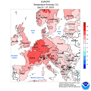
In late June and late July 2019 there were two temporally distinct European heat waves, which set all-time high temperature records in Belgium, France, Germany, Luxembourg, the Netherlands, and the United Kingdom.
↑ "2007". The British Weather. Archived from the original on 2008-02-24. Every winter month (December, January, February) had a CET above 5°C (41°F), only the second time this has happened since 1900 (after 1988/89, although November 1988 was colder than any month of 2006/07) and only the sixth since 1659 (1685–86, 1833–34, 1833–34, and 1868/69 also). There was no snow except in the mountains until the second half of January, and the only cold snap for most of the country occurred from 7–10 February.
This page is based on this Wikipedia article Text is available under the CC BY-SA 4.0 license; additional terms may apply. Images, videos and audio are available under their respective licenses.