Adger, Alabama

Last updated

Adger, Alabama
USA Alabama location map.svg
Red pog.svg
Adger
Usa edcp location map.svg
Red pog.svg
Adger
Coordinates: 33°22′37″N87°05′37″W / 33.37694°N 87.09361°W / 33.37694; -87.09361
Country United States
State Alabama
County Jefferson County
Elevation
472 ft (144 m)
ZIP code
35006
GNIS feature ID1921723 [1]

Adger is an unincorporated crossroads community in Jefferson County, Alabama, southwest of Birmingham.

Contents

Adger has a post office, two convenience stores and several churches. Local businesses include construction, a goat's milk soap business, roofing, plumbing, hauling, and heavy equipment operation.

The community is served by a volunteer fire department as well as a Neighborhood Watch office, which doubles as a working office for Jefferson County sheriff's deputies who patrol the area. It is governed by the Jefferson County Commission and the various departments and facets of the County Government.

History

The town is named for Andrew M. Adger, originally of Charleston, South Carolina. Mr. Adger moved to Bessemer, Alabama, when he became an investor in and secretary-treasurer of the Bessemer Land & Improvement Company. He also was an operating officer of the Debardeleben Coal & Iron Company. Adger is a rural community that arose in the late 1880s during development of Debardeleben's Adger, Johns, and Belle Sumter mines in the Blue Creek Coal Basin. The mines were operating at their peak in the early Twentieth Century. The Black Diamond Mine also operated in the Adger community along Blue Creek road where the mine's Hoist Tipple and Portal were located about 100 yards west of the Old Blue Creek Baptist Church. Since the closing of the mines the community has seen both periodic growth and decline. Currently ( March 2013 ) the Adger, Johns, Sumter and Black Diamond Coal mine sites are being strip mined by Drummond Company's Twin Pines Mining Company and only a few concrete foundations remain, hidden in the thick privet growth, that hint back to the original mining interest.

Geography

Its location is about 5.0 miles (8.0 km) northwest and about 6.5 miles (10.5 km) from Interstates 20/59 which merge in Northeast Jefferson County and run through Jefferson County into Tuscaloosa County and northward into Walker County. It is the former location of Oak Grove High School on Lock 17 Road. An F5 tornado destroyed it on April 8, 1998. City-Data.com reports the area to be 131 square miles (340 km2) with a population density of 23 per square mile. The zip code is 35006.

Climate

The climate in this area is characterized by hot, humid summers and generally mild to cool winters. According to the Köppen Climate Classification system, Adger has a humid subtropical climate, abbreviated "Cfa" on climate maps. [2]

Climate data for Adger, Alabama
MonthJanFebMarAprMayJunJulAugSepOctNovDecYear
Mean daily maximum °C (°F)12
(53)
14
(58)
19
(66)
24
(75)
28
(82)
32
(89)
33
(91)
33
(91)
30
(86)
24
(76)
19
(66)
13
(56)
23
(74)
Mean daily minimum °C (°F)−1
(30)
1
(33)
4
(40)
9
(48)
14
(57)
18
(65)
20
(68)
20
(68)
17
(62)
10
(50)
4
(40)
1
(33)
10
(50)
Average precipitation mm (inches)150
(5.9)
130
(5.2)
160
(6.3)
130
(5)
120
(4.7)
110
(4.5)
130
(5.3)
99
(3.9)
110
(4.2)
91
(3.6)
120
(4.7)
130
(5.1)
1,480
(58.4)
Source: Weatherbase [3]

Government

The governmental body which oversees Adger is the Jefferson County Commission.

There is a Courthouse (Annex) located in downtown Bessemer with a Probate Office and courtrooms. The main courthouse and most of the county services and offices are located in downtown Birmingham, which is approximately 26 miles (42 km) to the North East.

Adger lies within the boundaries of the "Bessemer Cut-off Area" and law enforcement is managed by the Jefferson County Sheriff's Department.

Economy

Adger is situated in the midst of the iron ore and coal district of Alabama. Coal is still mined in and around Adger by means of underground and strip mining. Steel is manufactured in nearby cities as well. Local mines include Jim Walter #3; Oak Grove Mine; and Shannon Mine.

Demographics

Adger, according to the returns from 1850 [4] -2010 [5] for Alabama, has never reported a population figure separately on the U.S. Census [6] as an unincorporated community. However, the area (ZIP code 35006) had a population of 3,109 in the year 2000. The Median Age of its residents was 37.5 yrs with 92.3% White; 6.4% Black; 0.4% Hispanic; 0.9% Other. In 2010, the population within the zip code had increased slightly to 3,121.

Transportation

Several trucking companies are located within the area and the entire county is served by rail and air transportation. Bessemer Airport is just south of here and Birmingham International Airport is approximately 30 miles (48 km) to the Northeast, along I-20/59.

Education

There are no public schools located in Adger. The Oak Grove Schools which were located approximately ten miles north from here until an F5 tornado destroyed them on April 8, 1998. They reopened as separate buildings two years later. It is within easy driving distance of several private schools in this area and approximately 45 minutes from several universities including UAB, located downtown Birmingham, and University of Alabama, located in Tuscaloosa.

Media

Adger has numerous television and radio stations located in and around the cities of Birmingham and Bessemer. Newspapers for the area include the Birmingham News, The Western Star, and The Western Tribune.

Religion

Adger is home to several churches, including Adger Baptist, Adger Church of God, Adger Holiness, and Bible Comes to Life. Most facilities are new or updated and several of the churches combine each year for a Community Revival.

Points of interest

Adger is approximately 6 miles (9.7 km) from WaterMark Outlet Mall and Alabama Adventure (formerly VisionLand). Alabama Adventure has rides, shops, attractions, and a Water Park.

Adger is approximately 10 miles (16 km) from a new state of the art shopping facility located along I-459 between Bessemer and McCalla. The shopping center will host a multiplex theater and several top name retailers.

The Bessemer Civic Center, which hosts many concerts, homeshows, etc. is located at exit 108 along I20/59, and is approximately 7 miles (11 km) from the heart of Adger.

Related Research Articles

<span class="mw-page-title-main">Jefferson County, Alabama</span> County in Alabama, United States

Jefferson County is the most populous county in the U.S. state of Alabama, located in the central portion of the state. As of the 2020 census, its population was 674,721. Its county seat is Birmingham. Its rapid growth as an industrial city in the 20th century, based on heavy manufacturing in steel and iron, established its dominance. Jefferson County is the central county of the Birmingham-Hoover, AL Metropolitan Statistical Area.

<span class="mw-page-title-main">Birmingham, Alabama</span> Major city in Alabama, United States

Birmingham is a city in the north central region of Alabama. Birmingham is the seat of Jefferson County, Alabama's most populous county. As of the 2022 census estimates, Birmingham had a population of 196,910, down 2% from the 2020 census, making it Alabama's third-most populous city after Huntsville and Montgomery. The broader Birmingham metropolitan area had a 2020 population of 1,115,289, and is the largest metropolitan area in Alabama as well as the 50th-most populous in the United States. Birmingham serves as an important regional hub and is associated with the Deep South, Piedmont, and Appalachian regions of the nation.

<span class="mw-page-title-main">Locust Fork, Alabama</span> Town in the United States

Locust Fork is a town in Blount County, Alabama, United States. At the 2010 census the population was 1,186 people, up from 1,016 in 2000.

<span class="mw-page-title-main">Bessemer, Alabama</span> City in Alabama, United States

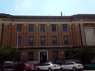
Bessemer is a city in Jefferson County, Alabama, United States and a southwestern suburb of Birmingham. The population was 26,019 at the 2020 census. It is within the Birmingham-Hoover, AL Metropolitan Statistical Area, of which Jefferson County is the center. It developed rapidly as an industrial city in the late 19th and early 20th centuries.

<span class="mw-page-title-main">Brighton, Alabama</span> City in Alabama, United States

Brighton is a city near Birmingham, Alabama, United States and located just east of Hueytown. At the 2020 census, the population was 2,337. It is part of the Birmingham-Hoover Metropolitan Statistical Area, which in 2010 had a population of about 1,128,047, approximately one-quarter of Alabama's population.

<span class="mw-page-title-main">Brookside, Alabama</span> Town in Alabama, United States

Brookside is a town in north-central Jefferson County, Alabama, United States. As of the 2020 census, the population of the town was 1,253. It is a former mining town. The community is a known for being a speed trap.

<span class="mw-page-title-main">Edgewater, Alabama</span> CDP in Alabama, United States

Edgewater is a census-designated place in Jefferson County, Alabama, United States. It is northeast from the Birmingham suburb of Pleasant Grove. Its population was 883 at the 2010 census. This area was damaged by tornadoes on April 15, 1956 and April 8, 1998. The 1998 tornado was rated F5 on the Fujita scale.

<span class="mw-page-title-main">Hueytown, Alabama</span> City in Alabama, United States

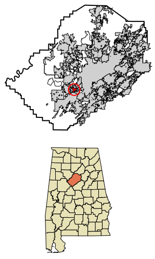
Hueytown is a city in western Jefferson County, Alabama, United States. It is part of the Birmingham metropolitan area, and was part of the heavy industry development in this area in the 20th century. The population was 16,776 at the 2020 census.

<span class="mw-page-title-main">Mulga, Alabama</span> Town in Alabama, United States

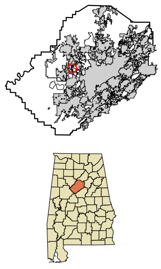
Mulga is a town in western Jefferson County, Alabama, United States. It is north from the Birmingham suburb of Pleasant Grove. It includes the community of Bayview. Mulga was a company town operated by Birmingham Coal and Iron Company around the Mulga Mine and Mulga was also the name of an independent community in the area. The company town was incorporated in 1947.

<span class="mw-page-title-main">Alexander City, Alabama</span> City in Alabama, United States

Alexander City, known to locals as "Alex City", is the largest city in Tallapoosa County, Alabama, United States, with a population of 14,843 as of the 2020 census. It has been the largest community in Tallapoosa County since 1910. It is known for Lake Martin with its 750 miles (1,210 km) of wooded shoreline and 44,000 acres (18,000 ha) of water. Lake Martin stands on the Tallapoosa River and offers boating, swimming, fishing, golfing, and camping. Many neighborhoods and luxury homes are located on the lake.

<span class="mw-page-title-main">Freeland, Pennsylvania</span> Borough in Pennsylvania, United States

Freeland is a borough in Luzerne County, Pennsylvania, United States. It was originally called Birbeckville, South Heberton, and Freehold. Freeland is 18 miles (29 km) south of Wilkes-Barre and 10 miles (16 km) northeast of Hazleton. It was incorporated as a borough on September 11, 1876. Coal mining was the chief industry in the community through the mid-20th century. As of the 2020 census, the population was 3,833.

<span class="mw-page-title-main">Midlothian, Virginia</span> Unincorporated community in Virginia, United States

Midlothian is an unincorporated area and Census-designated place in Chesterfield County, Virginia, U.S. Settled as a coal town, Midlothian village experienced suburbanization effects and is now part of the western suburbs of Richmond, Virginia south of the James River in the Greater Richmond Region. Because of its unincorporated status, Midlothian has no formal government, and the name is used to represent the original small Village of Midlothian and a vast expanse of Chesterfield County in the northwest portion of Southside Richmond served by the Midlothian post office.

Oak Grove High School is a combined middle school and high school. Its location is fifteen miles northwest of downtown Bessemer, a suburb of Birmingham, Alabama. It is physically located in the unincorporated community of Oak Grove for which the school is named. Oak Grove is one of fourteen high schools in the Jefferson County School System. School colors are red, white, and black but the athletic teams are called the Tigers. Oak Grove competes in AHSAA Class 4A athletics.

<span class="mw-page-title-main">Tennessee Coal, Iron and Railroad Company</span> American steelmaking company

The Tennessee Coal, Iron and Railroad Company (1852–1952), also known as TCI and the Tennessee Company, was a major American steel manufacturer with interests in coal and iron ore mining and railroad operations. Originally based entirely within Tennessee, it relocated most of its business to Alabama in the late nineteenth century, following protests over its use of free convict labor. With a sizable real estate portfolio, the company owned several Birmingham satellite towns, including Ensley, Fairfield, Docena, Edgewater and Bayview. It also established a coal mining camp it sold to U.S. Steel which developed it into the Westfield, Alabama planned community.

The Woodward Iron Company was founded on December 31, 1881, by brothers William and Joseph Woodward. William was the company president and Joseph was the company secretary. The company operated iron and coal mines, quarries and furnaces; these were connected by a private industrial railroad based in Bessemer, Alabama. The company administrative office was located near Woodward Ore Mine #1, south of Paul's Hill in Bessemer.

<span class="mw-page-title-main">Sloss Mines</span>

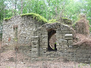
The Sloss Mines are a group of mines in southwestern Jefferson County, Alabama, United States. They were established by the Sloss Iron and Steel Company and its successor, the Sloss-Sheffield Iron and Steel Company, on the southern end of Red Mountain. The Sloss Iron and Steel Company itself was founded by James Sloss in 1881 as the Sloss Furnace Company. The Sloss Mines produced iron ore from 1882 until the 1960s. The ore that these mines produced were essential to the production of iron at the Sloss Furnaces, making them an important element in the formation of adjacent Birmingham and Bessemer as cities.

Alton is an unincorporated community in Jefferson County, Alabama, United States. Alton is located along Interstate 459, 10 miles (16 km) east-northeast of downtown Birmingham. Alton has a post office with ZIP code 35015. Part of the community has been annexed into the city of Birmingham, while the remainder remains an unincorporated area surrounded by the city.

Docena is an unincorporated community in Jefferson County, Alabama, United States. Docena is 8 miles (13 km) west-northwest of downtown Birmingham and has a post office with ZIP code 35060.

Zortman is a census-designated place and unincorporated community in Phillips County, Montana, United States. Its population was 69 as of the 2010 census. Zortman has a post office with ZIP code 59546.

Acton is an unincorporated community in Shelby County, in the U.S. state of Alabama. It is partially located within the city of Hoover. It is not to be confused with the village of Acton, approximately 6+12 miles to the northeast in Jefferson County.

References

  1. "Adger". Geographic Names Information System . United States Geological Survey, United States Department of the Interior . Retrieved July 18, 2010.
  2. Climate Summary for Adger, Alabama
  3. "Weatherbase.com". Weatherbase. 2013. Retrieved on November 3, 2013.
  4. http://www2.census.gov/prod2/decennial/documents/1850c-11.pdf, 1850 Census (places)
  5. http://www.census.gov/prod/cen2010/cph-1-2.pdf, 2010 AL Census
  6. "US Census Bureau Publications - Census of Population and Housing".