Ama, Louisiana

Last updated

Ama
CDP
USA Louisiana location map.svg
Red pog.svg
Ama
Location of Ama in Louisiana
Coordinates: 29°56′32″N90°18′14″W / 29.94222°N 90.30389°W / 29.94222; -90.30389
CountryUnited States
StateLouisiana
Parish St. Charles
Area
[1]
  Total4.43 sq mi (11.46 km2)
  Land3.50 sq mi (9.07 km2)
  Water0.92 sq mi (2.39 km2)
Elevation
10 ft (3 m)
Population
 (2020)
  Total1,290
  Density368.36/sq mi (142.23/km2)
Time zone UTC-6 (CST)
  Summer (DST) UTC-5 (CDT)
Area code 504
FIPS code 22-01780

Ama is a census-designated place (CDP) in St. Charles Parish, Louisiana, United States. Ama is on the West Bank of the Mississippi River, just west of the Jefferson Parish line. The population was 1,290 at the 2020 census. [2]

Contents

History

Ama was named in honor of Amazalie Perret, the postmaster's daughter. [3]

Geography

Ama is located at 29°56′32″N90°18′14″W / 29.94222°N 90.30389°W / 29.94222; -90.30389 (29.942144, -90.303940). [4] According to the United States Census Bureau, the CDP has a total area of 4.4 square miles (11 km2), of which 3.6 square miles (9.3 km2) is land and 0.9 square miles (2.3 km2) (19.78%) is water.

Demographics

Historical population
CensusPop.Note
2020 1,290
U.S. Decennial Census [5]

According to the 2000 United States census, there were 1,285 people residing in Ama. [6] By 2020, its population increased to 1,290. [2] At the 2019 American Community Survey, there were 79.8 males per 100 females and the median age among its population was 40. [7]

From 2010 census estimates to the 2020 census non-Hispanic or Latino whites and Black or African Americans have remained the largest racial and ethnic groups in the CDP, [8] [2] although multiracial Americans were also prominent. In 2000, the Ama's racial and ethnic makeup was 64.9% White, 34.4% Black or African American, 0.16% American Indian and Alaska Native, 0.16% Asian, 0.16% from some other race, 0.23% from two or more races, and 1.01% Hispanic or Latino American of any race.

Economically, the median income for a household in the CDP was $57,794; the CDP's mean income for a household was $65,775, up from a median of $41,691 in 2000. [9] [10] Among its population, 9.5% were approximately at or below the poverty line; 1.9% of families were below the poverty line in 2019. [11] [12]

Education

St. Charles Parish Public School System operates public schools:

Previously the Ama School served the community. [14]

Notable people

Related Research Articles

<span class="mw-page-title-main">St. Martin Parish, Louisiana</span> Parish in Louisiana, United States

St. Martin Parish is a parish located in the U.S. state of Louisiana, founded in 1811. Its parish seat is St. Martinville, and the largest city is Breaux Bridge. At the 2020 census, the population was 51,767. St. Martin Parish is part of the Lafayette metropolitan area in the region of Acadiana, along the Gulf Coast.

<span class="mw-page-title-main">Peridot, Arizona</span> CDP in Gila and Graham Counties, Arizona, US

Peridot is an unincorporated community and census-designated place (CDP) in Gila and Graham counties in the U.S. state of Arizona. The population was 1,350 at the 2010 census.

<span class="mw-page-title-main">Westminster, Louisiana</span> Census-designated place in Louisiana, United States

Westminster is a census-designated place (CDP) in East Baton Rouge Parish, Louisiana, United States. The population was 3,008 at the 2010 census, up from 2,515 in 2000. It is part of the Baton Rouge Metropolitan Statistical Area.

<span class="mw-page-title-main">Harvey, Louisiana</span> Census-designated place in Louisiana, United States

Harvey is a census-designated place (CDP) in Jefferson Parish, Louisiana, United States. Harvey is on the south side of the Mississippi River, within the New Orleans–Metairie–Kenner metropolitan statistical area. The majority-minority population was 20,348 at the 2010 census, down from 22,226 at the 2000 census. The 2020 census determined 22,236 people lived in the CDP.

<span class="mw-page-title-main">Terrytown, Louisiana</span> Census-designated place in Louisiana, United States

Terrytown is an unincorporated community and census-designated place (CDP) in Jefferson Parish, Louisiana, United States. It is on the "Westbank" of the Mississippi River. It is a suburb within the New Orleans–Metairie–Kenner metropolitan statistical area. The population was 23,319 at the 2010 census, and 25,278 in 2020.

Boutte is a census-designated place (CDP) in St. Charles Parish, Louisiana, United States. The population was 3,075 at the 2010 census, and 3,054 in 2020.

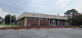
Hahnville is a census-designated place (CDP) in and the parish seat of St. Charles Parish, Louisiana, United States. The population was 2,792 at the 2000 census and 2,959 in 2020. For information on the origin of Hahnville, see Michael Hahn (1830–1886).

Killona is a census-designated place (CDP) in St. Charles Parish, Louisiana, United States. The population was 724 in 2020. On December 14, 2022, the town was hit by a destructive and deadly EF2 tornado that damaged or destroyed numerous structures, killed one person, and injured eight others.

Luling is a census-designated place (CDP) in St. Charles Parish, Louisiana. The population was 11,512 at the 2000 census and 12,119 at the 2010 census. At the 2020 census, 13,716 people lived in Luling. It is located on the west bank of the Mississippi River. Luling is part of the New Orleans—Metairie—Kenner metropolitan statistical area.

Paradis is a census-designated place (CDP) in St. Charles Parish, Louisiana, United States. The population was 1,252 at the 2000 census and 1,242 in 2020.

<span class="mw-page-title-main">Maurice, Louisiana</span> Town in Louisiana, United States

Maurice is a town in Vermilion Parish, Louisiana, United States. The population was 964 at the 2010 census and 2,118 for the 2020 Census. It is part of the Abbeville micropolitan statistical area.

<span class="mw-page-title-main">Suncook, New Hampshire</span> Census-designated place in New Hampshire, United States

Suncook is a census-designated place (CDP) in Merrimack County, New Hampshire, United States. The population was 5,501 at the 2020 census. Approximately two-thirds of Suncook is located in the town of Pembroke, with the remainder in Allenstown.

<span class="mw-page-title-main">Boothwyn, Pennsylvania</span> Census-designated place in Pennsylvania, United States

Boothwyn is a census-designated place (CDP) in Delaware County, Pennsylvania, United States. The population was 4,933 at the 2010 census, down from 5,206 at the 2000 census. The census estimation for population circa 2019 is 6,115.

<span class="mw-page-title-main">Des Allemands, Louisiana</span> Census-designated place in Louisiana, United States

Des Allemands is an unincorporated community and census-designated place (CDP) in Lafourche and St. Charles parishes in the southeastern part of the U.S. state of Louisiana. The population was 2,179 at the 2020 census. The town, known as the "Catfish Capital of the Universe", is along the Bayou des Allemands, which is the boundary of Lafourche and St. Charles parishes. Lac des Allemands is located northwest of the town. The ZIP code for Des Allemands is 70030.

<span class="mw-page-title-main">St. Charles Parish, Louisiana</span> Parish in Louisiana, United States

St. Charles Parish is a parish located in the U.S. state of Louisiana. At the 2020 census, its population was 52,549. The parish seat is Hahnville and the most populous community is Luling.

<span class="mw-page-title-main">North Berwick (CDP), Maine</span> Census-designated place in Maine, United States

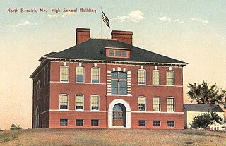
North Berwick is a census-designated place (CDP) consisting of the primary settlement in the town of North Berwick in York County, Maine, United States. The population was 1,615 at the 2010 census, out of a total town population of 4,576. It is part of the Portland–South Portland–Biddeford, Maine Metropolitan Statistical Area.

<span class="mw-page-title-main">Medfield (CDP), Massachusetts</span> CDP in Massachusetts, United States

Medfield is a census-designated place (CDP) in the town of Medfield in Norfolk County, Massachusetts, United States. The population was 6,483 at the 2010 census.

<span class="mw-page-title-main">New Orleans metropolitan area</span> Metropolitan area

The New Orleans metropolitan area, designated the New Orleans–Metairie metropolitan statistical area by the U.S. Office of Management and Budget, or simply Greater New Orleans, is a metropolitan statistical area designated by the United States Census Bureau encompassing eight Louisiana parishes—the equivalent of counties in other U.S. states—centered on the city of New Orleans. The population of Greater New Orleans was 1,271,845 in 2020, up from 1,189,166 at the 2010 United States census. Greater New Orleans is the most populous metropolitan area in Louisiana, and the 45th most populous in the United States. According to 2017 census estimates, the broader New Orleans–Metairie–Hammond combined statistical area (CSA) had a population of 1,510,562.

<span class="mw-page-title-main">St. Charles Parish Public School System</span> Public school system in Louisiana, USA

The St. Charles Parish Public School System is a public school district headquartered in Luling, Louisiana. It serves all of St. Charles Parish.

Hahnville High School is a public high school located in Boutte, Louisiana, United States. It is part of the St. Charles Parish Public School System, serving grades 9 through 12. J.B. Martin and R.K. Smith Middle Schools are the feeder schools for Hahnville High School.

References

  1. "2020 U.S. Gazetteer Files". United States Census Bureau. Retrieved March 20, 2022.
  2. 1 2 3 "2020 Race and Population Totals". United States Census Bureau. Archived from the original on October 25, 2021. Retrieved October 25, 2021.
  3. Leeper, Clare D'Artois (October 19, 2012). Louisiana Place Names: Popular, Unusual, and Forgotten Stories of Towns, Cities, Plantations, Bayous, and Even Some Cemeteries. LSU Press. p. 16. ISBN   978-0-8071-4740-5.
  4. "US Gazetteer files: 2010, 2000, and 1990". United States Census Bureau. February 12, 2011. Retrieved April 23, 2011.
  5. "Census of Population and Housing". Census.gov. Retrieved June 4, 2016.
  6. "U.S. Census website". United States Census Bureau . Retrieved January 31, 2008.
  7. "2019 Demographic and Housing Estimates". United States Census Bureau. Archived from the original on October 25, 2021. Retrieved October 25, 2021.
  8. "2010 Demographic and Housing Estimates". United States Census Bureau. Archived from the original on October 25, 2021. Retrieved October 25, 2021.
  9. "2019 Annual Income Estimates". United States Census Bureau. Archived from the original on October 25, 2021. Retrieved October 25, 2021.
  10. "2000 Median Household Income". United States Census Bureau. Archived from the original on October 25, 2021. Retrieved October 25, 2021.
  11. "2019 Poverty Statistics". United States Census Bureau. Archived from the original on October 25, 2021. Retrieved October 25, 2021.
  12. "2019 Family Poverty Statistics". United States Census Bureau. Archived from the original on October 25, 2021. Retrieved October 25, 2021.
  13. "Hahnville High School Archived 2016-12-03 at archive.today " (Archive). AdvancED. p. 4/9. Retrieved on December 3, 2016. "Hahnville High School services all students on the west bank of the Mississippi River in St. Charles Parish, including the communities of Ama, Boutte, Hahnville, Luling, Paradis, Des Allemands and Killona."
  14. "Education Expansion Archived 2018-12-03 at the Wayback Machine ." By: Richoux, Marilyn, Joan Becnel and Suzanne Friloux, from St. Charles Parish, Louisiana: A Pictorial History, 2010. Posted at the St. Charles Parish Museum and Historical Association. Retrieved on December 3, 2016.