
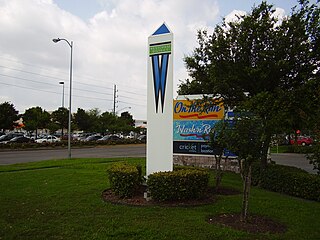
Westbury is a neighborhood in the Brays Oaks district of Southwest Houston, Texas, United States. It is located east of Bob White Road, north of U.S. Highway 90 Alternate, and west of South Post Oak Road, adjacent to the Fondren Southwest and Meyerland neighborhoods, just west of the southwest corner of the 610 Loop.

Alief Independent School District is a school district that is based in southwest Houston, Texas, United States.
Alief is a working-class suburb in Southwest Harris County, Texas, United States. Most of Alief is within the city limits of Houston, while a portion of the community is in unincorporated Harris County.

Sugar Land Regional Airport is a city-owned public-use airport located in Sugar Land, Texas (USA), 17 miles (27 km) southwest of the central business district of Houston.
Westchase is a business district and neighborhood in western Houston, Texas, bounded by Westheimer Road on the north, Gessner Road on the east, Houston Center Boulevard on the west, and Westpark Tollway on the south. The area is bisected by Beltway 8. Westchase is adjacent to Greater Sharpstown, the International District, and the Royal Oaks Country Club subdivision. The area is immediately northeast of Alief.

Pinal Airpark, also known as Pinal County Airpark, is a non-towered, county-owned, public-use airport located 8 miles northwest of the central business district of Marana, in Pinal County, Arizona, United States. Silverbell Army Heliport is co-located with Pinal Airpark. The heliport is a private-use military facility operated by the Arizona Army National Guard.
Falmouth Airpark is a public-use airport and residential airpark located four miles (6 km) northeast of the central business district of Falmouth, in Barnstable County, Massachusetts, United States. It is privately owned by Falmouth Airpark Homeowners Association. The airport grew to supersede the Coonamessett Airport which was located in close proximity to the Otis Air National Guard Base and closed in the 1960s.
This is a documentation of the routes, highways, parking requirements, or anything related to transportation in Houston.

Royal Oaks Country Club is a country club and subdivision in Houston, Texas, United States, in the Alief community. The country club is located at 2910 Royal Oaks Club Drive, 8 miles (13 km) west of The Galleria. Sunrise Colony Company developed Royal Oaks out of the former Andrau Airpark property.
Mathis Airport was a private airport located in unincorporated Forsyth County, Georgia, United States, about 5 miles (8.0 km) northwest of Suwanee in the northeastern part of metro Atlanta. The airport closed in October 2014.
Glenshire is a subdivision in the Brays Oaks district in Houston, Texas. The community is in proximity to Fort Bend County. In 1989 the community had about 5,000 residents. R.A. Dyer and Claire Osborn of the Houston Chronicle said in 1989 that Glenshire was "a middle-class residential area".
Westheimer Air Park(FAA LID: O07) was a privately owned, public-use airport in unincorporated Fort Bend County, Texas, United States. The airport was 20 nautical miles west of the central business district of Houston. It was located along Farm to Market Road 1093 east of Fulshear. The airport was closed in March 2015.
Sack-O-Grande Acroport, also known as the Harbican Airport, was an airport in unincorporated Harris County, Texas, United States. It was located seven nautical miles (13 km) north of the central business district of the city of Katy, and seven nautical miles northeast of Houston Executive Airport.
Woodward Field is a county-owned public-use airport located 3 nautical miles northeast of the central business district of Camden, a city in Kershaw County, South Carolina, United States. It is also known as the Kershaw County Airport. The airport serves the general aviation community, with no scheduled commercial airline service.
Lakeway Airpark is a public use airport in Travis County, Texas, United States. The airport is 17 nautical miles west of the central business district of Austin. It is privately owned by Lakeway Airpark, Inc. and is located in Lakeway, Texas.

Brays Oaks, formerly known as Fondren Southwest, is an area in Southwest Houston, Texas, United States. The Brays Oaks Management District, also known as the Harris County Improvement District #5, governs the Brays Oaks area as well as other surrounding areas, such as Westbury. The City of Houston also defines the Brays Oaks Super Neighborhood, with separate boundaries.

Cornelia Fort Airpark was a privately owned, public-use airport located five nautical miles northeast of the central business district of Nashville, in Davidson County, Tennessee, United States. Cornelia Fort was the first female pilot to die on war duty in American history and the airpark was built in 1945 near her family farm. The 141-acre airport was located on part of a plot of land granted to early Nashvillian Ephraim McLean for service in the Revolutionary War, near what is still known as McLean's Bend in the Cumberland River in East Nashville. The airport operated from 1944 until 2011, when the city of Nashville acquired it to include it as non-aviation part of Shelby Park.
Jefferson County Airpark , is a full-service general aviation public airport near Steubenville, Ohio, U.S., part of the Pittsburgh Combined Statistical Area that serves small and mid-sized private, corporate and commercial traffic. The airport serves transients traveling to and from Eastern Ohio, the Northern Panhandle of West Virginia, and Western Pennsylvania (Pittsburgh). The airport founded in January 1948 by R. G. and Pauline Pier as Pier Airport.