East Whittier is an unincorporated community in Los Angeles County, California, United States. The population was 9,757 at the 2010 census, up from 9,538 at the 2000 census. For statistical purposes, the United States Census Bureau has defined this community as a census-designated place (CDP). The name was changed from East La Mirada in 2012, likely due to its precise location in relation to the city of Whittier. The previous delineation of East Whittier CDP occurred during the 1960 census, when the area recorded a population of 19,884.
Worthington Springs is a spring and town in Union County, Florida, United States. The population was 181 at the 2010 census. According to the U.S. Census Bureau's 2018 estimates, the town had a population of 380.

Prairieburg is a city in Linn County, Iowa, United States. The population was 160 at the time of the 2020 census. It is part of the Cedar Rapids Metropolitan Statistical Area.

Lincolnshire is a home rule-class city in Jefferson County, Kentucky, United States. The population was 148 at the 2010 census.

Solway is a city in Beltrami County, Minnesota, United States. The population was 96 at the 2010 census. Solway serves as a bedroom community for nearby Bemidji.

Felton is a city in Clay County, Minnesota, United States. The population was 177 at the 2020 census.

Vermillion is a city in Dakota County, Minnesota, United States. The population was 441 at the 2020 census.

Lake Bronson is a city in Kittson County, Minnesota, United States. The population was 178 at the 2020 census. Lake Bronson State Park is nearby.
Angus Township is a township in Polk County, Minnesota, United States. It is part of the Grand Forks-ND-MN Metropolitan Statistical Area. The population was 112 at the 2000 census.

Cuartelez is a census-designated place (CDP) in Santa Fe County, New Mexico, United States. It is part of the Santa Fe, New Mexico Metropolitan Statistical Area. The population was 469 at the 2010 census.
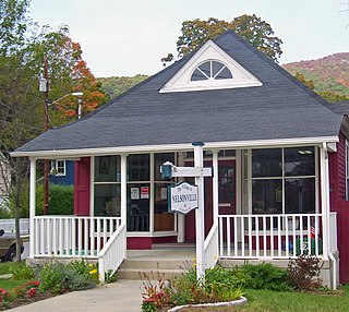
Nelsonville is a village located in the town of Philipstown in Putnam County, New York, United States. The population was 628 at the time of the 2010 census.

Risingsun is a village in Wood County, Ohio, United States. The population was 541 at the 2020 census.

Leidy Township is a township that is located in Clinton County, Pennsylvania, United States. The population was 155 at the time of the 2020 census, down from 180 in 2010.

Village Green-Green Ridge is a census-designated place (CDP) in Delaware County, Pennsylvania, United States. The population was 7,822 at the 2010 census, down from 8,279 at the 2000 census.
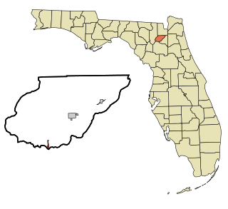
Mount Cobb is an unincorporated community and census-designated place (CDP) in Lackawanna County, Pennsylvania, United States. The population was 1,799 at the 2010 census.

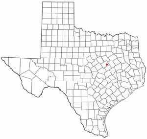
Lowry Crossing is a city in Collin County, Texas, United States. The population was 1,711 at the 2010 census.
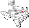
Hallsburg is a city in McLennan County, Texas, United States. The population was 507 at the 2010 census. It is part of the Waco Metropolitan Statistical Area.

Hamilton is a town in Skagit County, Washington, United States. The population was 299 at the 2020 census. It is included in the Mount Vernon-Anacortes, Washington Metropolitan Statistical Area.

Morrison is a town in Brown County in the U.S. state of Wisconsin. The population was 1,599 at the 2010 census.

Lake Ripley is a census-designated place (CDP), in the town of Oakland, Jefferson County, Wisconsin, United States. The population was 1,911 at the 2020 census.