Barry, Texas

Last updated

Barry, Texas
Barry Texas Wiki (1 of 1).jpg
Post office in Barry, Texas
Barry, Texas
Barry, Texas
Barry, Texas
Barry, Texas
Coordinates: 32°5′56″N96°38′13″W / 32.09889°N 96.63694°W / 32.09889; -96.63694
Country United States
State Texas
County Navarro
Government
  MayorCharles Worsham
  AlderpersonsCharlie Allen
Lori Armstrong
Ann Elmore
Jack Herod
Pamela Rose
Area
[1]
  Total0.45 sq mi (1.16 km2)
  Land0.44 sq mi (1.14 km2)
  Water0.01 sq mi (0.02 km2)
Elevation
499 ft (152 m)
Population
 (2020)
  Total220
  Density490/sq mi (190/km2)
Time zone UTC-6 (Central (CST))
  Summer (DST) UTC-5 (CDT)
ZIP code
75102
Area code 903
FIPS code 48-05708 [2]
GNIS feature ID1330100 [3]

Barry is a city in Navarro County, in the U.S. state of Texas. The population was 220 at the 2020 census.

Contents

History

Established in 1886, the city was named after Bryan T. Barry, an early landowner who sold 300 acres to settlers. Its original location was a mile south of its present site. After the St. Louis Southwestern Railway completed a line between Corsicana and Hillsboro in 1888, residents moved to the present location near the railroad tracks. A public school opened in 1896 to serve the settlement, which also had a post office, general store and gin. By 1914, the community of 400 residents had two banks, a newspaper, hotel, stores, eateries, a blacksmith, and three churches. A Masonic lodge was later founded. The Barry school merged with nearby Blooming Grove in 1958. [4]

Geography

Barry is located at 32°05′56″N96°38′13″W / 32.098806°N 96.636936°W / 32.098806; -96.636936 (32.098806, –96.636936). [5]

According to the United States Census Bureau, the city has a total area of 0.45 square miles (1.2 km2), of which 0.44 square miles (1.1 km2) is land.

Demographics

Historical population
CensusPop.Note
1960 178
1970 149−16.3%
1980 19228.9%
1990 175−8.9%
2000 20919.4%
2010 24215.8%
2020 220−9.1%
U.S. Decennial Census [6]
2020 Census [7]

As of the census [2] of 2000, there were 209 people, 80 households, and 56 families residing in the city. The population density was 467.2 inhabitants per square mile (180.4/km2). There were 86 housing units at an average density of 192.2 per square mile (74.2/km2). The racial makeup of the city was 88.52% White, 3.35% African American, 0.48% Native American, 7.18% from other races, and 0.48% from two or more races. Hispanic or Latino of any race were 9.09% of the population.

There were 80 households, out of which 27.5% had children under the age of 18 living with them, 56.3% were married couples living together, 12.5% had a female householder with no husband present, and 30.0% were non-families. 25.0% of all households were made up of individuals, and 15.0% had someone living alone who was 65 years of age or older. The average household size was 2.61 and the average family size was 3.07.

In the city, the population was spread out, with 23.0% under the age of 18, 7.7% from 18 to 24, 28.7% from 25 to 44, 25.4% from 45 to 64, and 15.3% who were 65 years of age or older. The median age was 37 years. For every 100 females, there were 99.0 males. For every 100 females age 18 and over, there were 96.3 males.

The median income for a household in the city was $40,000, and the median income for a family was $42,500. Males had a median income of $24,375 versus $20,625 for females. The per capita income for the city was $20,247. About 6.1% of families and 8.0% of the population were below the poverty line, including 11.3% of those under the age of eighteen and 13.0% of those 65 or over.

Education

The City of Barry is served by the Blooming Grove Independent School District.

Related Research Articles

<span class="mw-page-title-main">Navarro County, Texas</span> County in Texas, United States

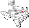
Navarro County is a county in the U.S. state of Texas. As of the 2020 census, the population was 52,624. Its county seat is Corsicana. The county is named for José Antonio Navarro, a Tejano leader in the Texas Revolution who signed the Texas Declaration of Independence.

<span class="mw-page-title-main">Pecan Hill, Texas</span> City in Texas, United States

Pecan Hill is a city in Ellis County, Texas, United States. The population was 735 at the 2020 census, down from 626 at the 2010 census.

<span class="mw-page-title-main">Ravenna, Texas</span> City in Texas, United States

Ravenna is a city in Fannin County, Texas, United States. The population was 175 at the 2020 census.

<span class="mw-page-title-main">Southmayd, Texas</span> City in Texas, United States

Southmayd is a city in Grayson County, Texas, United States. The population was 978 at the 2020 census. It is part of the Sherman–Denison Metropolitan Statistical Area.

<span class="mw-page-title-main">Caney City, Texas</span> Town in Texas, United States

Caney City is a town in Henderson County, Texas, United States. The population was 187 at the 2020 census.

<span class="mw-page-title-main">Log Cabin, Texas</span> City in Texas, United States

Log Cabin is a city in Henderson County, Texas, United States. The population was 678 at the 2020 census.

<span class="mw-page-title-main">Payne Springs, Texas</span> Town in Texas, United States

Payne Springs is a town in Henderson County, Texas, United States. The population was 741 at the 2020 census, down from 767 at the 2010 census.

<span class="mw-page-title-main">Star Harbor, Texas</span> City in Texas, United States

Star Harbor is a city in Henderson County, Texas, United States. The population was 482 at the 2020 census.

<span class="mw-page-title-main">Tool, Texas</span> City in Texas, United States

Tool is a city in Henderson County, Texas, United States. The population was 2,175 at the 2020 census. Located on the west side of Cedar Creek Lake, it is a popular second home and retiree destination.

<span class="mw-page-title-main">Cottonwood, Kaufman County, Texas</span> City in Texas, United States

Cottonwood is a city in Kaufman County, Texas, United States. The population was 181 at the 2020 census.

<span class="mw-page-title-main">Oak Grove, Kaufman County, Texas</span> Town in Texas, United States

Oak Grove is a town in Kaufman County, Texas, United States. The population was 617 at the 2020 census.

<span class="mw-page-title-main">Oak Ridge, Kaufman County, Texas</span> Town in Texas, United States

Oak Ridge is a town in Kaufman County, Texas, United States. The population was 771 at the 2020 census, up from 495 at the 2010 census.

<span class="mw-page-title-main">Jewett, Texas</span> City in Texas, United States

Jewett is a city in Leon County, Texas, United States. The population was 1,167 at the 2010 census. It was laid out in 1871 by the International Railroad Company.

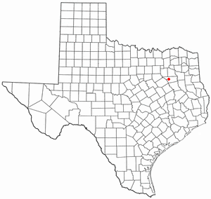
Angus is a city in Navarro County, Texas, United States. The population was 444 at the 2020 census.

<span class="mw-page-title-main">Blooming Grove, Texas</span> Town in Texas, United States

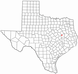
Blooming Grove is a town in western Navarro County, Texas, United States. As of the 2020 census, the town population was 857, up from 821 in the 2010 census.

<span class="mw-page-title-main">Emhouse, Texas</span> Town in Texas, United States

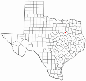
Emhouse is a town in Navarro County, Texas, United States. The population was 187 at the 2020 census.

<span class="mw-page-title-main">Eureka, Navarro County, Texas</span> City in Texas, United States

Eureka is a city in Navarro County, Texas, United States. The population was 313 at the 2020 census.

<span class="mw-page-title-main">Rice, Texas</span> City in Texas, United States

Rice is a city in Navarro County, Texas, United States. The population was 1,203 at the 2020 census.

<span class="mw-page-title-main">Cool, Texas</span> City in Texas, United States

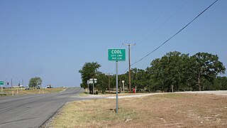
Cool is a city in Parker County, Texas, United States. The population was 211 at the 2020 census.

<span class="mw-page-title-main">Mobile City, Texas</span> City in Texas, United States

Mobile City is a city in Rockwall County, Texas, United States on the outskirts of Rockwall. The population was 142 at the 2020 census. It currently has the highest population density of any city in Texas, and is the only Texas city with a population density of over 10,000 people per square mile.

References

  1. "2019 U.S. Gazetteer Files". United States Census Bureau. Retrieved August 7, 2020.
  2. 1 2 "U.S. Census website". United States Census Bureau . Retrieved January 31, 2008.
  3. "US Board on Geographic Names". United States Geological Survey. October 25, 2007. Retrieved January 31, 2008.
  4. Barry, Texas from the Handbook of Texas Online
  5. "US Gazetteer files: 2010, 2000, and 1990". United States Census Bureau. February 12, 2011. Retrieved April 23, 2011.
  6. "Census of Population and Housing". Census.gov. Retrieved June 4, 2015.
  7. "Census Bureau profile: Barry, Texas". United States Census Bureau. May 2023. Retrieved May 23, 2024.