Related Research Articles
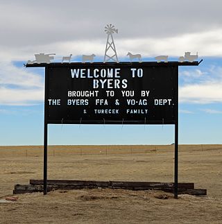
Byers is an unincorporated town, a post office, and a census-designated place (CDP) located in and governed by Arapahoe County, Colorado, United States. The CDP is a part of the Denver–Aurora–Lakewood, CO Metropolitan Statistical Area. The Byers post office has the ZIP Code 80103. At the United States Census 2020, the population of the Byers CDP was 1,322.

Sedalia is an unincorporated town, a post office, and a census-designated place (CDP) located in and governed by Douglas County, Colorado, United States. The CDP is a part of the Denver–Aurora–Lakewood, CO Metropolitan Statistical Area. The Sedalia post office has the ZIP Code 80135. At the United States Census 2020, the population of the Sedalia CDP was 177.

Eldon is an unincorporated community and census-designated place (CDP) in Cherokee County, Oklahoma, United States. The population was 368 at the 2010 census, a loss of 62.3 percent from 991 at the 2000 census, due largely to shrinkage of the CDP boundaries. It lies east of Tahlequah at the junction of U.S. Highway 62 and State Highway 51. The Eldon Post Office existed from March 20, 1911, until May 30, 1936. The community is said to have been named for Eldon, Illinois.
Deerfield is an unincorporated community and census-designated place (CDP) located within Upper Deerfield Township, Cumberland County, in the U.S. state of New Jersey. It was first listed as a CDP in the 2020 census with a population of 230.
Rocky Comfort is an unincorporated community and census-designated place in McDonald County, Missouri, United States, on Missouri Route 76. As of the 2020 census, it had a population of 176.
Pomona is an unincorporated community and census-designated place (CDP) in Howell County, Missouri, United States. It is located midway between Willow Springs and West Plains. As of the 2010 census, Pomona had a population of 511.
South Fork is an unincorporated community and census-designated place (CDP) in Howell County, Missouri, United States. It is located 10 miles (16 km) southwest of West Plains on U.S. Route 160. As of the 2010 census, South Fork had a population of 241.
Bennett Spring is an unincorporated community and census-designated place (CDP) in Dallas and Laclede counties, Missouri, United States. As of the 2010 census it had a population of 130. It lies 12 miles (19 km) west of Lebanon on Missouri Route 64. The community is named after a spring that is reported variously as the third or fourth largest in the state, with an average daily flow of about one hundred million gallons, and which is the centerpiece of Bennett Spring State Park.
Irwin is an unincorporated community and census-designated place in northern Barton County, Missouri, United States. As of the 2020 census it had a population of 47.
Mine La Motte is an unincorporated community and census-designated place (CDP) in Madison County, Missouri, United States. As of the 2020 census, the population was 364.
Dawn is an unincorporated community and census-designated place (CDP) in Livingston County, Missouri, United States. As of the 2020 census it had a population of 100.
Ravanna is an unincorporated community and census-designated place (CDP) in Mercer County, Missouri, United States. It is located 8 miles (13 km) northeast of Princeton on U.S. Route 136. The population was 60 at the 2020 census, down from 98 in 2010.
Harviell is an unincorporated community and census-designated place in Butler County, Missouri, United States. As of the 2020 census it had a population of 98.
Philadelphia is an unincorporated community and census-designated place in western Marion County, Missouri, United States. It is located 12 miles (19 km) west of Palmyra on Missouri Route 168. The community is part of the Hannibal Micropolitan Statistical Area.
Excello is an unincorporated community and census-designated place (CDP) in southern Macon County, Missouri, United States. As of the 2020 United States census, it had a population of 61.

Bendon is an unincorporated community and census-designated place in Benzie County in the U.S. State of Michigan. The population was 210 at the 2020 census. Bendon is located within Inland Township.
Cherokee Pass is an unincorporated community and census-designated place in Madison County, Missouri, United States. As of the 2020 census, it had a population of 271, up from 235 in 2010.

Bow Valley is an unincorporated rural village in Cedar County, Nebraska, United States. It is also the name-source for a census-designated place (CDP) which includes the village. Although the 2010 United States Census provides no data for the community itself, the population of the entire CDP is given as 116.
Leisure Lake is an unincorporated community and census-designated place (CDP) in Grundy County, Missouri, United States. As of the 2020 census, the population was 166.
Briarwood Estates is an unincorporated community and census-designated place (CDP) in Jefferson County, Missouri, United States. It is in the southern part of the county, northwest of De Soto. It is a residential community built around three lakes: Lake Briarwood, Fishermans Lake, and Spring Lake. Missouri Route 21 passes between Briarwood Estates and De Soto, leading northeast 44 miles (71 km) to St. Louis and southwest 24 miles (39 km) to Potosi.
References
- ↑ "2023 U.S. Gazetteer Files: Missouri". United States Census Bureau. Retrieved April 16, 2024.
- 1 2 U.S. Geological Survey Geographic Names Information System: Aurora Springs, Missouri
- 1 2 "P1. Race – Aurora Springs CDP, Missouri: 2020 DEC Redistricting Data (PL 94-171)". U.S. Census Bureau. Retrieved April 17, 2024.
- ↑ U.S. Geological Survey Geographic Names Information System: Aurora Springs, Missouri
- ↑ Eldon, Missouri, 7.5 Minute Topographic Quadrangle, USGS, 1983
- ↑ "Miller County Place Names, 1928–1945". The State Historical Society of Missouri. Archived from the original on June 24, 2016. Retrieved November 6, 2016.
- ↑ "Post Offices". Jim Forte Postal History. Retrieved November 6, 2016.
- ↑ "Census of Population and Housing". Census.gov. Retrieved June 4, 2016.
Municipalities and communities of Miller County, Missouri, United States | ||
|---|---|---|
| Cities |  | |
| Villages | ||
| Townships | ||
| CDP | ||
| Other communities | ||
| Footnotes | ‡This populated place also has portions in an adjacent county or counties | |
| | This Miller County, Missouri state location article is a stub. You can help Wikipedia by expanding it. |